Ocean Park Fire and Rescue Squad(OPVRS) Building 3769 E. Stratford Road. Enter door opposite Shore Drive.
The mission of the Bayfront Advisory Commission(BAC) is to review and make recommendations to the City Council regarding public and private projects and issues associated with the Bayfront area.
Public comment has apparently changed: expect no public comment discussion with city staff or an ability to ask city staff any questions. Public comment is available at the end of the meeting and may or may not be included in any minutes.
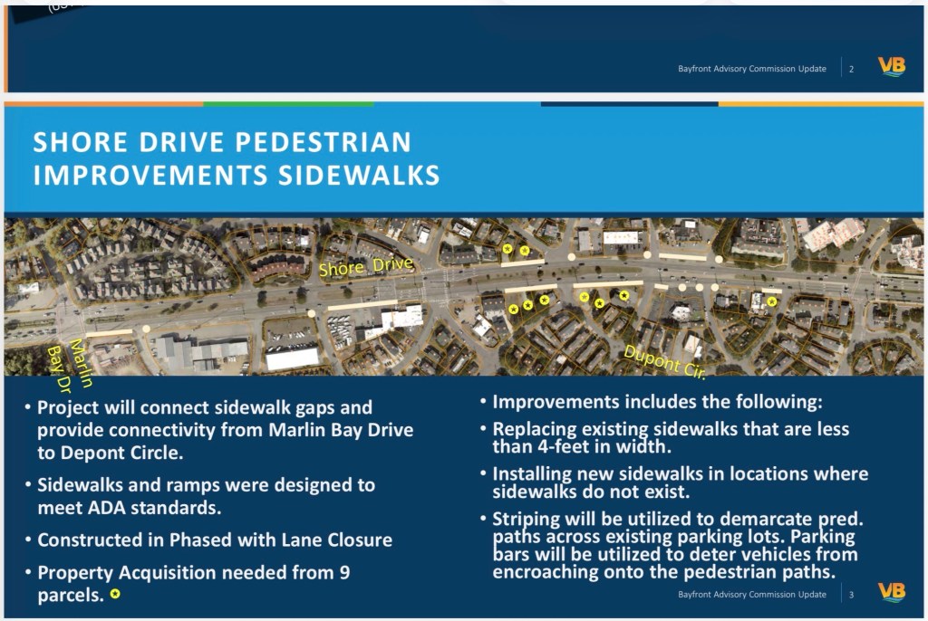
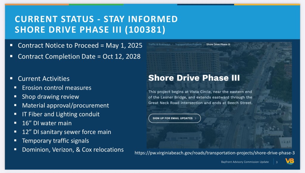
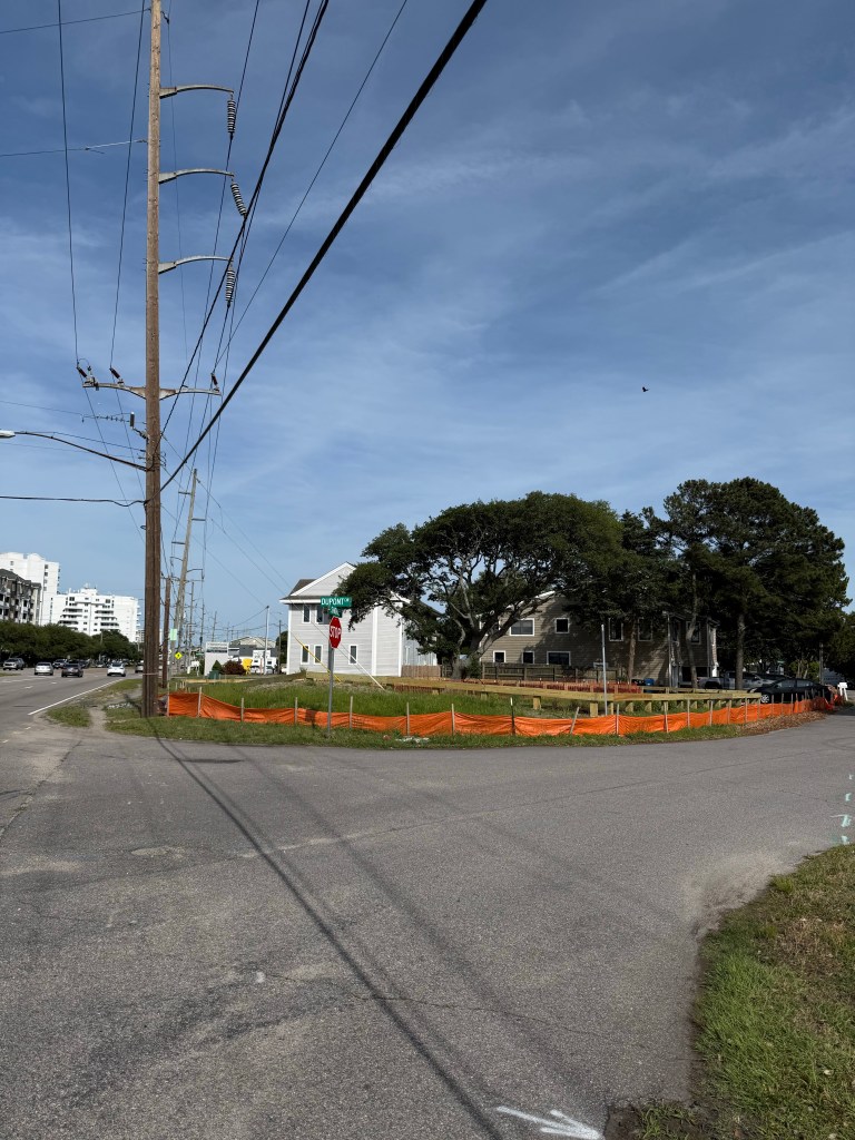
This long delayed project allegedly now starts May 2026. Note: “Property Acquisition” according to state law could have started & been completed years ago. It’s a CoVB policy not to do so.
Ocean Park Fire and Rescue Squad(OPVRS) Building 3769 E. Stratford Road. Enter door opposite Shore Drive.
The mission of the Bayfront Advisory Commission(BAC) is to review and make recommendations to the City Council regarding public and private projects and issues associated with the Bayfront area.
Public comment has apparently changed: expect no public comment discussion with city staff or an ability to ask city staff any questions. Public comment is available at the end of the meeting and may or may not be included in any minutes.
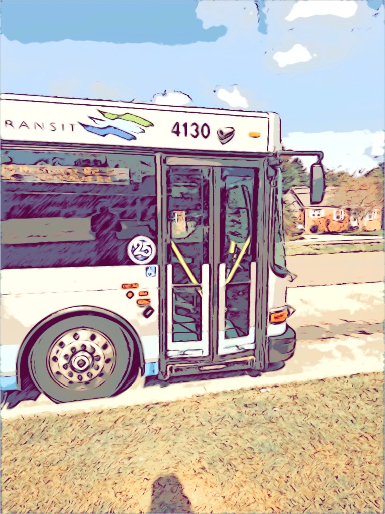
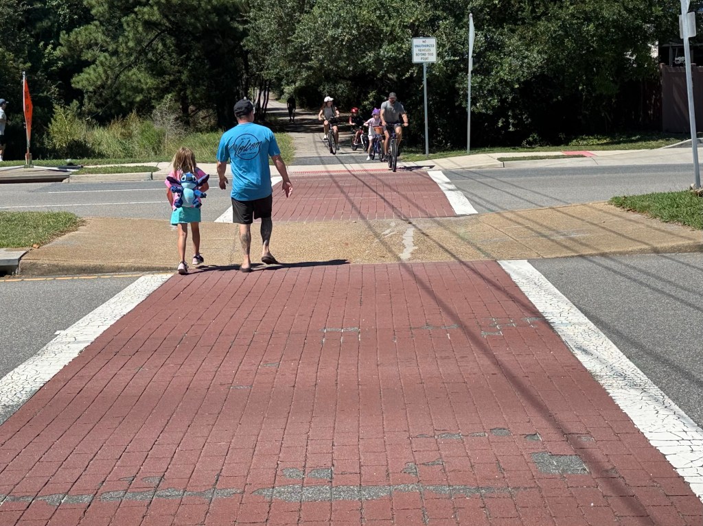
Route 35 ‘25 ridership was 37,091 over 3x ‘23 woot woot! With basically zero advertising too. Imagine how many people would take it if they knew about it!! It’s use plus safe walking & cycling opportunities would reduce traffic for Phase 3 too duh.
Church Point/Thoroughgood BMP & Conveyance Improvements Project Number 100596 Council District 9 CIP Budget 2024-2030 Total Programmed Project Cost $45,660,000.
Event Details:
Councilmember Schulman will host a District 9 community meeting to update residents on current city projects and issues. Topics of discussion include the citywide benefits of tourism and what it brings to our overall economy, new cultural arts funding and related grant programs and pedestrian/bike connectivity improvements currently underway in the district.
Ocean Park Fire and Rescue Squad(OPVRS) Building 3769 E. Stratford Road. Enter door opposite Shore Drive.
The mission of the Bayfront Advisory Commission(BAC) is to review and make recommendations to the City Council regarding public and private projects and issues associated with the Bayfront area.
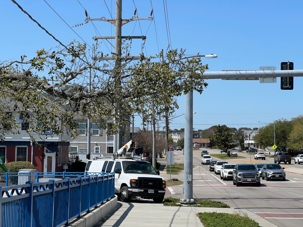
“The project includes installation of a HAWK (High-Intensity Activated Crosswalk) signal to enhance safety and connectivity for trail users crossing the corridor.”
An example graphic of new pedestrian & cycling safety HAWK signal. The very popular Cape Henry Trail. Note: safe pedestrian & cyclist infrastructure means less vehicles on roads.
The mission of the Bayfront Advisory Commission(BAC) is to review and make recommendations to the City Council regarding public and private projects and issues associated with the Bayfront area.
“Since the June BAC meeting falls on the Juneteenth holiday, we have rescheduled the meeting to Monday, June 16 at 3:30pm at the Ocean Park Volunteer Rescue Squad building (3769 E Stratford Rd).
The mission of the Bayfront Advisory Commission(BAC) is to review and make recommendations to the City Council regarding public and private projects and issues associated with the Bayfront area.
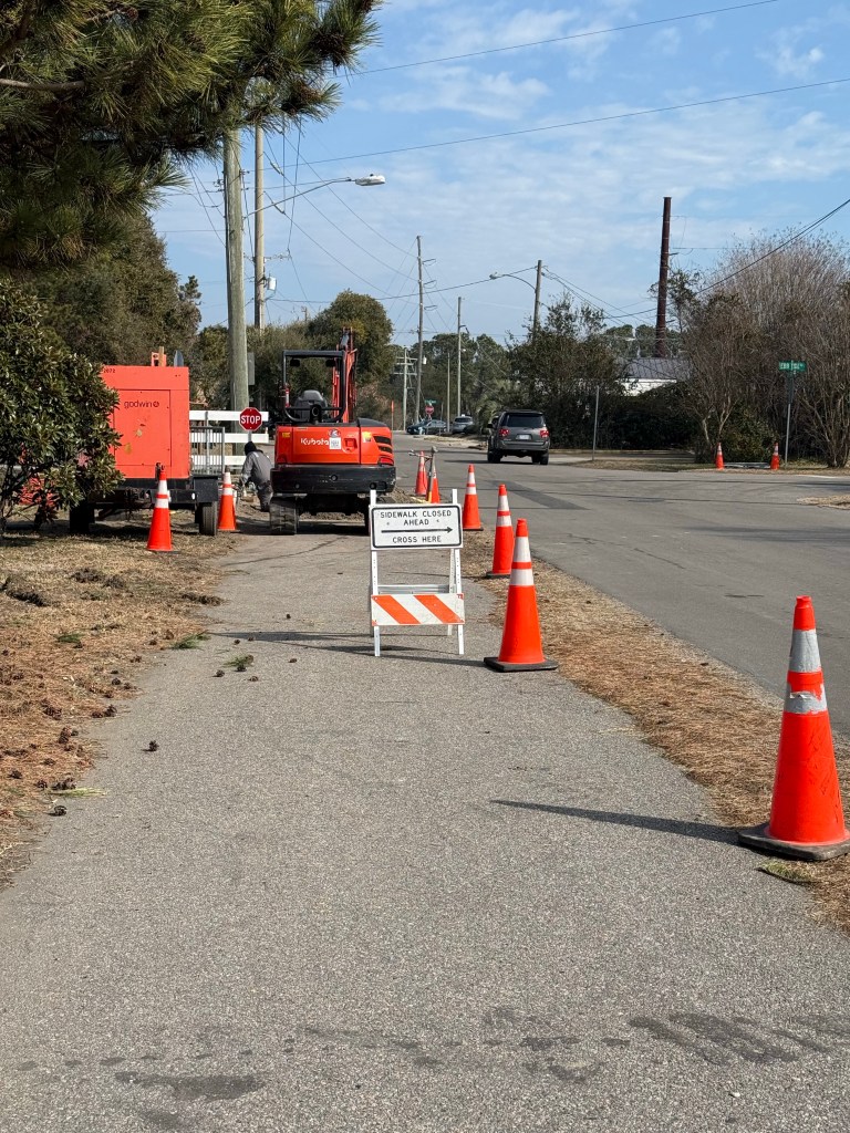
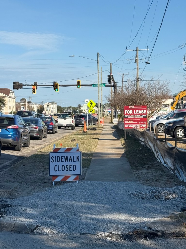
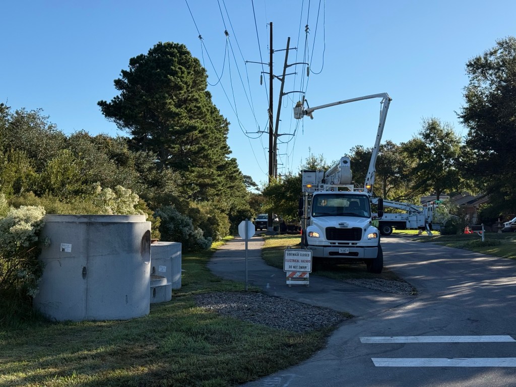
1 photo of more complete blocking of sidewalks. Seems doubtful this will ever be taken seriously. Strange, especially considering ADA compliance issues.
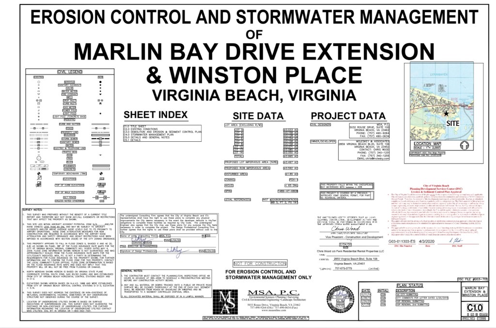
SUBJECT: City of Virginia Beach Public Works VMRC #2024-2851 The application for permit, referenced above, will be heard by the Marine Resources Commission at their public hearing scheduled for Tuesday, February 25, 2025, beginning at 9:30 a.m., at 380 Fenwick Road, Building 96, Fort Monroe, Virginia.
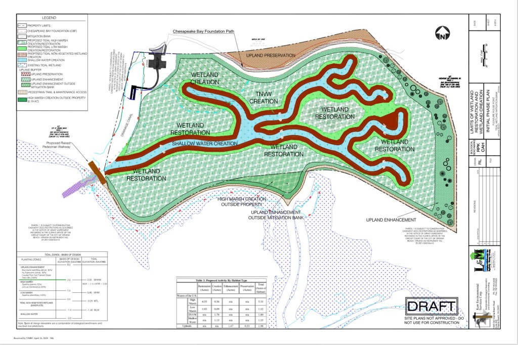
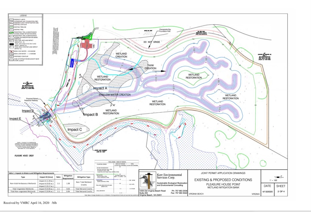
CITY OF VIRGINIA BEACH, #24-2851 requests authorization to mechanically dredge a 20-foot wide by 63-foot long subtidal area to a maximum depth of minus two (-2) feet mean low water within Pleasure House Creek to create a shallow water channel necessary to provide the hydrological connection to the proposed municipal Pleasure House Point Mitigation Bank in Virginia Beach. This project is protested by nearby property owners.
We believe the “purpose & need” of this fast moving project could be violating the spirit of “avoid, minimize, mitigate” in general. Therefore, we humbly request a Phase 1 Environmental Site Assessment and a Phase 2 Environmental Site Assessment are completed before approving the Nationwide 27 Permit.
“Please provide the list of projects that have required the city to buy wetland mitigation credits since the bond referendum passed November 2, 2021 and how many wetland mitigation credits are required now for future projects.” From 11/21/2021 to To 12/23/2024. Your request was forwarded to Public Works. I have been advised that they do not have a list in response to your request. Source: FOIA Request response January 13 2025
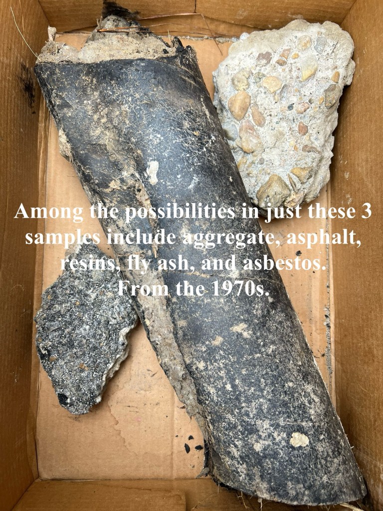
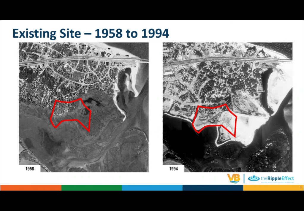
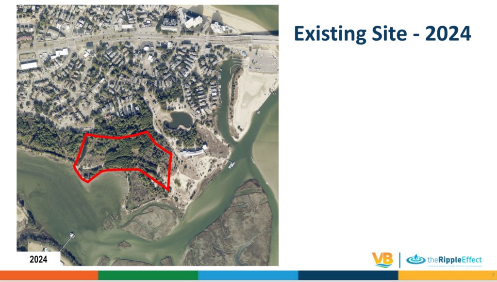
Three(3) samples of material was presented at City Council public hearing which was acknowledged by the Public Works Director – a piece of pavement, concrete with gravel & an unknown petrochemical material all presumably dumped on the spoils site – Pleasure House Point in the area Wetlands Mitigation Bank is proposed – in the 1970s. Was material being tested before dumped? After it was dumped? Video of City Council public hearing January 7th 2025 is provided here: https://www.youtube.com/watch?v=5D_T1v0rI3A
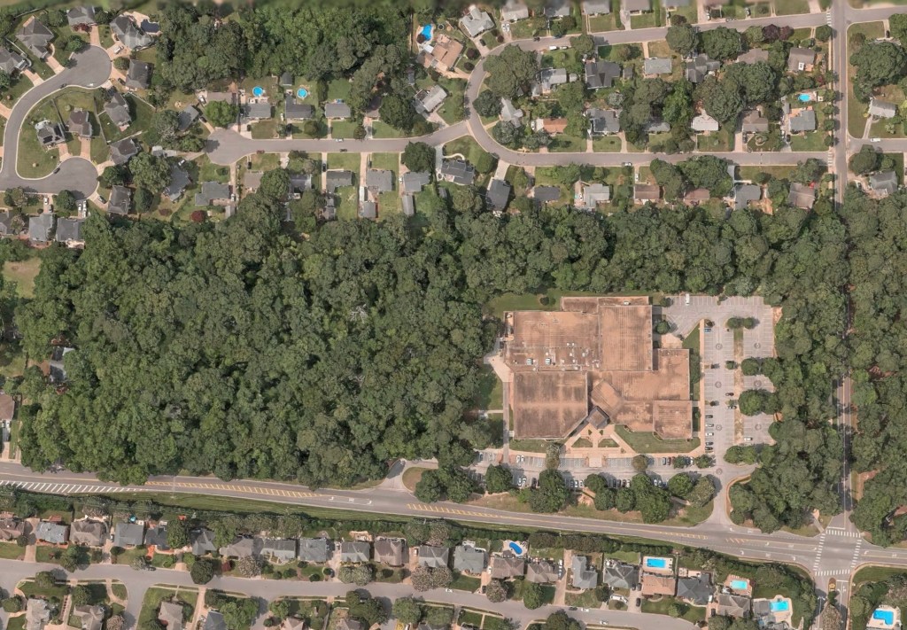
As you know, the Brock Environmental Center and Macon & Joan Brock Classroom campus is literally feet away from this project. Pre-schoolers thru senior citizens routinely spend time there. Meetings with visitors from national & international governments & NGOs also are held routinely. However, this project rolls out. It’ll certainly garner national news. Over 140,000 people have visited the campus since it opened.
In property acquisitions, it is customary for due diligence investigation(s) to be completed before a fee simple property transfer is finalized. It seems reasonable that such an investigation would have reported the obvious; materials of generally unknown origin were dumped on the PHP property as far back as the 1970’s.
These findings would have been followed up with Phase II soil and/or groundwater sampling and testing to screen for regulated substances (hazardous and petroleum constituents). If the investigations were completed, they should be made available to evaluate the potential effects on the proposed PHPWMB project.
Of principal concern is the transport of these dredge materials to the City’s Oceana disposal site, especially if they remain untested. Once removed from PHP, the material becomes a waste, and is subject to VDEQ regulations for transport and disposal. Secondly, possible exposures to regulated substances may result when construction workers are exposed to any contaminated soil, dust, and groundwater. Especially with workers involved in the planting process where hand work is proposed, and the incidence of physical contact with regulated materials may result.
Additionally, considerations for the sampling, testing and handling of regulated materials should be included in the project plans and specifications for the PHPWMB project. This information should be made available for public review and comment.
Therefore, we humbly request a Phase 1 Environmental Site Assessment and a Phase 2 Environmental Site Assessment are completed before approving the Nationwide 27 Permit.
What will be the “reasonably foreseeable effect” if the environmental site assessments haven’t successfully been completed for a spoils site used in the 1970s?
Please note: at the time of this post, currently proposed wetland mitigation bank details of the “90% design”, water budget and other info are still not available on official website.
Things learned last night: tidal wetland bank credits are available to purchase, 60,000 cubic yards (about 6,000 dump trucks) of fill will be removed, over 5,200 trees including live oaks over dozens & dozens of years old will be destroyed (number of dump trucks to move destroyed trees unknown).
Email your questions or concerns to: phpwetlands@vbgov.com
Note: this project does not include the controversial kayak launch which will potentially be located on western border of this project when built. It’s visible in graphics above.
Previously, several related links on this website here, here and here.