Ocean Park Fire and Rescue Squad(OPVRS) Building 3769 E. Stratford Road. Enter door opposite Shore Drive.
The mission of the Bayfront Advisory Commission(BAC) is to review and make recommendations to the City Council regarding public and private projects and issues associated with the Bayfront area.
Public comment has apparently changed: expect no public comment discussion with city staff or an ability to ask city staff any questions. Public comment is available at the end of the meeting and may or may not be included in any minutes.
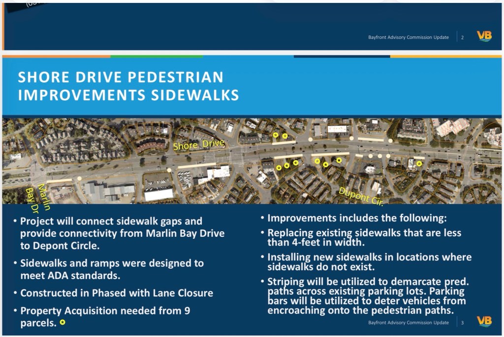
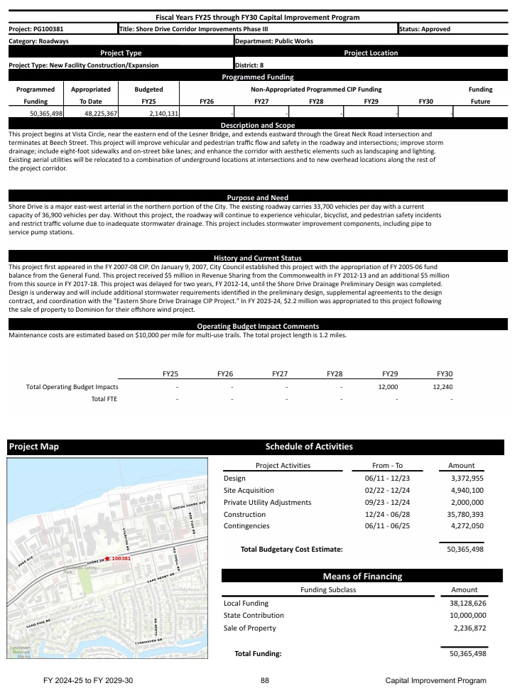
This long delayed project allegedly now starts May 2026. Note: “Property Acquisition” according to state law could have started & been completed years ago. It’s a CoVB policy not to do so.
The following update was provided by the City’s Public Works Department. The spreadsheet identifies all of the current projects in the Bayfront Area. Updates are identified in RED.
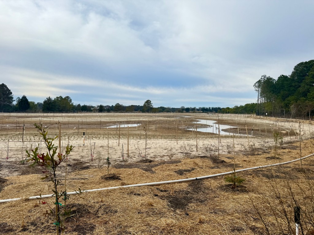
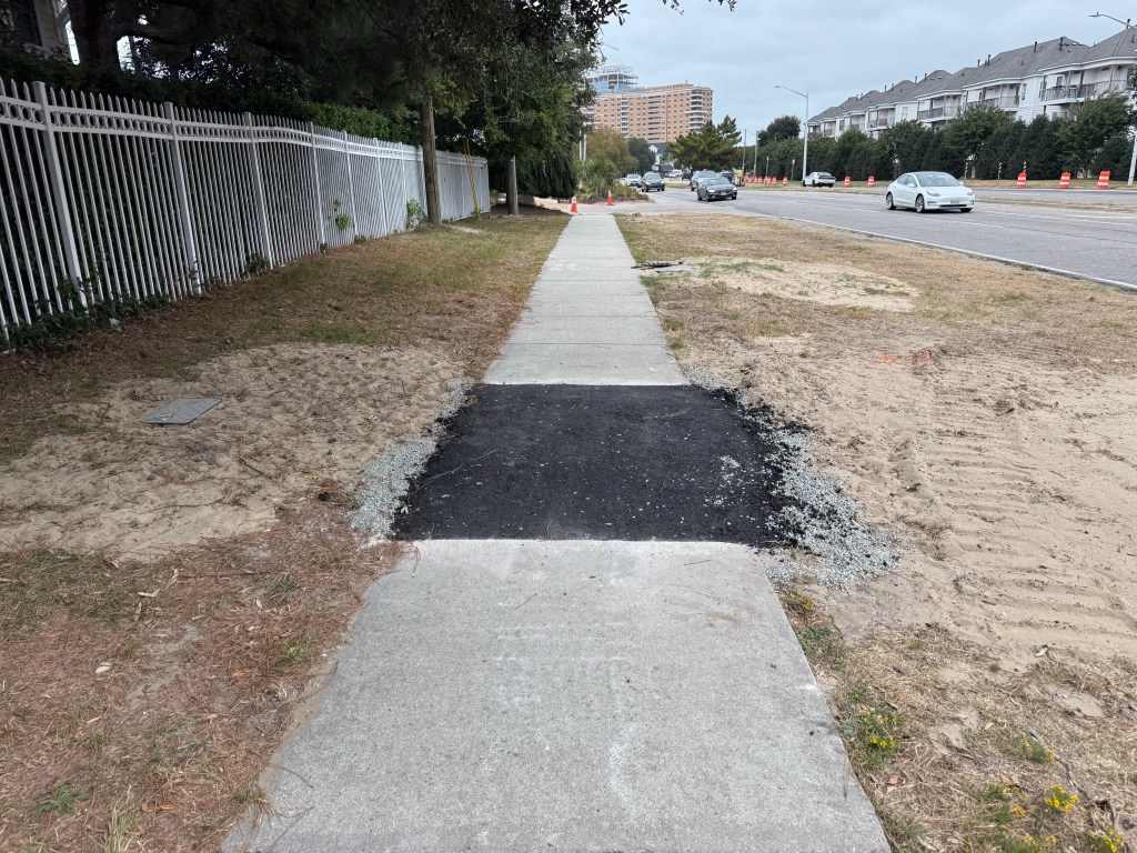
In Tree City USA, the PHP WMB plantings are complete including the 703 saplings listed in contract as $30,520. Less than the tree mulch cost of $34,240.
About WCCB “[m]entioned in [Thursday’s BAC] meeting that the City will not be accepting the beach access ramp from the private developer until it is made ADA compliant. Once the ramp is ADA compliant, the City will accept the ramp and take over maintenance.”
Ocean Park Fire and Rescue Squad(OPVRS) Building 3769 E. Stratford Road. Enter door opposite Shore Drive.
The mission of the Bayfront Advisory Commission(BAC) is to review and make recommendations to the City Council regarding public and private projects and issues associated with the Bayfront area.
Public comment has apparently changed: expect no public comment discussion with city staff or an ability to ask city staff any questions. Public comment is available at the end of the meeting and may or may not be included in any minutes.
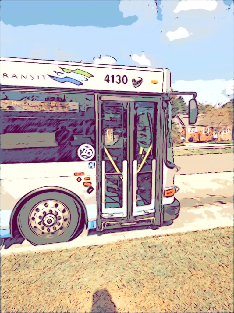
Route 35 ‘25 ridership was 37,091 over 3x ‘23 woot woot! With basically zero advertising too. Imagine how many people would take it if they knew about it!! It’s use plus safe walking & cycling opportunities would reduce traffic for Phase 3 too duh.
Ocean Park Fire and Rescue Squad(OPVRS) Building 3769 E. Stratford Road. Enter door opposite Shore Drive.
The mission of the Bayfront Advisory Commission(BAC) is to review and make recommendations to the City Council regarding public and private projects and issues associated with the Bayfront area.
The mission of the Bayfront Advisory Commission(BAC) is to review and make recommendations to the City Council regarding public and private projects and issues associated with the Bayfront area.
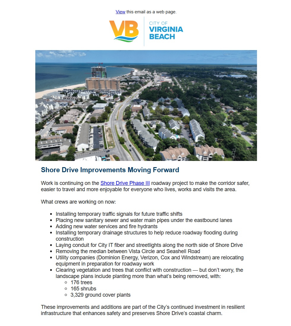
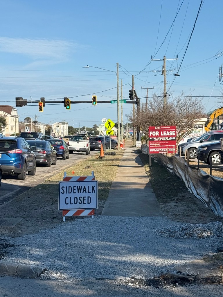
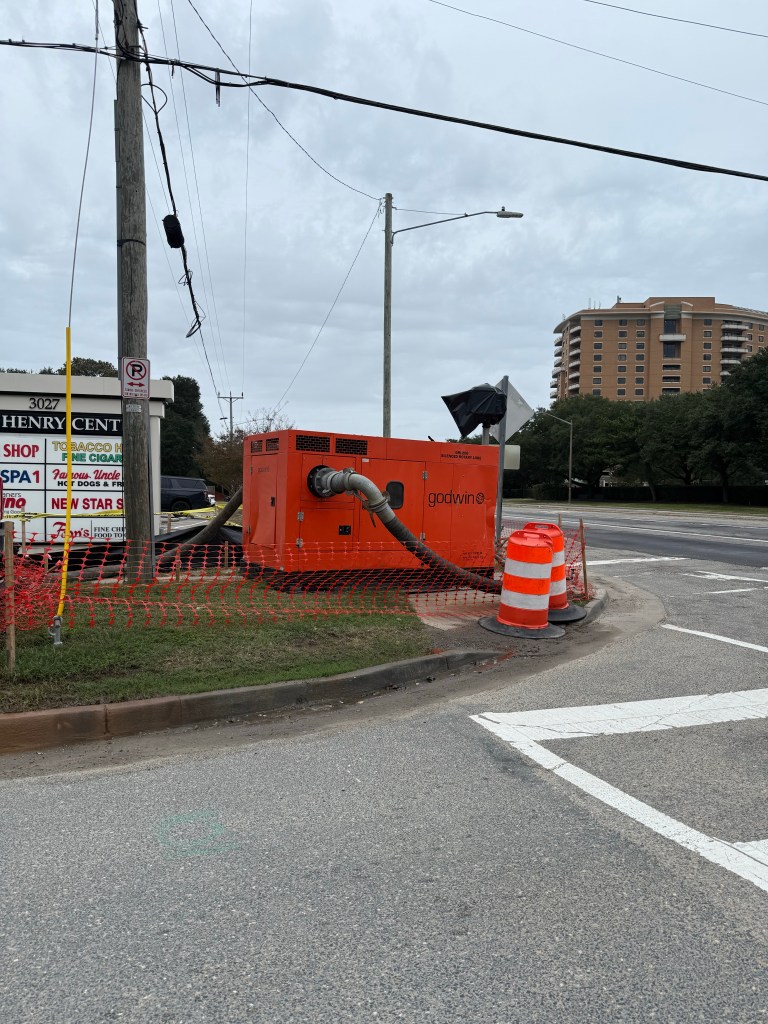
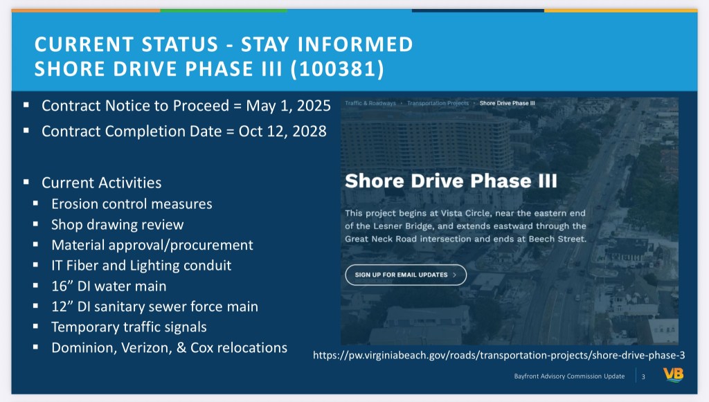
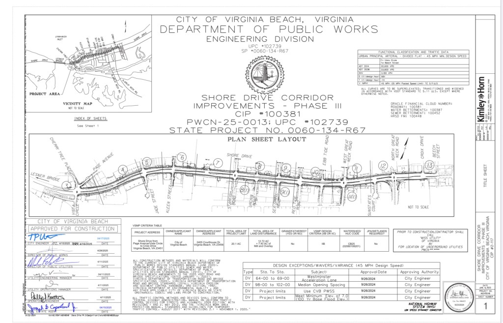
The Shore Drive Phase 3 Improvement Project(SDP3), first identified as a City Capital Improvement Project (CIP) in 2007, is finally getting ready to happen. This 3 year long construction project will improve the section of Shore Drive between the Lesner Bridge and North Great Neck Road, making the road safer for pedestrians and vehicles. Construction will take place over the next 3 years and will definitely have an impact on our Bayfront area in the process.
In an effort to help provide as much information to the residents as possible, we have been working with the City and Councilman Cummings to gather as many details as possible to help answer questions regarding this project. Thanks to the City’s Public Works and Councilman Cummings, we are able to provide the following detailed drawings for construction, traffic management and storm water plans. Please see below for a link to our project page for the SDP3 project.
We understand that this data is a lot to digest and we plan to help by posting drawing analysis reviews and City provided updates as best possible. Similar to the Lesner Bridge 3 year project, we can make it through the pain to get to the well deserved benefits and information will be a critical factor.
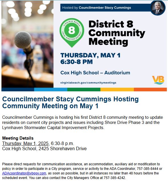
On Thursday May 1st, there will also be an opportunity to learn more about the upcoming construction project at the District 8 Councilman Cummings Community Meeting. More information on this meeting can be found below.