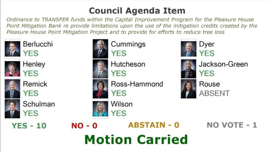
City Council public hearing on proposed Pleasure House Point Wetlands Mitigation Bank CIP transfer of funds including vote.
ITEM:
CITY OF VIRGINIA BEACH AGENDA ITEM
An Ordinance to Transfer Funds Within the Capital Improvement Program for the Pleasure House Point Mitigation Bank, to Provide Limitations upon the Use of
Mitigation Credits Created by the Pleasure House Point Mitigation Project, and to Provide for Efforts to Reduce Tree Loss
MEETING DATE: January 7, 2025
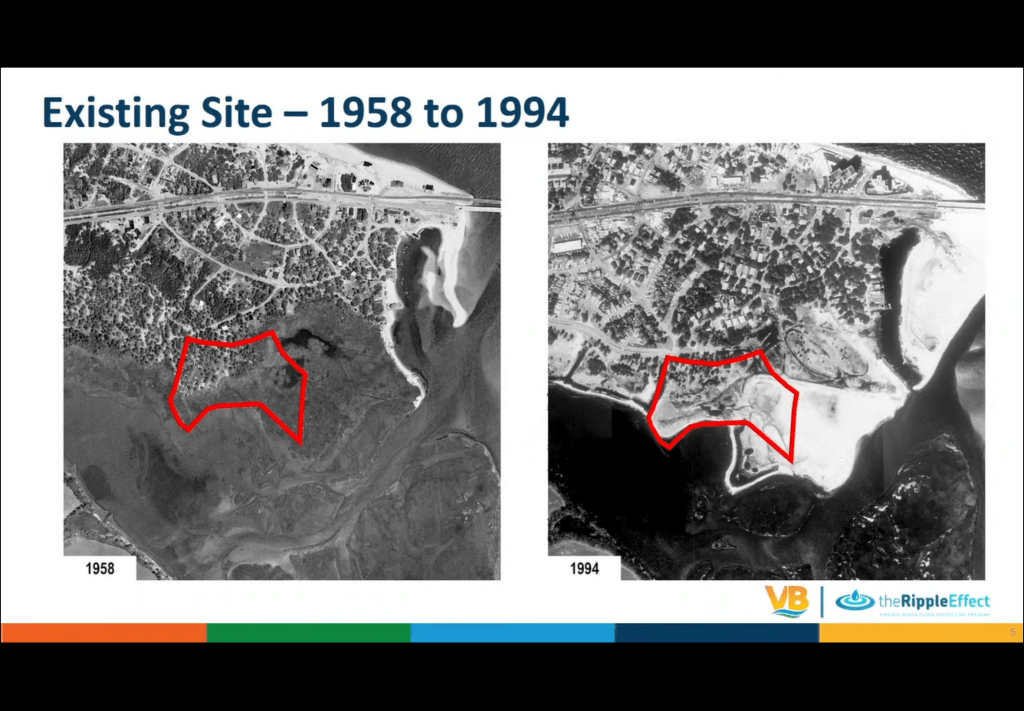
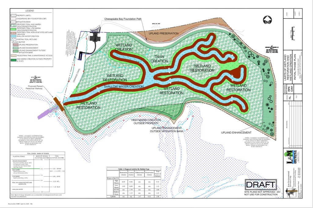
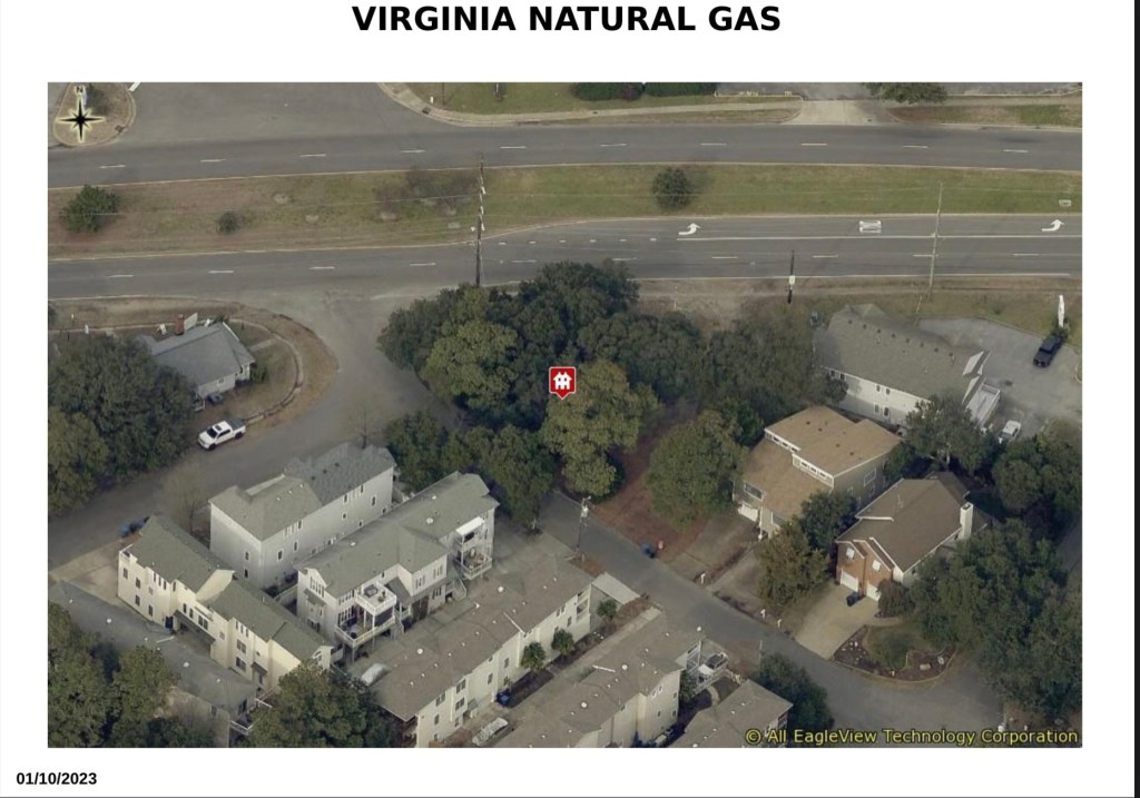
Background: Capital Project 100304, ” Pleasure House Point Mitigation Bank”
City Council January 7 ‘25 meeting info.
The video from City of Virginia Beach.
Please note: at the time of this post, currently proposed wetland mitigation bank details of the “90% design”, water budget and other info are still not available on official website.
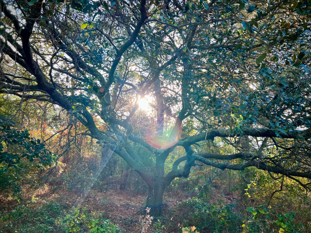
Things learned last night: tidal wetland bank credits are available to purchase, 60,000 cubic yards (about 6,000 dump trucks) of fill will be removed, over 5,200 trees including live oaks over dozens & dozens of years old will be destroyed (number of dump trucks to move destroyed trees unknown).
Email your questions or concerns to: phpwetlands@vbgov.com
Please correct any errors and discuss in the comment section.
Our current understanding is hundreds of trees will be cut down and this project is at the 90% design stage.
Bayfront Advisory Commission will accept public input at their December 19th meeting at 230pm in Ocean Park Volunteer Rescue Squad.
Join us!
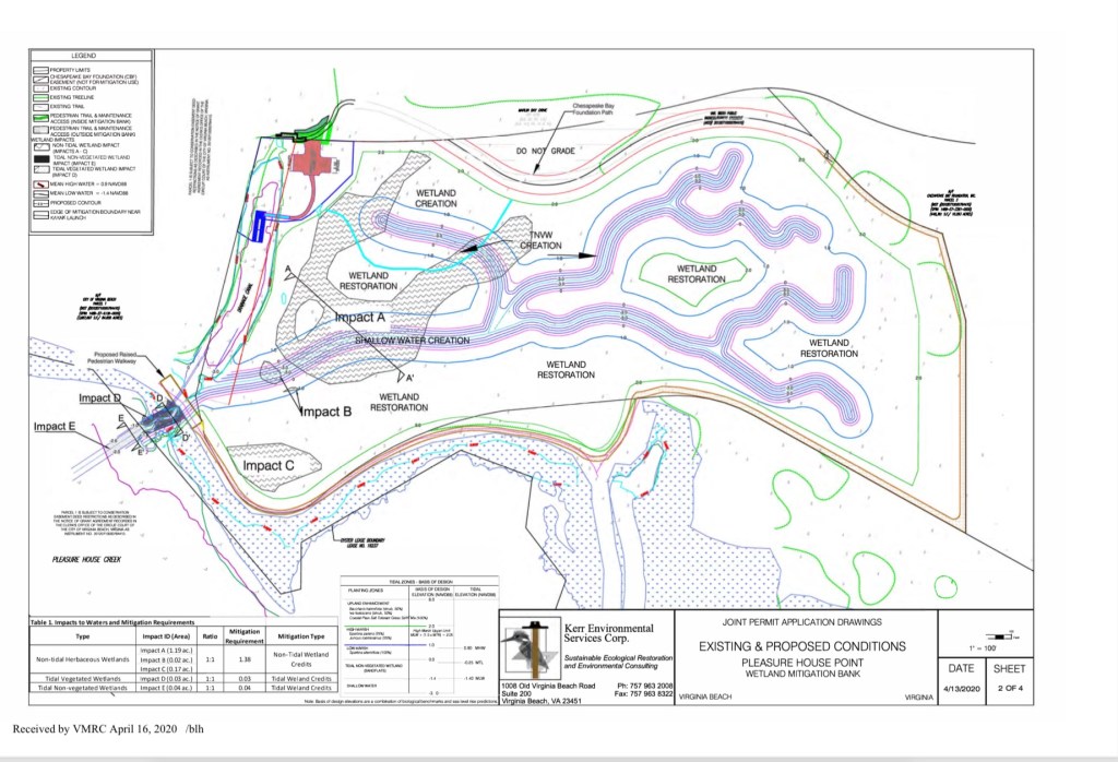
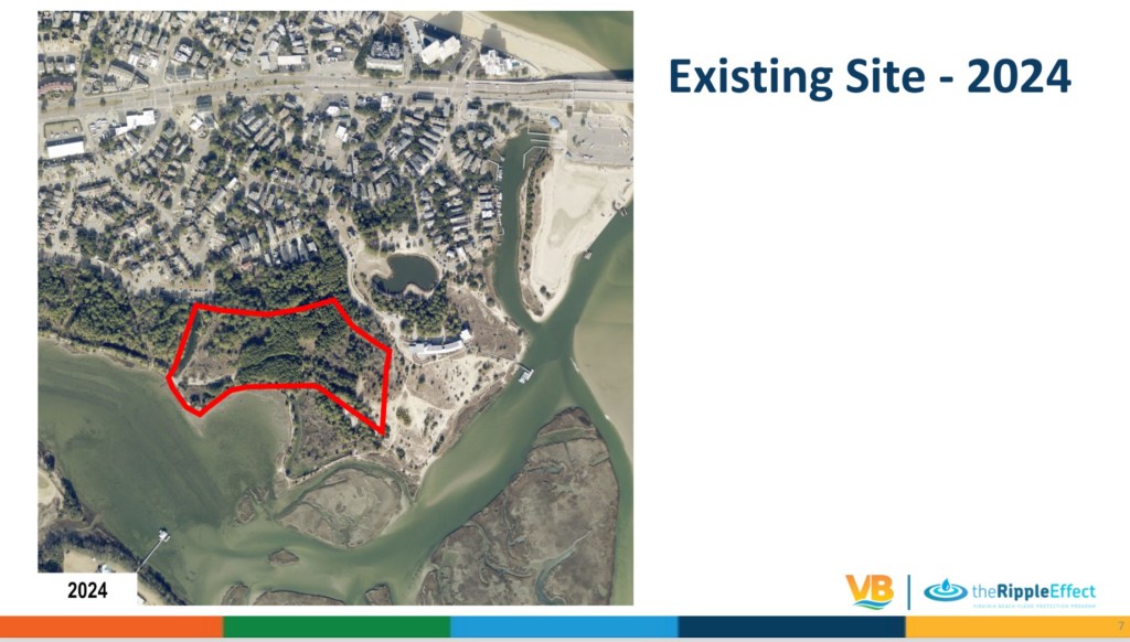
Note: this project does not include the controversial kayak launch which will potentially be located on western border of this project when built. It’s visible in graphics above.
Previously, several related links on this website here, here and here.
Love live oaks? Visit Friends of Live Oaks.
We are unsure if this live oak will be destroyed in either project. 
Jeremy can not attend so here is his report from an email:
+ + +
I have a conflict and can’t make the meeting today. I’m working with the city engineer on a project spreadsheet, I’ll keep you posted. Here are the updates from the PW side.
Chesapeake Beach Renourishment
Status
A contract has been awarded to Seaward Marine Corporation.
Work is underway and is to be completed by October 13, 2024.
Lynnhaven Inlet Dredging and Cape Henry Beach Placement
Status
USACE opened bids on April 3rd.
The work includes dredging the federal channel system, removing underwater debris, and placing the sand along Cape Henry Beach.
USACE intends to award the contract to Cottrell Dredging located in Norfolk, Va.
The most recent update from USACE indicated a pre-construction meeting and issuance of a Notice to Proceed sometime between late July and early August. From that point, Cottrell is required to submit a schedule within 15 days after NTP is issued.
Eastern Branch Lynnhaven River (EBLR) Dredging
Status
The City’s ongoing dredging project of the EBLR is going well with the contractor scheduled to complete Keeling Drain dredging this summer.
Crab Creek/Long Creek
Status
The next dredging cycle is being planned for winter 2024/2025.
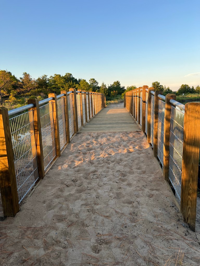
Pleasure House Point Trail Breach
Status
Work has been completed to construct an elevated crossing over a flood-prone area.
These improvements will make the path more accessible after heavy rain events.
Comprehensive Safety Action Plan
Status
A draft of the City’s first Comprehensive Local Road Safety Action Plan will be publicly available for review and comment in August. The Plan identifies and prioritizes countermeasures to address roadway safety issues throughout Virginia Beach. Stakeholders, including members of the Bayfront Advisory Commission, were briefed on the Plan on March 22nd and provided feedback to staff on current safety challenges. Public Works Engineering staff will brief City Council on the Draft Plan on August 27th, and the Plan is anticipated to be adopted in September or October.
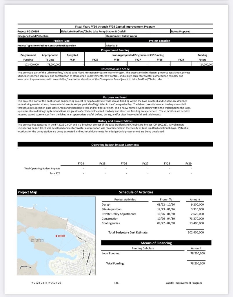
Lake Bradford / Chubb Lake projects
We typically do not provide updates to the BAC, but since the BAC provided support letters for the BRIC grant, we thought an update was needed.
Lake Pleasure House Outfall – construction complete
Lake Bradford Ditch Dredging – construction complete
Lake Bradford-Chubb Lake Stormwater Pump Station and Outfall
STATUS
The city is currently in the process of selecting a Design-Build team. The expected selection will take place in the first quarter of 2025.
The city applied for a Building Resilient Infrastructure and Communities (BRIC) Grant worth $35 million, but unfortunately, was not successful in receiving it.
Church Point-Thoroughgood BMP and Drainage Improvement – The City awarded the design contract to RK&K. Anticipated construction is in 2028.
STATUS
Design NTP – May 21, 2024
SCHEDULE
Advertise for Bids: February 2028
Estimated Construction Start Date: August 2028
Estimated Construction Completion: May 2031
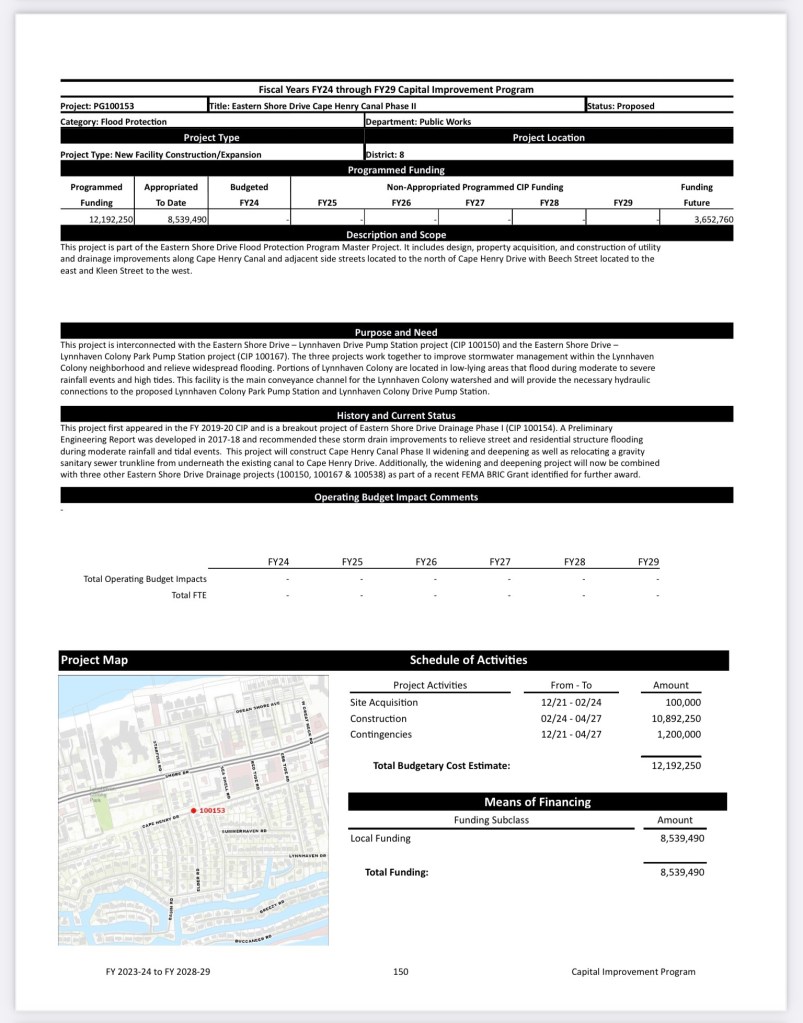
Eastern Shore Drive Drainage Improvement Projects
Cape Henry Canal Phase II – Relocation of Sanitary Sewer Gravity Mains, 1C.2
The project was completed on October 2, 2023. The project was on time and Under Budget by $185,682.
Eastern Shore Drainage Improvements Phase I – Section I – $35.9M Building Resilient Infrastructure and Communities (BRIC) Grant Projects:
Eastern Shore Drive – Lynnhaven Colony Park Pump Station, 1B
Cape Henry Canal Phase II – Widening and Deeping, 1C.2
Eastern Shore Drive – Lynnhaven Drive Pump Station, 1D
Eastern Shore Drive – Elevate Lynnhaven Drive, 1E
STATUS
90% Design Completed January 2024 Project #1-3.
60% Design Completed March 2024 Project #4.
SCHEDULE
100% Design Submittal for all 4 projects – August 2024
Advertise for Bids: January 2025
Estimated Construction Start Date: May 2025
Estimated Construction Completion: May 2028
Eastern Shore Drive – Vista Circle Pump Station, 1A
STATUS
PER Completed. Project detailed design has not begun.
SCHEDULE
Advertise for Bids: October 2026
Estimated Construction Start Date: April 2027
Estimated Construction Completion: December 2029
Eastern Shore Drive – Poinciana Pump Station
STATUS
60% Design Submittal Received and compiling City and Peer Review Comments
SCHEDULE
Advertise for Bids: April 2025
Estimated Construction Start Date: August 2025
Estimated Construction Completion: May 2028
Eastern Shore Drive – North Shore Drive Street Drainage Improvements, 1F & Eastern Shore Drive – Cape Henry Drive Street Drainage Improvements, 1G
STATUS
60% Design Submittal Received March 2024
SCHEDULE
Advertise for Bids: June 2025
Estimated Construction Start Date: September 2025
Estimated Construction Completion: June 2027
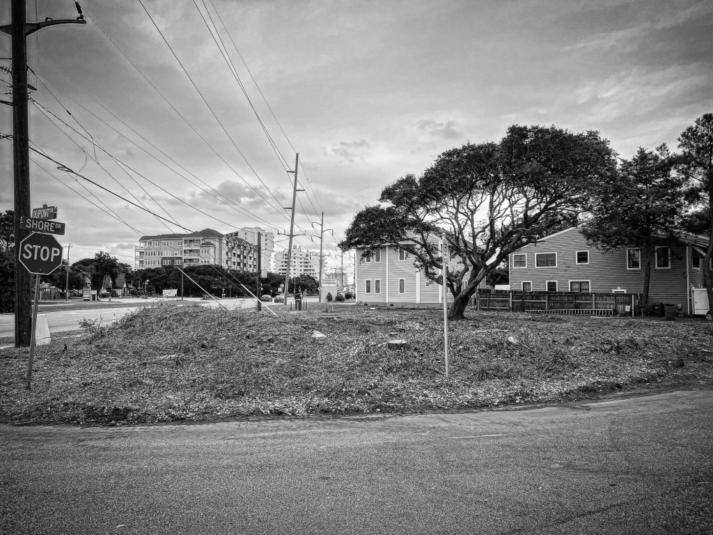
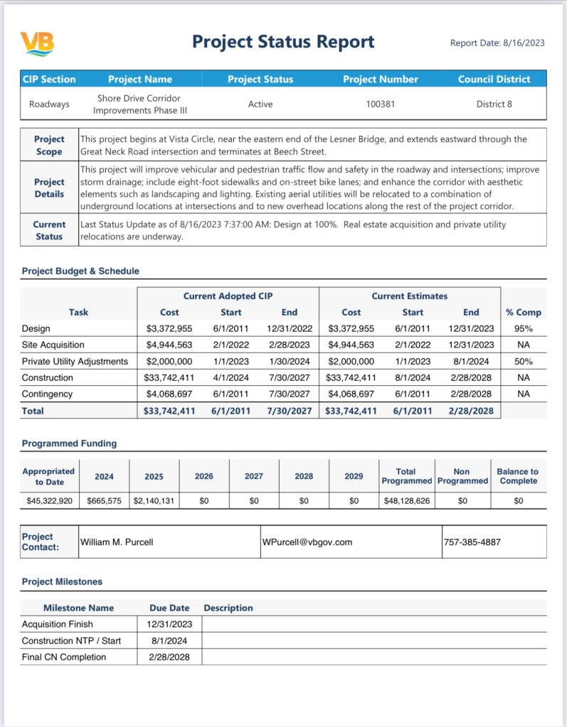
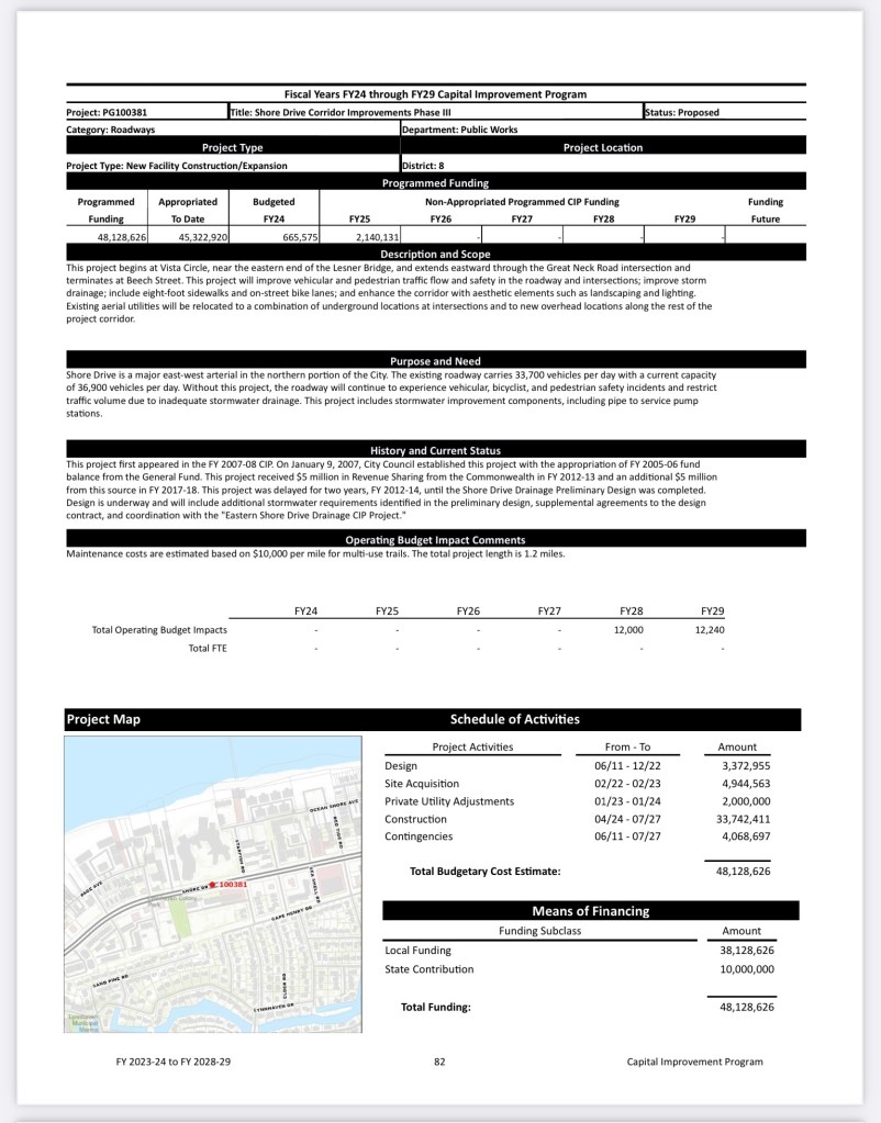
Shore Drive Corridor Improvements Phase III
STATUS
No change. Real estate acquisition and private utility relocations are underway.
SCHEDULE
Advertise for Bids: September 2024
Estimated Construction Start Date: January 2025
Estimated Construction Completion: July 2028
Shore Drive Pedestrian Improvements
STATUS
90% Design Submittal Received July 2, 2024
SCHEDULE
Advertise for Bids: June 2025
Estimated Construction Start Date: October 2025
Estimated Construction Completion: April 2026
Shore Drive Corridor Improvements Phase IV
STATUS
No change. Final Preliminary Engineering Report received 11/15/2023. The project is not funded
Jeremy Kline
DEPARTMENT OF PUBLIC WORKS
Deputy Director
757.385.8420 | jekline@vbgov.com
+++
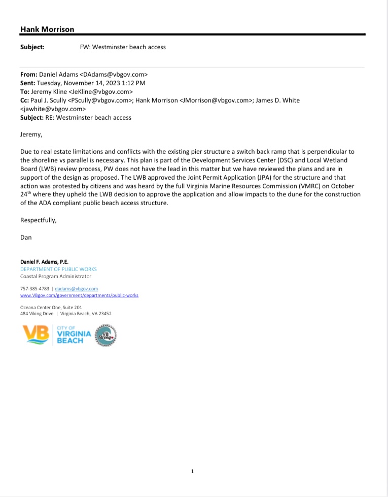
Vacation of Easement approved 9-1 including WCCB paying City $100,000 for future beach walkway replacement.
Wycliffe referred back to Planning Commission on 9-1 vote.
Additional public hearing plus vote on vacating easement currently scheduled for November 21st ‘23 City Council session.
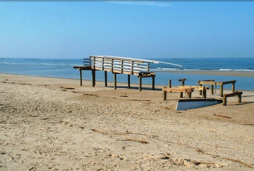
Also it seems WCCB is closer to guarantee their controversial approved beach walkway maintenance & probable rebuild since “we have reviewed the plans and are in support of the design as proposed”. Previously on this website.
Visit SurfRider.org/CAMPAIGNS.
Maybe redeveloping lakes is not smart or sustainable way for a City that will be dramatically impacted by sea level rise(SLR) and attempting to keep its currently stellar bond rating & logical story telling for rating agencies.
A downgrade by ratings agencies would obviously increase interest costs for tax payers.
Learn more at SaveLakeConrad.com including a link to Petition to stop this insanity. Join thousands who have signed the Petition.
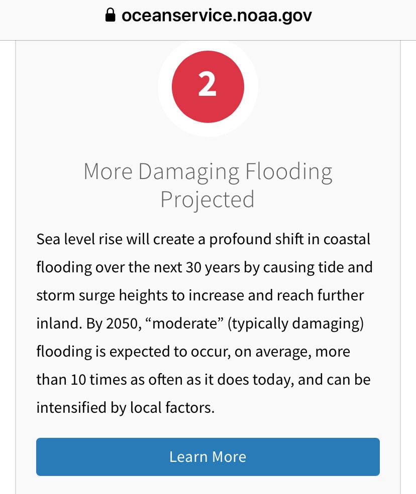
Learn more about realities of sea level rise by starting at our SLR Resources page.

Maybe only redevelopment NOT in City storm water management facilities and lakes is more intelligent considering we’re 2nd in the country for impacts from SLR.
CITY COUNCIL INFORMAL AND FORMAL SESSIONS
TUESDAY, NOVEMBER 14, 2023. JOIN US!
2 items:
Previously Fitch Downgrades Westminster-Canterbury on Chesapeake Bay (VA) Rev Bonds to BB+.
And:
I 1.VACATION OF EASEMENT
20’ public access easement at 2454 Starfish Road
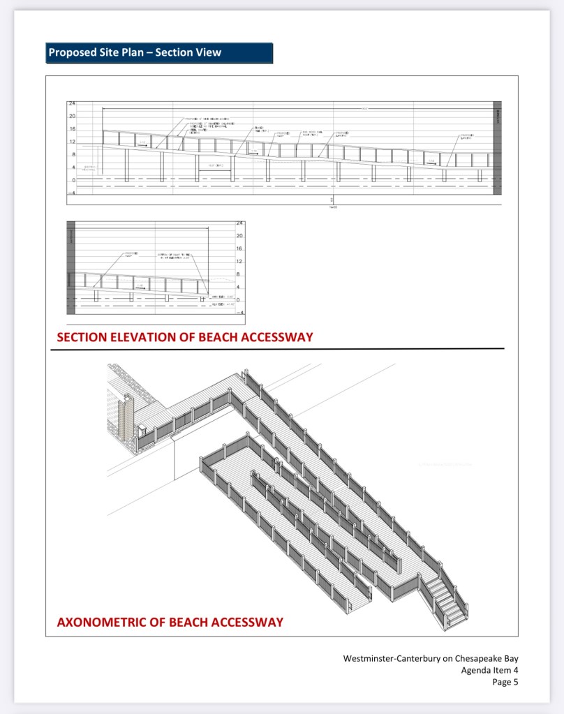
Vote Tuesday on VACATING easement is one step in process before beach walkway can be built.
Note: Wetlands Board unanimously approved this design recently. That approval was Appealed to VMRC. Appeal failed. After WCCB builds this walkway it’s believed their plan is to give it to VB tax payers. Who will pay for it to be maintained and rebuilt?
City Council Agenda November 14 ‘23 (488 page pdf)
OPVRS = Ocean Park Volunteer Rescue Squad located at 3769 E Stratford Rd, Virginia Beach, VA 23455.
Please enter door opposite Shore Drive.
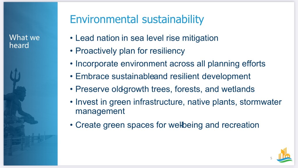
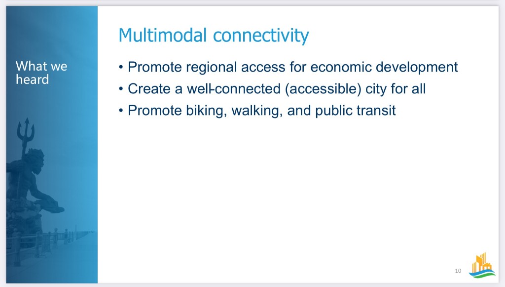
The Public Workshops will consist of a short recap presentation on themes developed in the Focus Groups and the Vision Mapping process. We will then proceed to break out into small groups to provide more direct, specific feedback on each of the draft themes. The Vision Map will take the draft themes of balanced growth, sustainability, connectivity, diversity, and wellbeing, and apply them to areas of the city to create a framework of how the city should grow and develop over time. There will be an interactive planning exercise in our small groups.
The workshops will be held at these times and locations:
There is no need to RSVP to these workshops. We estimate this meeting to run about 1.5 to 2 hours. Please pass along the information to your friends, family, neighborhoods, colleagues, youth groups, civic leagues, faith groups, etc.
Here’s where we are so far.


As always, for more information or if you have any outstanding questions, please reach out to me at RacMiller@vbgov.com or Hank Morrison, the Comprehensive Planning Administrator, at JMorrison@vbgov.com.
You are aware about the reality of sea level rise(SLR) correct?

Thanks to Hank for updated Agenda.
Official info link about meeting at Ocean Park Volunteer Rescue Squad. (Please enter door opposite Shore Drive.)
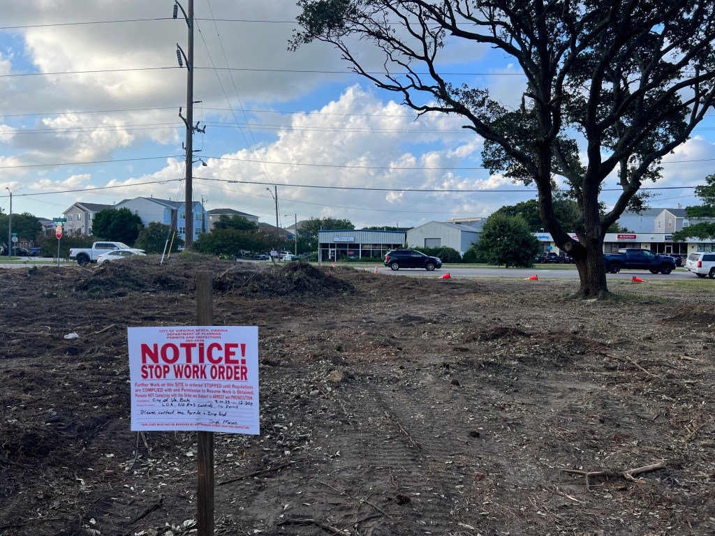
THE NEEDLESS DESTRUCTION OF ABOUT 6 LIVE OAKS, The City Tree, will be on the Agenda.


Bayfront Advisory Commission meeting link at City’s website.
Complete agenda, once we receive it, will be shared in another post.
BAC meets at OPVRS Thursday, September 21st.
Update from Hank about Phase 4 & 3:
Phil Pullen from Public Works informed me that his team will be presenting on the Shore Drive Projects at next month’s BAC meeting. …He also informed me that they are still scoping out the interim sidewalk improvements and will have a cost/schedule for the improvements soon. The attached status report will be placed on the BAC webpage by the end of the week.
2022 Sea Level Rise Technical Report
Norfolk-Va Beach Joint Land Use Study
This Just In – data dump about $52M 1/2 mile Phase 4 at OPCL.org
Care what VB becomes? Join us!
6pm at The Hive in Town Center 4636 Columbus Street
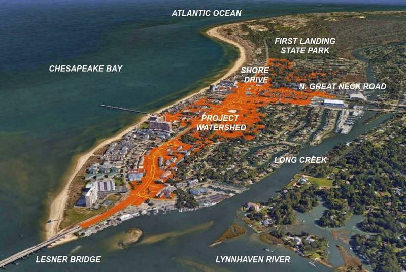
The Gateway to Virginia Beach, which is located on the Chesapeake Bay, has now become a high priority on par with the Oceanfront.
Woo hoo!

Not to bury the lede:
Shore Drive is a major east-west arterial in the northern portion of the City. The existing roadway carries 38,800 vehicles per day with a current capacity of 36,900 vehicles per day. Without this project, the roadway will continue to experience vehicular, bicyclist, and pedestrian safety incidents, and restrict traffic volume due to inadequate stormwater drainage.
🟢 The City Manager’s Proposed City Budget at VBGOV.com.

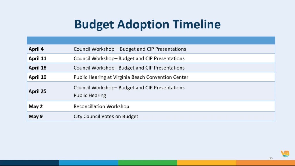
A few highlights of Proposed City Budget include:


Economic & Tourism Development
EV-22-0001 $200,000
Shore Drive Study Update
This project provides an update to the Shore Drive Corridor Plan (2000) and the Shore Drive Corridor Design Guidelines (2002). Flood mitigation strategies from the Joint Land Use Study (JLUS) for JEB Little Creek and JEB Fort Story (2019) as well as the bond referendum projects will be integrated into the update creating a broader, more comprehensive Shore Drive Plan. The Bayfront Advisory Commission will be utilized as a steering committee for the development of the update, public input, coordination, and engagement with the local community. The updated plan/guidelines will include: determination of existing conditions; development of a community wide public input survey; identification of issues and opportunities; development of specific land use recommendations by corridor segment; and development of architectural/landscaping/signage/public infrastructure guidelines.


To bury the other lede:
By the way, with this current proposal YOUR real estate taxes will probably jump over 10% based on recent new assessments.
