SDCC General Meeting – Monday Dec. 29th

Click here for a printable version of the agenda – SDCC Agenda DEC 2014

Shore Drive Community Coalition General Meeting

Monday December 29, 2014

7:30 – 8:30 pm

Ocean Park Volunteer Rescue Squad Station

(Intersection of Shore Drive and East Stratford Rd)

SDCC Mini-CHRISTMAS Party

(Finger Food, Salad, Soda, Cookies provided by David)

Call to order:

Meeting topic: Delegate Chris Stolle to discuss upcoming Assembly items:

  • Virginia Beach’s city package to Assembly
  • Commonwealth’s 2015 Budget outlook
  • Transportation Bill and funding projections
  • Affordable Care Act and State medical insurance expansion
  • State’s mitigation programs of sea level rise
  • Assembly outlook for 2015
  • Questions and answers

Nominations for SDCC Officer’s Slate for 2015

Officer’s Reports:   President’s Report      David Williams

Vice Pres Report         Rick Mercadante

Secretary’s Report      Todd Solomon- November Minutes

Treasurer’s Report      Paulette Hruska

Old Business:   See meeting topics

Adjourn

Next SDCC – Monday January 26, 2015 7:30 pm

Ocean Park Volunteer Rescue Squad Station

Please check www.sdcc.info for more information on area news and events

“Adaptive Planning for Flooding and Coastal Change in Virginia: Next Steps for the Commonwealth moved the current dialogue forward by providing a forum for the second meeting of the Governor’s Climate Change and Resiliency Update Commission. It also brought together for discussion national, state, and local experts and leaders on current actions being taken to adapt to flooding and coastal change and highlighted key legal and policy matters currently confronting both the public and private sectors.”

We’re fortunate we can share the Adaptive Planning for Flooding and Coastal Change in Virginia: Next Steps for the Commonwealth conference that was held very recently.

Click graphic to visit W&M's Law School website for conference

Click graphic to visit W&M’s Law School website for conference

To view conference, visit link at William & Mary’s Law School website which includes:

    Conference Videos:

    Introductory Remarks & Reports to Commission (1:22:28)
    Second session of the Commission (25:11)
    Senator Kaine’s Keynote Address (57:24)
    FEMA, National Flood Insurance Program’s Community Rating System, and Local Government Liability Panel (1:01:13)
    Adaptation: Market Sector Responses Panel (57:11)
    Social Vulnerability Panel & Voices of Adaptation in Virginia Panel (1:39:20)

    Conference Presentations:

    Jim Redick, Secure Commonwealth Panel Presentation
    Carl Hershner, Climate Commission Report Presentation
    Bill Lesser, NFIP Presentation
    Shannon Hulst Jarbeau, CRS Presentation
    Kristen Clark, Stormwater CRS Presentation
    James Andris, Local Government Liability Presentation
    Scott Hunter, Comparity Insurance Presentation
    Mike Vernon, Flood Mitigation Hampton Roads Presentation
    Lisa Schiavinato, Strict Scrutiny Presentation
    Erica Holloman, Southeast CARE Coalition Presentation
    Sarah Stafford, Social Vulnerability in Mapping
    Molly Mitchell, Virginia Vulnerability Mapping Presentation
    Curt Smith, Adaptation on the Eastern Shore of Virginia

Last year, the Virginia Coastal Policy Clinic (VCPC) at the William & Mary Law School and the Center for Coastal Resources Management (CCRM) at the Virginia Institute of Marine Science (VIMS) hosted a forum for state and local government officials as well as coastal stakeholders to discuss the legal and policy challenges presented by coastal flooding.

Described as a “game-changer” for Virginia, the event generated recognition that the magnitude and complexity of these challenges places local governments in a position of needing a variety of assistance if they are to meet their responsibilities to protect health, safety, and welfare.

We encourage you to visit Willam & Mary’s Law School website to learn more about the massive changes coming to your neighborhood, and to continue the conversation.

“We hope that once the project is finished, the improvements will improve access and visibility so these businesses are affected in a much more positive way.”

Coverage at WTKR.com.

“People would have to go to a detour through the neighborhood,” she said. “I had tons of customers email me and say ‘I didn’t think you were open because of the construction.’ They thought I was completely closed.”

/home/wpcom/public_html/wp-content/blogs.dir/ca1/18933209/files/2014/12/img_2609.jpg

The good news is the COVB does not want to cut down 2 live oaks at LBR

IMG_2616.JPGIMG_2612.JPG

The bad news is COVB has hired an arborist to see how much love they need so as not be cut down.

The Twelve Days of Christmas (The Shore Drive Version)

It only seemed fitting with 12 days until Christmas and the recent Lesner Bridge update (minus the speed bump fix)…..


Twelve deflated tires

Eleven misalignments

Ten angry emails

Nine nasty tweets

Eight wheelbarrows of asphalt

Seven hardhats shoveling

Six hour work window (9am to 3pm)

Five Orange Cones

Four flagmen warning

Three rollers smoothing

Two lanes a-opening

And a SPEED BUMP fixed on Shore Drive

Filing Service SCAM may target Incorporated Civic Leagues and Associations as well as Businesses

The state is warning business owners about a private firm sending solicitations that look similar to annual forms required by the State Corporation Commission.

The mailings, from an entity called the Virginia Council for Corporations, ask business owners to return a form, along with a check for $125.

To read the entire Virginian-Pilot article, please click here

There is no reason to use this service and the State is not accepting the documents.  Please do not pay them for anything.

“Complete Streets are streets for everyone. They are designed and operated to enable safe access for all users, including pedestrians, bicyclists, motorists and transit riders of all ages and abilities. Complete Streets make it easy to cross the street, walk to shops, and bicycle to work. They allow buses to run on time and make it safe for people to walk to and from train stations.”

Virginia Beach Adopts Complete Streets Policy

Woo hoo!

The purpose of the Complete Streets Policy is to improve the Virginia Beach transportation system by providing safe, attractive travel for all users through a system of connected transportation choices designed in harmony with adjacent land uses.

View Press Release at VBGov.com.
Learn more about Complete Streets Policy at VBGov.com.

EB-ShoreDrivePedSign-LaCasa

“The city is moving forward on a long-awaited sand replenishment project for Chic’s Beach, starting with collecting “public beach” releases from the neighborhood’s waterfront property owners.”

View article at Pilotonline.com.

The release states that a property owner agrees the portion of the land between the dune or the bulkhead line and the water is a public beach. The owner gives the city permission to dump sand on it and agrees not to impede public access.

City officials met with Chic’s Beach residents about the project and the release form last month. They’ll need consent from the owners of roughly 140 properties stretching about a mile from Joint Expeditionary Base Little Creek to Joyce Avenue.

Chic's Beach resident Taylor Sharpe and his dog Sandy walk the beach there at high tide on Aug. 28, 2011, after the departure of Hurricane Irene. Waves from the Chesapeake Bay lap at the pilings of the waterfront homes on Ocean View Avenue in this section of Virginia Beach. (Vicki Cronis-Nohe | The Virginian-Pilot)

Chic’s Beach resident Taylor Sharpe and his dog Sandy walk the beach there at high tide on Aug. 28, 2011, after the departure of Hurricane Irene. Waves from the Chesapeake Bay lap at the pilings of the waterfront homes on Ocean View Avenue in this section of Virginia Beach. (Vicki Cronis-Nohe | The Virginian-Pilot)

Comprehensive Plan Open House – Thursday Nov. 13th, 7:00 to 9:00pm at John B Dey School

[Note: Thank you for the many emails pointing out we had the incorrect date initially. You passed the test.]

Get Involved!  It’s Your City and Your Future

Thursday November 13, 2014

7:00pm to 9:00pm

John B. Dey Elementary School  Click here for a map

Open House Agenda
Welcome & Introductions (7:00-7:10)
Open House Purpose & Format (7:10-7:15)
Comprehensive Plan Overview Presentation (7:15-7:45)
Open House Station Visits (7:45-9:00)

The SDCC has sorted through the 2009 Plan and pulled the information pertaining to our Shore Drive area and has listed it below with some basic background wording.  These are just a few issues that may be important to you.  You may have other issues that don’t even show up in the current 2009 Plan.

Either way, please take an hour on Thursday to attend the open house and let the City know what YOU VALUE.

  1. Shore Drive Corridor Special Focus Area (SFA) – This 3 page chapter list general policies such as: road improvements for safety; continuous multipurpose trail; replace Lesner Bridge.  It also identifies 3 main areas of focus: (Pleasure House Point, Lynnhaven Boat Ramp, Waterman’s Walk).  Pleasure House Point has been resolved.  Other actions are still working.  Click here to read this section
  2. Water Resources Management Plan – This section touches slightly on protecting waterways for habitat and recreational use.  No mention of a Neighborhood Dredge Plan, it is recommended that this complicated plan be identified and explained in the Plan.  Click here to read this section
  3. Bicycle and Pedestrian Transportation – This sections identifies the need for a Complete Streets policy, which is currently being reviewed for implementation.  It also talks about connecting neighborhood and improving safety.  Click here to read this section
  4. Sea Level Rise – Although this section offers eight suggestions, many new issues have come up in the past 5 years.  It is recommended that the issue of Sea Level Rise be expanded and detailed more with suggestions for home raising, flood insurance support, etc. Click here to read this section


The 2009 Comprehensive plan and details can be found on the City’s website by clicking here

What is a Comprehensive Plan?

The ‘plan’ is City Council’s official statement regarding how the physical development of the City should be directed for at least the next 20 years. It must be stressed, however, that the Comprehensive Plan (the ‘Plan’ hereinafter) does not claim and should not claim to have precise answers to all of the issues that may arise over time. The Plan’s role is the establishment of the policy framework within which operates a continuous planning process. That process is a vital means of implementing the recommendations of the Plan and revising the Plan as necessary in response to the unseen issues and opportunities that the future always provides. In that regard, this Plan is a ‘living plan,’ as it is not intended for the Plan to remain just as it is when adopted. The intent is for the Plan to interact with the various situations where it has a role and to be open to change as necessary to respond to recognized challenges and opportunities. The Plan should always be evolving in response to its environment. 

Why does the City have to have a Plan?

Comp Plan Rules

“Every five years, Virginia Beach takes a new look at its long-term plan for growth and development. It’s called the Comprehensive Plan, “It’s Our Future,” and we need your input.”

That means you!

One of the reasons you still have time to comment is the work that Shore Drive Community Coalition – your neighbors – does to ensure We The People have a stronger voice.

Updates, info & more at VBGov.com.
Virtual Town Hall to share your input now. IMG_1347.JPG

Have a voice in your neighborhood now!

More coverage about arrest of man from Sunday hit & run, chase …

WAVY.com

A full list of Palma’s charges can be found below:

1. No Virginia safety inspection
2. Fail to display license plates
3. Operating an unregistered vehicle
4. Display fictitious registration
5. No liability insurance
6. Driving while suspended/revoked 7th offense within 10 years
7. Possession of stolen plates
8. Felony hit and run on a marked State Police car
9. Hit and run on property exceeding $10,000
10. Felony elude

13NewsNow.com

Online court records show his arraignment is at 2 p.m.

Pilotonline.com

A man faces 10 charges after a police pursuit Sunday that included crashes into a Virginia State Police car and two other vehicles along with a fence and a jet ski trailer.

APPREHENDED! “Palma is being held without bond at the Virginia Beach jail.”

News & video at WTKR.com.

State Police with the assistance of Virginia Beach Police, searched for the suspect to no avail.

Virginia Beach Police say Sam A. Palma II was arrested on Thursday, October 9th around 8:00 p.m.

IMG_0666.JPG

#LESNERBRIDGE update from Project Manager – “To begin this update, the project team has received a number of requests from citizens to have more consistent project updates.”

The October 2 2014 update:

To begin this update, the project team has received a number of requests from citizens to have more consistent project updates. We are glad to do that, so each week we will send out an update that includes a two-week “look ahead” schedule so that everyone will know what impacts from the project can be expected – including any lane closures.

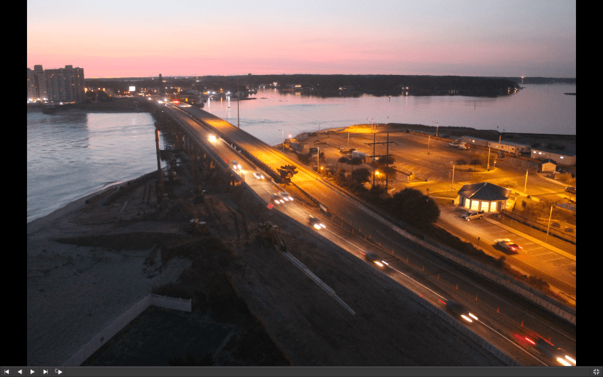
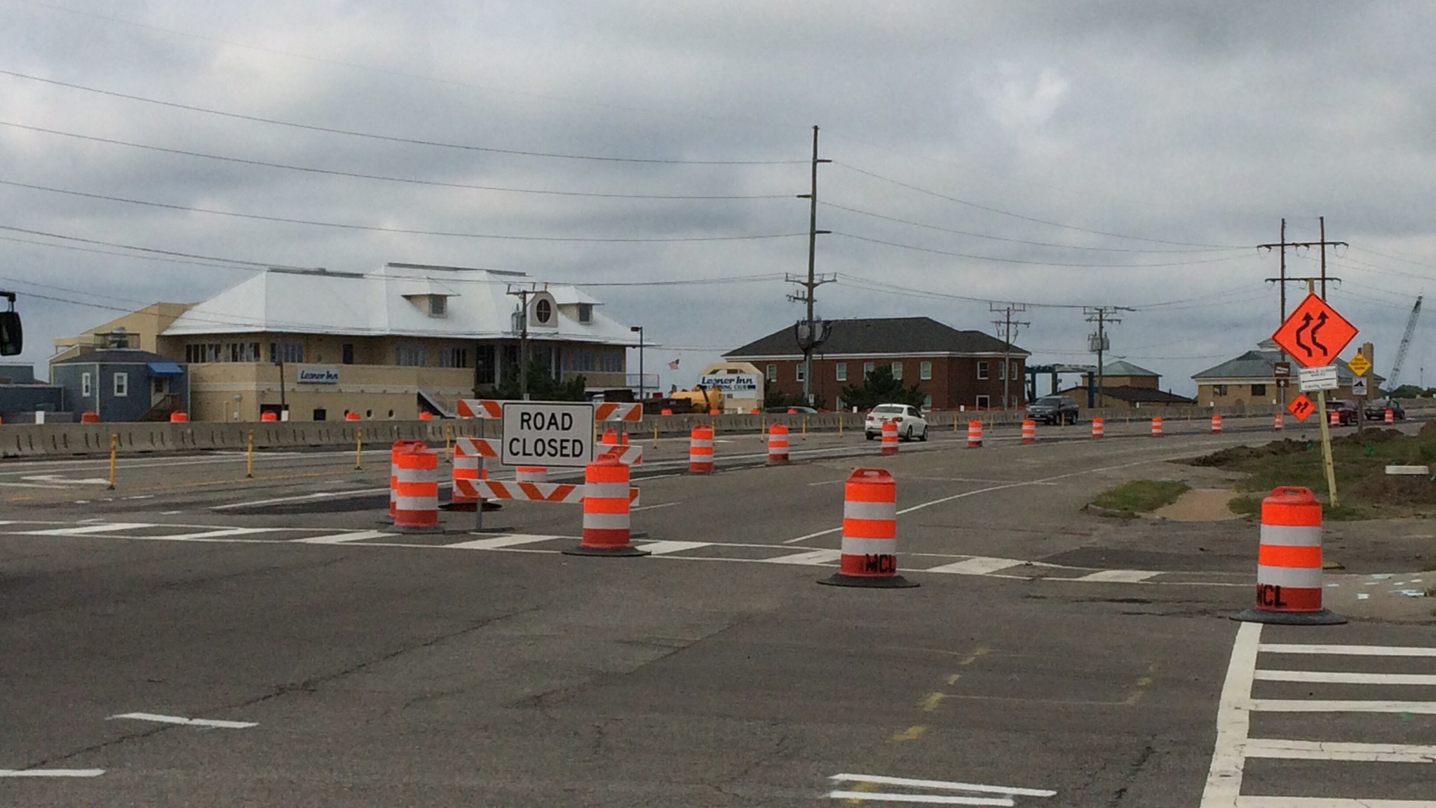
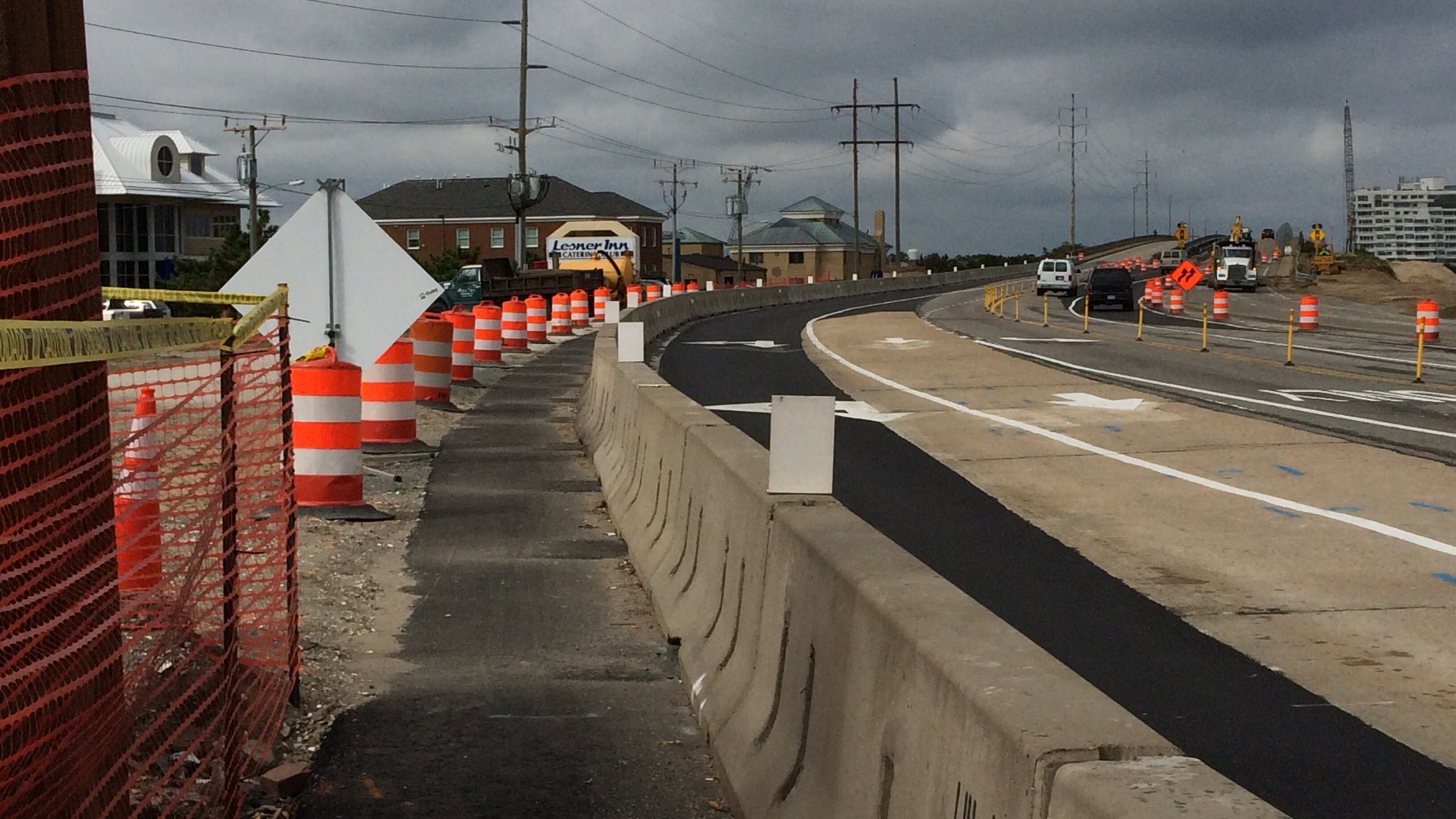
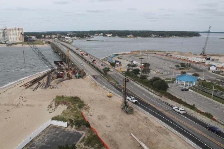
With the recent lane shift on westbound Shore Drive at Page Avenue, we have completed our Phase 2 Maintenance of Traffic (MOT). This will be the new traffic pattern for at least the next 12-14 months while we build the new westbound Lesner Bridge.

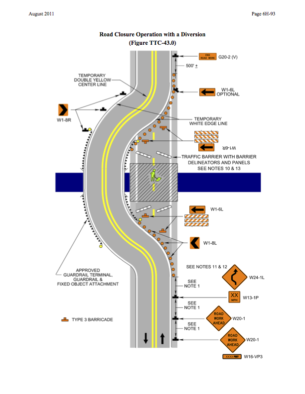
Any DAYTIME lane closures that are needed will be setup by 9:00 AM and removed by 3:00 PM the same day. NIGHTIME lane closures, when they occur, will be from 9:00 PM to 5:00 AM.

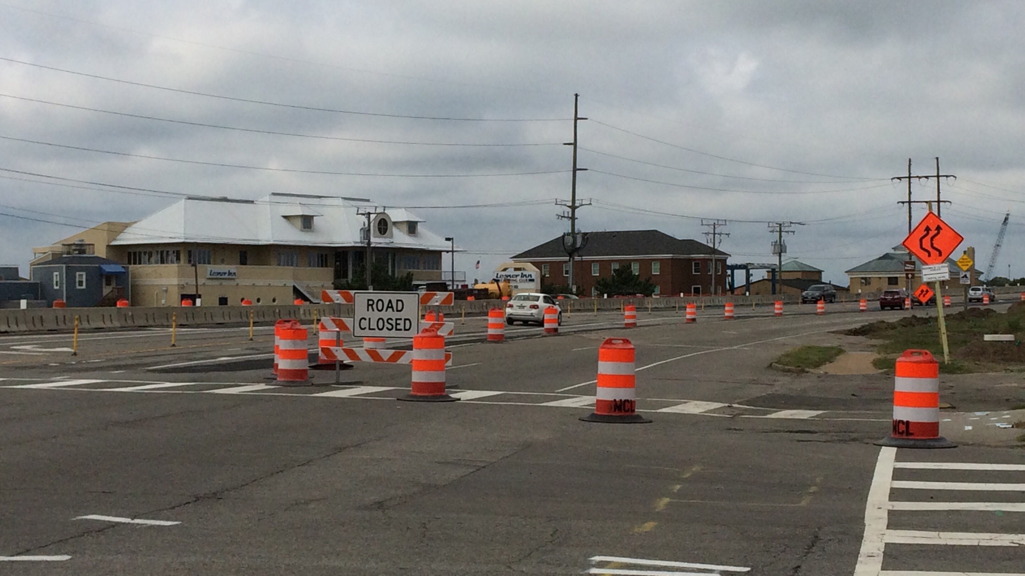
That being said, the next anticipated lane closure related to the bridge work will occur on westbound Shore Drive between the bridge and Page Avenue next Monday, October 6th and Tuesday October 7th. This closure is only temporary and is needed so that the contractor can install concrete barrier service in this area and remove the orange traffic barrels (just like what was done on the west side of the bridge). It is expected that this lane closure will occur at night, but it is possible that this may occur during the day between the hours of 9:00 AM and 3:00 PM.

Over the next two weeks the contractor will complete the drilled shaft work at bridge Abutment A and Pier 1. Foundation construction will start at Pier 2 on Tuesday, October 7th 2014, and continue into the week of October 13th. During this same time period wick drains will continue to be installed along the north side of Shore Drive on the west side of the bridge (in front of 3556 On the Bay Condominiums). Abutment A is located on the west side of the Lynnhaven Inlet and Abutment B is on the eastside. There are 9 piers for each bridge. Pier #1 is located west of the inlet and Pier #9 is located on the eastside of the inlet.

All of the steel sheets for the temporary bulkhead located at the Lynnhaven Dredge Material Storage Area have been installed. During the weeks of October 6th and October 13th, formwork and the tie-back system for this bulkhead will be constructed.

The 18-inch sanitary sewer forcemain that crosses the existing westbound Lesner Bridge needs to be taken out of service for us to continue with the new bridge construction. Over the past several months, the City and the Hampton Roads Sanitation District (HRSD) have been coordinating this effort. In order for HRSD to take this large forcemain out of service, two linestops will have to be installed in the line; one at the intersection of Shore Drive and Rockbridge Road and one just west of Kleen Street (in front of Mango’s Grill).

HRSD will not implement any lane closures for this work, but they will need to install a concrete barrier along the shoulder west of Kleen Street, and install some temporary pavement in the median of Shore Drive across from Rockbridge Road. They anticipate this work to begin the week of October 13th, 2014 and continue thru Friday, October 17th. This schedule is subject to change, but we will provide a more up-to-date schedule in next week’s Lesner Bridge project update.

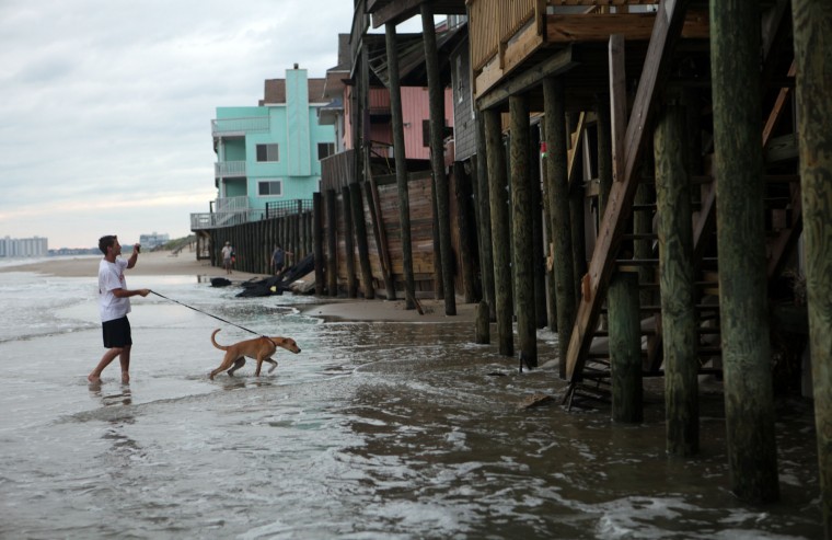
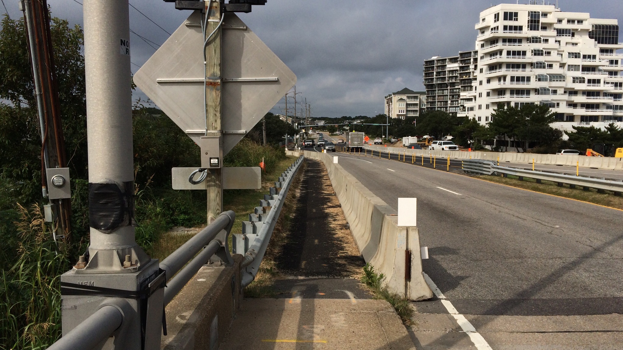
As a reminder, the speed limit over the Lesner Bridge is 35 MPH. Although it’s easy to exceed 35 MPH on Shore Drive, the temporary lane shifts on Shore Drive at both the eastbound and westbound Lesner Bridge are only designed for 35 MPH. Exceeding this speed limit through the construction zone not only risks your safety, but the safety of the bridge construction workers and any pedestrians/cyclists crossing the bridge.

Thanks to everyone who has contributed helpful tips for how we could make things better for the road users through this busy corridor!

Emphasis ours.

# # #

Follow @LesnerBridge in Twitter!

Screen Shot 2014-10-03 at 9.38.01 AM

ROAD CLOSED sign being changed at #LESNERBRIDGE to improve safety on Shore Drive

Some of you, including me, have been thrown off by the ROAD CLOSED sign on the east side of the #LESNERBRIDGE.

It’s being changed.

Please have McLean remove the ROAD CLOSED sign from the TYPE III Barrier located on WB Shore Drive at Page Avenue and replace it with a WI-6 ARROW. Also have them replace the TYPE III barricade with one that has hash marks as shown in the attached plan.

Page 6H-93 of Virginia WAPM

#LESNERBRIDGE photo update

Lanes shifted on east side.
Not sure why the choice is a ROAD CLOSED sign vs one of those shifting arrows signs.

IMG_0491.JPGIMG_0492.JPG

Understand the infamous “speed bump” eastbound Shore Drive at Vista Circle/Starbucks will be repaired.
IMG_0487.JPGIMG_0489.JPG

MUP won’t be blocked by parked vehicles again.
IMG_0498.JPGIMG_0500.JPG

Be safe!
IMG_0501.JPG

MUP = Multi Use Path

Virginia Beach Named #1 Flood Safe City

In case you didn’t know.

View entire article at VBGov.com.

About our area:

Neighborhoods such as Bay Island, Lynnhaven Colony, Ocean Park and a few others are directly adjacent to tidal waters. Streets and developed land in these neighborhoods are sometimes so low lying that during higher tides, there is no practical way to stop that tide from encroaching on those properties.

At the direction of City Council, Public Works has initiated a sea level rise study to identify all the vulnerable areas in the city and then determine what type of adaptation strategies could be employed to reduce those impacts.

How Virginia Beach was scored includes:

Virginia Beach scores very well based on those criteria. However, this ranking didn’t account for sea level rise. Coastal Virginia has land subsidence issues— just a fraction of an inch each year — but our relative sea level rise is greater than what it might be in other parts of the country because of it.
Sea level rise and coastal protection:
“Sea level rise has been happening since we started recording the sea surface elevation,” says Roehrs. “In fact, since Jamestown was settled, sea level has risen almost two feet, but it is a very slow process, and people generally adapt.”

WHAT CAN YOU DO ?

What can you can do to help reduce flood risk?
1.To help the stormwater drainage system work well, there are a few things individual citizens can do. First, keep leaf debris and grass clippings from entering the system — rake and bag yard waste and keep the gutter clean. Sweep sediments up and add them to your garden; don’t let them wash down the drain and create clogs.

2.During periods of heavy rainfall, large impermeable surfaces generate large amounts of runoff. This sudden influx of runoff can cause flash flooding. Consider reducing non-permeable surfaces such as asphalt and concrete on your property. Instead, use materials that allow water to enter the soil such as mulch, gravel or permeable pavers.

Reduce storm water for the Lynnhaven oysters too.

Reduce storm water heading into the Lynnhaven for the Lynnhaven oysters too.

Congressman Scott Rigell Invites you to Attend the Second Annual State of the Chesapeake Bay Discussion

More details here.

    What: Addressing the important Bay restoration issues for the citizens of the 2nd District.

    When: Tuesday, October 7, 2014
    6:00 pm – 8:00 pm

    Where: Cavalier Golf and Yacht Club
    1052 Cardinal Road
    Virginia Beach, VA 23451

    Panelists:
    Molly Ward, Virginia Secretary of Natural Resources
    Dr. Mark W. Luckenbach, VIMS, Professor of Marine Science; Associate Dean for Research and Advisory Services
    Will Baker, President of the Chesapeake Bay Foundation
    Chad Ballard, President of Cherrystone Aqua Farms

** Oysters will be provided by Pleasure House Oysters**

** Oysters will be provided by Pleasure House Oysters**

“@CityofVaBeach: The emergency work at Vista Circle and Shore Dr has been completed. The emergency lane closure has been removed and all lanes are open.”

From COVB Tweet
IMG_0381.JPGPhoto live at 608p. #LESNERBRIDE construction cam.

Project Manager for #LESNERBRIDGE update

From an email:

Friends:
We sincerely apologize for the backup you experienced on Shore Drive yesterday. Unfortunately, we did not anticipate the need for the lane closure on Lesner Bridge. Our lane closures for the Lesner Bridge construction project usually take place at night in order to avoid the serious delays you experienced yesterday.

As a matter of public safety, the emergency lane closure that was put in place yesterday was to alleviate a potentially dangerous situation that was created by incomplete temporary pavement markings at the Vista Circle/Shore Drive intersection. We could not keep both THRU lanes open with this condition until it was corrected. The correction is being made now, and the plan is to have the lanes re-opened for this evening’s rush hour (5:00 PM).

Again, I apologize for the short notice.

-Chris

IMG_0380.JPG
Screen grab of live photo at 327p.

Complete Streets Public Meeting on Draft Complete Streets Policy to be Held Thursday, September 18, 2014 at 6 p.m. at the Renaissance Academy, 5100 Cleveland St.

Learn more at VBGov.com:

“Complete Streets are streets for everyone. They are designed and operated to enable safe access for all users, including pedestrians, bicyclists, motorists and transit riders of all ages and abilities. Complete Streets make it easy to cross the street, walk to shops, and bicycle to work. They allow buses to run on time and make it safe for people to walk to and from train stations.”

Watch a video presentation from  Michael Ronkin of Complete Streets, filmed during VB’s Envision Transportation project – http://envisiontransportation.com/index.php?option=com_hwdvideoshare&task=viewvideo&Itemid=184&video_id=14


Google Map to 5100 Cleveland Street. About 15 minutes from Shore Drive area.

CompleteStreetsSDCCpost

Learn more about Complete Streets at SmartGrowthAmerica.org.

You can have an impact on the streets you want!

One example:

Shore Drive Phase IV for Shore Drive in Ocean Park is slated to be finished in 2026.

Help design the road you want!

Note: If link is broken – start here and Search for 2.118.000: Shore Drive Corridor Improvements – Phase IV