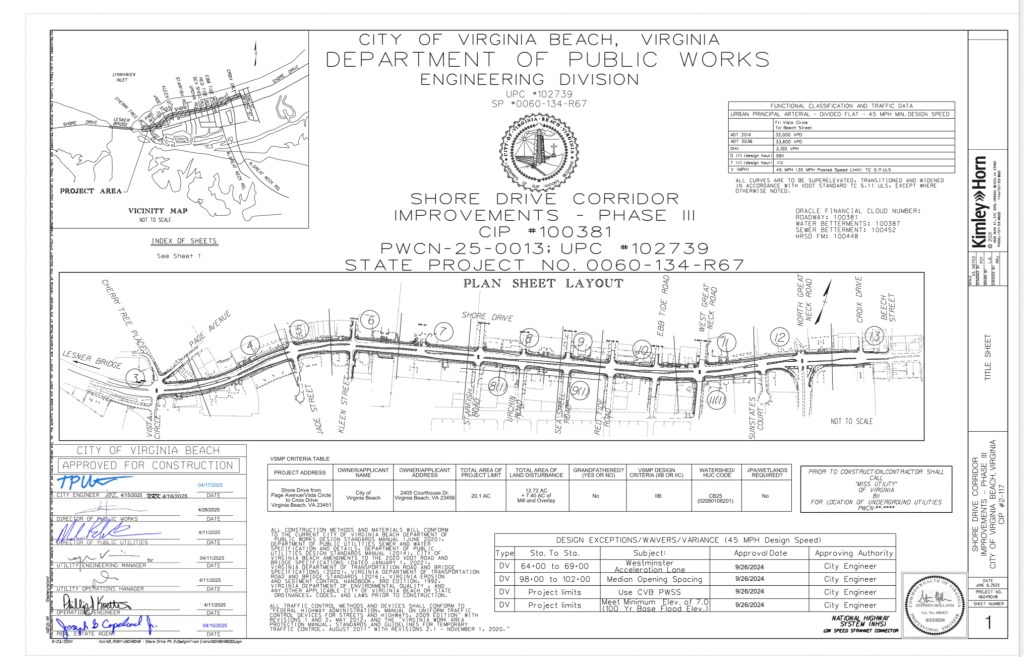
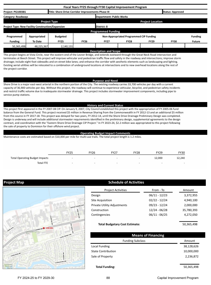
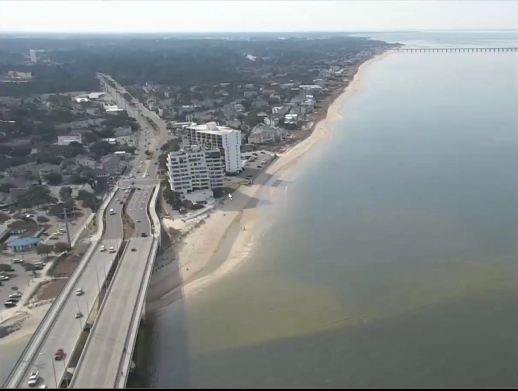
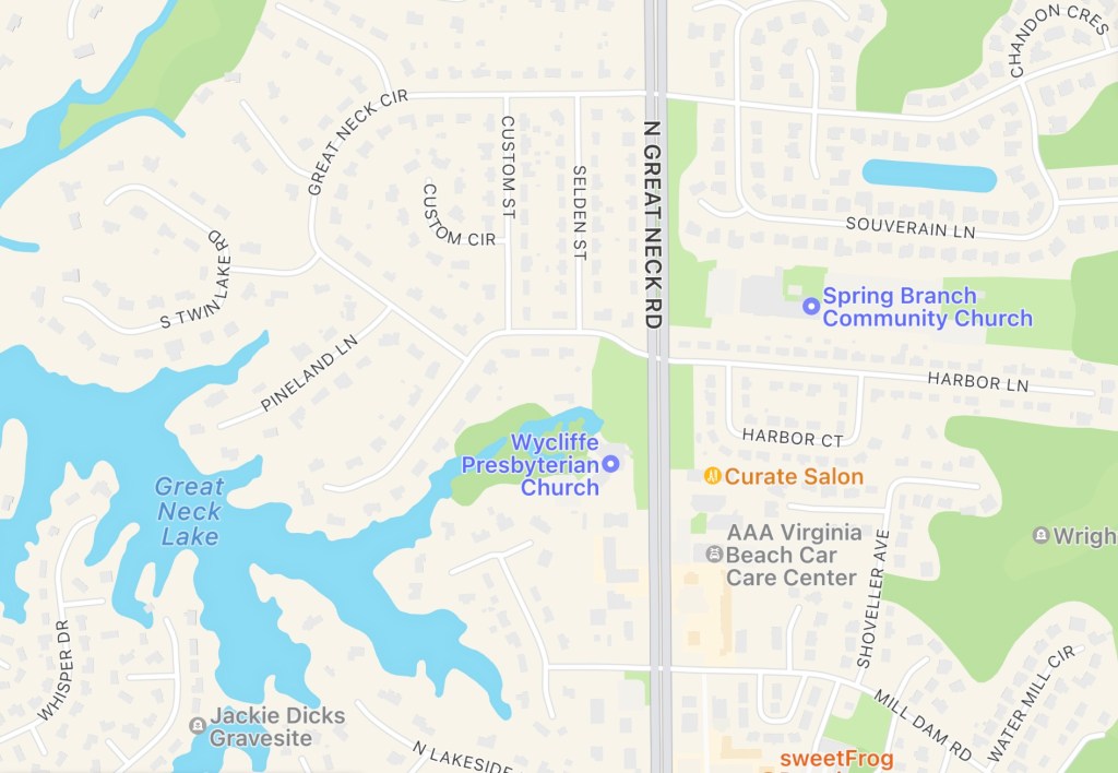
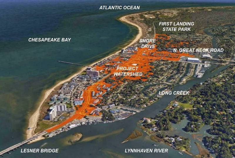
The Shore Drive Phase 3 Improvement Project(SDP3), first identified as a City Capital Improvement Project (CIP) in 2007, is finally getting ready to happen. This 3 year long construction project will improve the section of Shore Drive between the Lesner Bridge and North Great Neck Road, making the road safer for pedestrians and vehicles. Construction will take place over the next 3 years and will definitely have an impact on our Bayfront area in the process.
In an effort to help provide as much information to the residents as possible, we have been working with the City and Councilman Cummings to gather as many details as possible to help answer questions regarding this project. Thanks to the City’s Public Works and Councilman Cummings, we are able to provide the following detailed drawings for construction, traffic management and storm water plans. Please see below for a link to our project page for the SDP3 project.
We understand that this data is a lot to digest and we plan to help by posting drawing analysis reviews and City provided updates as best possible. Similar to the Lesner Bridge 3 year project, we can make it through the pain to get to the well deserved benefits and information will be a critical factor.
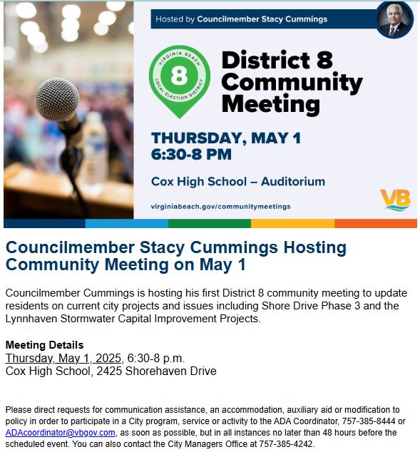
On Thursday May 1st, there will also be an opportunity to learn more about the upcoming construction project at the District 8 Councilman Cummings Community Meeting. More information on this meeting can be found below.
The duties of the Stormwater Management Implementation Advisory Group shall be to:
Further review the topic of stormwater management and its impact and consequences on land use and redevelopment issues.
Identify whether there are any opportunities, advantages, or disadvantages to strengthening regulation alignment and specificity based on the City’s varied drainage basins, and a property’s land use and zoning characteristics.
Formalize a cost-sharing program relative to stormwater infrastructure and policy to include developing criteria for cost-sharing eligibility.
Determine whether there are any opportunities to …
We apologize for the delay sharing these. We were offered them weeks ago and finally received them, from a FOIA request we chose to make, this afternoon.
They are also available on paper in Brock Environmental Center 3663 Marlin Bay Drive.
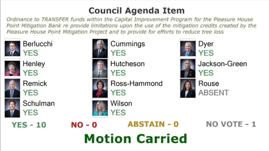
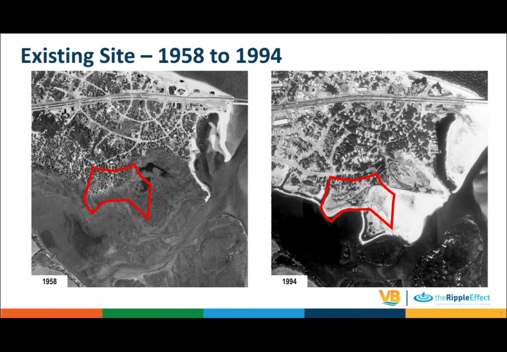
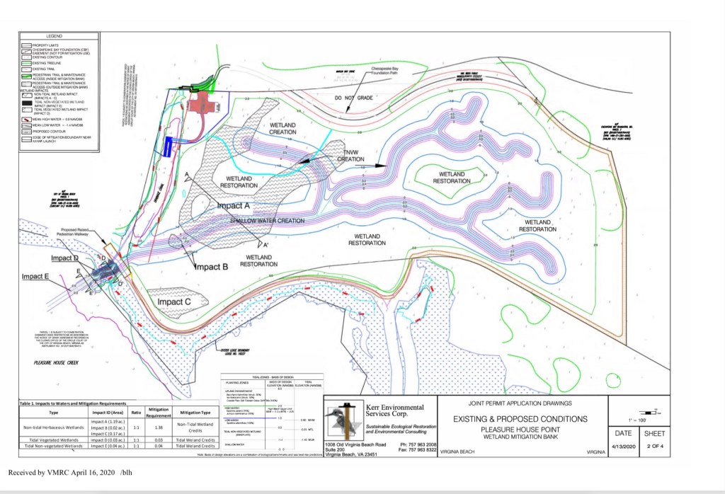
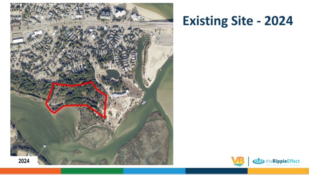
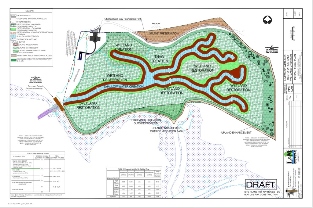
ITEM: CITY OF VIRGINIA BEACH AGENDA ITEM An Ordinance to Transfer Funds Within the Capital Improvement Program for the Pleasure House Point Mitigation Bank, to Provide Limitations upon the Use of Mitigation Credits Created by the Pleasure House Point Mitigation Project, and to Provide for Efforts to Reduce Tree Loss MEETING DATE: January 7, 2025 Background: Capital Project 100304, ” Pleasure House Point Mitigation Bank”
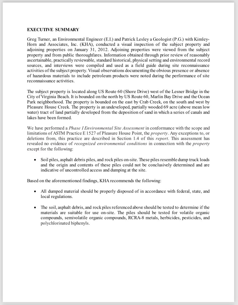
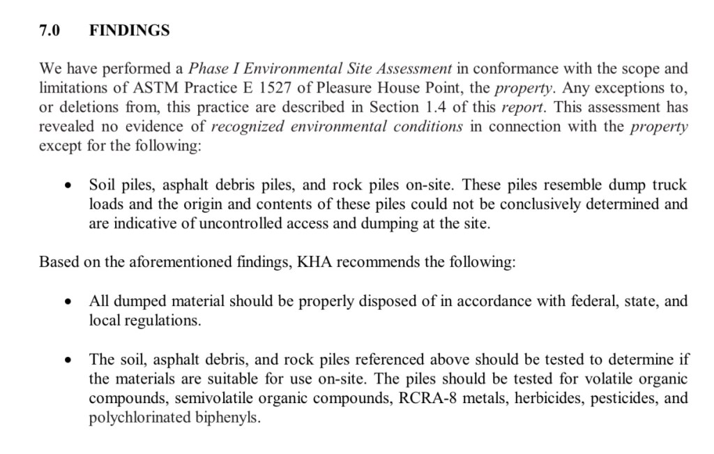
Please note: at the time of this post, currently proposed wetland mitigation bank details of the “90% design”, water budget and other info are still not available on official website.
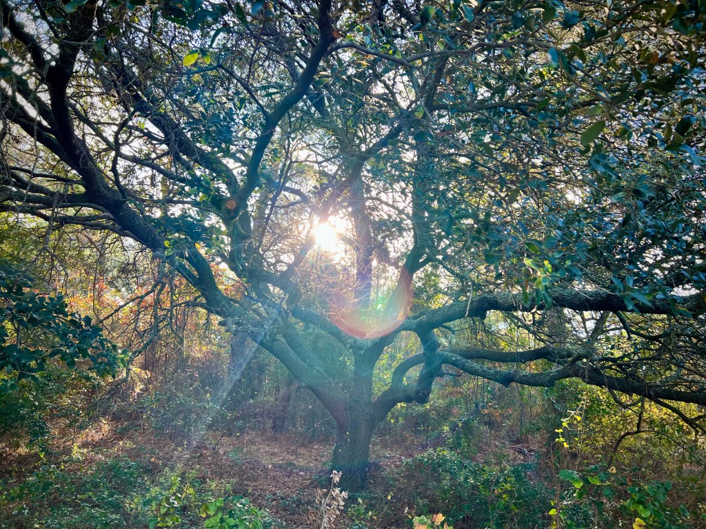
Things learned last night: tidal wetland bank credits are available to purchase, 60,000 cubic yards (about 6,000 dump trucks) of fill will be removed, over 5,200 trees including live oaks over dozens & dozens of years old will be destroyed (number of dump trucks to move destroyed trees unknown).
Email your questions or concerns to: phpwetlands@vbgov.com
Note: this project does not include the controversial kayak launch which will potentially be located on western border of this project when built. It’s visible in graphics above.
Previously, several related links on this website here, here and here.
Jeremy can not attend so here is his report from an email:
+ + +
I have a conflict and can’t make the meeting today. I’m working with the city engineer on a project spreadsheet, I’ll keep you posted. Here are the updates from the PW side.
Chesapeake Beach Renourishment Status
A contract has been awarded to Seaward Marine Corporation.
Work is underway and is to be completed by October 13, 2024.
Lynnhaven Inlet Dredging and Cape Henry Beach Placement Status
USACE opened bids on April 3rd.
The work includes dredging the federal channel system, removing underwater debris, and placing the sand along Cape Henry Beach.
USACE intends to award the contract to Cottrell Dredging located in Norfolk, Va.
The most recent update from USACE indicated a pre-construction meeting and issuance of a Notice to Proceed sometime between late July and early August. From that point, Cottrell is required to submit a schedule within 15 days after NTP is issued.
Eastern Branch Lynnhaven River (EBLR) Dredging Status
The City’s ongoing dredging project of the EBLR is going well with the contractor scheduled to complete Keeling Drain dredging this summer.
Crab Creek/Long Creek Status
The next dredging cycle is being planned for winter 2024/2025.
Pleasure House Point Trail Breach Status
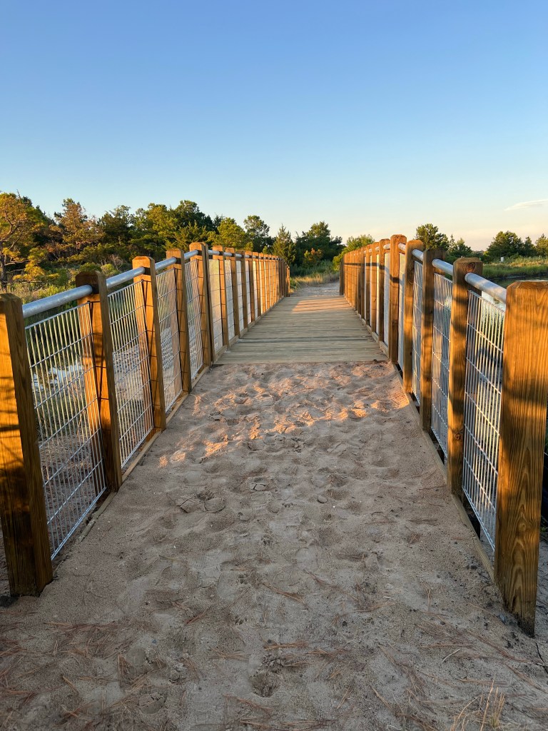
Work has been completed to construct an elevated crossing over a flood-prone area.
These improvements will make the path more accessible after heavy rain events.
Comprehensive Safety Action Plan Status
A draft of the City’s first Comprehensive Local Road Safety Action Plan will be publicly available for review and comment in August. The Plan identifies and prioritizes countermeasures to address roadway safety issues throughout Virginia Beach. Stakeholders, including members of the Bayfront Advisory Commission, were briefed on the Plan on March 22nd and provided feedback to staff on current safety challenges. Public Works Engineering staff will brief City Council on the Draft Plan on August 27th, and the Plan is anticipated to be adopted in September or October.
Lake Bradford / Chubb Lake projects
We typically do not provide updates to the BAC, but since the BAC provided support letters for the BRIC grant, we thought an update was needed.
Lake Pleasure House Outfall – construction complete Lake Bradford Ditch Dredging – construction complete Lake Bradford-Chubb Lake Stormwater Pump Station and Outfall
STATUS
The city is currently in the process of selecting a Design-Build team. The expected selection will take place in the first quarter of 2025.
The city applied for a Building Resilient Infrastructure and Communities (BRIC) Grant worth $35 million, but unfortunately, was not successful in receiving it.
Church Point-Thoroughgood BMP and Drainage Improvement – The City awarded the design contract to RK&K. Anticipated construction is in 2028. STATUS
Design NTP – May 21, 2024
SCHEDULE
Advertise for Bids: February 2028
Estimated Construction Start Date: August 2028
Estimated Construction Completion: May 2031
Eastern Shore Drive Drainage Improvement Projects
Cape Henry Canal Phase II – Relocation of Sanitary Sewer Gravity Mains, 1C.2 The project was completed on October 2, 2023. The project was on time and Under Budget by $185,682.
Eastern Shore Drainage Improvements Phase I – Section I – $35.9M Building Resilient Infrastructure and Communities (BRIC) Grant Projects:
Eastern Shore Drive – Lynnhaven Colony Park Pump Station, 1B Cape Henry Canal Phase II – Widening and Deeping, 1C.2 Eastern Shore Drive – Lynnhaven Drive Pump Station, 1D Eastern Shore Drive – Elevate Lynnhaven Drive, 1E
STATUS
90% Design Completed January 2024 Project #1-3.
60% Design Completed March 2024 Project #4.
SCHEDULE
100% Design Submittal for all 4 projects – August 2024
Advertise for Bids: January 2025
Estimated Construction Start Date: May 2025
Estimated Construction Completion: May 2028
Eastern Shore Drive – Vista Circle Pump Station, 1A STATUS
PER Completed. Project detailed design has not begun.
SCHEDULE
Advertise for Bids: October 2026
Estimated Construction Start Date: April 2027
Estimated Construction Completion: December 2029
Eastern Shore Drive – Poinciana Pump Station STATUS
60% Design Submittal Received and compiling City and Peer Review Comments
SCHEDULE
Advertise for Bids: April 2025
Estimated Construction Start Date: August 2025
Estimated Construction Completion: May 2028
Eastern Shore Drive – North Shore Drive Street Drainage Improvements, 1F & Eastern Shore Drive – Cape Henry Drive Street Drainage Improvements, 1G STATUS
60% Design Submittal Received March 2024
SCHEDULE
Advertise for Bids: June 2025
Estimated Construction Start Date: September 2025
Estimated Construction Completion: June 2027
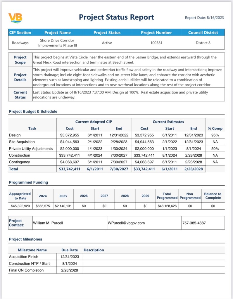
Shore Drive Corridor Improvements Phase III STATUS
No change. Real estate acquisition and private utility relocations are underway.
SCHEDULE
Advertise for Bids: September 2024
Estimated Construction Start Date: January 2025
Estimated Construction Completion: July 2028
Shore Drive Pedestrian Improvements STATUS
90% Design Submittal Received July 2, 2024
SCHEDULE
Advertise for Bids: June 2025
Estimated Construction Start Date: October 2025
Estimated Construction Completion: April 2026
Shore Drive Corridor Improvements Phase IV STATUS
No change. Final Preliminary Engineering Report received 11/15/2023. The project is not funded
Jeremy Kline
DEPARTMENT OF PUBLIC WORKS
Deputy Director
757.385.8420 | jekline@vbgov.com
+++
New bridge on PHP. In my estimation, based on 20 years of experience, potentially 4 to 7 more bridges before 2034 will be needed or choices made to leave sea level rise take over. Educational opportunities!
I’ve attached the 1997 ULI Study and the text from Zoning Ordinance pertaining to the Shore Drive Corridor Overlay District. Below are links to the following:
Comprehensive Plan (Section 1.3 – Suburban Area; Page 1-69 – Suburban Focus Area 1:
I believe this covers the current applicable documents with guidance on the Shore Drive Corridor, but if there are other documents that I may have missed in regards to the Shore Drive/Bayfront area, please let me know and I will be happy to pass them along as well.
Maybe redeveloping lakes is not smart or sustainable way for a City that will be dramatically impacted by sea level rise(SLR) and attempting to keep its currently stellar bond rating & logical story telling for rating agencies.
A downgrade by ratings agencies would obviously increase interest costs for tax payers.
A speculator wants to redevelop a lake. A LAKE! How this idea has gotten so far is mind boggling.
Maybe only redevelopment NOT in City storm water management facilities and lakes is more intelligent considering we’re 2nd in the country for impacts from SLR.
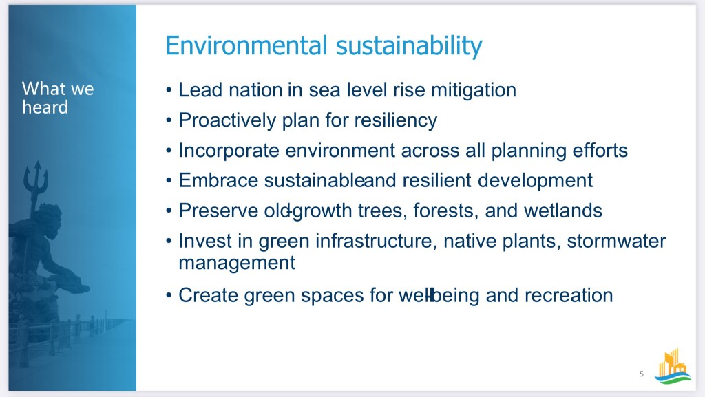
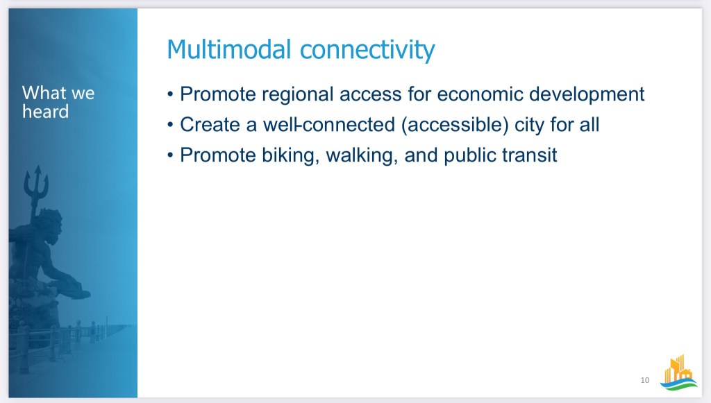
The Public Workshops will consist of a short recap presentation on themes developed in the Focus Groups and the Vision Mapping process. We will then proceed to break out into small groups to provide more direct, specific feedback on each of the draft themes. The Vision Map will take the draft themes of balanced growth, sustainability, connectivity, diversity, and wellbeing, and apply them to areas of the city to create a framework of how the city should grow and develop over time. There will be an interactive planning exercise in our small groups.
The workshops will be held at these times and locations:
Saturday, November 4th at 2pm: College Park Elementary School Cafeteria – 1110 Bennington Road
Monday, November 6th at 6pm: Kellam High School Cafeteria – 2665 West Neck Road
Wednesday, November 8th at 6pm: Bayside Recreation Center – 4500 First Court Road
Thursday, November 9th at 6pm: Virginia Beach Convention Center, Suite 3 (2nd Floor; Middle of the Building) – 1009 19th Street
There is no need to RSVP to these workshops. We estimate this meeting to run about 1.5 to 2 hours. Please pass along the information to your friends, family, neighborhoods, colleagues, youth groups, civic leagues, faith groups, etc.
The more engagement we have from the community in this process, the better the plan will be! City Staff and the Consultant Team are eager to hear from as many residents as possible, so we hope to see you there!
As always, for more information or if you have any outstanding questions, please reach out to me at RacMiller@vbgov.com or Hank Morrison, the Comprehensive Planning Administrator, at JMorrison@vbgov.com.
You are aware about the reality of sea level rise(SLR) correct?
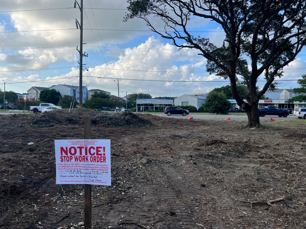
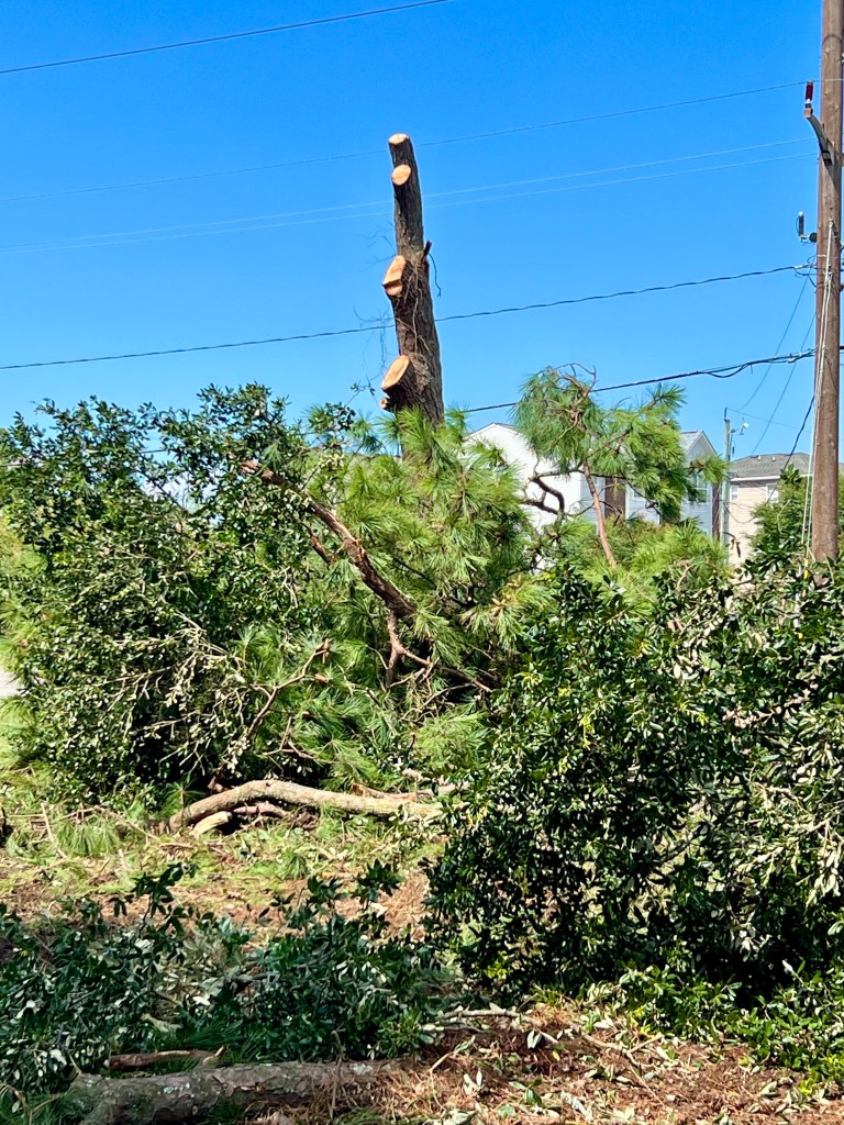
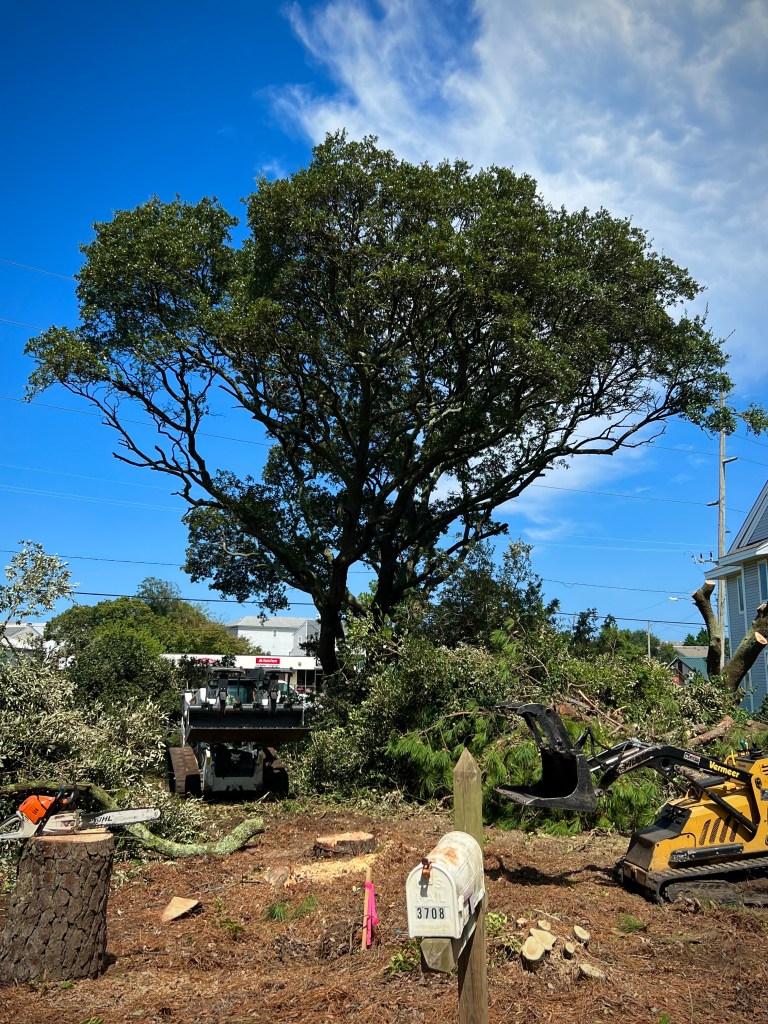
Mistakes were made! This is how many mistakes were made.This was VIOLATED Thursday night and Friday.
Coincidentally, the VNG Director of Government Affairs made a Presentation Tuesday. Councilman Schulman asked her about the needless destruction, lack of respect by VNG and how to move forward having discussions how VNG, a PUBLIC utility is going to fix this.
Thanks to Mickey Toll, owner of Chesapeake Tree Service, for explaining that the larger live oak pieces being cut down will be hauled away by North Landing Firewood & Hauling Inc and milled for USE AS LUMBER for furniture & other potential uses well beyond mulch & firewood. Hooray!
Phil Pullen from Public Works informed me that his team will be presenting on the Shore Drive Projects at next month’s BAC meeting. …He also informed me that they are still scoping out the interim sidewalk improvements and will have a cost/schedule for the improvements soon. The attached status report will be placed on the BAC webpage by the end of the week.
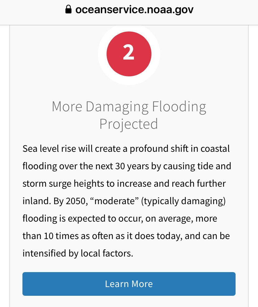
“By 2050, “moderate” (typically damaging) flooding is expected to occur, on average, more than 10 times as often as it does today, and can be intensified by local factors.”
10X MORE “MODERATE” (TYPICALLY DAMAGING) FLOODING.