It’s a great time with great people!

View the article including photos at Pilotonline.com:
Planning Department Director Barry Frankenfield offered to look into adding a crosswalk at the intersection of Great Neck Road and Lynnhaven Drive for residents to walk safely to a shopping center across the street.
Click the image to head there.
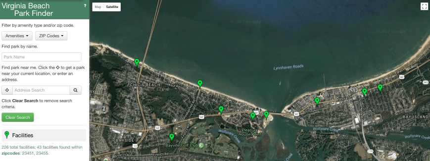
Screen shot of 23451 & 55 search.
View October Baylines. (4 page PDF)
Baylines includes:
Vice Mayor Louise Jones,, Ocean Park Civic League President Andrew Broyles and Mayor Will Sessoms participate in a ceremony unveiling median signs on Shore Drive delineating the historical neighborhood…

Update from email:
Residents/Folks/Travelers/Bridge Gazers:
As the hot, steamy days of summer give away to the almost-as-hot days of a Hampton Roads autumn, we find ourselves exchanging the soft summer breezes for the brutal breezes that feel like needles painfully piercing your face and arms from the winds of the latest tropical storm. As you fuel your generator and horde lots of Chef Boy-Ar-Dee and peanut butter, you might want to stockpile some reading material. Why not start with this update?
Mr. Chris the Kingfish and his crews having been plugging away all summer on the popular Lesner Bridge project. Included in this update is chit chat about the gantry, the fender system, a cofferdam, and mechanically stabilized earth. (Some of us will be breaking into discussion groups once we have completed the reading, hoping to dig through some of that deep sub-text that comes with these engineering updates.)
As always, we appreciate your questions and e-mails, so please don’t hesitate to contact us. We are regularly updating information on our WEB page at: http://www.vbgov.com/lesner-bridge. You can also follow us on Twitter at: @lesnerbridge. If you haven’t already signed up for the City’s FB page or Twitter account, I encourage you to do so so that you receive timely updates from all things City-related.
If you know of someone who would like to be added to our update list, please have them get in touch with me at this e-mail address and I will be glad to add them. Please feel free to pass this along to others.
Thanks again for all of your interest and patience throughout this project. And don’t forget . . . stay safe, look out for each other, and put the phone down while you’re driving.
Drew Lankford
Media and Communications
Department of Public Works
City of Virginia Beach
dlankfor@vbgov.com
(O) 757.385.8062
(C) 757.409.4353***************************************
Folks:
We are in the peak of hurricane season, and with all of the talk and news coverage of the hurricanes churning in the Atlantic, it is worth noting that should a storm impact this area and winds begin to gust above 90 mph, it will be necessary to TEMPORARILY CLOSE the Lesner Bridge to all but emergency vehicles due to the proximity of the construction gantry. We kept a very close eye on the storm track of Hurricane Irma and were ready to take the necessary precautions to secure the Lesner Bridge construction site, if needed. Fortunately, that no longer seems to be a concern.
Even though storm preparations were being made, construction work on the bridge continued. Since the last project update in early August, two more spans of the new eastbound bridge have been completed (spans 2 and 3) and if the weather holds out, McLean Contracting could launch the gantry crane to bridge span #4 as early as this Friday the 15th.
View Looking East from atop the Gantry (New Westbound Lesner Bridge shown on left)
New Westbound Lesner Bridge (left) and Completed Span #2 of the New Eastbound Lesner Bridge (right)
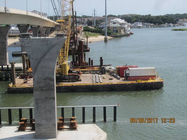
As work continues on the bridge superstructure, other work is also being completed concurrently. Folks that use the Lynnhaven Inlet will notice that the southern half of the new bridge fender system is now being constructed on either side of the main channel. Within the next few weeks all of the piles for the new fender system will be driven. The timber rails and walkways, as well as the permanent lighting for this fender system, will be installed through the month of October, and we anticipate completing it by the first week of November.
New Westbound Lesner Bridge (left) and Completed Span #2 of the New Eastbound Lesner Bridge (right)
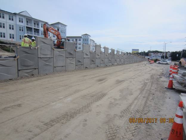
New MSE wall in front of Bubba’s Restaurant and the Lesner Inn
A lot of work is also occurring along Cape Henry Drive on the east side of the bridge in front of the Lesner Inn, and the Virginia and Maryland Pilots Association. At this location, work has begun on the last MSE (Mechanically Stabilized Earth) wall for the project. With a length of 645 feet, it is also the longest MSE wall on the project and is expected to be completed by the first week of October.
Installation of drilled shaft foundations for the bridge pier columns also continues. All but one of the drilled shafts have been installed for Pier #5 and at Pier #6 only one drilled shaft remains to be placed. McLean will mobilize the drilling equipment to Pier #7 at the completion of these two drilled shafts. Preparations for work at Pier #7 have already been made. The cofferdam at Pier #7 has been installed, and the permanent steel casings for the 5 drilled shafts at this location have been delivered to the work area.
In summary, the following work has been completed since our last project update in August:
· Most of the old Lesner Bridges have been demolished, with only a few in-water concrete piles remaining to be removed;
· Spans 1, 2, and 3 (of 10) for the new EB bridge have been completed and the gantry crane is being prepared for launching to Span #4;
· The footing and column at Pier #4 have been completed;
· Streetlight pole foundations on the new eastbound bridge approach between East Stratford Street and the new bridge have been installed;
· 9 of the 10 drilled shafts for Pier #5 have been installed;
· 4 of the 5 drilled shafts for Pier #6 have been installed;
· Work on the southern half of the new bridge fender system has begun;
· 9 of the 10 drilled shafts for Pier #5 have been installed;
· Approximately 400 linear feet (of 645 linear feet) of MSE Wall #5 (in front of Lesner Inn) has been built.
AMI, Inc. in Portsmouth, continues to build the superstructure of the new Lesner Bridge. A total of 163 of the 168 segments have been cast for the new eastbound bridge. It is expected that all bridge segments for the eastbound bridge will be cast by the end of this month.
Over the next two weeks, the bridge contractor will:
· Complete drilled shaft foundations at Pier #5;
· Complete drilled shaft foundations at Pier #6;
· Complete pile installation for the new bridge fender system;
· Begin assembly of the superstructure for bridge span #4; and
· Continue work on the new MSE wall along the south side of Shore Drive between the new bridge and Vista Circle (in front of Lesner Inn);
That’s it for now. Please drive safely!
-Chris
Christopher J. Wojtowicz, PE
Project Manager
City of Virginia Beach
Department of Public Works
Engineering Division
2405 Courthouse Drive
Virginia Beach, VA 23456-9031
Office: (757) 385-5785
Fax: (757) 385-5668
Email: cwojtowi@vbgov.com
From an email sent to City Council:
Dear Mayor Sessoms and City Council Members,
I am writing to request a deferral for the subject agenda item, Planning Item #4 – New Millennium Senior Living Communities, being heard at tonight’s Council meeting. The deferral would allow time for the community and City Traffic Engineers to find a safer design for the proposed additional entrance located at the intersection of Shore Drive and Indian Hill Road.
Residents have expressed concern at both Bayfront Advisory Commission and Shore Drive Community Coalition meetings that adding 2 additional points of conflict at the new entrance intersection will result in an unsafe situation. The existing intersection already creates a two car stacking conflict in the median and the proposed City design could result in a 3 or even 4 car interaction.
The following recommendation has been made for the new traffic pattern and would provide a safer intersection with no adverse impact to the operation of the new development.
At the proposed Indian Hill Road entrance – only allow vehicles heading eastbound on Shore Drive to enter and exit the new development.
Keep operating the existing old building main entrance with 4 way median flow as-is. This entrance is located approximately 500 feet to the west of the proposed Indian Hill Road entrance.
Vehicles leaving the development heading westbound on Shore Drive would use the existing old building entrance or the First Court Road entrance which leads to stop lighted intersections.Thank you for your continued efforts to make Shore Drive safe for all modes of travel
Sincerely,
Todd Solomon
Shore Drive Community Coalition-President
(757) 667-8533 cell“Shore Drive, We Love This Place”, check out http://www.sdcc.info
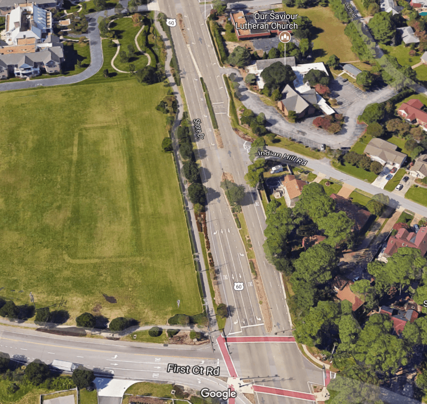
Aerial view of existing conditions. Proposed new Baylake facility will be in grass area on left.
Emphasis added for this post.
Thanks to David for the timely update to CASPER – Coastal Action Plan Storm Emergency Response.
View & download CASPER version 7. (28 page PDF)
DISCLAIMER
The statements, recommendations, and procedures provided in this planning guide are those of the author and Safety Net Consulting, Incorporated. This guide does not necessarily reflect all the available options for emergency planning, or preventing property loss or personal injuries associated with natural or man-made disasters. The material presented in this document reflects multiple accredited sources and the accumulated best practices of those involved in emergency planning and disaster recovery…
A snippet:
Many emergency agencies estimate that only 10-15% of the residents living in the coastal areas affected by hurricanes have an emergency plan. Without a plan, a family could be caught in a “lose- lose” situation not having considered the major problems that nature could present. Too late to leave, but without sufficient preparations to stay, you could be stranded in a dangerous situation. This Coastal Area Storm Plan Emergency Response (CASPER) is “bare bones” without lengthy explanations except when essential for a point. The CASPER is divided into three major sections; Long Term Planning and Preparation, Pre-Hurricane Warning Stage, and Post Storm Recovery. This plan contains buy lists to aid gathering the needed supplies…

unexpected damage at Lynnhaven Boat Ramp from Sandy Oct 2012
View article including photos at Pilotonline.com.
“That tree is just gorgeous,” Morrell said. “It’s like a breath of fresh air.”
Since the residents’ petition surfaced, the city has delayed removing the tree and is seeking a second opinion, said Susan French, an arborist for Virginia Beach.
The resident who owns property impacted by the towering oak’s branches asked the city to inspect the tree a few months ago, French said.
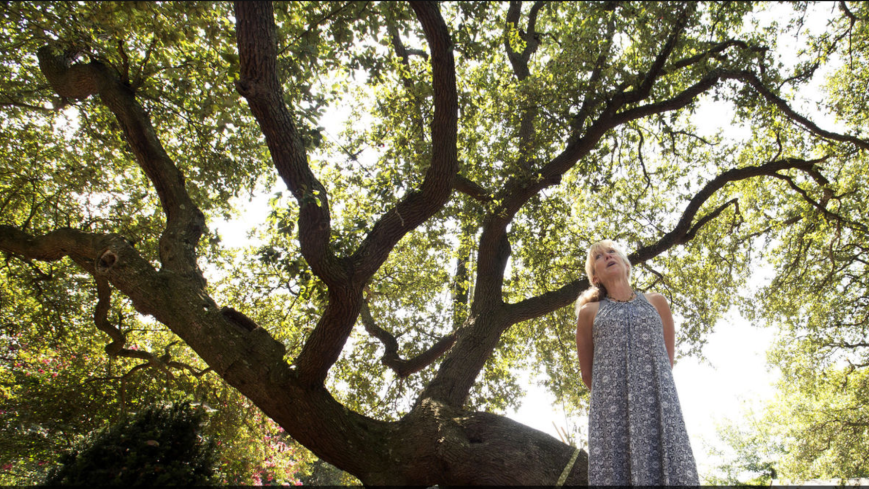
Photo credit: Bill Tiernan | Virginian-Pilot
We’ll be discussing this tonight at our meeting.
Join us at Ocean Park Volunteer Rescue Squad at 730pm!
Update from email:
Structural Scholars/Bridge Aficionados/Bored Readers Who Will Read This:
Just in case you are short on reading material for a Monday, and you’re asking yourself: “How can I be enlightened about the Lesner Bridge and the progress that we have been promised?” Rest your souls, for I present to you a quick update from Wojo the Kingfish of Bridges. You’ll be quite pleased to learn about the progress that is being made due to the diligent efforts of the crews and Kingfish and his trusty communications chump.
As always, we appreciate your questions and e-mails, so please don’t hesitate to contact us. We are regularly updating information on our WEB page at: http://www.vbgov.com/lesner-bridge. You can also follow us on Twitter at: @lesnerbridge.
If you know of someone who would like to be added to our update list, please have them get in touch with me at this e-mail address and I will be glad to add them. Please feel free to pass this along to others.
Thanks again for all of your interest and patience throughout this project. So . . . stay safe, look out for each other, and put the phone down while you’re driving.*************************************************
Folks:
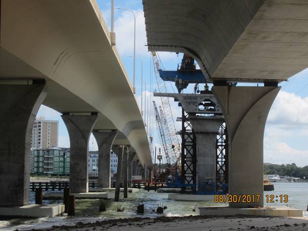
Since the movement of the gantry crane into position for the construction of the new eastbound Lesner Bridge last month, much progress has been made on the project.Demolition of all the superstructure of the old bridges has been completed and most of the substructure (footings and pile foundations) of the old bridges have been removed. Work is continuing in the federal channel of the Lynnhaven Inlet to cut and remove the large submerged footings of the old bridges (old piers 14 and 15) located on either side of this channel and is expected to be completed by 8/15/2017.
Old Bridge Main Span Bridge Footing (Pier 14 WB) Loaded on Barge – NOTE the 12-inch cutoff piles
Old Bridge Main Span Bridge Footings (Piers 14 EB /WB and 15 WB) Loaded on Barge
The final placement of concrete for the backwall of Abutment A (west side of the bridge by the Lynnhaven Boat Ramps) was completed on July 21st and the first span (of 10) of the new eastbound bridge was completed on July 24th, 2017. The drilled shaft foundations, footings, and columns for bridges piers 1, 2, and 3 (of 9) have also been completed. Last week the contractor completed the foundation and footing for pier column 4 and plans and completed the column for this pier last Friday. Work is also continuing on the MSE (mechanically stabilized earth) walls located on both the eastern and western bridge approaches.
MSE Wall at the Scenic Overlook at Abutment A near the Lynnhaven Boat Ramps
We anticipate that only 1 or 2 more barge loads of bridge demolition structures remain to be delivered to Cabbage Patch Reef. For those of you that are interested, MAP Environmental has put together a great drone video of the placement of the old bridge materials into Cabbage Patch Reef.
Drilled shaft foundations continue to be installed for the foundation at pier column 5. Concrete placement for these shafts are being performed from the eastbound outside lane on the new bridge between the hours of 2:00 AM and 5:00 AM. The next anticipated lane closures for this concrete placement is on Wednesday and Thursday August 16th and 17th and on Wednesday and Thursday August 23rd and 24th.
In summary, the following work has been completed since our last project update in June:
· The two temporary steel girders have been removed from across Shore Drive and the western end of the new WB Lesner Bridge;
· Approximately 95% of the old Lesner Bridges have been demolished;
· The backwall at Abutment A has been completed;
· Span 1 of 10 for the new EB bridge has been completed and the gantry crane launched to Span #2;
· The footing for Pier #4 has been completed and the steel reinforcing for the pier column has been installed;
· MSE Wall #2 (near the Lynnhaven Boat Ramps) and Wall #3 (Scenic Overlook) have been constructed;
· 8 of the 10 drilled shafts for Pier #5 have been installed;
AMI, Inc. in Portsmouth, continues to build the superstructure of the new Lesner Bridge. A total of 162 of the 168 segments have been cast for the new eastbound bridge. It is expected that all bridge segments for the eastbound bridge will be cast by September 2017.
Aerial view of the bridge segment casting yard located at Atlantic Metrocast, Inc. in Portsmouth, VA (note the number of completed segments being stored for Lesner Bridge)
Over the next two weeks, the bridge contractor will:· Complete Bridge Demolition with the removal of the eastern bridge abutments and remaining in-water concrete piles;
· Complete drilled shaft foundations at Pier #5;
· Mobilize material and equipment to Pier #6;
· Fill the western bridge approach to rough grade;
· Complete the construction of Span #2 and launch the gantry crane to Span #3;
· Complete Pier Column #4;
· Begin excavation for the leveling pad of the new MSE wall along the south side of Shore Drive between the new bridge and Vista Circle (in front of Lesner Inn);
· Begin installation of the steel “H” piles for the new bridge fender system on the south side of the new EB Lesner Bridge;
That’s it for now. Please drive safely!
-Chris
Christopher J. Wojtowicz, PE
Project Manager
City of Virginia Beach
Department of Public Works
Engineering Division
2405 Courthouse Drive
Virginia Beach, VA 23456-9031
Office: (757) 385-5785
Fax: (757) 385-5668
Email: cwojtowi@vbgov.com
Here’s the 1 page PDF of the letter sent to FEMA.

You’ll find more info about CRS at Search & Hot on this website.
 View 2017_0606 PLAN11-019-20 REV1 with CE (1 page PDF)
From an email about tree inventory & parking lot design revision:
The parking layout provides 2 ADA parking spaces with the required access aisle area between the two spaces. The minimum access aisle between ADA spaces for vans is 8ft so that is why it appears to be able to accommodate 3 vehicles. The ADA spaces are on the east side of the drive aisle. The 3 parking areas for 15 minute only to drop off equipment are on the west side of the drive aisle.
We do not have a separate tree inventory. The consultant was asked to survey the location and size of trees 2” caliper and larger in the area of the construction entrance/parking lot and provide that information on a plan sheet.
From an email about ADA requirements:
The ADA standards do not have a specific chapter addressing kayak launches. We use Chapter 2 Section 235 as a guide for the parking requirements. Then follow the applicable requirements in Chapters 2, 5 and 10 for accessible routes, parking space sizes, etc.
This link is to Chapter 2-Scoping Requirements.
Within Chapter 2;
- Section 206 addresses the accessible routes required
- Section 208 addresses the “shortest accessible route” requirement between the facility and the parking.
- Section 235 addresses the parking requirements for “Recreational Boating Facilities”. The parking requirements are based on a marina’s number of boat slips. We are required to provide 1 ADA space. Providing 2 spaces seemed reasonable given the minimal amount of space needed to add the second parking stall and the likely use of a fully ADA accessible launch site in this area of the Lynnhaven.
This link is to Chapter 5-General Site and Building Elements.
- Section 502 addresses the dimensions of the parking spaces and access aisles.
This link is to Chapter 10-Recreation Facilities.
- Section 1003 addresses recreational boating facilities requirements
Plans for the winery in a vacant restaurant building on Shore Drive near the Chesapeake Bay Bridge-Tunnel include an outside seating area with fire pits. A tasting room will be available for private parties.
“It’s a good fit,” said Jimmy McNamara, staff planner for the city.

Norfolk location.
Photo Credit: Mermaid Winery Facebook page.

A presentation was made to the Bayfront Advisory Committee meeting in June ’17.
View and download PDF of presentation briefing. (27 page PDF)
PDF includes info such as:
Completed Projects FY17
Shore Drive Bike Facilities CIP 2-300.101
• EB & WB On road bike lanes from Diamond Springs Road to
Northampton Boulevard, approx. 3 miles.
• Completed February 2017
• Total Project Cost: $4.4M
Crab Creek & Long Creek Dredging CIP 8-011 • Spot dredging to address shoaling
• Completed February 2017 • Total Project Cost: $285K
Lynnhaven Inlet Maintenance Dredging • Minor dredging to address shoaling
• Completed August 2016
• Annualized Payments to USACE – $363K
CIP 8-013
Update from Email:
Folks:
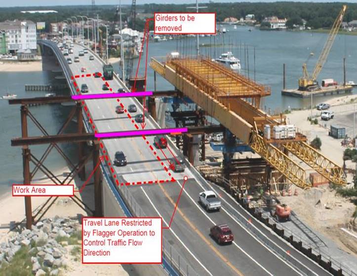
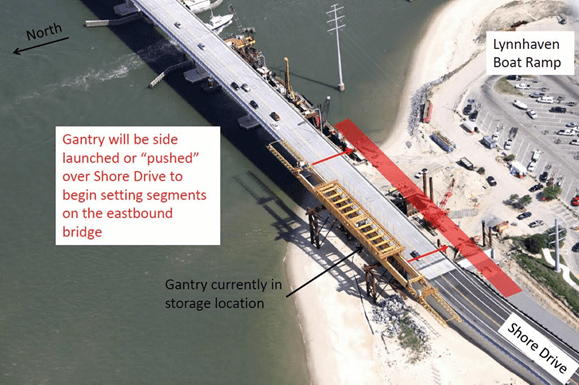
Last week we successfully accomplished a major milestone in the project – moving the gantry crane from the north side of Shore Drive to the south side of Shore Drive and into position to begin assembly of the eastbound bridge superstructure segments. To do this, we had to close Shore Drive and setup a long detour until the move could be completed. The last piece of this move is to remove the two beams that are currently located on the western end of the bridge crossing Shore Drive.
Unlike the first two phases of this gantry crane move, a detour WILL NOT be required to remove these two beams. NEXT Thursday July 6th, beginning at 12:01 AM and ending at 4:00 AM – Shore Drive at Lesner Bridge will be reduced to a single lane and a flagger operation will control the direction of traffic across the bridge. Therefore, motorists should be PREPARED TO STOP on their approach to the bridge during this time period.
Bridge crossing delays of up to 15 minutes should be expected and motorists may want to plan an alternate route while these two beams are removed.
Area of Work and Restricted Traffic on Lesner Bridge July 6, 2017 12:00 AM to 4:00 AM
Please note that on Wednesday July 5th, beginning at 10:00 PM Shore Drive at Lesner Bridge will be reduced to a single lane in each direction in preparation for the flagger operation that will begin at midnight.
We appreciate your patience regarding these traffic interruptions along Shore Drive at Lesner Bridge!
Have a Happy and Safe Independence Day! …and of course Please Drive Safely!
-Chris
Christopher J. Wojtowicz, PE
Project Manager
City of Virginia Beach
Department of Public Works
Engineering Division
2405 Courthouse Drive
Virginia Beach, VA 23456-9031
Office: (757) 385-5785
Fax: (757) 385-5668
Email: cwojtowi@vbgov.com
Bridge closure is cancelled.
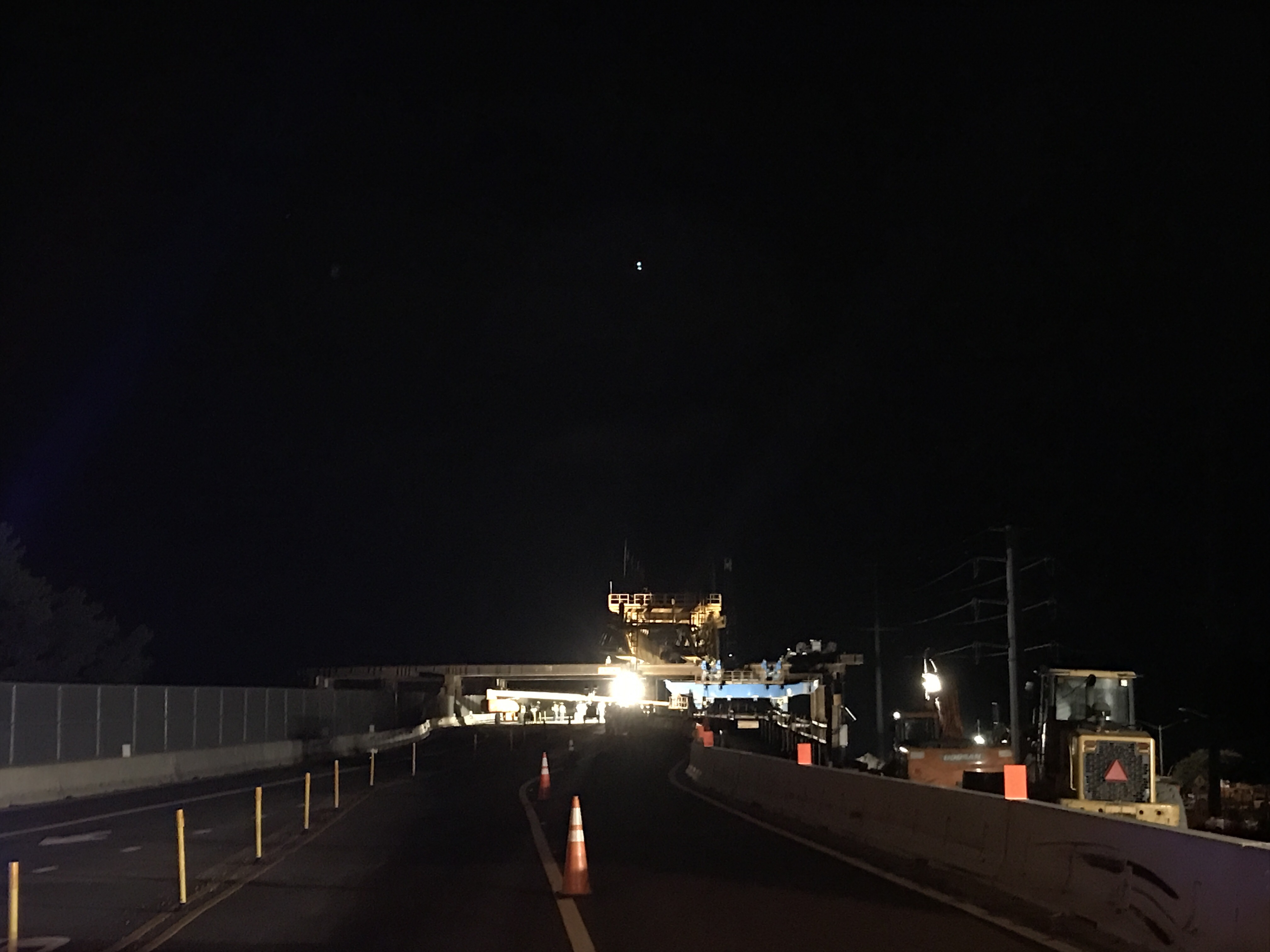
Last night pics.


From the classic update from a comedian in COVB Media and a guy from Public Works who <3 the Lesner:
Structural Scholars/Bridge Aficionados/Bored Readers:
For those of you who were wondering: “What am I going to read on the beach this weekend,” or “What can I read late at night that will stir me intellectually and heighten my awareness about structural engineering,” I have an answer – Before you is the latest from the Czar of Bridges, Chris Wojo, the Kingfish.
This is IMPORTANT information, so please take note. The Fish speaks of moving the gantry, substructure work, overheight vehicles, and most importantly . . . CLOSING SHORE DRIVE for a BRIEF period. He has gone to great pains to scratch out everything in details, and I have gone to great pains to check for spelling and punctuation errors . . . I know, it’s dirty work, but someone has to do it. It’s my lot in life.
There truly is a lot of information here and we are doing everything we can to get the word out to the local community so that everyone is aware of what will be taking place. Chris and his team have worked very hard to schedule everything so that there is a minimum of inconvenience to everyone.
We will be posting the latest info on our web pages, as well as the City’s Facebook and Twitter accounts. If you know of an organization or groups we should alert, please let me know and I will be glad to contact them. And if you haven’t already signed up for the City’s FB page or Twitter account, I encourage you to do so so that you receive timely updates from all things City-related.
As always, we appreciate your questions and e-mails, so please don’t hesitate to contact us. We are regularly updating information on our WEB page at: http://www.vbgov.com/lesner-bridge. You can also follow us on Twitter at: @lesnerbridge.
If you know of someone who would like to be added to our update list, please have them get in touch with me at this e-mail address and I will be glad to add them. Please feel free to pass this along to others.
Thanks again for all of your interest and patience throughout this project. So . . . stay safe, look out for each other, and put the phone down while you’re driving.
Drew Lankford
Media and Communications
Department of Public Works
City of Virginia Beachdlankfor@vbgov.com
(O) 757.385.8062
(C) 757.409.4353*****************************************
Folks:
A lot of you have been asking, “When is the gantry going to be moved?” Now that time has come. I hope most of you have heard about or seen the message on the portable signs on Shore Drive:
LES BRDG CLOSED 12AM-4AM
JUNE 19 THRU JUNE 24We have reached that point in the construction schedule where we need the gantry crane that is currently stored on the north side of Shore Drive to be put in place so that the superstructure of the new eastbound Lesner Bridge can be assembled.
To do this, we need to temporarily close Shore Drive to slide the gantry over the roadway and into position on the south side of Shore Drive.
This move will be conducted over three nights: June 19th, 20th, and 21st.
We will need short-term closures of Shore Drive between the hours of 12 midnight and 4 am, so as to disrupt as little traffic as possible. Note: One lane of the bridge will be kept open for use by emergency vehicles. In the event that emergency vehicles need to cross the bridge during this time, work will be temporarily halted to let the emergency vehicles cross the bridge. The detour route for all other vehicles during these dates and times is provided below.
Detour Route for the Temporary Short-Term Closure of Lesner Bridge
The move of the gantry crane will take place with the following anticipated schedule:
Monday, June 19th: 12 midnight through 4 am.
We will be:
+ Installing two support beams across Shore Drive to connect the falsework on the north side of the bridge to the falsework located on the south side
+ Connecting cables from the winches located on the south side of the bridge to the gantry located on the north side.
+ Re-opening Shore Drive to traffic.
NOTE: OVERHEAD CLEARANCE WILL BE 13’9” THEREFORE, OVERHEIGHT VEHICLES WILL HAVE TO USE ANOTHER ROUTE UNTIL THE SUPPORT BEAMS ARE REMOVED
Tuesday, June 20th: 12 midnight until 4 a.m.
We will be:
+ Completing preparations to the gantry rolling system and survey the falsework to ensure proper alignment of the channels.
+ Winching the gantry across Shore Drive and onto the falsework located on the south side of the bridge.
+ Re-opening Shore Drive to traffic.
NOTE: AGAIN . . . OVERHEAD CLEARANCE WILL BE 13’9” THEREFORE, OVERHEIGHT VEHICLES WILL HAVE TO USE ANOTHER ROUTE UNTIL THE SUPPORT BEAMS ARE REMOVED.
Wednesday, June 21st: 12 midnight until 4 a.m.
We will be:
+ Removing the two support beams from the falsework that crosses Shore Drive.
+ Re-opening Shore Drive to traffic.
NOTE: NO RESTRICTIONS TO OVERHEIGHT VEHICLES.
Gantry Support Falsework
Gantry Move
Other Bridge Construction News:
In addition to the preparations being made for the gantry move, substructure work on the new bridge continues.
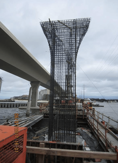
Piers 1 and 2 (of 9) of the new eastbound bridge have been completed. All of the drilled shaft foundations and the footing for Pier 3 have been completed and only one drilled shaft remains to be installed for the foundation at Pier 4.Reinforcing Steel at Pier Column 3
As McLean continues to build the new bridge substructure from the west, they are also continuing the demolition of the old bridges to the east and have completed approximately 80% of this demolition.
Bridge Demolition on the East side of Lynnhaven Inlet
AMI, Inc. in Portsmouth, continues to build the superstructure of the new Lesner Bridge. A total of 143 of the 168 segments have been cast for the new eastbound bridge. It is expected that all bridge segments for the eastbound bridge will be cast by August 2017.
Over the next two weeks, the bridge contractor will:+ Continue bridge demolition;
+ Place concrete and complete construction of Pier #3;
+ Place reinforcing steel and concrete in the footing for Pier #4;
+ Install the falsework and seal slab for Pier #5;
+ Install the falsework and seal slab for Pier #6:
+ Place the leveling pad for the new MSE wall along the south side of Shore Drive between East Stratford Street and the new bridge;
+ Continue filling and grading operations at the new bridge abutments;
+ Install the new traffic signal pole and mast arm on the southeast corner of Shore Drive and East Stratford Street (to be done during the night of the Shore Drive Road closure on June 19th – 20th).
Other information regarding the status of the bridge construction can also be found at http://www.vbgov.com\lesner-bridge
As always, please contact us with any questions or concerns regarding this project and we will get back to you as soon as we can.
Drive Safely!
-ChrisChristopher J. Wojtowicz, PE
Project Manager
City of Virginia Beach
Department of Public Works
Engineering Division
2405 Courthouse Drive
Virginia Beach, VA 23456-9031
Office: (757) 385-5785
Fax: (757) 385-5668
Email: cwojtowi@vbgov.com
CLICK FOR 1 PAGE PDF OF ROUTE 35
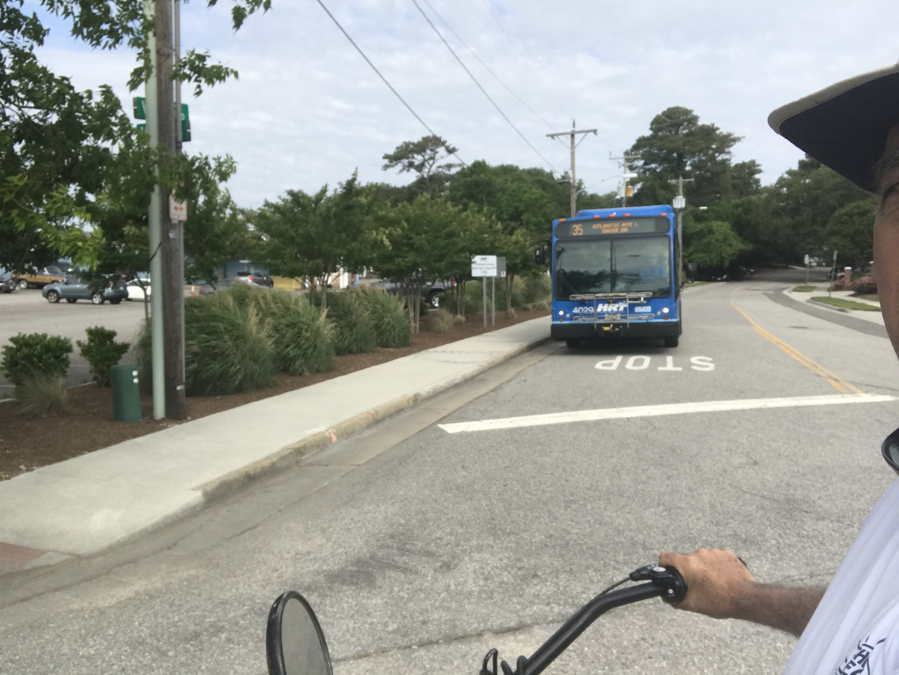


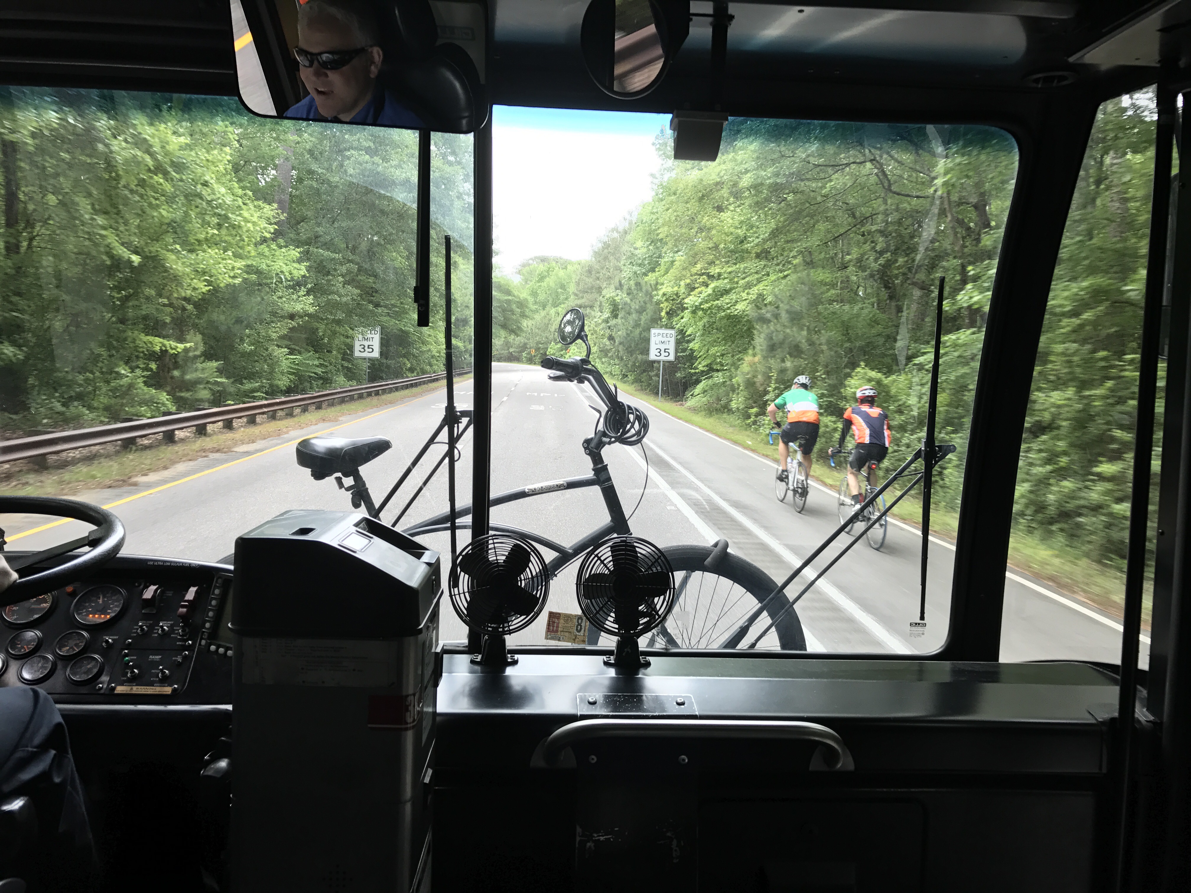
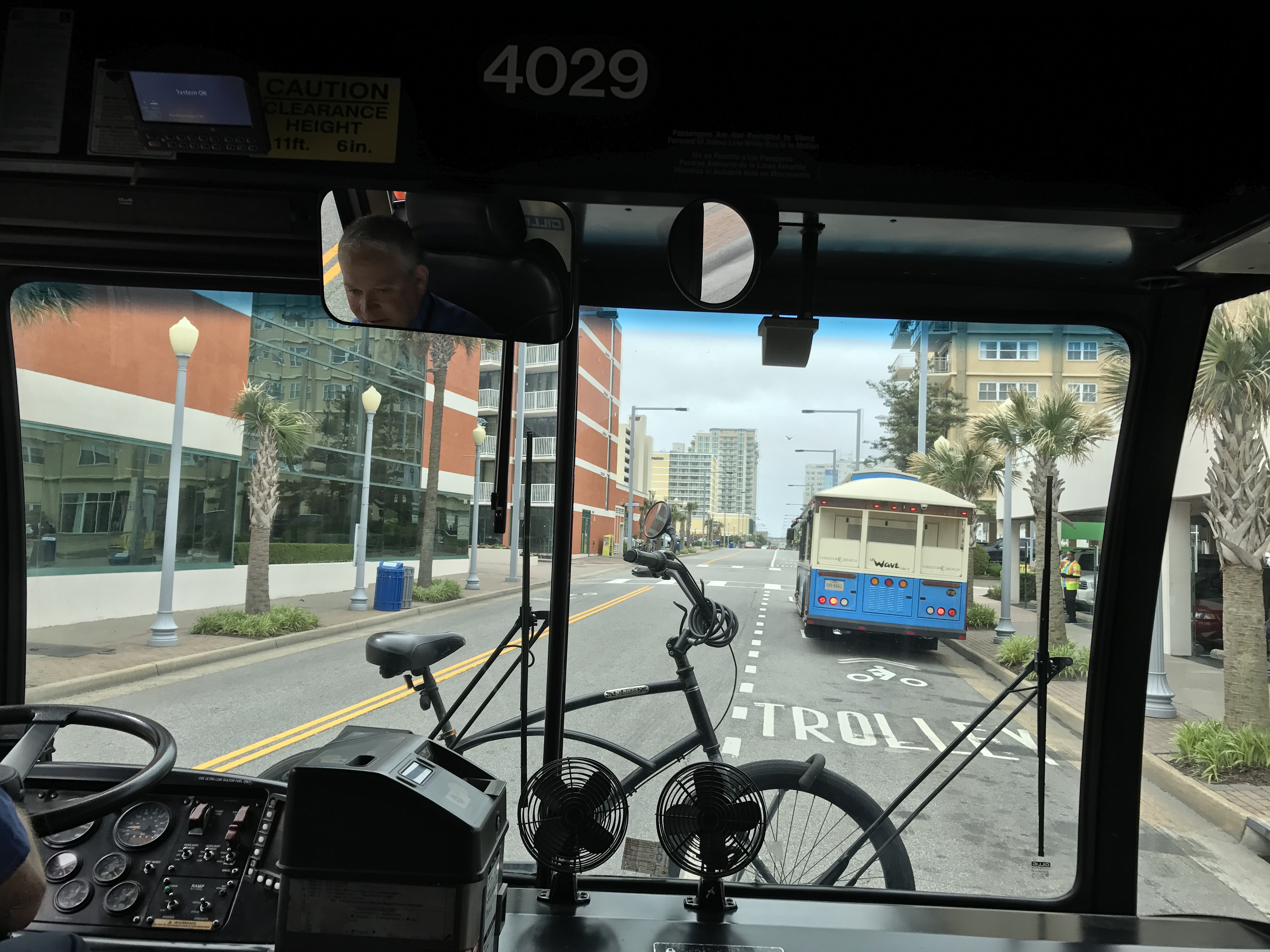
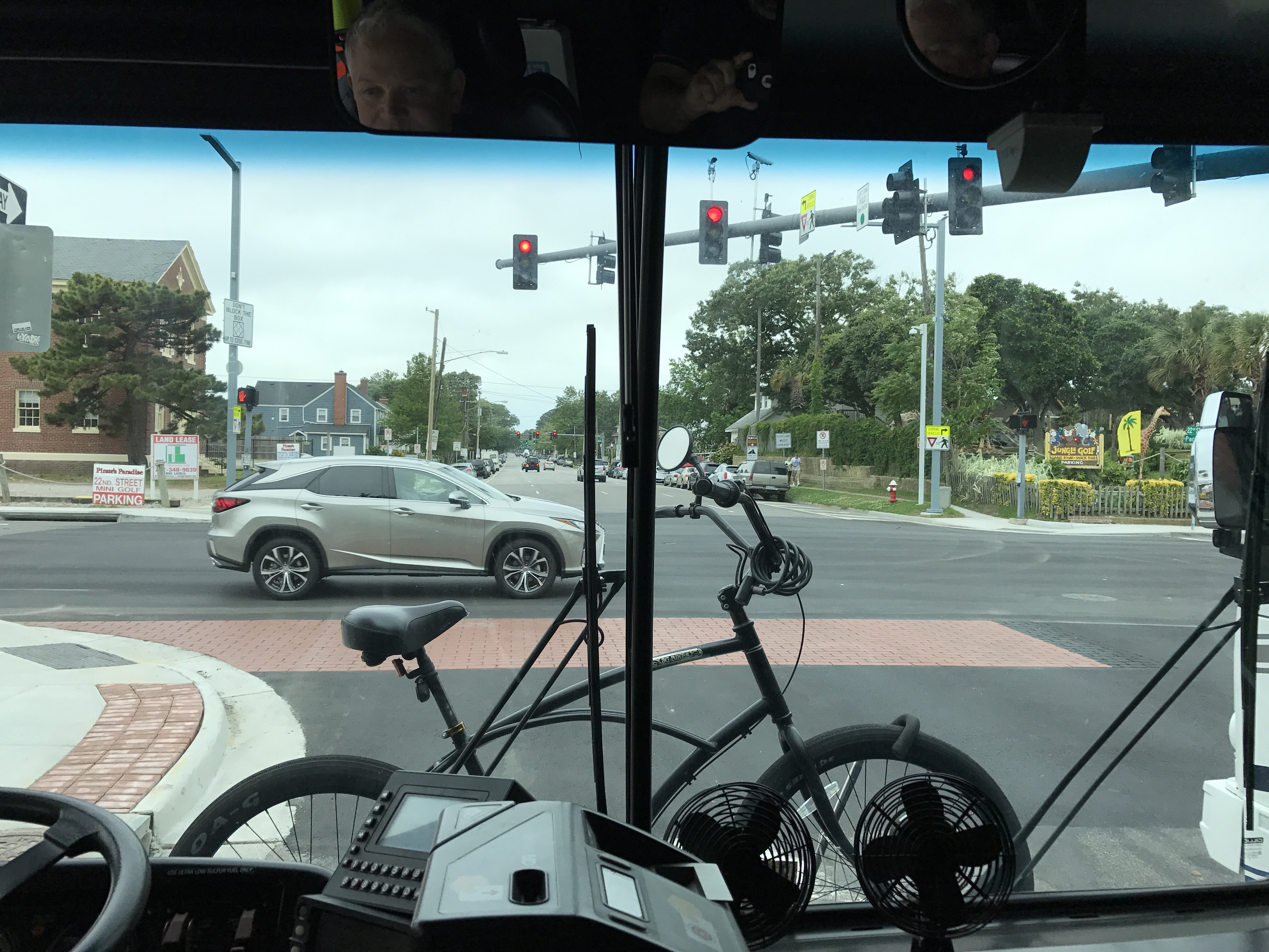
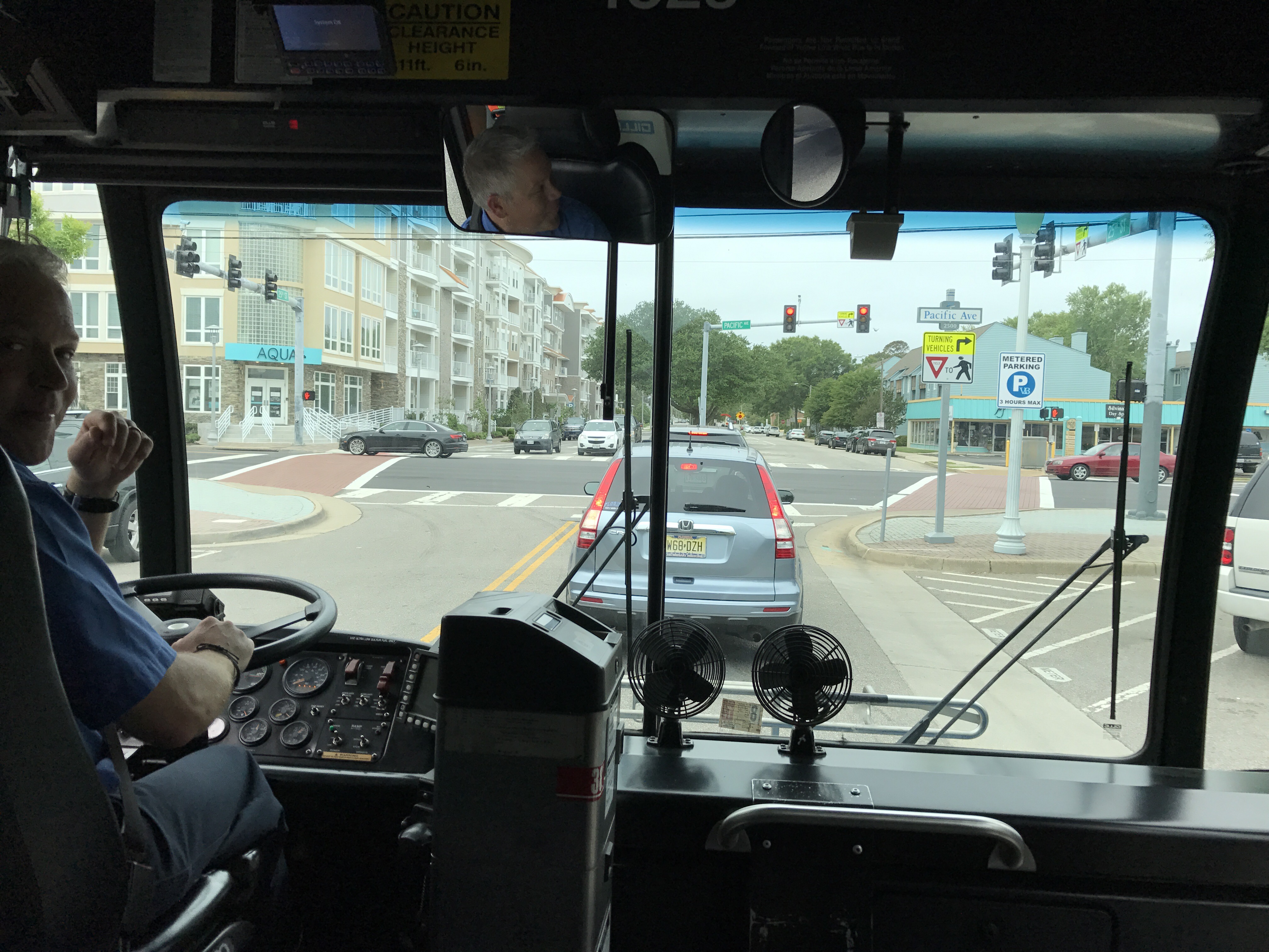


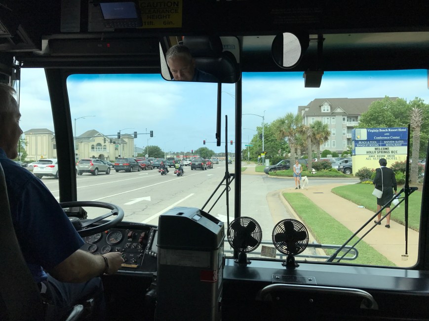

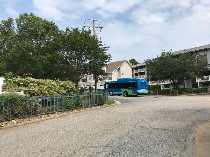
First driver: John
First rider: Todd
First rider with a bike: Wally
First round-tripper: Tim
Roundtrip on this Inaugural run started about 905 to 1020am return trip at Vista Circle.
Although the state is paying McLean Contracting to rebuild the bridge, the contractor is using its own money to hire crews that move tons of concrete to the reef. The VMRC monitors the process.
Crews load up a barge of concrete pieces roughly every two weeks and travel about 18 miles to Cabbage Patch Reef. They begin the ride at midnight and make it by the time the sun rises.

Screen Shot of Construction Cam photo taken February 18th at noon.
#LESNERBRIGE

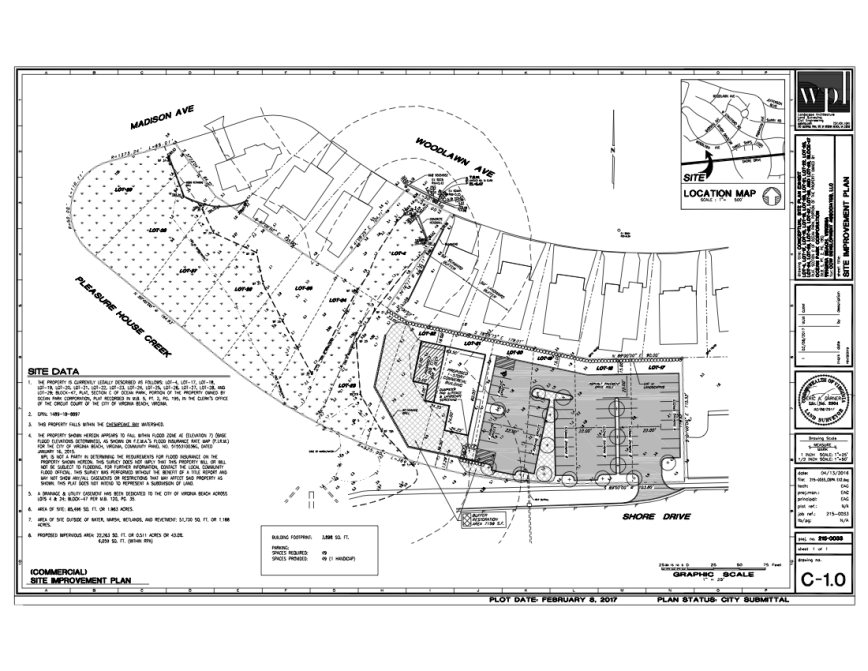
Link to VMRC website for Application #20151622 CCW DEVELOPMENT ASSOCIATES, LLC
Note: Due to timing of May 22nd ’17 CBPA Hearing Date and no presentation made by applicant to Shore Drive Community Coalition, SDCC has not taken a vote on what action to take in response to this proposal.
First Public Presentation of CCW on Pleasure House Creek is this Thursday May 18th ’17 Bayfront Advisory Committee Meeting at Resort & Conference Center 2800 Shore Drive. Meeting starts at 3pm.
Recent press about the proposed parking lot in Pleasure House Point Natural Area.

View article, photos and comment at Pilotonline.com:
City officials told residents about the plan May 4 at the Ocean Park Civic League meeting. Ocean Park borders Pleasure House Point.
Some residents think it’s hypocritical of the city to buy the land for conservation and then destroy part of it.
Right now plans include a kayak launch, a pedestrian bridge, more trails, and of course the parking lot. Past drawings of the site included bathrooms and lights, but right now the city says the money just isn’t there. Julie Braley with Parks and Recreation says there are some misconceptions with the project.
This website is also a public record including documentation, news and more about Pleasure House Point since 2003.