Category Archives: City Government
“Complete Streets are streets for everyone. They are designed and operated to enable safe access for all users, including pedestrians, bicyclists, motorists and transit riders of all ages and abilities. Complete Streets make it easy to cross the street, walk to shops, and bicycle to work. They allow buses to run on time and make it safe for people to walk to and from train stations.”
Virginia Beach Adopts Complete Streets Policy
Woo hoo!
The purpose of the Complete Streets Policy is to improve the Virginia Beach transportation system by providing safe, attractive travel for all users through a system of connected transportation choices designed in harmony with adjacent land uses.
View Press Release at VBGov.com.
Learn more about Complete Streets Policy at VBGov.com.

Comprehensive Plan Open House – Thursday Nov. 13th, 7:00 to 9:00pm at John B Dey School
[Note: Thank you for the many emails pointing out we had the incorrect date initially. You passed the test.]
Get Involved! It’s Your City and Your Future
Thursday November 13, 2014
7:00pm to 9:00pm
John B. Dey Elementary School Click here for a map
Open House Agenda
Welcome & Introductions (7:00-7:10)
Open House Purpose & Format (7:10-7:15)
Comprehensive Plan Overview Presentation (7:15-7:45)
Open House Station Visits (7:45-9:00)
The SDCC has sorted through the 2009 Plan and pulled the information pertaining to our Shore Drive area and has listed it below with some basic background wording. These are just a few issues that may be important to you. You may have other issues that don’t even show up in the current 2009 Plan.
Either way, please take an hour on Thursday to attend the open house and let the City know what YOU VALUE.
- Shore Drive Corridor Special Focus Area (SFA) – This 3 page chapter list general policies such as: road improvements for safety; continuous multipurpose trail; replace Lesner Bridge. It also identifies 3 main areas of focus: (Pleasure House Point, Lynnhaven Boat Ramp, Waterman’s Walk). Pleasure House Point has been resolved. Other actions are still working. Click here to read this section
- Water Resources Management Plan – This section touches slightly on protecting waterways for habitat and recreational use. No mention of a Neighborhood Dredge Plan, it is recommended that this complicated plan be identified and explained in the Plan. Click here to read this section
- Bicycle and Pedestrian Transportation – This sections identifies the need for a Complete Streets policy, which is currently being reviewed for implementation. It also talks about connecting neighborhood and improving safety. Click here to read this section
- Sea Level Rise – Although this section offers eight suggestions, many new issues have come up in the past 5 years. It is recommended that the issue of Sea Level Rise be expanded and detailed more with suggestions for home raising, flood insurance support, etc. Click here to read this section
The 2009 Comprehensive plan and details can be found on the City’s website by clicking here
What is a Comprehensive Plan?
The ‘plan’ is City Council’s official statement regarding how the physical development of the City should be directed for at least the next 20 years. It must be stressed, however, that the Comprehensive Plan (the ‘Plan’ hereinafter) does not claim and should not claim to have precise answers to all of the issues that may arise over time. The Plan’s role is the establishment of the policy framework within which operates a continuous planning process. That process is a vital means of implementing the recommendations of the Plan and revising the Plan as necessary in response to the unseen issues and opportunities that the future always provides. In that regard, this Plan is a ‘living plan,’ as it is not intended for the Plan to remain just as it is when adopted. The intent is for the Plan to interact with the various situations where it has a role and to be open to change as necessary to respond to recognized challenges and opportunities. The Plan should always be evolving in response to its environment.
Why does the City have to have a Plan?

#LESNERBRIDGE update from Project Manager – HRSD, lane closures & bulkhead at LBR&BF
October 30th 2014 UPDATE:
Happy Halloween! Our news update for the bridge project is in NO WAY as frightful as the candy-craving minions who will be roaming the streets of Virginia Beach this evening!
The installation of the conduits beneath Shore Drive and East Stratford Street has been completed. For these next two weeks there are no scheduled daytime lane closures within the Lesner Bridge project limits.
Beginning on Monday, November 3rd, however, the Hampton Roads Sanitation District (HRSD) will begin their work on the existing sanitary sewer forcemain in WB Shore Drive. HRSD will mobilize two construction crews; one located at Shore Drive/Rockbridge Road and one at Shore Drive/Kleen Street. They will begin work on the active forcemain in order to remove from service the portion of this forcemain that crosses the existing westbound Lesner Bridge.
The first week of HRSD’s work will involve setting up their traffic control. None of this work will require long term lane closures on Shore Drive. There will likely be daytime lane closures the week of November 3rd as they setup the temporary barrier service on westbound Shore Drive at Kleen Street and build the temporary lane shift at Rockbridge Road.
The actual work to excavate, cut and cap the forcemain will take place the week of November 10th through Saturday November 15th. Restoration work of the roadway and work areas will take place the week of November 17th. All work, including equipment demobilization and removal of the temporary traffic control, should be completed by November 24th.
As for the latest bridge construction progress:
Ø Construction of the new bridge abutment “A” continues on the west side of the Lynnhaven Inlet. The first concrete pour on the new bridge abutment took place on Wednesday, October 29th. Placement of the reinforcing steel and formwork for the second tier of the abutment will take place the week of November 3rd.
Ø All of the drilled shafts at Piers 1 and 2 have been installed. Over the next two weeks the Contractor will mobilize equipment to Pier #3, the first in-water pier to be constructed on this project. Also within the next two weeks the Contractor will begin preparing the excavation at Pier #1 for the formwork of the concrete cap.
The temporary bulkhead at the Lynnhaven Dredge Material Storage Site (LDMSS) continues. The tie-back system on the new bulkhead is nearly complete. Construction of the tie-back and waler system on the temporary bulkhead will be completed by Wednesday, November 5th. Placement of the formwork and steel reinforcing for the concrete cap on the bulkhead will also continue through November 5th.
Wick drain installation for the new westbound bridge approach located on the east side of the bridge between Page Avenue and the existing bridge abutment continues. On the west side of the bridge – in front of 3556 On the Bay Condominiums – the subgrade has been prepared for the foundation of the new retaining wall. Between November 5th and November 7th the Contractor will begin to form and place the concrete footing support for the new retaining wall. Delivery of the first concrete panels for the new wall is expected Friday, November 7th.
On the east side of the bridge drainage work also continues. The new storm drainage structures are being placed along Cape Henry Drive in front of Bubba’s and the Lesner Inn. The temporary steel sheeting installed at the corner of Shore Drive and Vista Circle will be removed between November 5th and November 7th. After this is removed, work will begin to install 36-inch stormwater pipe from the structure to the existing 36-inch pipe located on the south side of Cape Henry Drive.
At some point during this construction Cape Henry Drive will be reduced to one lane and the Contractor will have to provide a flagger to control traffic on this road until the new pipe can be installed. Once we have a better idea of schedule for this work, we will issue another project updated with specific dates and estimated duration of the work.
Finally, unrelated to the bridge construction but contributing to the amount of construction work now taking place within the Lynnhaven Inlet and along Cape Henry Drive, is the Dominion Virginia Power (DVP) transmission line rehab work. This is just an FYI to all of you who are curious as to what is going on with the old transmission lines and towers.
DVP is replacing a number of wooden poles and structures along Cape Henry Drive and along the south side of Shore Drive near the Lynnhaven Boat Ramps with galvanized steel monopoles. They will also be installing two new transmission line towers to replace the two aging towers that are currently located in the Lynnhaven Inlet. The new tower on the east side of the inlet (by the Virginia and Maryland Pilots Association) will be installed approximately 210 feet east of the current tower location. The new tower on the west side of the inlet (Lynnhaven Boat Ramp) will be installed approximately 25 feet west of the current tower location. This will result in a new tower spacing of 810 feet that is significantly greater than the current 575 foot spacing.
That’s it for now. Have a safe driving weekend, and keep an eye out for those munchkins roaming the streets tonight!
-Chris
Christopher J. Wojtowicz, P.E.
Project Manager
City of Virginia Beach
Department of Public Works
Municipal Center-Bldg 2
2405 Court House Drive
Virginia Beach, VA 23456-9031
Phone: (757) 385-5785
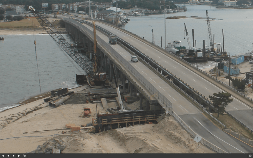
Zoomed in screen shot of construction cam photo taken at 10am OCT30 2014
“Every five years, Virginia Beach takes a new look at its long-term plan for growth and development. It’s called the Comprehensive Plan, “It’s Our Future,” and we need your input.”
That means you!
One of the reasons you still have time to comment is the work that Shore Drive Community Coalition – your neighbors – does to ensure We The People have a stronger voice.
Updates, info & more at VBGov.com.
Virtual Town Hall to share your input now. 
Have a voice in your neighborhood now!
City Council Candidates Forum Monday, October 20, 6-8:30 PM VB Oberndorf Central Library
City Council Candidates Forum
Monday, October 20, 6-8:30 PM
VB Oberndorf Central Library
Vote Button On Tuesday, November 4, we will be electing seven new members to our City Council. Come to our Forum at the Central library on Monday, October 20th to hear all the candidates’ positions of issues of interest to you.
Co-sponsored by the Princess Anne Garden Club, the Virginia Beach Garden Club, the Back Bay Restoration Foundation, and the Virginia Beach Council of Civic Organizations.
No pre-registration is required. For more information, 757-962-5398 or Karen@LRNow.org.

VB City Council Forums coming up. VOTE!
Forum Dates & Times
Thursday October 9
6:30 to 8:30pm Atlantic Shores Baptist Church Forum
1861 Kempsville Road
Virginia Beach
Saturday October 11
8am to 9:30am Virginia Beach Republican Breakfast Forum
Westin Town Center
Wednesday October 15
7pm to 8:30pm John Fredericks Debate
Tidewater Community College
Virginia Beach Campus Student Center (Third Floor),
1700 College Crescent, Virginia Beach
Thursday, October 16
7:00pm Bellamy Manor & Stratford Chase
City Council Candidate Forum
Kempsville Middle School
860 Churchill Dr, Virginia Beach, VA 23464
Monday October 20
6:00pm to 8:30pm Lynnhaven River Now Forum
Virginia Beach Central Library
Virginia Beach Blvd.
Wednesday October 29
7:00pm to 8:30pm Farm Bureau Forum
1507 Princess Anne Road
Dick Cottrell Youth Arena
Pungo
Any corrections, please let us know.
#LESNERBRIDGE update from Project Manager – “To begin this update, the project team has received a number of requests from citizens to have more consistent project updates.”
The October 2 2014 update:
To begin this update, the project team has received a number of requests from citizens to have more consistent project updates. We are glad to do that, so each week we will send out an update that includes a two-week “look ahead” schedule so that everyone will know what impacts from the project can be expected – including any lane closures.
With the recent lane shift on westbound Shore Drive at Page Avenue, we have completed our Phase 2 Maintenance of Traffic (MOT). This will be the new traffic pattern for at least the next 12-14 months while we build the new westbound Lesner Bridge.
Any DAYTIME lane closures that are needed will be setup by 9:00 AM and removed by 3:00 PM the same day. NIGHTIME lane closures, when they occur, will be from 9:00 PM to 5:00 AM.
That being said, the next anticipated lane closure related to the bridge work will occur on westbound Shore Drive between the bridge and Page Avenue next Monday, October 6th and Tuesday October 7th. This closure is only temporary and is needed so that the contractor can install concrete barrier service in this area and remove the orange traffic barrels (just like what was done on the west side of the bridge). It is expected that this lane closure will occur at night, but it is possible that this may occur during the day between the hours of 9:00 AM and 3:00 PM.
Over the next two weeks the contractor will complete the drilled shaft work at bridge Abutment A and Pier 1. Foundation construction will start at Pier 2 on Tuesday, October 7th 2014, and continue into the week of October 13th. During this same time period wick drains will continue to be installed along the north side of Shore Drive on the west side of the bridge (in front of 3556 On the Bay Condominiums). Abutment A is located on the west side of the Lynnhaven Inlet and Abutment B is on the eastside. There are 9 piers for each bridge. Pier #1 is located west of the inlet and Pier #9 is located on the eastside of the inlet.
All of the steel sheets for the temporary bulkhead located at the Lynnhaven Dredge Material Storage Area have been installed. During the weeks of October 6th and October 13th, formwork and the tie-back system for this bulkhead will be constructed.
The 18-inch sanitary sewer forcemain that crosses the existing westbound Lesner Bridge needs to be taken out of service for us to continue with the new bridge construction. Over the past several months, the City and the Hampton Roads Sanitation District (HRSD) have been coordinating this effort. In order for HRSD to take this large forcemain out of service, two linestops will have to be installed in the line; one at the intersection of Shore Drive and Rockbridge Road and one just west of Kleen Street (in front of Mango’s Grill).
HRSD will not implement any lane closures for this work, but they will need to install a concrete barrier along the shoulder west of Kleen Street, and install some temporary pavement in the median of Shore Drive across from Rockbridge Road. They anticipate this work to begin the week of October 13th, 2014 and continue thru Friday, October 17th. This schedule is subject to change, but we will provide a more up-to-date schedule in next week’s Lesner Bridge project update.
As a reminder, the speed limit over the Lesner Bridge is 35 MPH. Although it’s easy to exceed 35 MPH on Shore Drive, the temporary lane shifts on Shore Drive at both the eastbound and westbound Lesner Bridge are only designed for 35 MPH. Exceeding this speed limit through the construction zone not only risks your safety, but the safety of the bridge construction workers and any pedestrians/cyclists crossing the bridge.
Thanks to everyone who has contributed helpful tips for how we could make things better for the road users through this busy corridor!
Emphasis ours.
# # #
Follow @LesnerBridge in Twitter!
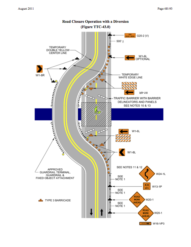
ROAD CLOSED sign being changed at #LESNERBRIDGE to improve safety on Shore Drive
Some of you, including me, have been thrown off by the ROAD CLOSED sign on the east side of the #LESNERBRIDGE.
It’s being changed.
Please have McLean remove the ROAD CLOSED sign from the TYPE III Barrier located on WB Shore Drive at Page Avenue and replace it with a WI-6 ARROW. Also have them replace the TYPE III barricade with one that has hash marks as shown in the attached plan.
Virginia Beach Named #1 Flood Safe City
In case you didn’t know.
View entire article at VBGov.com.
About our area:
Neighborhoods such as Bay Island, Lynnhaven Colony, Ocean Park and a few others are directly adjacent to tidal waters. Streets and developed land in these neighborhoods are sometimes so low lying that during higher tides, there is no practical way to stop that tide from encroaching on those properties.
At the direction of City Council, Public Works has initiated a sea level rise study to identify all the vulnerable areas in the city and then determine what type of adaptation strategies could be employed to reduce those impacts.
How Virginia Beach was scored includes:
Virginia Beach scores very well based on those criteria. However, this ranking didn’t account for sea level rise. Coastal Virginia has land subsidence issues— just a fraction of an inch each year — but our relative sea level rise is greater than what it might be in other parts of the country because of it.
Sea level rise and coastal protection:
“Sea level rise has been happening since we started recording the sea surface elevation,” says Roehrs. “In fact, since Jamestown was settled, sea level has risen almost two feet, but it is a very slow process, and people generally adapt.”
WHAT CAN YOU DO ?
What can you can do to help reduce flood risk?
1.To help the stormwater drainage system work well, there are a few things individual citizens can do. First, keep leaf debris and grass clippings from entering the system — rake and bag yard waste and keep the gutter clean. Sweep sediments up and add them to your garden; don’t let them wash down the drain and create clogs.2.During periods of heavy rainfall, large impermeable surfaces generate large amounts of runoff. This sudden influx of runoff can cause flash flooding. Consider reducing non-permeable surfaces such as asphalt and concrete on your property. Instead, use materials that allow water to enter the soil such as mulch, gravel or permeable pavers.
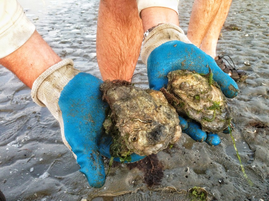
Reduce storm water heading into the Lynnhaven for the Lynnhaven oysters too.
Monday Sept. 29th SDCC General Meeting – At-Large Candidate Forum
This Monday Sept. 29th at 7:30pm, SDCC will host an At-large City Council Candidate Forum at the Ocean Park Volunteer Rescue Squad meeting hall.
Click here to view the meeting agenda or Click here SDCC SEP 2014 Agenda for a printable version of the agenda
There are 4 candidates running for 2 council seats. Please come out and listen to what they have to say regarding issues that impact our Shore Drive neighborhoods.
Below is the list of At-large Candidates taken from the City of VB’s website.
At-large
- November 4 General election candidates:
- Note: Two seats are up for election. The top two candidates are the winners.
- M. Ben Davenport
- George Furman, III
- Brad D. Martin – Incumbent Martin was appointed to city council in 2014.
- John D. Moss – Incumbent Moss was most recently elected to city council in 2011.
Project Manager for #LESNERBRIDGE update
From an email:
Friends:
We sincerely apologize for the backup you experienced on Shore Drive yesterday. Unfortunately, we did not anticipate the need for the lane closure on Lesner Bridge. Our lane closures for the Lesner Bridge construction project usually take place at night in order to avoid the serious delays you experienced yesterday.As a matter of public safety, the emergency lane closure that was put in place yesterday was to alleviate a potentially dangerous situation that was created by incomplete temporary pavement markings at the Vista Circle/Shore Drive intersection. We could not keep both THRU lanes open with this condition until it was corrected. The correction is being made now, and the plan is to have the lanes re-opened for this evening’s rush hour (5:00 PM).
Again, I apologize for the short notice.
-Chris

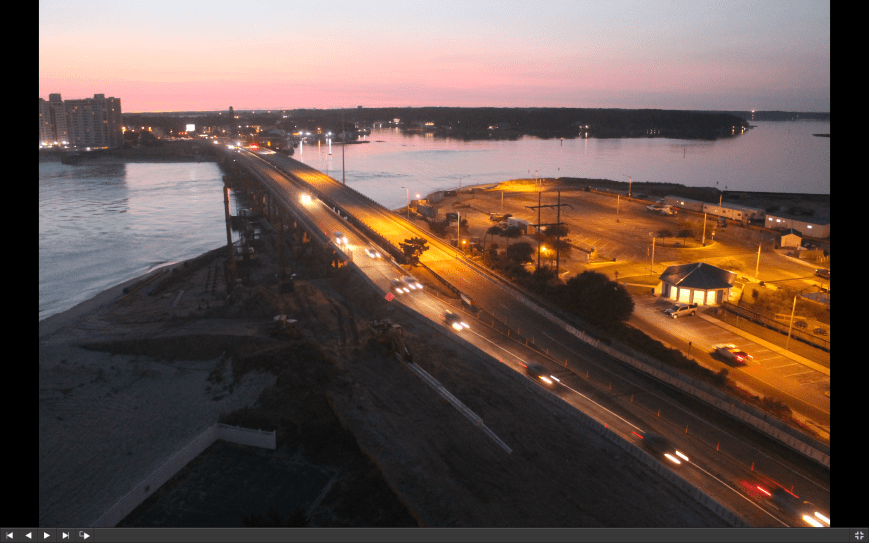
Screen grab of live photo at 327p.
“Public Utilities has contracted with Hydrostructures and RJN Group to conduct testing and surveying of the City’s sanitary sewer system. You may notice Hydrostructures or RJN Group crews in your neighborhood.”
View notice & more details at VBGov.com:
By watching to see where smoke escapes, crews can identify problem areas in the pipes for further sanitary sewer investigation techniques. Smoke may be seen coming from manhole covers, storm inlets, or holes in the ground. On occasion, smoke may be seen coming from building foundations or roof vent stacks. However, the smoke should not enter your home or business unless you have defective plumbing or dried-up drain traps. If you have any seldom used drains, pouring water into the drain to fill the trap will help prevent sewer gases or odors and smoke from entering your home or business.
Your neighborhood should receive flyers on your doors alerting you to the day it’ll be done.
Complete Streets Public Meeting on Draft Complete Streets Policy to be Held Thursday, September 18, 2014 at 6 p.m. at the Renaissance Academy, 5100 Cleveland St.
“Complete Streets are streets for everyone. They are designed and operated to enable safe access for all users, including pedestrians, bicyclists, motorists and transit riders of all ages and abilities. Complete Streets make it easy to cross the street, walk to shops, and bicycle to work. They allow buses to run on time and make it safe for people to walk to and from train stations.”
Watch a video presentation from Michael Ronkin of Complete Streets, filmed during VB’s Envision Transportation project – http://envisiontransportation.com/index.php?option=com_hwdvideoshare&task=viewvideo&Itemid=184&video_id=14
Google Map to 5100 Cleveland Street. About 15 minutes from Shore Drive area.
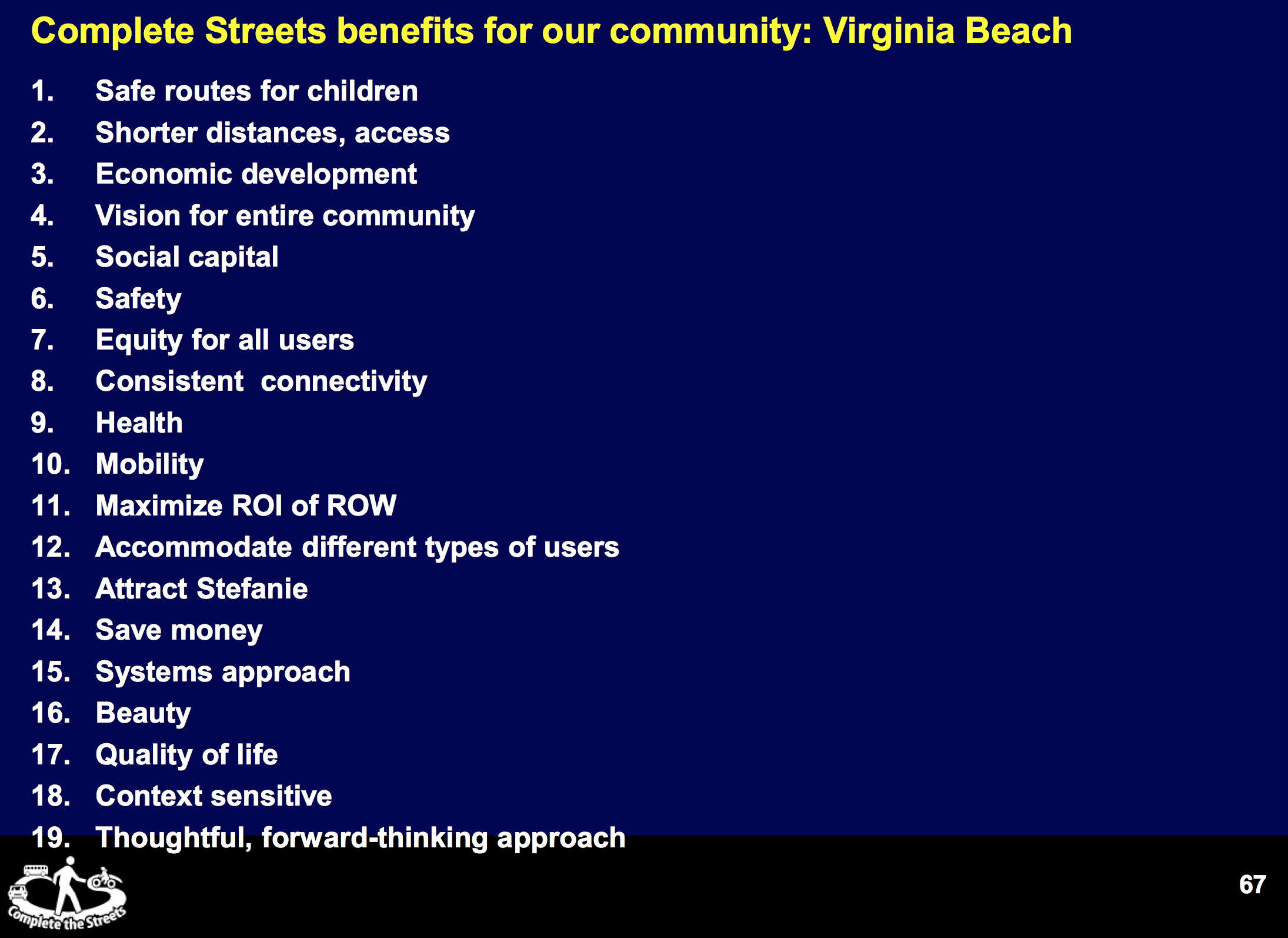
Learn more about Complete Streets at SmartGrowthAmerica.org.
You can have an impact on the streets you want!
One example:
Shore Drive Phase IV for Shore Drive in Ocean Park is slated to be finished in 2026.
Help design the road you want!
Note: If link is broken – start here and Search for 2.118.000: Shore Drive Corridor Improvements – Phase IV
LEGISLATIVE AGENDA—DRAFT GENERAL ASSEMBLY SESSION 2015 – COMMENT PERIOD NOW
This might not seem exciting to you now, however, without your input you do not have a say in your government.
LEGISLATIVE AGENDA—DRAFT GENERAL ASSEMBLY SESSION 2015 [41 pg PDF]
The public input process is through the public hearing which is being held next Tuesday, September 16, at 6:00 p.m., in the Council Chambers and through direct contact with members of City Council.
EMAIL EVERY MEMBER OF CITY COUNCIL WITH YOUR COMMENTS HERE
Note: Time is short! We just received this DRAFT REPORT Friday. Please do not delay in commenting!
Here is a sample of what the City of Virginia Beach is requesting of the Virginia Legislature:
-
14. PUBLIC HEARING NOTICE REQUIREMENT
SPONSORED BY VICE MAYOR, LOUIS R. JONES
Background Information:
Currently there is a 30-day notice (public hearing requirement) of real estate assessments increases of more than 1%. Prior to 2007, there was a seven-day window to notify the public of such increases. The City requests this be changed to 14 days. This would be consistent with the 14 days required when the General Appropriation Act did not occur, which is in the same code section.
We are required to have two public hearings each year for the budget. One of the public hearings is a general public hearing. This public hearing is usually held first on a Thursday night at one of our local high schools. We schedule our high school because the first public hearing usually has a large crowd because it is considered the “budget” public hearing and high school auditoriums can accommodate the crowds. It also provides a more central location away from the municipal center.
The other public hearing is required if real estate assessments increase 1% or greater, per section § 58.1- 3321. We have historically held this meeting the night of City Council’s formal meeting. City Council only has one night meeting during the budget process. Because Council has moved its formal meetings to the 1st and 3rd Tuesday of the month, we are left with unfavorable choices, which are not in the best interest of the public. We believe the 30-day notice complicates scheduling public hearings with no benefit. A two-week notice would provide ample opportunities for the public to be informed of real estate tax increase.
Request:
The General Assembly is requested to amend section § 58.1-3321 in section “B,” and change notice of the public hearing shall be given at least 14 days for the date of such hearing by publication of a notice in: 1) at least one newspaper general circulation in such county and city…
Page 27 of PDF
EMAIL EVERY MEMBER OF CITY COUNCIL WITH YOUR COMMENTS HERE
-
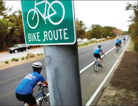
22. FOLLOWING BIKES TOO CLOSELY
SPONSORED BY COUNCIL MEMBER, ROSEMARY A. WILSON
There has been much progress in recent years in making bicycling safer for both the bicyclist and motorist. However, there is still work to be done. An effort was made during the 2014 session, House Bill 82, that would delete the word “motor” from the sentence, “the driver of a motor vehicle shall not follow another motor vehicle, trailer, or semi-trailer more closely than is reasonable and prudent, having due regard of the speed of both vehicles of traffic and the conditions of the highway at the time.” Since this language failed in the Senate, the suggestion is for a new section “B” to be added to 46.2-839 of the Code, to clearly state the intent to keep motor vehicles at a safe distance from other vehicles such as bicycles, etc.
Request:
The General Assembly is requested to amend the Code of Virginia, section 46.2-839 by adding a section “B” that states, “a driver of a motor vehicle shall not follow a bicycle, an electric personal assistive mobility device, electric power-assisted bicycle, moped, animal, or animal-drawn vehicle preceding in the same direction more closely than is reasonable and prudent, having due regard to the traffic and the conditions of the highway at the time.” Creating a separate section would make enforcement easier for police officers and increase safety for all of those who use our highways and roads.
Page 36 of PDF
EMAIL EVERY MEMBER OF CITY COUNCIL WITH YOUR COMMENTS HERE
-
23. CITIZEN COMMENT AT HAMPTON ROADS TRANSPORTATION ACCOUNTABILITY COMMISSION MEETINGS
SPONSORED BY COUNCIL MEMBER, JOHN D. MOSS
Background Information:
During its 2014 session, the General Assembly adopted a bill that created the Hampton Roads Transportation Accountability Commission (“HRTAC”), which was given the responsibility for approval of projects and the priority of such projects pursuant to the Hampton Roads Transportation Fund. The HRTAC adopted bylaws at their July 2014 organizational meeting. Although the bylaws provide for public hearings and public comment, they do not authorize residents of the fourteen counties and cities within the Planning District to speak on any agenda item, resolution or motion.
Request:
The City Council requests the General Assembly enact legislation which would require the HRTAC to allow any resident living within the fourteen counties and cities within Planning District 23 to speak on any agenda item, resolution or motion, for at least three minutes each.
Page 37 of PDF
EMAIL EVERY MEMBER OF CITY COUNCIL WITH YOUR COMMENTS HERE
-
24. BAN THE RELEASE OF MORE THAN TEN (10) BALL[O]ONS
SPONSORED BY COUNCIL MEMBER, BARBARA M. HENLEY
Background Information:
The Virginia Code currently allows the release of up to fifty (50) balloons an hour. However, balloons are a substantial threat to waterfowl and the environment and allowing the release of 49 balloons seams excessive. Balloons are a significant part of the litter collected from most waterways.
Request:
The General Assembly is requested to amend the Code of Virginia as follows:
§ 29.1-556.1. Release of certain balloons prohibited; civil penalty
A. It shall be unlawful for any person to knowingly release or cause to be released into the atmosphere within a one-hour period fifty ten (10) or more balloons which are (i) made of a nonbiodegradable or nonphotodegradable material or any material which requires more than five minutes’ contact with air or water to degrade and (ii) inflated with a substance which is lighter than air. Any person who violates this section shall be liable for a civil penalty not to exceed five dollars per balloon released above the allowable limit, which shall be paid into the Lifetime Hunting and Fishing Endowment Fund established pursuant to § 29.1-101.1.
B. The provisions of this section shall not apply to (i) balloons released by or on behalf of any agency of the Commonwealth, or the United States or pursuant to a contract with the Commonwealth, the United States, or any other state, territory or government for scientific or meteorological purposes or (ii) hot air balloons that are recovered after launch.
Editors note: My opinion is: BAN THE RELEASE OF MORE THAN ZERO (0) BALLOONS
EMAIL EVERY MEMBER OF CITY COUNCIL WITH YOUR COMMENTS HERE
-
25. ESTABLISHMENT OF COASTAL VIRGINIA STANDARDS FOR DAM SAFETY REGULATIONS
SPONSORED BY COUNCIL MEMBER, BARBARA M. HENLEY
Background Information:
The Code and the Regulations do not have specific standards that apply to Coastal Virginia, as such, every impounding structure must request special consideration. A change to the Regulations requiring specific modification factors for Coastal Virginia would alleviate this time and expense.
This amendment would require the establishment of regulations that require specific modification factors for Coastal Virginia.
Request:
The General Assembly is requested to amend the Code of Virginia as follows:
§ 10.1-605. Promulgation of regulations by the Board; guidance document
A. The Board shall adopt regulations to ensure that impounding structures in the Commonwealth are properly and safely constructed, maintained and operated. Dam safety regulations promulgated by the State Water Control Board shall remain in full force until amended in accordance with applicable procedures.
E. The Board’s regulations shall establish a Coastal Virginia modification factor for both the Probable Maximum Flood (PMF) and the Spillway Design Flood (SDF) in calculating the hazard of impounding structures.
Page 39 of PDF
EMAIL EVERY MEMBER OF CITY COUNCIL WITH YOUR COMMENTS HERE
-
26. AN ACT TO EXCLUDE THE LITTLE CREEK WATERSHED FROM THE JAMES RIVER BASIN FOR PURPOSES OF THE CHESAPEAKE BAY WATERSHED IMPLEMENTATION PLAN
SPONSORED BY COUNCIL MEMBER, BARBARA M. HENLEY
Background Information:
This amendment would remove the Little Creek watershed from the James River basin, just as the City requested the Lynnhaven River be removed from the James River basin.
Request:
The General Assembly is requested to amend the Code of Virginia as follows: Be it enacted by the General Assembly of Virginia:
1. § 1. That no state agency shall consider or include the Little Creek watershed as part of the James River Basin when developing or implementing the Chesapeake Bay Watershed Implementation Plan.
Page 40 of PDF
EMAIL EVERY MEMBER OF CITY COUNCIL WITH YOUR COMMENTS HERE

-
27. REQUIRE THE STATE WATER CONTROL BOARD TO ESTABLISH REGULATIONS FOR INNOVATIVE STORMWATER TREATMENT PROTOCOLS FOR LOCALITIES
SPONSORED BY COUNCIL MEMBER, BARBARA M. HENLEY
Background Information:
The City has not been able to have certain innovative stormwater treatment protocols approved that it believes would be less expensive and more effective than the protocols allowed, such as oyster reefs, phragmites harvesting, etc.
The amendment would require the State Water Control Board to establish a regulatory framework to have these innovative techniques evaluated.
Request:
The General Assembly is requested to amend the Code of Virginia as follows: § 62.1-44.15:28. Development of regulations.
A. The Board is authorized to adopt regulations that specify minimum technical criteria and administrative procedures for Virginia Stormwater Management Programs. The regulations shall:
… .
16. Establish a regulatory framework, including timeline and appeals procedures for localities to obtain approval for innovative stormwater treatment protocols to meet Chesapeake Bay TMDLs and other stormwater quality TMDLs.
Page 41 of PDF
View definition of § 62.1-44.15:28. Development of regulations.
EMAIL EVERY MEMBER OF CITY COUNCIL WITH YOUR COMMENTS HERE
Your thoughtful comments do make a difference!
Weekly #LESNERBRIDGE update from Public Works Manager
*** As a reminder, the sidewalk on westbound Shore Drive is closed to pedestrians and cyclists between Page Avenue and East Stratford Street. If pedestrians need to cross the bridge, they will need to cross the eastbound bridge where we have provided a temporary 4-foot wide pedestrian/cyclist access.
Read entire update from an email:
Folks:
Below is the latest update for the Lesner Bridge Project from Chris Wojtowicz, project manager. Please let either Chris or me know if you have any questions or need additional information.
Also as an FYI – Public Works has created a project website at http://www.vbgov.com/lesner-bridge. We have posted information, background information, and – sometime within the next few days – a Twitter feed. A Construction Camera has also been installed to view images of the bridge construction, with images updated every 30 minutes.
Please visit this website for the current project updates and other useful project information.
Enjoy these last days of summer, and thanks for your interest.
Drew Lankford
Media and Communications
Department of Public Works
City of Virginia Beachdlankfor@vbgov.com
(O) 757.385.8062
(C) 757.409.4353Friends:
As many of you have seen, traffic patterns on Shore Drive are beginning to change as you approach the Lesner Bridge. Work over the next two weeks will consist of preparing both the eastbound and westbound bridge approaches for the lane shifts as we move into Stage 2 construction of the bridge.
The eastbound lanes on Shore Drive as you approach the bridge have already been shifted to the south. Work was done on Wednesday to place asphalt, temporary pavement markings, and delineators on Shore Drive between the bridge and East Stratford Street in preparation of the lane shift of the westbound Shore Drive traffic towards the sushi restaurant and away from 3556 On the Bay Condominiums. This traffic move will provide the required space we need to install the utilities, temporary retaining walls, grading, and infrastructure required for the new westbound bridge abutment.
A similar lane shift will also occur on the east side of the bridge towards the Lesner Inn. It will be several weeks, however, before we begin this lane shift. Once the contractor sets a date for this work, we will post another project update to inform you of the necessary details.
*** As a reminder, the sidewalk on westbound Shore Drive is closed to pedestrians and cyclists between Page Avenue and East Stratford Street. If pedestrians need to cross the bridge, they will need to cross the eastbound bridge where we have provided a temporary 4-foot wide pedestrian/cyclist access.
As Drew has mentioned, please visit our website for information and updates.
Thanks for your interest, and as always – Please Drive Safely!
-Chris
Christopher J. Wojtowicz, P.E.
Project Manager
City of Virginia Beach
Department of Public Works
Municipal Center-Bldg 2
2405 Court House Drive
Virginia Beach, VA 23456-9031
Phone: (757) 385-5785
Fax: (757) 385-5668
email: cwojtowi@vbgov.com

Screen grab at time of this post
Bayfront Advisory Committee (BAC) Meeting (Thursday Aug. 21st) and Newsletter
Bayfront Advisory Committee to Meet August 21, 2014
The Bayfront Advisory Committee will meet Thursday, August 21, 2014,
at the Resort and Conference Center, 2800 Shore Drive, from 3:30pm-5:30pm
Click here for the meeting agenda and to read the latest BAC Newsletter
Pedestrians, Crosswalks and Frogger
I think many would agree that motor vehicle regulations have been put in place to address safety issues and to keep us safe. To be effective, these laws must be understood and applied fairly, not arbitrarily or capriciously. Given that broad statement, how should we drivers respond to pedestrians in crosswalks?
If you condense the VDOT Crosswalk statutes to their understandable part, what are we required to do when we come across a pedestrian and a crosswalk? VDOT laws can be found at http://www.virginiadot.org, specifically for crosswalks; 46.2-924 Drivers to stop for pedestrians.
If the speed limit on the road is 35 MPH or less, you are required to “yield the right of way to any pedestrian crossing…” Drivers entering, crossing, or turning at intersections shall change course, yield, slow down, or stop if necessary to permit pedestrians cross such intersections safely and expeditiously.
So, there you are driving down Pacific Ave down at the oceanfront and somebody steps into the crosswalk. You now slow down and some horn-happy driver behind you lets you know that apparently he is late for some important occasion. Or, even worse, that driver whips around you and then almost nails the pedestrian in the crosswalk. It is getting almost as dangerous for you to stop (getting rear-ended) as it is for the pedestrian if you don’t stop.
It seems like driver-pedestrian encounters are too commonplace and a lose-lose situation with mostly deadly consequences. People from other parts of the world where pedestrian crosswalk laws are rigidly enforced don’t know what applies. Some pedestrians become trapped in the no-man’s land, the center median as they seek temporary refuge. What gives?
How does the city and state (Dillon rules; state makes the laws, not the cities) solve this continuously dangerous situation? ENACT UNDERSTANDABLE LAWS, EDUCATE EVERYONE, and MOST IMPORTANTLY, ENFORCE. As for Frogger, it was a great video game in the mid-70’s where you, as a frog, tried to cross a busy road. This game should never be attempted in real life by us or our fellow drivers and pedestrians.
“The city of Virginia Beach has recently pulled this information to get an idea of where their citizens are cycling… Also clearly visible, is the use of Shore Drive.”
Learn more about the Bikeways & Trails Advisory Committee at VBGov.com.
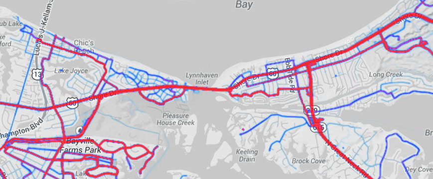
Strava Labs is where Strava engineering occasionally releases side projects independent of our product.
Projects may be added, removed, or break at any time, so use them at your own risk.
“The Pleasure House Point Natural Area represents a unique opportunity to showcase the beauty and function of a coastal eco-system in the midst of the highly developed waterfront community in the Bayfront area of Virginia Beach. The property has been manipulated time and time again over the past 50 years. Even with all of this intrusion, the environment has survived and flourished as a prime example of the resilience of a natural eco-system.”
View 88 page PDF online at VBGov.com.
About the Management Plan
This management plan was developed to comply with the conditions of the recorded conservation easement. The recommendations that are contained within the management plan are the result of a year long study of the property. This plan has a horizon of five years. It will be important to measure the progress made annually on the stated goals in the plan and to update the plan every five years.
The Pleasure House Point Natural Area represents a unique opportunity to showcase the beauty and function of a coastal eco-system in the midst of the highly developed waterfront community in the Bayfront area of Virginia Beach. The property has been manipulated time and time again over the past 50 years. Even with all of this intrusion, the environment has survived and flourished as a prime example of the resilience of a natural eco-system. There are many lessons to be learned from this property, as well as many actions we can take to restore and enhance the property. This document was developed with this charge in mind and outlines specific steps and priority projects to ensure that the property is properly managed and maintained for the benefit of both man and nature.
About Management Objectives
The conservation easement is held by the Virginia Department of Game & Inland Fisheries (VDGIF). This management plan is being developed to comply with the conditions of the recorded conservation easement and the management plan has been coordinated with VDGIF. The management plan will govern operations and maintenance as well as future improvements and restoration projects on the 84.658 acre parcel known as the Conservation Easement Parcel. The site must be managed consistent with conservation goals used to rank and fund the project as listed below.
• Maintain habitat values
• Maintain Coastal Maritime Forests
• Maintain water quality
• Maintain/educational and recreational values not detrimental to other aspects
About Public Engagement
There will be many different opportunities to provide environmental education in partnership with Chesapeake Bay Foundation and Lynnhaven River Now. In addition, the City will be providing outdoor programming in the park. We will continue to keep the neighbors engaged by coordinating regularly with the Bayfront Advisory Committee, the Shore Drive Community Coalition and the Ocean Park Civic League. The Bayfront Advisory Committee is appointed by City Council and provides a forum for residents and businesses in the area to discuss land use, transportation and social issues. The Shore Drive Community Coalition is a volunteer organization that coordinates among various civic groups. The Ocean Park Civic League represents the neighborhood directly adjacent to the site and the members have officially adopted the Pleasure House Point Natural Area and are responsible for conducting at least one trash clean up quarterly on the property. They are also diligent in reporting violations of the pet waste and leash laws.
I encourage you to read and digest the entire document.
It’s fascinating.

 #WeLoveShoreDrive