Folks:
It’s been a while since the last update on the project and some of you have asked why it seems that we have stopped construction of the bridge superstructure over the inlet channel. The answer is we cannot launch the gantry across the channel to complete construction of the center span until we complete construction of Pier #5. The construction of pier 5 was delayed over the summer due to an issue with one of the 10 drilled shafts installed for this foundation. This shaft was completed this past Saturday 11/18/2017 and work is currently under way to prepare the formwork for the footing of this pier.
Once Pier #5 is complete, we will launch the gantry across the inlet, set the pier segments on Pier #5 and then launch to Pier #6 (recently completed) and set the pier segments on Pier column #6. Span #6 will then be assembled by picking segments off a barge moored in this location. After Span #6 is completed, the gantry will be back-launched toward the channel to complete the other half of the cantilever section of Span #5 that crosses the channel. So for the next two months expect see a lot of activity in the area of Pier #5 (east side of the channel).
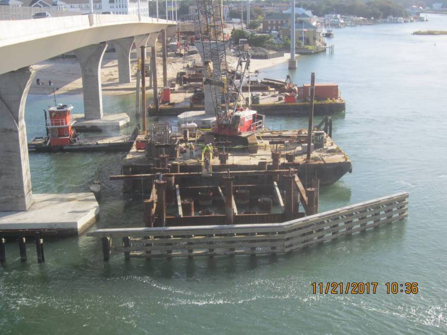
Completed Drilled Shafts at Pier #5 EB Bridge (Completed Pier Column #6 shown in background)
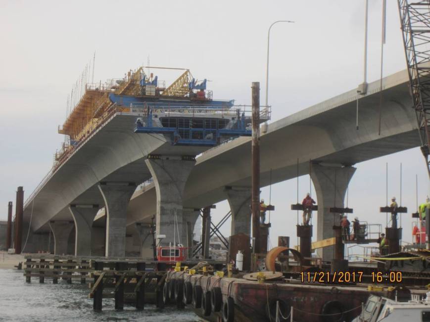
View looking WNW at Cantilever A of Span 5 of the new EB Lesner Bridge.
Although the construction of Pier #5 was delayed, other bridge work continued and a lot has been done since the last update. Since our last project update in September the following work has been completed:
· Span #4 (of 10) and 4 segments of cantilever Span #5 have been constructed for the new EB bridge;
· Drilled Shaft foundations at Pier #5 have been completed;
· The footing and column at Pier #6 have been completed;
· The footing at Pier #7 has been completed;
· All four drilled shafts at Pier #8 have been installed;
· Two of the four drilled shafts at Pier #9 have been installed;
· Two of the three concrete placements for bridge Abutment B have been completed;
· The new bridge fender system beneath the new eastbound bridge has been completed (only four piles remain to be installed between the two new bridges);
· Construction of the bridge approach slab on the west side of the bridge has been completed;
· The storm drain system on the eastern bridge approach has been completed;
· The storm drain system on the western bridge approach has been completed (tie-in to existing stormwater drainage system at East Stratford Street currently under way);
· The retaining wall, including scenic overlook area, along Piedmont Circle and next to American Brew and the Lynnhaven Boat Ramp Office has been completed;
· Two of the four new street lights on the western bridge approach have been installed;
· All casting of bridge segments have been completed for the project by Atlantic Metrocast in Portsmouth, VA;

Partially Completed Abutment B EB Bridge. Forms being removed.

Completed Footing at Pier #7 new EB Bridge.
Over the next two weeks, the bridge contractor will:
· Complete drilled shaft foundations at Pier #9 (this will complete all drilled shaft installation on the project);
· Set formwork and chip drilled shafts to specified elevation at Pier #5;
· Place column at Pier #7;
· Complete MSE wall #5 located in front of the Virginia and Maryland Pilots Association ;
· Work on setting 4 more segments in Span #5; and
· Complete curbing along MSE wall #2 located next to the Lynnhaven Boat Ramp Office;
That’s it for now.
Have a Happy Thanksgiving and Please drive safely!
-Chris