MarineTraffic.com Site gives landlubbers trove of information about ships

While crossing or stuck in traffic on the Lesner Bridge, have you ever looked out on the Bay and wondered about all the ships that anchor just off our beach.  Where are they from?  What are they carrying?

Well, the website www.MarineTraffic.com can help you answer these questions and more.

marinetraffic

Also check out the recent article in the Virginian-Pilot that features Shore Drive resident Joe DiGeronimo.  Click here to read the entire article

A New Jersey native and retired businessman, DiGeronimo, 70, became fascinated by the daily parade of vessels – and curious.

“I wanted to know where they were going and what they were doing for the community,” he said. “It’s a beautiful view, but what’s going on? Why are those ships parked out there? Why are they running by with the loads they are?”

“Virginia Beach HAS NOT Been Suspended From Flood Insurance Program”

At VBgov.com:

On Dec. 10, the Federal Emergency Management Agency’s (FEMA) Region 3 office sent a letter to Virginia Beach Mayor William D. Sessoms, Jr., confirming that Virginia Beach was in compliance with the flood insurance program. In addition, the Virginia Department of Conservation and Recreation (DCR) confirms that Virginia Beach is in compliance with all requirements of the program, and will not be suspended.

#LESNERBRIDGE Update from Project Manager – “Faded pavement markings”…

January 15 2014 Update:

Friends:

As we bask in the cold, damp, drizzly, foggy, chilly, London-type weather, while watching moss grow everywhere, we have been receiving some inquiries about some pavement problems that need to be addressed on the Lesner Bridge project.

Below is the latest information from Chris Wojtowicz, our project manager. Please give this a look when you have the time, and feel free to let Chris or me know if you have any questions or need more information.

As a reminder, we are regularly updating information on our WEB page at: http://www.vbgov.com/government/departments/public-works/roadways/Pages/lesner-bridge-7-14.aspx .

You can also follow us on Twitter at: @lesnerbridge.

If you know of someone who would like to be added to our update list, please have them get in touch with me at this e-mail address and I will be glad to add them.

Please feel free to pass this along to others. Thanks again for all of your patience throughout this project.

Thanks for all your questions and comments – and patience. Enjoy your weekend, and please stay warm and be safe.

Drew Lankford
Media and Communications
Department of Public Works
City of Virginia Beach
dlankfor@vbgov.com
(O) 757.385.8062
(C) 757.409.4353

To All:

This Lesner Bridge project update is to bring you all up to speed on the status of addressing several pavement issues on Shore Drive within the bridge project limits. We have been receiving a number of phone calls, texts, and emails regarding the faded temporary pavement markings on westbound Shore Drive just past the Page Avenue intersection, as well as the bump on eastbound Shore Drive at the Vista Circle intersection.

1) The “Bump”: A request for estimate and schedule has been submitted to a paving contractor. This estimate is due to the City no later than tomorrow, 1/16/2015. The estimate is based on the milling of the asphalt that is causing this bump in the eastbound outside lane for Shore Drive at the Vista Circle intersection and then replacing this asphalt with up to 2” of surface asphalt to match the elevation of the existing concrete pavement and eliminate the elevation difference that is causing the bump.

2) Faded Pavement Markings: We are very aware of the faded pavement markings along Shore Drive, both eastbound and westbound, and between East Stratford Street and Vista Circle/Page Avenue. We have attempted three times to replace these markings, but due to the wet weather and cold temperatures we have had to delay this maintenance work. Once we get a day where the pavement temperature is 50°F and rising, as well as dry, we will replace these painted temporary markings with a more durable thermoplastic marking. We will also place raised reflective pavement makers to help delineate the travel and turn lanes during wet weather and nighttime driving.

Once we have a definite schedule for this work, we will send out a news release announcing the date and times for the lane closures required to perform this work.

We appreciate your patience on these issues as we navigate through this period of cold and wet – typical coastal VIRGINIA – weather.

Thanks Again,

-Chris

Christopher J. Wojtowicz, P.E.
Project Manager
City of Virginia Beach
Department of Public Works
Municipal Center-Bldg 2
2405 Court House Drive
Virginia Beach, VA 23456-9031
Phone: (757) 385-5785
Fax: (757) 385-5668
email: cwojtowi@vbgov.com

2015/01/img_3441.jpg

“Others have suggested making permanent its nickname, the Lynnhaven Inlet Bridge, or bestowing the honor on longtime Vice Mayor Louis Jones, who represents part of the Shore Drive corridor.”

View article at Pilotonline.com:

Voting will be open through the end of February.

The Bayfront Advisory Commission, which advises the City Council on issues pertaining to the Shore Drive and Chesapeake Bay-area communities, is expecting some unique input.

Click to visit website to submit your response.

Click to visit website to submit your response.

About Vice Mayor Jones about VBGov.com who has represented Baylake Pines, Chesapeake Beach & Ocean Park neighborhoods for years.

He serves as the City Council liaison to several organizations, including the Water Task Force Committee, the Bayfront Advisory Commission, the Oceana Land Use Conformity Committee, the Pembroke Strategic Growth Area Policy Committee and the Town Center Committee.

About the Bayfront Advisory Committee at VBGOv.com:

The purpose of the Bayfront Advisory Committee (BAC) shall be to serve in an advisory capacity to City Council with respect to development and improvement to the Bayfront area.

Learn more about #LESNERBRIDGE construction at SDCC.info.

#LESNERBRIDGE update from Project Manager – “The City will be addressing bump on eastbound Shore Drive, located in the outside lane at the Vista Circle intersection . . .”

HOORAY FOR FIXING BUMP!

Ahem.

January 9 2015 UPDATE:

Friends:

I hope that all of you have had a safe and enjoyable holiday season. Now it’s back to work and back to our Lesner Bridge Project updates!

The cold temperatures and blustery winds aren’t helping, but work on the new westbound (WB) bridge and temporary bulkhead began again this past Monday (1/5/2015) after the holiday break. Also, form work for the first bridge segments have been assembled at the casting yard in Portsmouth (Atlantic Metrocast Inc. next to the Jordan Bridge). The steel reinforcement on several of the new bridge segments have been tied and pouring of the first concrete segment will begin in approximately one week (see photo below). [Note: The new Lesner Bridge will have a similar appearance as the Jordan Bridge shown in the background.]

unnamed-4

Now some quick notes on the latest construction progress:

Ø Construction of the new bridge abutment “A” located on the west side of the new WB bridge has been completed.

Ø The foundation cap for Pier #1 (first pier located east of Abutment A) has been completed. Steel reinforcement and formwork for the support column that is being built on this cap is now being assembled and will be in place by the end of next week .

Ø The foundation cap for Pier #2 (second pier located east of Abutment A) is now being constructed. Steel reinforcement and formwork for the foundation cap is currently being placed and readied for the scheduled concrete pour on Monday, January 12, 2015.

Ø Installation of drilled shafts at Pier #3 continues. One of the five shafts for this foundation has been completed. Work on the second shaft began on Wednesday (1/07/2015), and will be completed by tomorrow, Saturday the 10th. The remaining drilled shafts for this pier is scheduled to be complete by 1/23/2015.

Ø Work on the WB bridge approach in front of 3556 On the Bay condos (Shore Drive/East Stratford Street) continues. The concrete retaining wall, utilities, and temporary wire wall are all being installed – concurrently – at this location. It is expected that both the temporary wire wall (next to WB Shore Drive) and the new textured concrete retaining wall will be completed by Wednesday of next week (1/14/2015). Once these items are completed, the contractor will begin installing the new 16-inch water main up to the new bridge abutment. Some utility work will be needed in the intersection of East Stratford Street and Shore Drive as part of this new water main tie-in and construction. Once we have a schedule for this this utility work we will send out another update.

Ø Work on the WB bridge approach next to the old Duck-In property (Shore Drive/Page Avenue) also continues. A portion of the concrete footing for the new retaining wall has been poured and the area prepared for the placement of the pre-cast concrete retaining wall panels. The first of these textured concrete retaining wall panels will be installed at this location on or about January 14, 2015.

Ø The developer of the Duck-In site is currently constructing a seawall as part of their new development for the property. Where this private seawall meets the City’s right-of-way, the City will extend the seawall under the new bridges and tie into the existing bulkhead located on the south side of the bridges at the Virginia Pilots Association. The City’s bridge contractor has recently installed a portion of the City’s seawall between the existing WB Lesner bridge and the private seawall. The remainder of the City’s seawall will be installed once both existing bridges are demolished.

Ø As many of you have noticed over the past month there have been several lane closures on westbound Shore Drive between Page Avenue and East Stratford Street. Several of these closures were needed to repair several portions of the temporary concrete barrier service and others were needed to remove the sand that had accumulated on the roadway. We have asked the contractor to provide better notice of these daytime lane closures so that we can better inform you of these events. There was a single lane closure on both eastbound and westbound Shore Drive between Page Avenue and East Stratford Street today between the hours of 9:00 AM and 3:00 PM. The bridge contractor was repairing several potholes that have developed on Shore Drive. Time permitting, he was also going to re-stripe the temporary pavement markings that have faded over the past few months.

Ø The City will be addressing bump on eastbound Shore Drive, located in the outside lane at the Vista Circle intersection (just before Starbucks®). We are waiting for the cost estimate from the Public Works annual service contractor so that we can prepare the work order and schedule this work. We expect this estimate sometime next week. We will provide an update of when this work will be performed as soon as we get the schedule from the paving contractor. Essentially, we will mill out the EB portion of the intersection and then overlay with asphalt to match the existing elevation of the concrete turn lane at Vista Circle to remove this bump.

Lastly, the construction of the temporary bulkhead at the Lynnhaven Dredge Material Storage Site (LDMSS) is nearing completion. All of the concrete cap for this bulkhead will be completed next week. Dredging in front of this temporary bulkhead will likely begin the last week of January and will be coordinated with the City’s annual Crab Creek dredging maintenance contractor.

That’s it for now. Have a great weekend, and please drive safely!

-Chris

Christopher J. Wojtowicz, P.E.
Project Manager
City of Virginia Beach
Department of Public Works
Municipal Center-Bldg 2
2405 Court House Drive
Virginia Beach, VA 23456-9031
Phone: (757) 385-5785
Fax: (757) 385-5668
email: cwojtowi@vbgov.com

Screen shot of construction cam photo taken at 1215 JUL14 2014 12:15pm. The first photo!

Screen shot of construction cam photo taken at 1215 JUL14 2014 12:15pm. The first photo!

Hooray for live oaks at the beloved Lynnhaven Boat Ramp & Beach Facility!

They’re staying!

10869820_10154981654915251_6288584450173955274_o

Thanks to the hard work of City Arborist Susan French and a 3rd party arborist these 2 epic live oaks are staying!

There’s going to be some changes to future landscaping maintenance and a few other housekeeping type items too.

Hooray!

“The coalition believes Shore Drive can and needs to be safer for pedestrians and drivers. And what has reinforced that in their minds is the recent death of 53-year-old Kenneth Allen. He died last week after being hit while crossing Shore Drive on foot.”

Coverage including video at WAVY.com.

Williams and Brown believe enforcement could lead to more awareness of pedestrians and crosswalk laws. They said this will be part of the Shore Drive Community Coalition’s safety initiative for the coming year, and they plan on bringing it before the city.

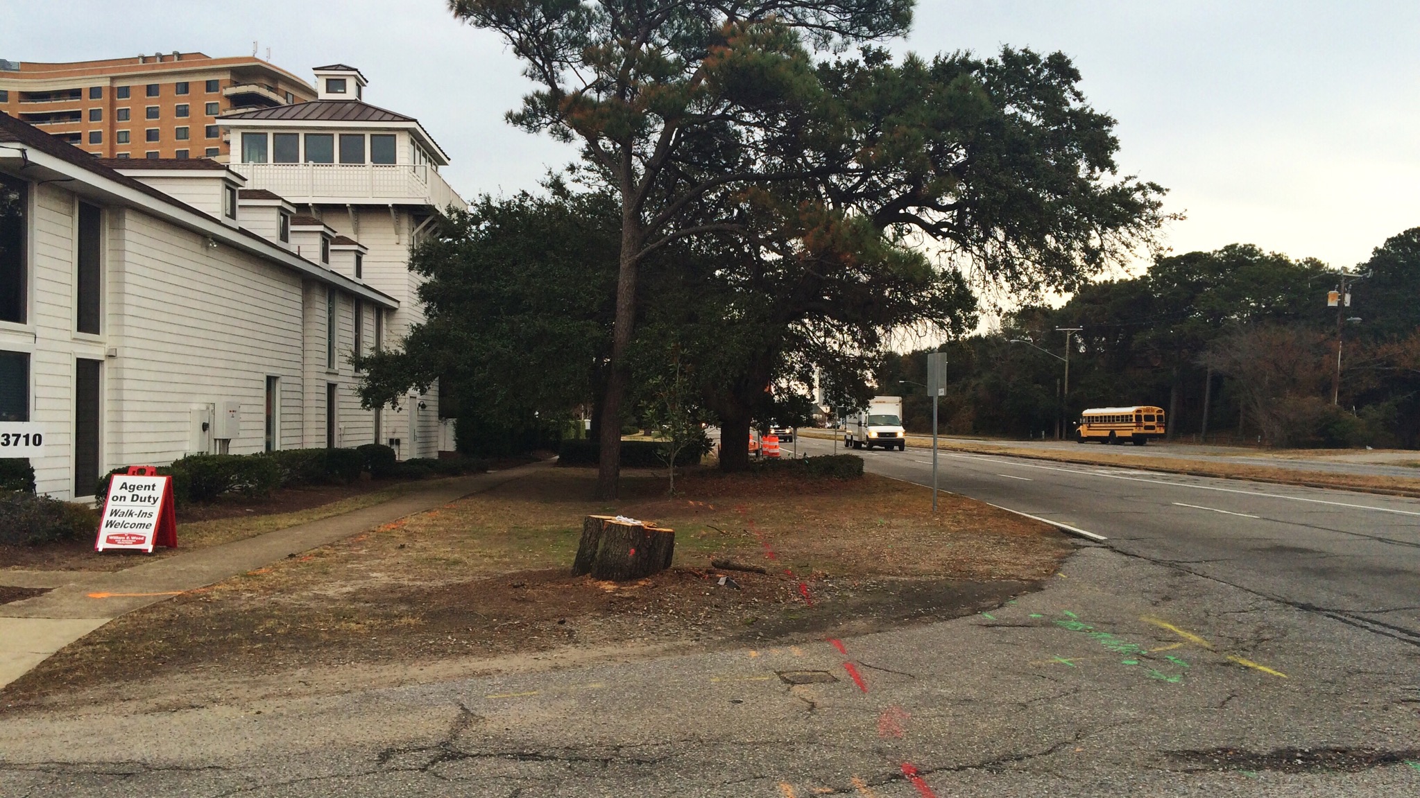
Some residents have also called for continuous sidewalks on Shore Drive and more crosswalks.

View comments and add your own to continue the conversation at WAVY TV story. Or comment below by clicking “LEAVE A COMMENT”.

Sorry, oh all knowing and all seeing benevolent Shore Drive Community Coalition, but you are trying to legislate STUPID.
Reduce the speed limit, they more boldly cross without the cross walk
Put up barriers, they will jump them.
I know this will sound harsh, but it is the Darwin theory in effect.
The stupid and week WILL be culled from the gene pool.

Clearly there can be more down to educate the users of this vital multi-modal thoroughfare.

4 examples, did you know:

§ 46.2-923. How and where pedestrians to cross highways.

When crossing highways, pedestrians shall not carelessly or maliciously interfere with the orderly passage of vehicles. They shall cross, wherever possible, only at intersections or marked crosswalks. Where intersections contain no marked crosswalks, pedestrians shall not be guilty of negligence as a matter of law for crossing at any such intersection or between intersections when crossing by the most direct route.

The governing body of any town or city or the governing body of a county authorized by law to regulate traffic may by ordinance permit pedestrians to cross an intersection diagonally when all traffic entering the intersection has been halted by lights, other traffic control devices, or by a law-enforcement officer.

Source: Virginia General Assembly Legislative Information System

§ 46.2-924. Drivers to stop for pedestrians; installation of certain signs; penalty.

A. The driver of any vehicle on a highway shall yield the right-of-way to any pedestrian crossing such highway:

1. At any clearly marked crosswalk, whether at mid-block or at the end of any block;

2. At any regular pedestrian crossing included in the prolongation of the lateral boundary lines of the adjacent sidewalk at the end of a block;

3. At any intersection when the driver is approaching on a highway or street where the legal maximum speed does not exceed 35 miles per hour.

(contd)

Source: Virginia General Assembly Legislative Information System

Sharing the Road
Drivers share the road with many other users: pedestrians, bicyclists, moped and motorcycle riders, trucks and buses, recreational vehicles and other vehicles of all shapes and sizes. It is your responsibility to adjust your driving to avoid other drivers’ mistakes and assure everyone’s safety.

Source: Virginia Department of Motor Vehicles, Section 3: Safe Driving (24 page PDF)

Central to this evaluation will be the understanding that Shore Drive serves as the sole east-west transportation corridor in the City north of the I-264 / Virginia Beach Boulevard corridor. As such, from a land use perspective, it needs to be considered as a multimodal corridor and not solely as a vehicular corridor. Increased densities of development in the corridor demand that pedestrian amenities are more fully addressed in all aspects of the development process, from the rezoning and conditional use permit stage through to the development plan approval and inspection stage. The goal of improving the level of transportation services for a wide variety of users – pedestrians of all types, cyclists, in-line skaters, varied recreational users, transit users, as well as vehicle operators – and the interrelationships between these various users and land uses in an area characterized as being first and foremost as a resort community and not as a resort destination is suggested. Accordingly, both public and private proposed development criteria need to be evaluated from a multimodal perspective to ensure that the needs of these varied users are addressed. Since increasing roadway capacity in the area has strict limits, given the City Council directive that Shore Drive remain a four lane facility for the foreseeable future, greater emphasis needs to be placed on reducing intra-corridor trip demand, particularly where non- vehicular transit among various uses in the corridor can be promoted and encouraged.

Note:Emphasis ours.

Source: Excerpt from conclusion of COVB adopted Shore Drive Safety Task Force Recommendations 2006
View, and download Shore Drive Safety Task Force Recommendations from VBGov.com. (18 Page PDF)

Note: This is one document officially adopted by the City of Virginia Beach to be used for planning, construction, design and funding of infrastructure and other amenities for the Shore Drive community.
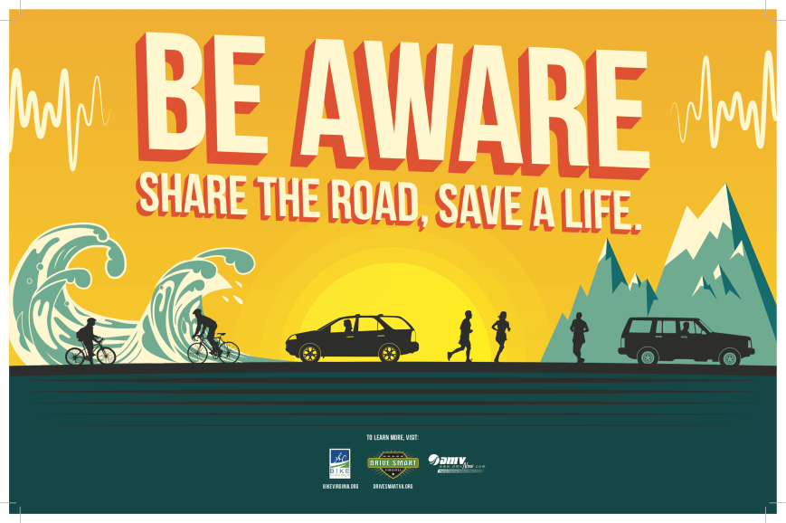
SHARE THE ROAD

SHARE THE ROAD

First in a series for 2015.

Find injured or stranded wildlife? Here’s what you can do.

We’re fortunate to live in such an amazing neighborhood that includes the Chesapeake Bay, Lynnhaven River, Pleasure House Point & First Landing State Park!

As most of you know, we share this area with a lot of wildlife.

Sometimes our local feathered, finned and furred friends need a little help.

Here’s what you can do.

Virginia Law sez:

Please remember it is illegal to keep or care for orphaned, sick or injured wildlife unless you are a licensed wildlife rehabilitator.

Virginia Department of Game & Inland Fisheries website has a searchable data base of Licensed Wildlife Rehabbers including phone numbers. Start here for Virginia Beach.

More resources include:

VBSPCA Wildlife Center

Aside from having an outstanding core group of wildlife volunteers, The Virginia Beach SPCA boasts its very own Wildlife Treatment Room onsite at the shelter. We are very proud to be one of only a handful of shelters nationwide that have a dedicated room just for wildlife care.

Wildlife Response

WRI, Hampton Roads oldest Wildlife Rehabilitation Organization, was formed in 1992 by a group of licensed rehabilitators, veterinarians, and other concerned citizens in response to the increasing numbers of wildlife in need of assistance and the lack of people trained and funded to help them.

Evelyn’s Wildlife Refuge

Hello and thanks for stopping by. Here is a little about me and what we are doing.

We have been rehabbing for about 19 years now. We are doing this primarily due to the loss of habitat due to destruction of wilderness.

Virginia Aquarium Stranding Team

Marine mammals and sea turtles spend their lives in the ocean, allowing only brief glimpses into their intriguing world. Unfortunately, these amazing creatures sometimes end up on our beaches, sick, injured, or dead, or become entrapped and unable to return to their natural habitats. These events are known as “strandings.”

Photo Credit: Tim Solanic

Photo Credit: Tim Solanic

Starting today: “Drivers 75-years and older will now have to renew their driver’s licenses every five years, and it must be done in person. Also, when they do renew, they must pass a vision test. Finally, if a mature driver is found guilty of breaking a traffic law, a judge could require the person to take a crash-prevention course.”

View video and more at WAVY.com.

“We’re actually going to see an increase in safety for all of these drivers,” said Georjeane Blumling, Vice President of Public Relations for AAA Tidewater Virginia.

The new law is named after Darren Morrell, a 32-year-old Oakton man killed in 2011 by an elderly driver who turned into traffic. Darren’s Law makes driving rules more strict for senior citizens.

View the Legislation and notes at Virginia’s Legislative Information System.

Mature driver crash prevention. Provides for a course in mature driver motor vehicle crash prevention and provides that such course is an option for the court in adjudicating defendants. The bill also lowers the age at which drivers are required to appear before the DMV for renewal from 80 to 75 and requires that licenses issued to persons age 75 or older be valid for no more than five years. The bill contains a delayed effective date.

Senior Programs | Tune up your driving skills and refresh your roadside knowledge at AAA of Tidewater.

Would you like to use your experience to become a better driver and pay less for you automobile insurance? AAA’s Senior Defensive Driving course is a two-day, four hour per day class designed to reduce crashes involving mature drivers by increasing the understanding of how age affects driving decisions, and how these decisions can alter your risk.

Screen shot of construction cam photo taken at 1200am JAN1 2015. Happy New Year!

Screen shot of construction cam photo taken at 1200am JAN1 2015. Happy New Year!

“Mr.Kenneth Robert Allen, 53, of Pungo passed peacefully in his sleep on December 26th, 2014. He was born in Alameda, Ca and raised in Reston, Va. Ken was a retired paramedic, stockbroker, and business man who was a lifetime member of the Sandbridge Volunteer Rescue Squad.”

Kenneth Robert Allen (1961 - 2014)

Kenneth Robert Allen (1961 – 2014)

View more of Mr. Allen’s obituary.

In lieu of flowers, memorial donations may be made to the Sandbridge Volunteer Rescue Squad.

Mr. Allen was the pedestrian struck on Shore Drive Christmas Eve.

“​Are you or your family struggling with the effect of alcohol or substance use? Beginning in January, the Virginia Beach Human Services Department will offer two free classes to help family members learn more about how addiction affects them and how to strengthen family relationships.”

Learn more at VBGov.com.

The class will meet every Tuesday for 16 weeks beginning Jan. 13 at Newtown Elementary School, 5277 Learning Circle, from 5:30 to 8 p.m. The class is free and includes dinner and activities to promote healthy family relationships. If interested, please contact Sabrina Pugh at (757) 385-0827 or spugh@vbgov.com . Open enrollment ends Jan. 27.

“Adaptive Planning for Flooding and Coastal Change in Virginia: Next Steps for the Commonwealth moved the current dialogue forward by providing a forum for the second meeting of the Governor’s Climate Change and Resiliency Update Commission. It also brought together for discussion national, state, and local experts and leaders on current actions being taken to adapt to flooding and coastal change and highlighted key legal and policy matters currently confronting both the public and private sectors.”

We’re fortunate we can share the Adaptive Planning for Flooding and Coastal Change in Virginia: Next Steps for the Commonwealth conference that was held very recently.

Click graphic to visit W&M's Law School website for conference

Click graphic to visit W&M’s Law School website for conference

To view conference, visit link at William & Mary’s Law School website which includes:

    Conference Videos:

    Introductory Remarks & Reports to Commission (1:22:28)
    Second session of the Commission (25:11)
    Senator Kaine’s Keynote Address (57:24)
    FEMA, National Flood Insurance Program’s Community Rating System, and Local Government Liability Panel (1:01:13)
    Adaptation: Market Sector Responses Panel (57:11)
    Social Vulnerability Panel & Voices of Adaptation in Virginia Panel (1:39:20)

    Conference Presentations:

    Jim Redick, Secure Commonwealth Panel Presentation
    Carl Hershner, Climate Commission Report Presentation
    Bill Lesser, NFIP Presentation
    Shannon Hulst Jarbeau, CRS Presentation
    Kristen Clark, Stormwater CRS Presentation
    James Andris, Local Government Liability Presentation
    Scott Hunter, Comparity Insurance Presentation
    Mike Vernon, Flood Mitigation Hampton Roads Presentation
    Lisa Schiavinato, Strict Scrutiny Presentation
    Erica Holloman, Southeast CARE Coalition Presentation
    Sarah Stafford, Social Vulnerability in Mapping
    Molly Mitchell, Virginia Vulnerability Mapping Presentation
    Curt Smith, Adaptation on the Eastern Shore of Virginia

Last year, the Virginia Coastal Policy Clinic (VCPC) at the William & Mary Law School and the Center for Coastal Resources Management (CCRM) at the Virginia Institute of Marine Science (VIMS) hosted a forum for state and local government officials as well as coastal stakeholders to discuss the legal and policy challenges presented by coastal flooding.

Described as a “game-changer” for Virginia, the event generated recognition that the magnitude and complexity of these challenges places local governments in a position of needing a variety of assistance if they are to meet their responsibilities to protect health, safety, and welfare.

We encourage you to visit Willam & Mary’s Law School website to learn more about the massive changes coming to your neighborhood, and to continue the conversation.

The good news is the COVB does not want to cut down 2 live oaks at LBR

IMG_2616.JPGIMG_2612.JPG

The bad news is COVB has hired an arborist to see how much love they need so as not be cut down.

The Twelve Days of Christmas (The Shore Drive Version)

It only seemed fitting with 12 days until Christmas and the recent Lesner Bridge update (minus the speed bump fix)…..


Twelve deflated tires

Eleven misalignments

Ten angry emails

Nine nasty tweets

Eight wheelbarrows of asphalt

Seven hardhats shoveling

Six hour work window (9am to 3pm)

Five Orange Cones

Four flagmen warning

Three rollers smoothing

Two lanes a-opening

And a SPEED BUMP fixed on Shore Drive

#LESNERBRIDGE update from Project Manager – We hope that this project update will assure you that crossing the Lesner Bridge during this busy time will be a “non-event”.

December 12 2014 UPDATE:

Friends:

I am sure that many of you are busy with your holiday shopping and planning for all kinds of events over the next several weeks as we approach the end of 2014. We hope that this project update will assure you that crossing the Lesner Bridge during this busy time will be a “non-event”.

Let’s start with GOOD news:

For these next two weeks there are no scheduled daytime lane closures within the Lesner Bridge project limits.

Hampton Roads Sanitation District (HRSD) has completed their work on the existing sanitary sewer forcemain in WB Shore Drive and will require no further lane closures. HRSD has de-mobilized their construction crews located at Shore Drive/Rockbridge Road and at Shore Drive/Kleen Street.

As for the latest bridge construction progress:

Ø Construction of the new bridge abutment “A” continues on the west side of the Lynnhaven Inlet. The first concrete pour on the new bridge abutment took place on Wednesday, October 29th. Placement of the reinforcing steel and formwork for the second tier of the abutment will take place the week of November 3rd. The last concrete placement for this bridge abutment is taking place today, December 12th.

Ø All of the drilled shafts at Piers 1 and 2 of the new westbound (WB) bridge have been installed. Over the next two weeks the contractor will continue with drilled shaft installation at Pier #3, the first in-water pier to be constructed on this project. Concrete placement for the foundation cap at Pier #1 is also taking place today, December 12th.

Ø Work on the WB bridge approach in front of 3556 On the Bay condos (Shore Drive/East Stratford Street) continues. The concrete retaining wall, utilities, and temporary wire wall are all being installed concurrently at this location. As the grade in this area is built up to plan elevations, folks should begin to see how much higher the new bridge will be. The top of the wooden formwork for Abutment A will be the new elevation of the bridge deck.

Ø Work on the WB bridge approach next to the old Duck Inn property (Shore Drive/Page Avenue) also continues. A portion of the concrete footing for the new retaining wall has been poured and the area prepared for the placement of the pre-cast concrete retaining wall panels. Work on the new seawall (closer to the water’s edge) has begun within this area.

The City is coordinating their seawall construction with the private construction contractor building the private seawall on the Point Chesapeake property. The City’s seawall starts at the right-of-way line located north of Shore Drive and will continue south until it connects to the existing bulkhead located south of Shore Drive at the Maryland Pilots Association. The private seawall connects to the City’s seawall at the right of way line and continues north along the dune line towards Cape Henry Towers.

The temporary bulkhead at the Lynnhaven Dredge Material Storage Site (LDMSS) continues. The tie-back system and placement of all the reinforcing steel on the new bulkhead is now complete. Approximately half of the concrete cap has been place on the bulkhead. Work will continue on the bulkhead over the next several weeks to form and place the remainder of the bulkhead cap.

As a final note, the construction contractor will not be working over the holidays; and no work will take place on the project between December 24th, 2014 through January 5th, 2015.

That’s it for now. Have a safe driving weekend!

-Chris

Christopher J. Wojtowicz, P.E.
Project Manager
City of Virginia Beach
Department of Public Works
Municipal Center-Bldg 2
2405 Court House Drive
Virginia Beach, VA 23456-9031
Phone: (757) 385-5785
Fax: (757) 385-5668
email: cwojtowi@vbgov.com

No update on “speed bump” in slow lane on east side of #LESNERBRIDGE at Vista Circle as you can see.

Screen shot of construction cam photo taken at 1130am DEC12 2014

Screen shot of construction cam photo taken at 1130am DEC12 2014

Healthy live oak cut down on Shore Drive & Kleen Street

Any one know why the Official City Tree, the live oak, was cut down?

IMG_2233.JPGIMG_2234.JPG

Update:

Tim, it had a big vertical fissure in the trunk and rot inside. Susan said that pedestrians were in potential danger.

“Complete Streets are streets for everyone. They are designed and operated to enable safe access for all users, including pedestrians, bicyclists, motorists and transit riders of all ages and abilities. Complete Streets make it easy to cross the street, walk to shops, and bicycle to work. They allow buses to run on time and make it safe for people to walk to and from train stations.”

Virginia Beach Adopts Complete Streets Policy

Woo hoo!

The purpose of the Complete Streets Policy is to improve the Virginia Beach transportation system by providing safe, attractive travel for all users through a system of connected transportation choices designed in harmony with adjacent land uses.

View Press Release at VBGov.com.
Learn more about Complete Streets Policy at VBGov.com.

EB-ShoreDrivePedSign-LaCasa

“Later, a group of six or so great egrets flew in a graceful dance over the water, sparkling in the sunlight. Four of the beauties settled in a treetop as if to give the photographers a chance for shots. Since 2012, 144 species of birds have been reported at Pleasure House Point. More than 20 species were seen at last week’s bird walk, including the great big rare Brock Center species.”

Read all of Mary Reid Barrow’s article here.

The bird walk was one of several scheduled through the year by Lynnhaven River Now and led by Steve Coari, an expert birder from the Virginia Beach Audubon Society.

More about Lynnhaven River NOW at LRNow.org.
Visit Virginia Beach Audubon Society page for Pleasure House Point to learn more about bird sightings at PHP.

Photo Credit: Tim Solanic on a different trip.

Photo Credit: Tim Solanic on a different trip.

“LRNow is turning mere peasants into royalty this holiday season!”

For All of Our
Oyster Kings and Queens

LRNow is turning mere peasants into royalty this holiday season!
Gift your loved ones with an Oyster Castle at the Laskin Gateway Project, to be constructed spring 2015. We need 420 castle blocks to build our oyster kingdom, and they are available for purchase at $10 per block or $250 for a whole castle.

You will receive an acknowledgement card to give to the recipient and all donors and recipients will be listed in our quarterly newsletter. To purchase a castle for your king or queen click here, call us at 757-962-5398, or stop by our office.

unnamed-2

original

“The city is moving forward on a long-awaited sand replenishment project for Chic’s Beach, starting with collecting “public beach” releases from the neighborhood’s waterfront property owners.”

View article at Pilotonline.com.

The release states that a property owner agrees the portion of the land between the dune or the bulkhead line and the water is a public beach. The owner gives the city permission to dump sand on it and agrees not to impede public access.

City officials met with Chic’s Beach residents about the project and the release form last month. They’ll need consent from the owners of roughly 140 properties stretching about a mile from Joint Expeditionary Base Little Creek to Joyce Avenue.

Chic's Beach resident Taylor Sharpe and his dog Sandy walk the beach there at high tide on Aug. 28, 2011, after the departure of Hurricane Irene. Waves from the Chesapeake Bay lap at the pilings of the waterfront homes on Ocean View Avenue in this section of Virginia Beach. (Vicki Cronis-Nohe | The Virginian-Pilot)

Chic’s Beach resident Taylor Sharpe and his dog Sandy walk the beach there at high tide on Aug. 28, 2011, after the departure of Hurricane Irene. Waves from the Chesapeake Bay lap at the pilings of the waterfront homes on Ocean View Avenue in this section of Virginia Beach. (Vicki Cronis-Nohe | The Virginian-Pilot)