Bayfront Advisory Committee (BAC) Meeting – Thursday Feb. 20th at 3:30pm (Parking and Floodplain Presentations)

Click here for the meeting agenda  february2014-bac-agenda

Click here for the VB Meeting Notice  BAC NR 2-20-14

BAYFRONT ADVISORY COMMITTEE

Thursday, February 20, 2014

3:30pm – 5:30pm.

Virginia Beach Resort and Conference Center,

2800 Shore Drive

City Presentations will include:

  • Update on parking in the Bayfront area by Mike Shahsiah of Traffic Engineering

  • Floodplain presentation by Clay Bernick of the Environment and Sustainability Office


HRT Holding Light Rail Study Updates – Mon Feb 10th and Wed Feb 12th from 6-8pm

Click here for the flyer VBTES Meeting Announcement 2-2014

Hilltop Area Alignment Alternative Captial Costs and the Preliminary Results of the Environmental Analysis

These public information sessions will provide an update on the on-going analyses being conducted as part of the Virginia Beach Transit Extension Study Draft Environmental Impact Statement. Information will be presented on the projected capital costs (construction-related) for the Hilltop Area Alignment.

The meeting will also present the preliminary results of the environmental analysis for the Virginia Beach Transit Extension Study.

The meetings will have a presentation followed by a question and answer session with HRT staff. The public will also have the opportunity to discuss the night’s topics on an individual basis with HRT and consultant staff following the presentation.

The two meetings will have an identical format and will present identical information. Please come to the meeting that is most convenient to you.

Meeting Information:

Monday, February 10, 2014

Westin Virginia Beach Town Center

4535 Commerce Street

Virginia Beach, VA 23462

6:00 p.m. – 8:00 p.m


Wednesday, February 12, 2014

DoubleTree by Hilton Virginia Beach

1900 Pavilion Drive

Virginia Beach, VA 23451

6:00 p.m. – 8:00 p.m.


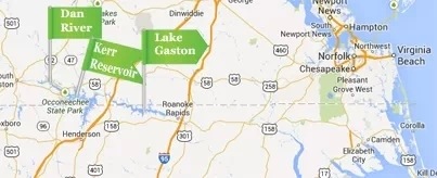
“Since learning of the contaminants in the Dan River, city officials have halted all pumping at the Virginia Beach Lake Gaston intake station until more information becomes available. The City’s water supply and quality have not been compromised.”

Learn more at VBGOV.com.
20140204-175842.jpg

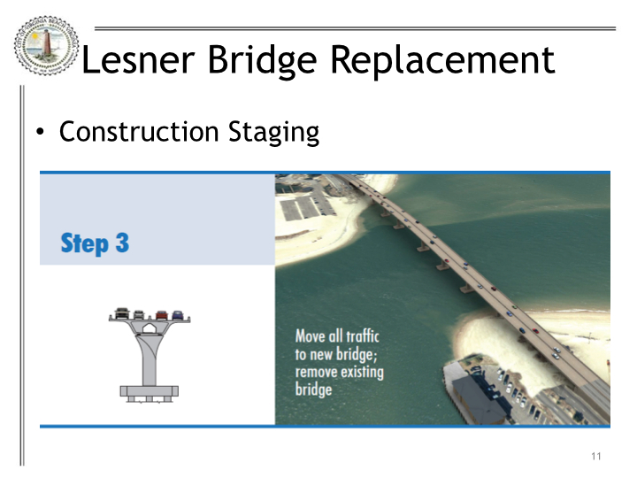
Powerpoint of bridge construction presentation at SDCC meeting in January ’14

Thanks to Christopher J. Wojtowicz, P.E., Project Manager City of Virginia Beach Department of Public Works for his detailed presentation at our SDCC meeting in January.

View the powerpoint here.

Construction to start April 2014

Construction to start April 2014

View more links about bridge construction at SDCC.info/Hot.

Questions about Bar Harbor answered

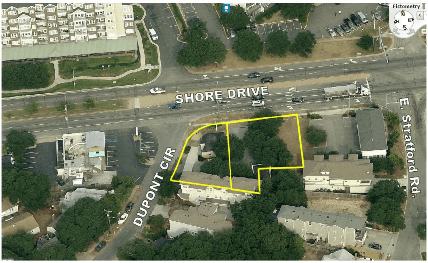
Questions like how did they get to build so close to the road, I thought cutting down live oaks was illegal, how could they put that many units there …
Bar Harbor

The answers can be found in the Bar Harbor Planning Commission Staff Report. (16 page PDF)

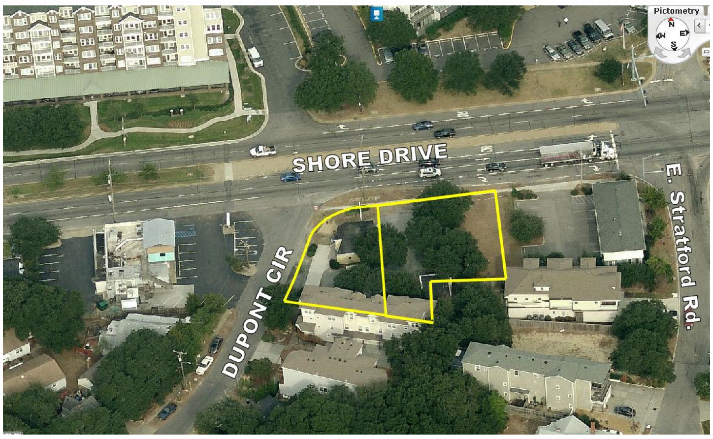
EXISTING LAND USE: The site is developed with two small buildings, a retail store constructed in 1960 and
storage building constructed in 1930.

SURROUNDING LAND USE AND ZONING:
North: Shore Drive
Across Shore Drive are multi-family multiple storied buildings / B-4 Mixed Use (SD – Shore Drive Corridor Overlay)South: Duplex and single family dwellings / R5-D Residential (SD – Shore Drive Corridor Overlay)
East: Office building and residential / B-4 Mixed Use and R5-D Residential (SD – Shore Drive Corridor Overlay)
West: DuPont Circle
Across DuPont Circle is a restaurant and residential / B-2 Community Business and R5-D Residential (SD – Shore Drive Corridor Overlay)

NATURAL RESOURCE AND CULTURAL FEATURES:

The sandy soil on the site supports seven live oak trees. While the trees cannot be maintained the applicant can mitigate the loss with a contribution to the Live Oak Fund and by agreeing to have the logs of the trees set aside and given Friends of Live Oaks (http://www.friendsofliveoaks.org).
The Live Oak is the officially adopted tree and icon for the Shore Drive Corridor and Bayfront community.

And an excerpt:

The site design is slightly deficient with respect to setback requirements in the district. A 30-foot setback is required from the front property line (DuPont Circle), the plan depicts a 20 foot setback; a 15 foot setback is required adjacent to residential zoning (southern and eastern property lines) the plan depicts a varying setback of 5 feet to 21 feet. Staff feels the site design is consistent with other projects in the corridor and does not find the reduction in setbacks to be detrimental. Further the applicant met with adjacent property owners as well as the civic league and no objections were raised regarding the plan. The Ordinance allows that “The City Council may, for good cause shown and upon a finding that there will be no significant detrimental effects on surrounding properties, allow reasonable deviations from the following requirements otherwise applicable to the proposed development:
(1) Required setbacks;
(2) Required landscaping;
(3) Height restrictions, except as provided in Section 202(b); and (4) Minimum lot area requirements.
The applicant also met with the Bayfront Advisory Committee (BAC) on May 19, 2012. The BAC found that the project substantially complies with the Shore Drive Corridor Plan, the ULI Bayfront study, the Comprehensive Plan, and the Shore Drive Corridor Plan.
Staff finds the request acceptable and recommends approval subject to the conditions listed below…
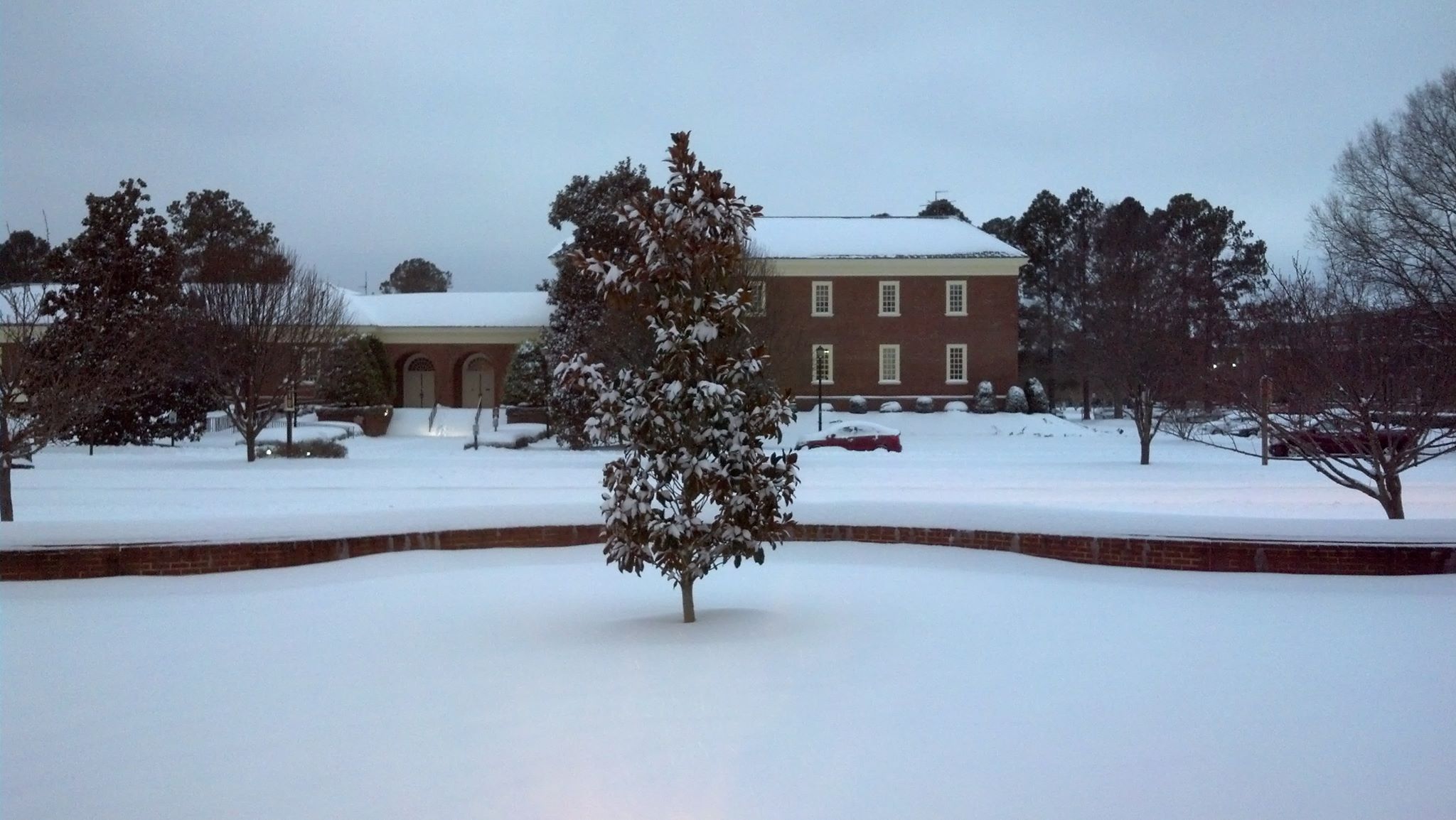
Trash pickup CANCELLED today Weds Jan 22

From VBGov.com:

Due to road and weather conditions, Public Works/Waste Management has CANCELLED any waste pickup for Wednesday. They request that residents place black trash carts and blue recycling carts at the curb line on their regular collection day, and leave them there until they have been serviced. We will shift resources to catch up as quickly as possible.​

Public Utilities shutting off water to fix valve tonight. 3600 block of Shore Drive & Dupont Circle affected.

In case you missed the notice on your door, here it is:

PUBLIC NOTICE - Public Utilities

Ocean Park Drainage Improvements (CIP 7-063) update

Email about the project:

Dear Vice Mayor Jones, Ms. Walston, Mr. Vaughn, and Mr Kassir,

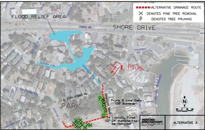
A public information meeting was held on Thursday, February 23, 2012, to review three alternatives for relieving tidal flooding up to elevation 5 in the vicinity of the intersection of Dupont Circle and Dinwiddie Road. Subsequent to that meeting the Ocean Park Civic League endorsed Alternative A. Alternative A proposes a 27-inch storm drain along Dinwiddie Road from East Stratford Road to Lockhaven Crescent (paper street), then westward along Lockhaven Crescent (South edge of Lockhaven Neighborhood Park) to the Ocean Park Stormwater Pump Station on Winston Place in the vicinity of the proposed Brock Environmental Center parking lot.

Through coordination with the Chesapeake Bay Foundation, City of Virginia Beach Department of Parks and Recreation, City of Virginia Beach Public Works, and public and private utilities, plans have been developed for the Ocean Park Drainage Improvements. The plans have been given to one of the Department of Public Works annual services contractors and a work order is about to be executed for the work. Construction is scheduled to commence this month and continue until June 2014.

The attached notification letter is being mailed to 178 residents who live on East Stratford Road, Dinnwiddie Road, Rockbridge Road, and Chesterfield Avenue and is provided for your information. You are copied on the notification letter.

If you have any comments or questions please do not hesitate to contact me or my supervisor, Mike Mundy, at 385-4131.

Sincerely,

Michael S. Bumbaco, P.E.
PW ENGINEERING / WATER RESOURCES
mbumbaco@vbgov.com
Direct: (757) 385-1978
Office: (757) 385-4131

1 page PDF of letter sent to homeowners.

Link to (CIP 7-063).

20140107-074654.jpg

List of Beach council appointee hopefuls down to 11

Read & comment on Pilotonline.com article.

List for the currently vacant at-large seat includes a resident of Cape Story by The Sea, our Secretary & founding President, Todd Solomon.

Please send your comments to ctycncl@vbgov.com.

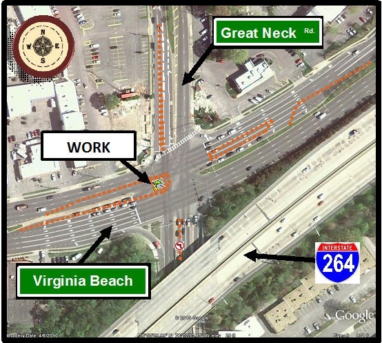
Starting about 7pm tonight “Major Traffic Delays and Congestion Expected at Virginia Beach Boulevard and Great Neck Road Intersection Beginning Wednesday Night” thru Thursday rush hour if all goes well

At VBGov.com:

There will be significant traffic congestion in and around the intersection that will cause traffic disruption and delays. Morning and afternoon rush hour traffic should expect delays in excess of 10 minutes.

Motorists should consider using alternate routes while the water main is being repaired. Possible routes include: First Colonial Road, Potters Road, International Parkway and Lynnhaven Parkway.

Police officers will be on the scene to help direct traffic. Advanced warning signs will be posted beginning today advising motorists of the temporary traffic patterns.

Weather permitting, repairs are expected to be completed by 6 p.m. on Thursday, Nov. 21.

For additional information, please contact James M. Cherry, Utility Engineer at (757) 650-5058.

20131120-111832.jpg

This will not be fun is a huge understatement.

Legislative Prorities to Build a Better Virginia Beach. The proposed package is public.

Read the entire document at VBGov.com.

Read on to learn the city’s stance on key issues, the reason behind the city’s position, and how these issues might impact your life. You can help by contacting your representative to share your thoughts on these important issues.

One example of what the City will be asking of the Commonwealth.

10. Preservation of Private Riparian/Littoral Rights (Title 28.2)
Sponsored by Council Member James L. Wood

Request: The General Assembly is asked to enact a new section in Title 28.2 to clarify the riparian/littoral status of private property owners after public sand replenishment projects on public beaches and waterways.

Why? Virginia Beach has undertaken several sand replenishment projects along our shores, and additional new projects are planned to project homes, business and other infrastructure currently at risk due to erosion and flooding. In Virginia, lands that are submerged below the water line belong to the Commonwealth (§ 28.2-1200), and it has been claimed that when sand is placed on the water’s edge, the Commonwealth continues to own the strip of emerged land caused by the sand placement, thereby severing private property owners’ riparian status. The city offers this legislation as a means to clarify the riparian status after a sand replenishment project and to maintain the status quo for private property rights when public projects involve the placement of sand on public beaches and easements.

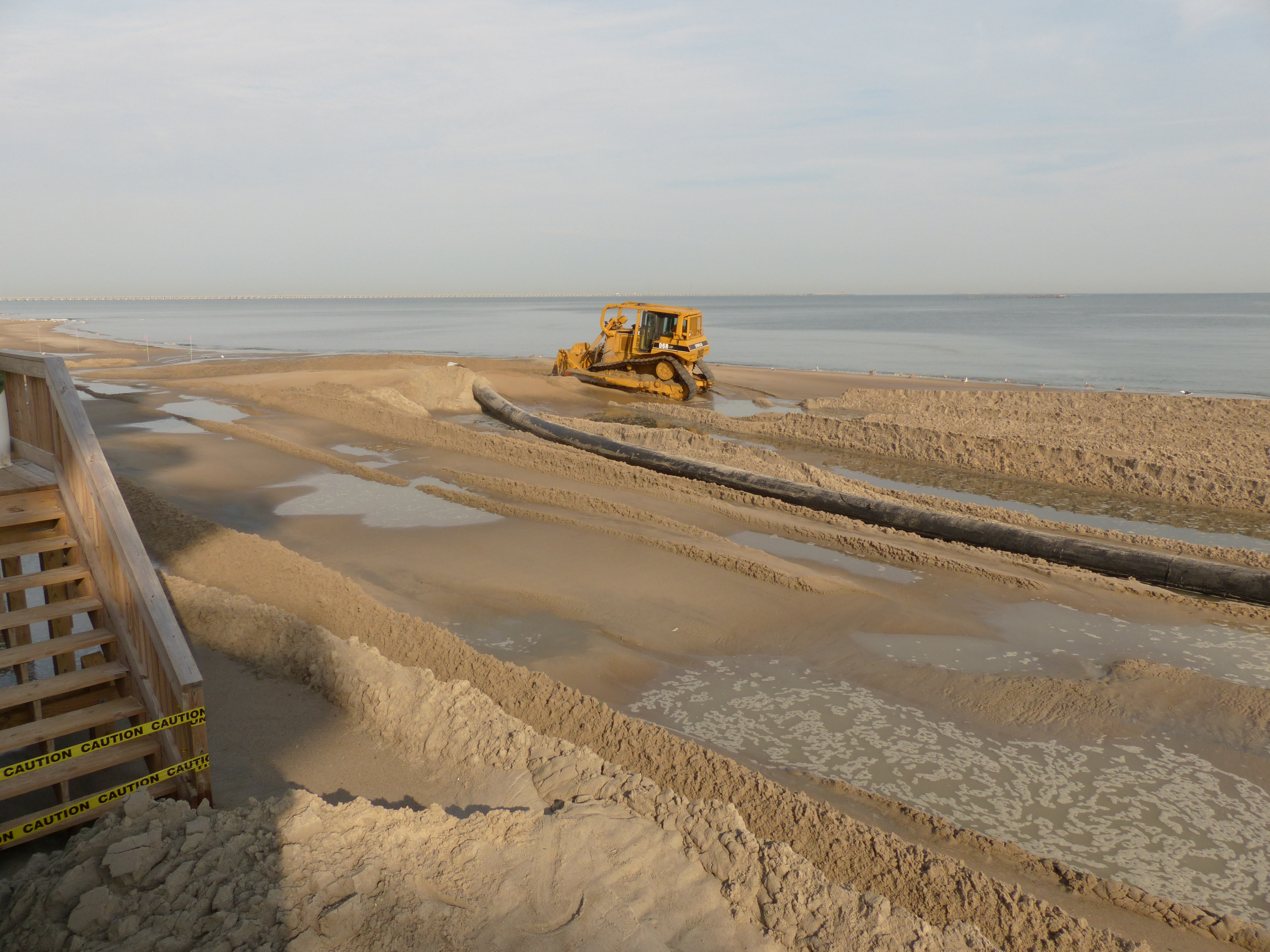
Beach replenishment thanks to needed dredging in the Lynnhaven

Beach replenishment thanks to needed dredging in the Lynnhaven

“Temporary Road Closure: Pleasure House Road between Northampton Boulevard and Shore Drive”

Weather permitting, the temporary road closure is scheduled to begin at 7 a.m. on Sunday, Nov. 10, 2013, and reopen at approximately 7 p.m. on the same day.

Check the info at VBGov.com:

Traffic will be temporarily affected on a portion of Pleasure House Road between Northampton Boulevard and Shore Drive while a water line is replaced.

During the water line replacement, Pleasure House Road will be closed to through traffic between Northampton Boulevard and Shore Drive. Local traffic will be maintained along Pleasure House Road up to the point of work. Through traffic will be rerouted via Northampton Boulevard and Shore Drive. Advanced warning signs will be installed advising motorist of the alternate routes. Local businesses and the church along Pleasure House Road have been notified of the traffic disruptions.

Weather permitting, the temporary road closure is scheduled to begin at 7 a.m. on Sunday, Nov. 10, 2013, and reopen at approximately 7 p.m. on the same day.

For additional information, contact Gene Rainey, Assistant Utility Suerintendent at (757) 650-4987.

***CANCELLED due to lack of interest*** VBCCO Neighborhood Conference/Light Rail Forum

Attention Residents: 


Please be advised that the Virginia Beach Council of Civic Organizations (VBCCO) has cancelled its annual neighborhood conference that was slated for Saturday, Nov. 2 at the Virginia Beach Convention Center.

Please contact the VBCCO  or email mjmcf@cox.net for refunds or further information.

Mon. Oct. 28th at 7:30pm Community Meeting with Councilman Wood – Shore Drive Flooding Issues – Present and Future Solutions

Click here for a printable version of the agenda SDCCAgendaOCT2013


Shore Drive Community Coalition

Monday, 28 OCT – 7:30-8:30 pm

SDCC General Meeting  

Ocean Park Volunteer Rescue Squad Station (Intersection of Shore Drive and East Stratford Rd.)


Call to order:

Meeting topic:   Councilman Jim Wood Discusses Shore Drive Flooding Issues, Present and Future Solutions


 Officers’ Reports:    President’s Report              David Williams

                                    Vice President’s report       Rick Mercadante

                                    Secretary’s Report               Todd Solomon –SEPT Minutes

                                    Treasurer’s Report              Ann Williams (acting treas.)


Old Business  

New Business       

Adjourn

 Next SDCC- Monday NOV 25, 2013               Ocean Park Volunteer Rescue Squad Center

 Topic: City Topics (Light Rail, Dredging, Lesner Bridge Construction)

Please check www.sdcc.info for more information on area news and events

2014 Legislative Agenda – Recurring Flooding Item letter from the Mayor

Read the entire 75 page PDF which includes the Mayor’s letter, slides, etc.

As council is well aware, the recurrent flooding issue is of great concern to our citizens.

So the Mayor is asking City Council to add an additional item for VB’s legislative agenda.

…but to ask to support the authorization of the study.

Legislative Request # 1: The City of Norfolk requests the General Assembly to establish and fund a Joint Study Committee to further investigate and make recommendations on recurrent coastal flooding in Virginia.

A slide from the 75 page PDF

A slide from the 75 page PDF

The VIMS Report concludes Virginia localities are not adequately equipped to address and
implement meaningful flood mitigation strategies required for responding to predicated
relative sea level rise on their own. Within the VIMS Report, there are a series of simulations
that show impacted areas as influenced by: a) storm surge, b) sea level rise, and c) the
recurrences of storms making land fall within the region. All of these factors both individually
and collectively, are anticipated to increase the frequency and the severity of coastal flooding
events. This will increase damages to public and private property, amplify impacts to public
safety, and increase disruption to individuals and the economy. Left unaddressed, the
Commonwealth can reasonably anticipate that it will see significant and profound coastal
flooding now and into the immediate planning horizon.