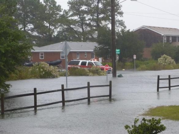
At Tuesday’s meeting, the City Council will hear budget presentations from several city departments. The Public Works Department also will brief the council on proposed solutions to chronic flooding in the eastern Shore Drive area.
GO!
At Tuesday’s meeting, the City Council will hear budget presentations from several city departments. The Public Works Department also will brief the council on proposed solutions to chronic flooding in the eastern Shore Drive area.
GO!
Read & comment at Pilotonline.com.
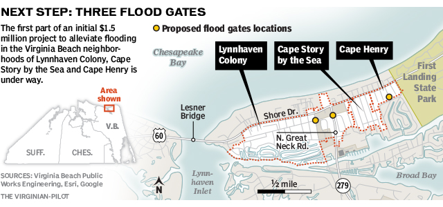
Graphic from Virginian-Pilot
As you may know, it will challenging to say the least for pedestrians & cyclists to cross the Lesner Bridge during the new bridge construction.
We’re happy to announce that we can share the news about a public/private partnership we created to solve this issue!
We worked with the city & state to legalize it.
We worked with various manufacturers, businesses, sponsors & non-profit groups to ensure we use the best practices in all facets of this project – self-driving cars on Shore Drive!

How it will work:
It’s that easy!
So far we’ve been able to have several vehicles to choose from, and by the time this project goes live in 2015, we hope to add more.
We’re happy to announce you’ll be able to choose from a Toyota, Nissan, Volkswagen, Volvo & Audi.


Please share your ideas.
Check out more info about the CRS at FEMA.gov.
As a result, flood insurance premium rates are discounted to reflect the reduced flood risk resulting from the community actions meeting the three goals of the CRS:
1. Reduce flood damage to insurable property;
2. Strengthen…
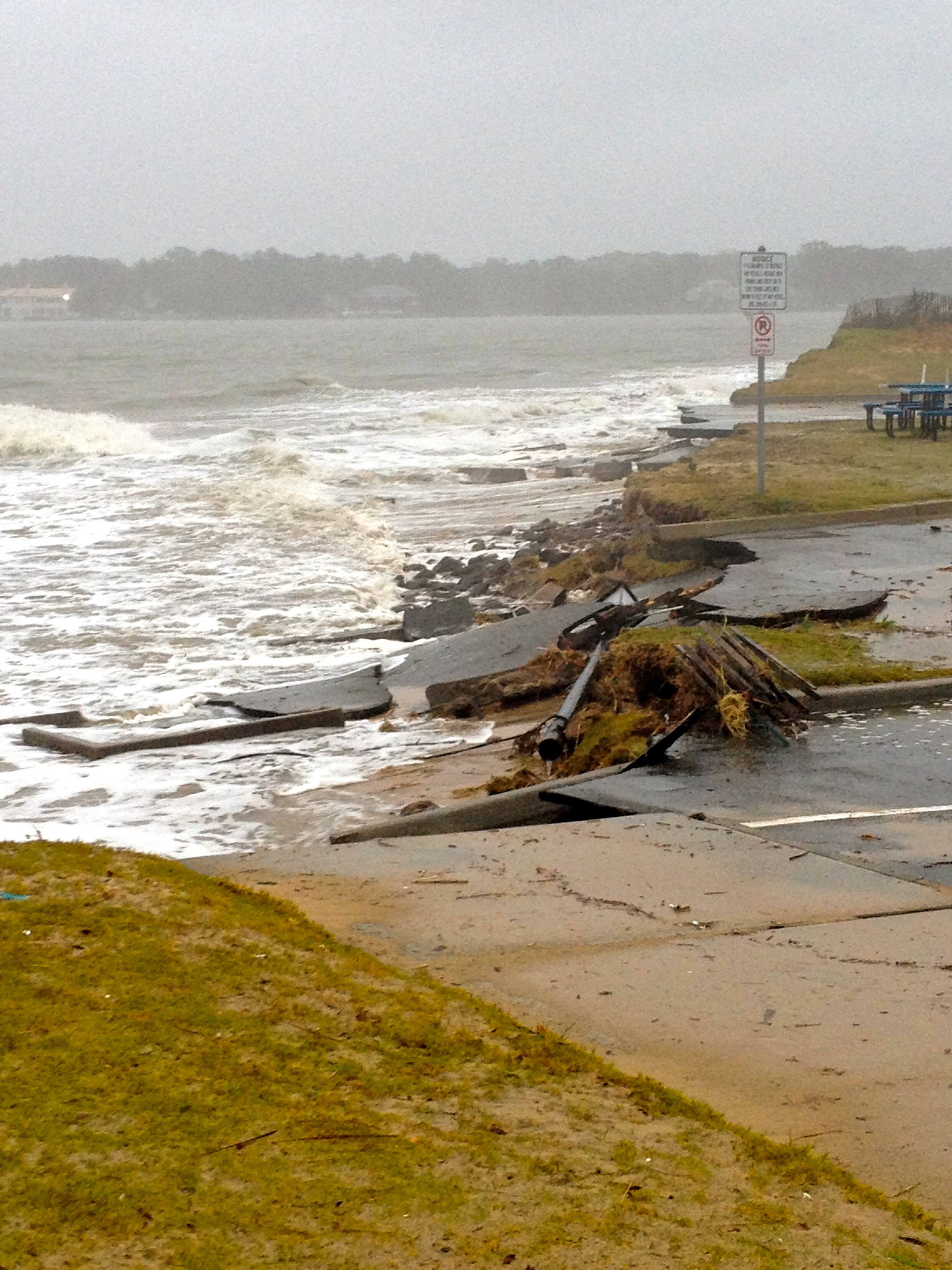
unexpected damage at Lynnhaven Boat Ramp from Sandy Oct 2012
The tips and detective work led police to the Ocean View area of Norfolk. Police said they charged Frederick Charles Witt, 57, of the 1000 block of West Ocean View Ave., with attempted robbery and robbery. He is being held without bond in the city jail.

A man robbed the Wells Fargo on Shore Drive in Virginia Beach on Tuesday, March 25, 2014. (Courtesy of Virginia Beach Police)
The second incident was reported about 10:30 a.m. at the Wells Fargo at 2821 Shore Drive, according to a police spokesman. The man who robbed that bank bore a resemblance in a surveillance photo to the man in the BB&T incident.
He walked in, made demands of the teller, got money and left the bank.
No injuries were reported in either incident.
Both men were described as 5 feet 9 inches tall, 30 to 40 years old, with dark hair and facial hair, including a mustache. They both wore a distinctive hat and dark sunglasses.
Click here for the meeting agenda february2014-bac-agenda
Click here for the VB Meeting Notice BAC NR 2-20-14
Questions like how did they get to build so close to the road, I thought cutting down live oaks was illegal, how could they put that many units there …
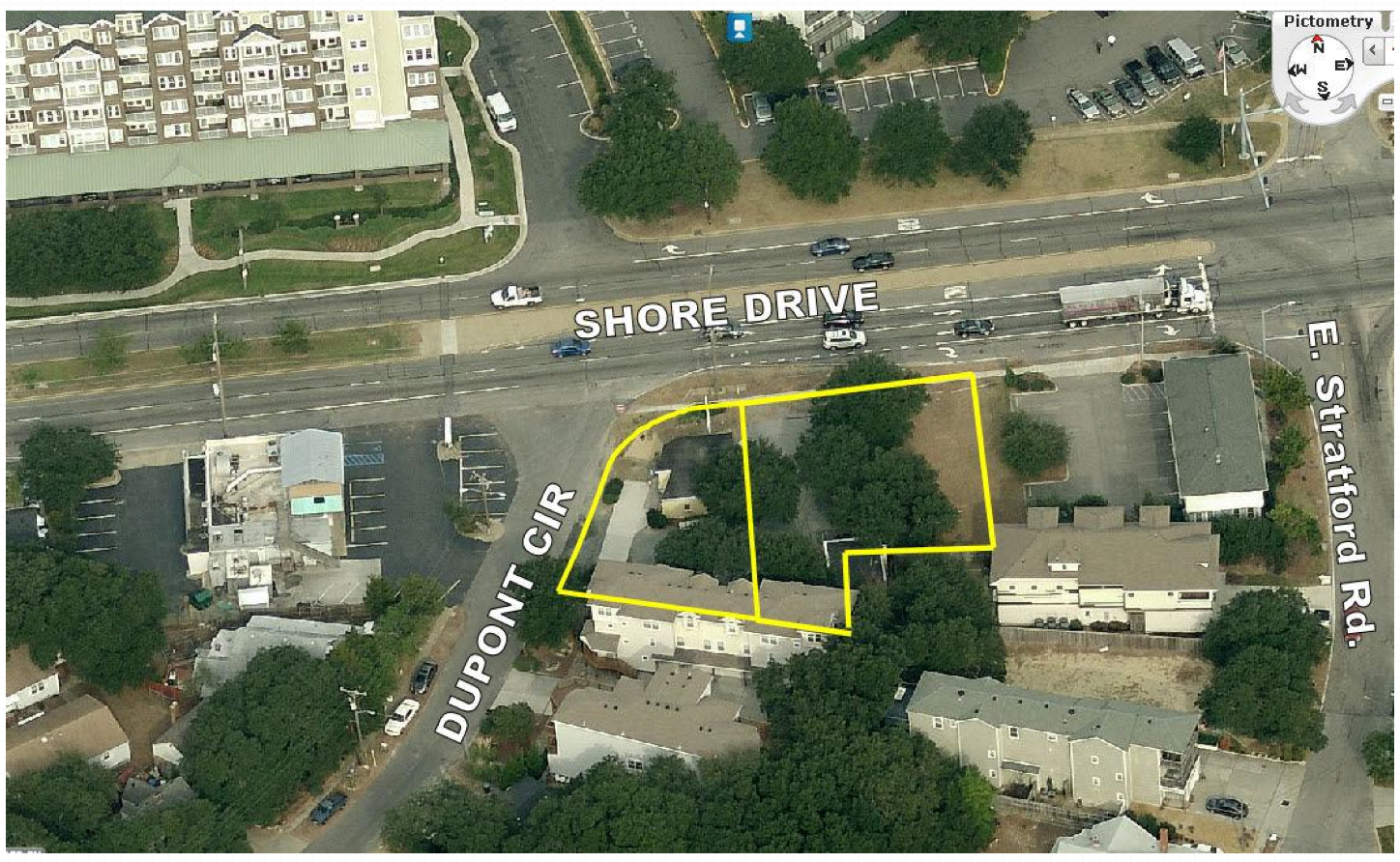
The answers can be found in the Bar Harbor Planning Commission Staff Report. (16 page PDF)
EXISTING LAND USE: The site is developed with two small buildings, a retail store constructed in 1960 and
storage building constructed in 1930.SURROUNDING LAND USE AND ZONING:
North: Shore Drive
Across Shore Drive are multi-family multiple storied buildings / B-4 Mixed Use (SD – Shore Drive Corridor Overlay)South: Duplex and single family dwellings / R5-D Residential (SD – Shore Drive Corridor Overlay)
East: Office building and residential / B-4 Mixed Use and R5-D Residential (SD – Shore Drive Corridor Overlay)
West: DuPont Circle
Across DuPont Circle is a restaurant and residential / B-2 Community Business and R5-D Residential (SD – Shore Drive Corridor Overlay)NATURAL RESOURCE AND CULTURAL FEATURES:
The sandy soil on the site supports seven live oak trees. While the trees cannot be maintained the applicant can mitigate the loss with a contribution to the Live Oak Fund and by agreeing to have the logs of the trees set aside and given Friends of Live Oaks (http://www.friendsofliveoaks.org).
The Live Oak is the officially adopted tree and icon for the Shore Drive Corridor and Bayfront community.
And an excerpt:
The site design is slightly deficient with respect to setback requirements in the district. A 30-foot setback is required from the front property line (DuPont Circle), the plan depicts a 20 foot setback; a 15 foot setback is required adjacent to residential zoning (southern and eastern property lines) the plan depicts a varying setback of 5 feet to 21 feet. Staff feels the site design is consistent with other projects in the corridor and does not find the reduction in setbacks to be detrimental. Further the applicant met with adjacent property owners as well as the civic league and no objections were raised regarding the plan. The Ordinance allows that “The City Council may, for good cause shown and upon a finding that there will be no significant detrimental effects on surrounding properties, allow reasonable deviations from the following requirements otherwise applicable to the proposed development:
(1) Required setbacks;
(2) Required landscaping;
(3) Height restrictions, except as provided in Section 202(b); and (4) Minimum lot area requirements.
The applicant also met with the Bayfront Advisory Committee (BAC) on May 19, 2012. The BAC found that the project substantially complies with the Shore Drive Corridor Plan, the ULI Bayfront study, the Comprehensive Plan, and the Shore Drive Corridor Plan.
Staff finds the request acceptable and recommends approval subject to the conditions listed below…
Call to order:
Meeting Presentation:
Lesner Bridge Construction Project Overview – Presentation by the Chris Wojtowicz, City of Virginia Beach Project Engineer. Chris will provide updates on the project schedule, traffic plans/impacts, and other details.
Officers’ Reports: President’s Report David Williams
Vice President’s report Rick Mercadante
Secretary’s Report Todd Solomon –NOV Minutes
Treasurer’s Report Ann Williams (acting treas.)
Old Business: Proposed SDCC Candidates Slate for 2014
New Business :
Adjourn
Next SDCC- Monday FEB 24, 2014- Ocean Park Volunteer Rescue Squad Center
Topic: SDCC Election of Officers and Budget for 2014
Please check www.sdcc.info for more information on area news and events
News from the William & Mary Law School Virginia Coastal Policy Clinic via Tidewater Current:
BREAKING NEWS:
Delegate Stolle (R-VA Beach) and Senator Locke (D-Hampton) Introduce Resolutions to Create a Joint House & Senate Subcommittee Addressing the Growing Threat of Recurrent Flooding!
“NORFOLK – Delegate Christopher P. Stolle (R-Virginia Beach) and Senator Mamie E. Locke (D-Hampton) today announced the introduction of a legislative resolution creating a joint Senate and House subcommittee fostering the development of a comprehensive and coordinated flood mitigation action plan. The proposed joint committee implements a recent Virginia Institute of Marine Science recommendation that the Commonwealth intervene to assist regions and communities attempting to manage recurrent flooding. VIMS is part of the College of William and Mary. The resolutions (HJR16 And SJR3) will be considered during the 2014 session of the Virginia General Assembly scheduled to convene on Wednesday, January 8.
Stolle and Locke’s proposal comes on the heels of Super-Storm Sandy, October 2012, and recognizes the importance of developing and implementing a coordinated statewide planning effort addressing severe and ongoing flooding events as well as a major event like Sandy. Several nations and Mid-Atlantic States have undertaken similar planning efforts; Stolle’s and Locke’s legislation ensures that the Commonwealth undertakes important planning initiatives.
Speaking about the announcement, Senator Locke said, “Water doesn’t recognize boundaries. As a former Mayor, I know that our regions and localities require statewide planning assistance. Although I live and work in Hampton Roads, ground-zero for recurrent flooding, our planning efforts must assist the entire Commonwealth.”
Delegate Stolle added, “We have all seen the destruction that can be caused by major hurricanes or our frequent Nor’easters. We can no longer simply hope and pray that our lives and property will be spared; it is time to plan and prepare. This Joint Subcommittee will ensure that the Commonwealth begins to develop and implement a comprehensive strategy to protect both our citizens and our property. I am committed to bringing all interests, including business and military, to the planning table with the focus on protecting lives and property.”
Although the consequences of a severe storm may provide the impetus for this work, recurrent flooding threatens many areas of the Commonwealth. Virginians from across the state regularly battle recurring flooding resulting from specific events including major rain storms and storm surges. The VIMS review of global flood management strategies suggests that it is possible for Virginia to have an effective response to increasing flood issues but it takes time, estimated at 20-30 years, to effectively plan and implement many of the adaptation strategies. They include planning, management, and engineering strategies, such as infrastructure projects like hard barriers and other natural systems to protect coastal communities.
As proposed, the joint subcommittee, comprised of Senate and House members, will meet for two years and will be comprised of 15 members: eight legislative and seven non-legislative. The non-legislative members include three business leaders, two local officials representing flood-prone communities, one military official representing a federal installation and a member of the environmental community.
Governor Robert F. McDonnell’s Secure Commonwealth Panel established a Recurrent Flooding Subpanel last spring. Comprised primarily of technical and operational experts from federal, state and regional agencies, academia, and local levels, the panel is housed in the cabinet Office of Veterans Affairs and Homeland Security. The proposed legislative committee will work closely with the panel to develop and implement short and longer-term flood mitigation strategies. Senator John C. Watkins (R-Powhatan) and Jim Redick, the City of Norfolk’s Director of Emergency Preparedness and Response, co-chair the panel. Speaking of Senator Locke’s and Delegate Stolle’s announcement, Senator Watkins said, “This legislation is an important step to ensure that the Commonwealth is working diligently to protect people, property and livelihoods.”
Earlier today, the Virginia Housing Study Commission, comprised of business and government leaders endorsed the pending legislation. Michael L. Toalson, Chief Executive Officer of the Home Builders Association of Virginia and a member of the Commission stated, “My members welcome the opportunity to work with the Commonwealth and businesses to prepare for major flooding events. A major storm will negatively impact millions of Virginians and has the potential to displace untold number of homeowners.”
Senator Locke chairs the Virginia Housing Study Commission.”
The resolutions (HJR16 And SJR3) will be considered during the 2014 session of the Virginia General Assembly scheduled to convene on Wednesday, January 8.

Photo Credit: Friends of Lynnhaven Colony in Facebook. Starfish & Cape Henry. Photo taken ~1130 Monday during Sandy.
Read entire article at Pilotonline.com.
Photo Credit: Margaret Allen Inge for all the photos below.
Thank you!
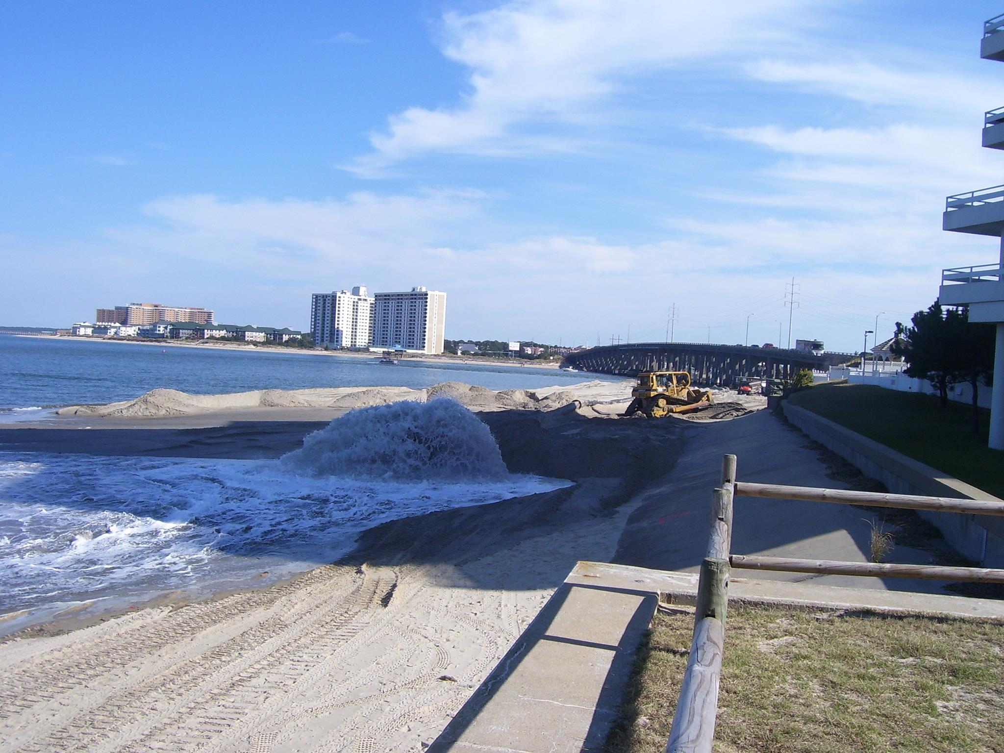
Photo Credit: Margaret Allen Inge
Ocean Park Volunteer Rescue Squad Station (Intersection of Shore Drive and East Stratford Rd.)
Call to order:
Officers’ Reports: President’s Report David Williams
Vice President’s report Rick Mercadante
Secretary’s Report Todd Solomon –SEPT Minutes
Treasurer’s Report Ann Williams (acting treas.)
Old Business
New Business
Adjourn
Next SDCC- Monday NOV 25, 2013 Ocean Park Volunteer Rescue Squad Center
Topic: City Topics (Light Rail, Dredging, Lesner Bridge Construction)
Please check www.sdcc.info for more information on area news and events
Read the entire 75 page PDF which includes the Mayor’s letter, slides, etc.
As council is well aware, the recurrent flooding issue is of great concern to our citizens.
So the Mayor is asking City Council to add an additional item for VB’s legislative agenda.
…but to ask to support the authorization of the study.
Legislative Request # 1: The City of Norfolk requests the General Assembly to establish and fund a Joint Study Committee to further investigate and make recommendations on recurrent coastal flooding in Virginia.
A slide from the 75 page PDF
The VIMS Report concludes Virginia localities are not adequately equipped to address and
implement meaningful flood mitigation strategies required for responding to predicated
relative sea level rise on their own. Within the VIMS Report, there are a series of simulations
that show impacted areas as influenced by: a) storm surge, b) sea level rise, and c) the
recurrences of storms making land fall within the region. All of these factors both individually
and collectively, are anticipated to increase the frequency and the severity of coastal flooding
events. This will increase damages to public and private property, amplify impacts to public
safety, and increase disruption to individuals and the economy. Left unaddressed, the
Commonwealth can reasonably anticipate that it will see significant and profound coastal
flooding now and into the immediate planning horizon.
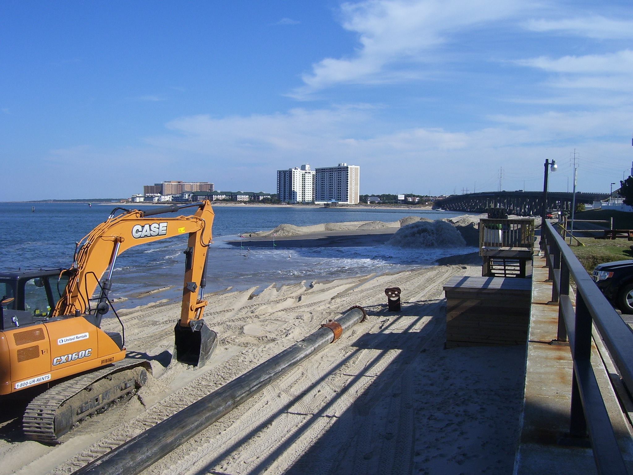
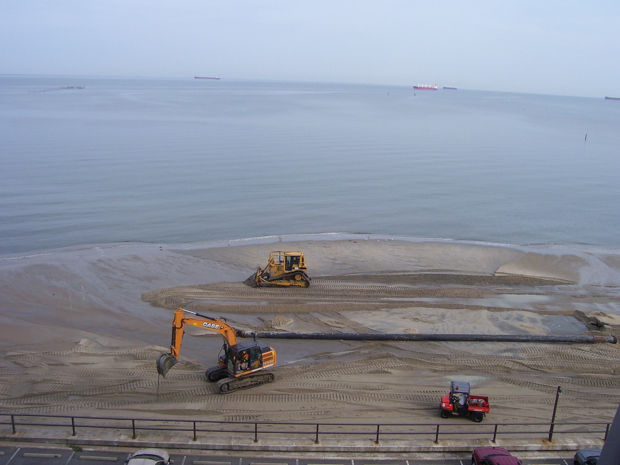
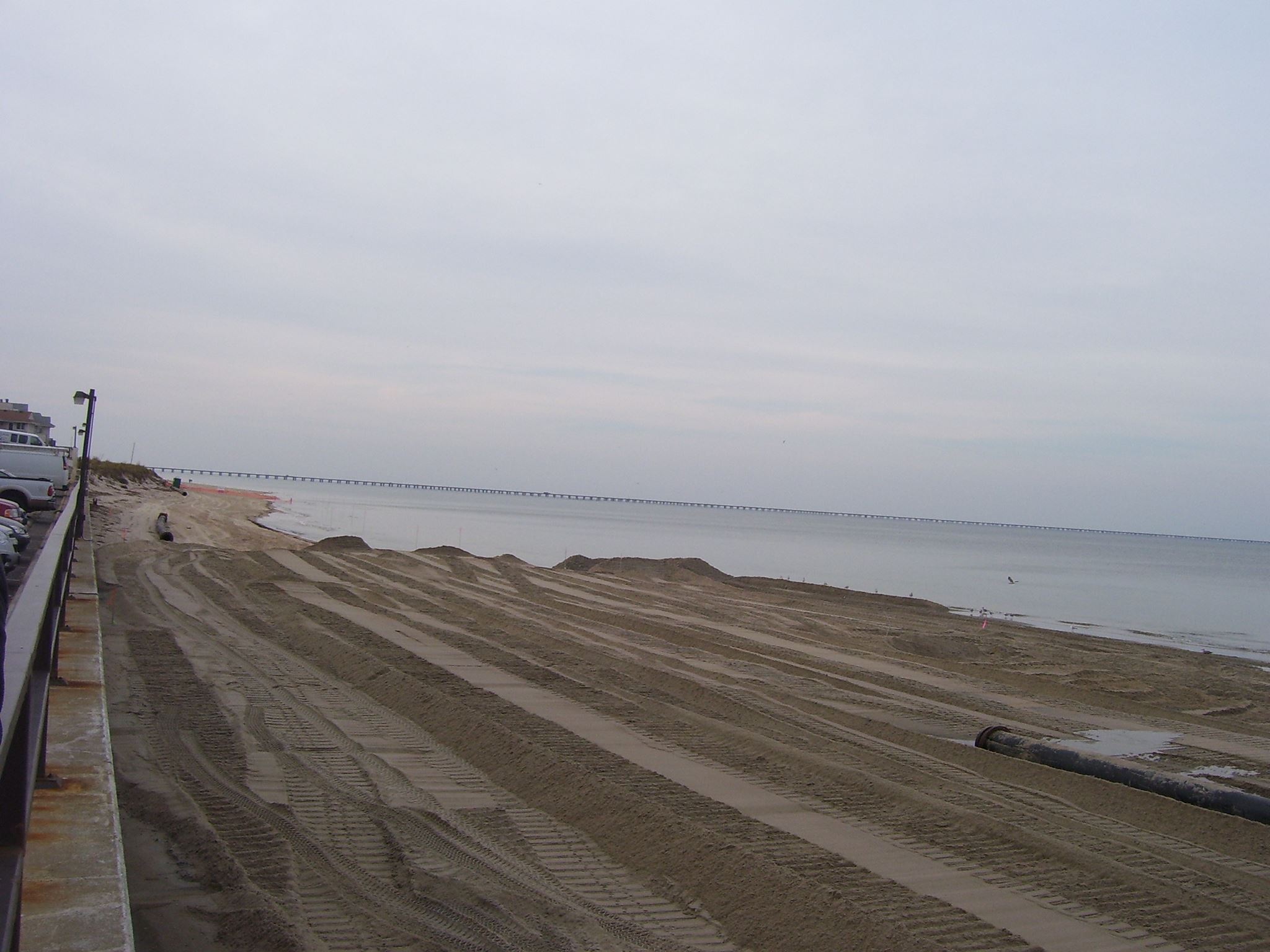
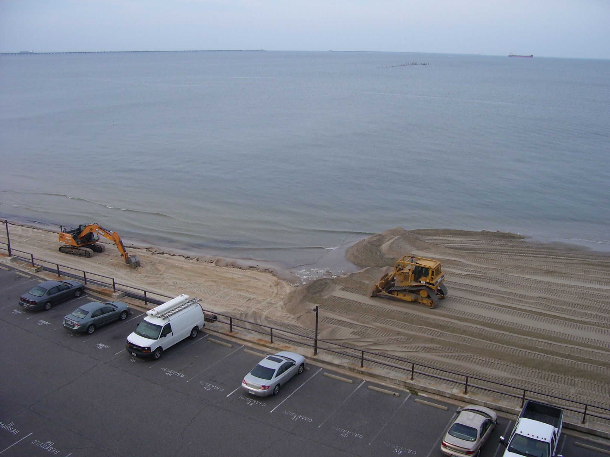
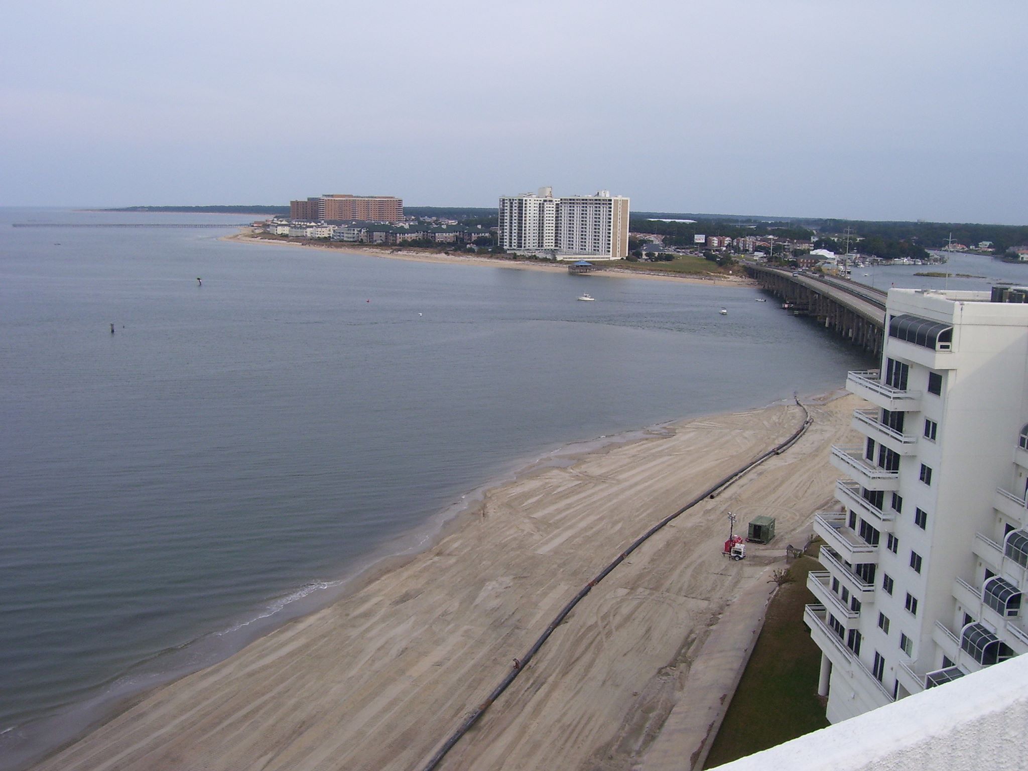
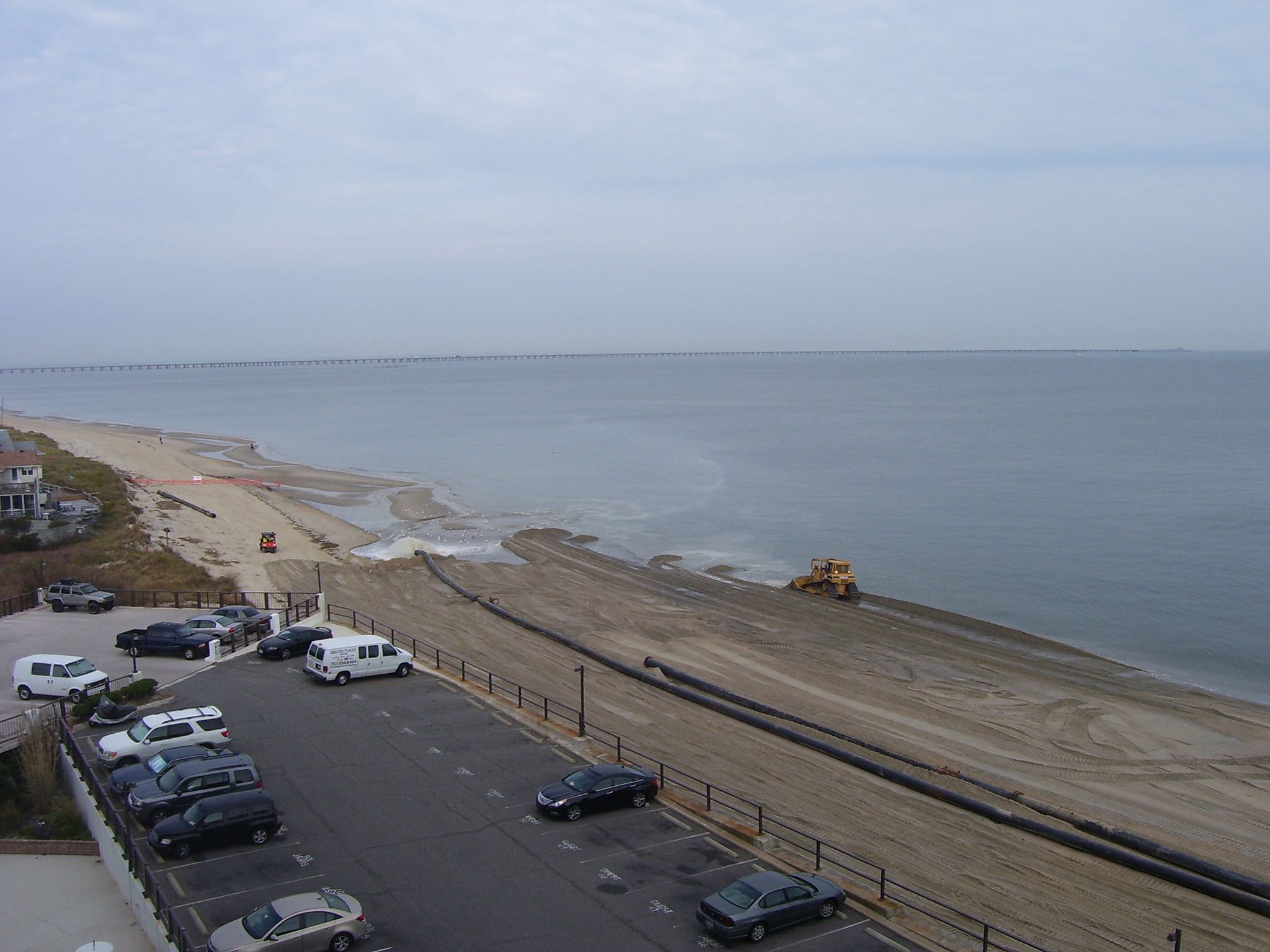
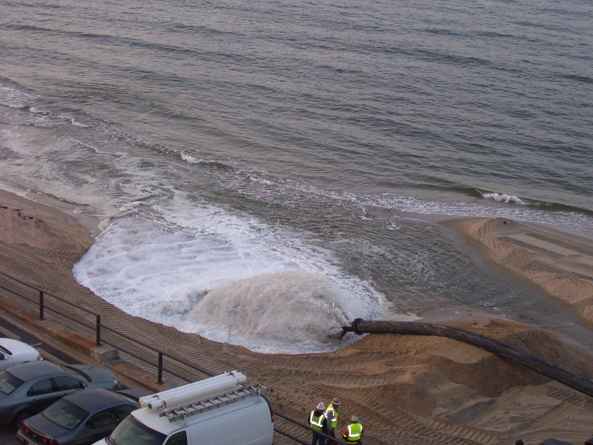
According to an email City staff sent to Mrs. Dorinda Ennis of 3356 on the Bay, the Lynnhaven Inlet dredging, which was scheduled to take place last year but was delayed because of funding problems, will start within the next 30 days. Please see the City staff email below
According to David Jarman….
Here is the feedback from our Coastal Group that handles the dredging work:
- The Corps inlet contract has been awarded. Notice to proceed will be issued 9/10/2013 and work will begin within 30 days. The dredged sand will be placed on the Ocean Park Beach. Project completion is anticipated by the end of February. If necessary, truck hauling from the boat ramp stockpile to the Ocean Park Beach will be available once the Corps dredging project is complete. This work would begin in March and last for a few weeks, again as needed.
- Crab Creek bids were opened two weeks ago, work will begin in November, with completion by the end of March.
From the project manager in response to an email:
Thank you for your attached letter regarding the Lesner Bridge. We are very excited about this project and eager to begin the work next spring.
As you noted in your letter, there are going to be some impacts to the live oaks associated with this project. We do have to remove approximately 12 live oaks to accommodate the new bridge. We have already removed some of these trees with the gas line that was bored under the Lynnhaven Inlet (on the north side of the existing bridges). This work was completed several weeks ago. The remaining trees will be removed when construction begins next spring.
We do recognize that the live oaks are an important natural resource in this area. This point was made clear during the public meetings that were held for this project. In order to mitigate the loss of these trees, we are currently planning to install 25 new live oaks with the project—this equates to a 2:1 replacement ratio. These trees have been incorporated with the overall landscaping plan to ensure that they have the best opportunity for survival in this harsh environment.
With regards to relocating or transplanting the existing trees, I did speak with our Operations staff at Parks & Recreation. They take care of the landscaping maintenance throughout the City. Their experience with transplanting live oaks has not be very positive in this area. Specifically, they noted the following issues:
1. The soil is too sandy for live oaks
2. The live oak root systems are not compact, which makes transplanting difficult
3. The salt environment is harsh on trees in this area
Since our Parks & Recreation staff maintain the landscaping in this area, they do have a lot of firsthand knowledge regarding the survival rate for certain species. We try to incorporate this real world information into our landscaping designs so we can provide the best planting plan for each project. Based on this information, we are not planning to relocate any existing live oaks at this time.
If you have any further questions or need more information, please let me know. Thank you for your time and interest in this project.
Sincerely,
David S. Jarman, P.E.
Transportation Project Management Supervisor
Department of Public Works
City of Virgina Beach
757-385-4144 (direct)
757-385-4131 (main)
The meeting agenda will include the following:
· The Floodplain Ordinance is being changed to meet the most recent FEMA requirements. An overview of the changes will be presented by city staff.
· Stormwater Management Program changes, including a revised ordinance and technical design criteria, are required by state law.
Read the entire article at Pilotonline.com.
After the Lesner Bridge project, Jarman said, the city may consider keeping the bulkhead at Crab Creek permanently and request a permit modification from the U.S. Army Corps of Engineers.
During the first phase of construction, the pedestrian walkway on the westbound span of the existing bridge will be removed. The new westbound span will be built just north of the current bridge, and all traffic will remain open on the old bridge. That could take about 15 months, wrapping up by summer 2015, Jarman said.

Photo Credit: Share Shore Drive Day July 11 2009
Read entire article at Pilotonline.com:
The city is tasked with finding a permanent solution as it watches the sea levels rise, coupled with more intensive weather events, City Manager Jim Spore said in a letter to the council.
His staff will present a comprehensive plan early next year.
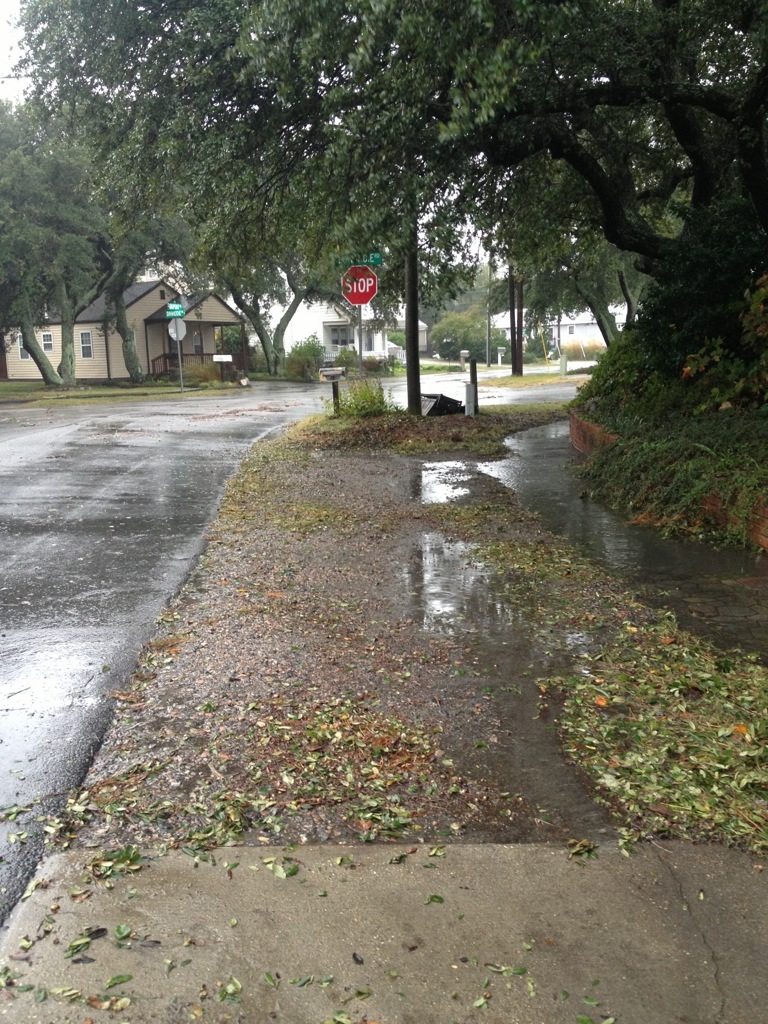
Crab Creek outfall back flow preventer installed
Hopefully they will be as successful as the one installed in Crab Creek that prevented storm surge flooding coming through the storm drains in October 2012 during Super Storm Sandy.
Previously at SDCC.info:
