Chesapeake Bay Foundation Action Alert – Withdraw SB926 Now

The following Action Alert has been sent out by the CBF.  Click here for an easy way to take action

The Chesapeake Bay and her precious wetlands need your help TODAY.

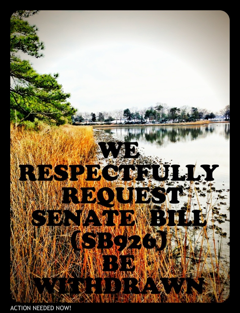
Senate Bill 926, a measure that weakens the authority of local wetlands boards, will be considered at tomorrow’s Senate Agriculture, Conservation, and Natural Resources. Your state senator, Sen. Jeff McWaters, has introduced this bill. Please ask Senator McWaters to withdraw this bill, which will have unintended harmful consequences.

CBF and many other conservation organizations oppose this bill, as it undermines Virginia’s effective, four-decades-old tidal wetlands program that relies upon local citizen wetland boards, with oversight by the Virginia Marine Resources Commission (VMRC), to protect our valuable tidal wetlands.Time is of the essence. Please contact  Sen. McWaters today, and tell him SB 926 is a step backward and to please withdraw it immediately!

Wording for Wetlands Board Code Modification in the City’s Legislative Agenda

Here is some more background information regarding SB926.  The attached document was pulled from this year’s City Legislative Agenda and was used to start the ball rolling on SB926.

CVB 2013 LegislativeAgenda

City Staff Information Regarding SB926

The following updated wording of SB926 was provided by Mr. Dave Hansen, Deputy City Manager, earlier today

10. Governmental activity in wetlands owned, leased or within an easement or right to use held by the Commonwealth or a subdivision thereof or a local government approved neighborhood navigation dredging project within a Special Services District adopted by the local governing body in accordance with Va. Code Section 15.2-2400, et seq.  

170 4.  For governmental activity not falling within the exceptions set forth in § 3 (10) above,

the board shall not condition approval on compensatory mitigation for adverse impacts if compensatory mitigation is required for the same activity by the Commission pursuant to Title 28.2 of the Code of Virginia, the Department of Environmental Quality pursuant to Title 62.1 of the Code of Virginia or  § 401 of the Clean Water Act,  or the United States Corps of Army Engineers pursuant to § 404 of the Clean Water Act and § 10 of the Rivers and Harbors Appropriations Act of 1889

Mr. Hansen also provided the following justification for making the legislative request that created SB926

SB926 is a modification of the existing law regarding government activities in wetlands.  The City Council has asked that the language be modified to expand the definition of government projects to include bon-a-fide easements and the Navigation SSD Dredging Projects.  These additions modify the 1992 law  of Va. Code Section 28.2-1302.  The specifics are:

  1. 1.      In Section 3, Paragraph 10, the addition of “or within an easement or right of use held by the Commonwealth or a subdivision thereof.”  The absence of reference to a legally binding easement has significantly disrupted the ability of government entities to implement timely and cost effective projects when substantiated, documented, and City Attorney validated legal instruments allowing the public use of property are in existence.  The “right of use” reference addresses the potential existence of a documented conveyed right other than title, easement or lease.  This instance occurred in the construction of the Constitution Drive Extension across Thalia Creek in Virginia Beach which delayed construction for over 12 months while properties were dedicated and accepted by the Council to establish the relationship of fee simple ownership.
  2. 2.      Also in Section 3, Paragraph 10 was the inclusion of additional specifying language, “or a local government approved neighborhood navigation dredging project within a Special Services District adopted by the local governing body in accordance with VA.Code Section 15.2-2400.”  This language is added to specifically allow SSD Navigation Projects to be considered government projects as they are engineered, constructed, funded and administered by local government staff and therefore, also exempt from Local Wetlands Board review.  This in no way is intended to amend or circumvent the State and Federal permitting process.  All navigation SSD projects will have permit applications submitted through the Joint Permit Application Process managed by VMRC for the purpose of obtaining State permits from both DEQ and VMRC as well as federal permits from the Corps of Engineers.  This specific exemption from Local Wetlands Board review solidifies the need for all three segments of the neighborhood SSD projects (City spur, neighborhood SSD channel, and individual connections) as being the complete project for the purpose of design, permitting and contracting.  By making these projects a government activity all mitigation becomes eligible for use in a government mitigation bank which the City of Virginia Beach is establishing as a result of the Pleasure House Point Purchase and its partnership with the Chesapeake Bay Foundation.  It is essential this specific language be included in Senator McWaters’ bill so that Lynnhaven River Now can create a Trust for the oversight of mitigation funds related to impacts in the Lynnhaven.

So as you see, this is a definitional clarification for what constitutes a government project that is exempt for local wetland board review.   The City Council sponsors feel that a permit application submitted by the City Manager’s Office to perform a City Council directed Navigation SSD Project that has been formulated by the City staff charged with providing the regulatory staff research and recommendations for the Local Wetlands Board creates a conflict of interest.  The staff that prepares the application should not be the staff support charged with reviewing and  recommending approval of that application. Currently the definition of “governmental activity” for the Local Wetland Boards, due to legislation for the Virginia Marine Resources Commission (VMRC),  is limited to lands the government either owns or holds an easement or right-of-way over.  The language must be modified as it is antiquated and not consistent with the SSD legislation, which was created decades after VMRCs legislation.  This in no way circumvents the state and federal permit review and approval process which this City adheres to on all government projects.

The neighborhood SSD program created by the City Council of Virginia Beach, following state enabling legislation available to all coastal communities in Virginia,  is a tremendous opportunity for waterfront residents to regain navigable access to city channels.  The SSD program is an essential program for many neighborhoods who could not otherwise dredge because the city is able to bundle the regulatory process, tax residents over a period of 16 years, thus building in a means to  finance the effort making it cost effective. Additionally, the “mud tax” which the City’s wetland board collects from private residential projects does not take into account that exposed sediment (“non-vegetated wetland” – or “mudflat” exposed at low tide) is “natural” versus a consequence of sedimentation from surrounding development.    The “mud tax” adds $112.50/cy ($12.50 per square foot x 9 square feet per cubic yard) to the cost of a project currently estimated to cost $30/cy (surveying, engineering, permitting and dredging) to remove the mud. It is this outrageous mud tax that has caused these project to be unaffordable.  In a matter of speaking this tax could be viewed as a prohibition to the property rights of waterfront home owners.

 The Local Wetland Board does not have jurisdiction over subaqueous river bottoms. These Projects will help to restore the environmental quality of the Lynnhaven River by improving the volume of water flow which will improve the tidal cleansing of the river.  All of which will improve the health of fish and shell fish in the river which is of major environmental benefit to the city and its citizens. I could understand the concern that the Local Wetland Board would have regarding tidal wetlands located around the point where dredge spoils are removed from the river but this will be covered in the state and federal permitting. Notwithstanding their normal concerns, all of the Projects are located within the river proper and not in the tidal wetlands.  It would appear that the only other concern that the Local Wetland Board could possibly have is where non-vegetative wetlands and subaqueous river bottom overlap.  Subaqueous river bottom and non-vegetative tidal wetlands are generally one in the same and determining where one starts and stops is of no environmental consequences.  Finally, the public is not further served in any way by requiring the waterfront property owner and the public to spend additional time and money to file and process redundant permits with their City Council appointed Local Wetland Board. Additionally, the fees that the Wet Lands Board could impose on the property owners were arbitrarily established several years ago by the Local Wetland Board without empirical environmental or economic basis. It is beyond reason to require the property owner to submit to additional public hearings only for the property owners to be required to pay additional fees.   To simply duplicate the review of the state and federal agencies that have jurisdiction over such project with an unnecessary local bureaucratic layer is not appropriate.

URGENT NOW: “PLEASE WITHDRAW SENATE BILL SB926” PLEASE CONTACT SENATOR MCWATERS NOW

Please call and/or email Senator McWaters:

Respectfully ask Senator McWaters to withdraw Senate Bill SB 926.

EMAIL Senator McWaters & His Aid
PHONE Richmond Office: (804) 698-7508

Senator McWaters Contact Info
20130129-195815.jpg
WHY?

Dear Gentleman,

I respectfully request that Senate Bill (SB926) be withdrawn.

Removing local Wetlands Board review of local City projects is unacceptable.

Citizen engagement at the local level must be maintained in order to keep trust in government.

The current review process for “28.2-1302 of the Code of Virginia, relating to the jurisdiction of local wetlands boards” results in State owned wetlands projects being reviewed by State commissions (VMRC) and locally owned wetlands projects being reviewed by local Wetlands Boards.

This is the correct method and must be protected.

Moving review boards out of the local area places an unfair burden on citizens and their rights for public comment.

Additionally, local Wetlands Boards are more familiar with the particulars of local projects and are best suited to review these applications.

Sincerely,

Todd Solomon

Shore Drive Community Coalition-Secretary

Maintaining the Status Quo for Shore Drive, check out http://www.sdcc.info

ALSO:

It could undermine Virginia’s no net loss goals for preservation of wetlands acreage and function.

It could undermine government openness and transparency by imposing additional barriers to public participation in the local public hearing of projects that would impact state-protected wetlands.

PLEASE CONTACT SENATOR MCWATERS NOW
Senator Jeffrey L. McWaters
Republican-District 8

Capitol Office
Senate of Virginia
P.O. Box 396
Richmond, VA 23218
Email: district08@senate.virginia.gov
Phone: (804) 698-7508
Fax: (804) 698-7651
Room No: 310
Legislative Assistant: Cheryl Simmons, Christen T. Smith

District Office
1207 Laskin Road
Virginia Beach, VA 23451

Phone: (757) 965-3700

Legislative Assistant: Cheryl Simmons, Christen T. Smith

1207 Laskin Road
Virginia Beach, VA 23451
Phone: (757) 965-3700

As of the time of this post, this Senate Bill SB926 could be heard Thursday.

UPDATE: read the bill. Start here.

Noticed more files available at replacement for Lesner Bridge CIP Project Page

Added a list of what’s available at our SDCC.info/Hot page. Scroll down to find info about bridge.

Direct link to CIP Project Page for Lesner Bridge.

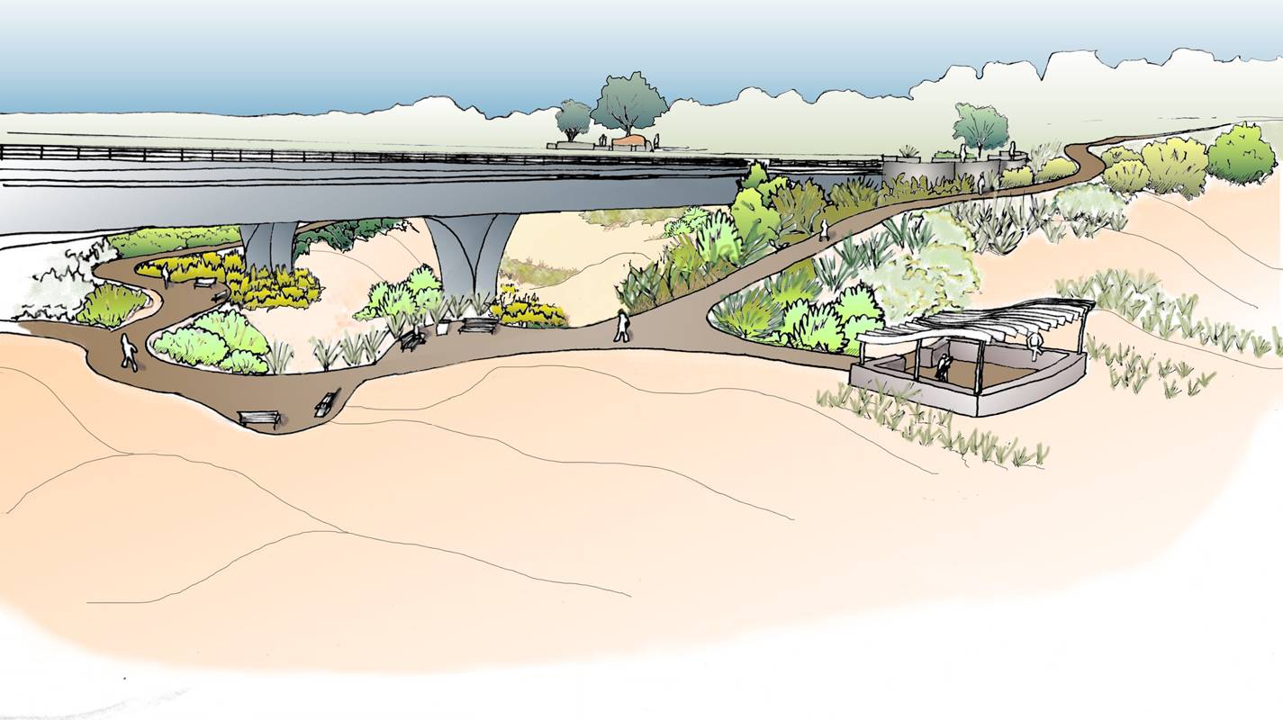
Landscaping Concept Under Bridge

Landscaping Concept Under Bridge

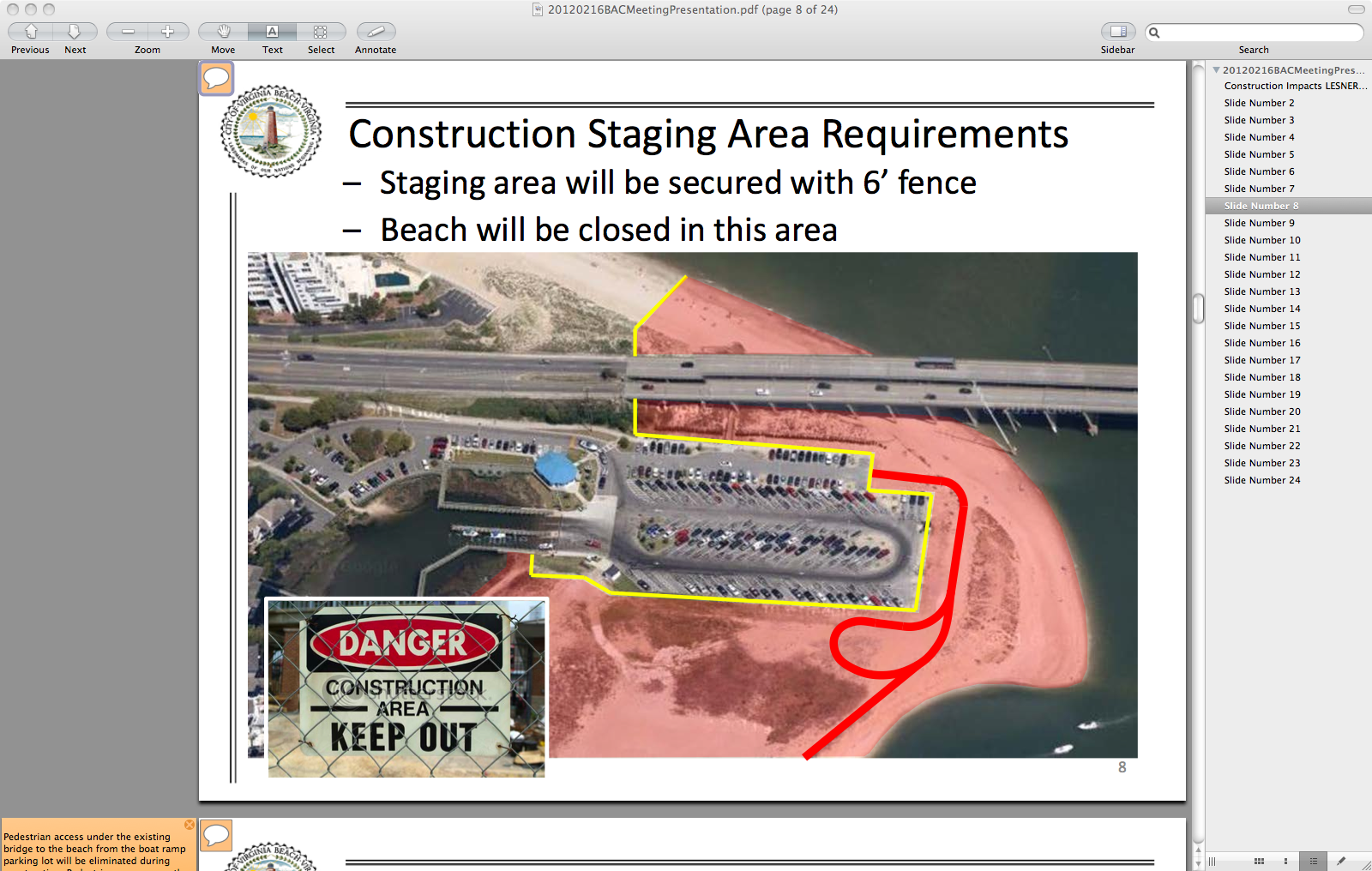
Construction Impacts – Lesner Bridge Replacement Project

Sneak peak of power point presentation pulled from the Official City Project Page.

Construction – Begin July 2013; Complete July 2016

One image from presentation

One image from presentation

Download presentation from VBGov.com. [24 page PDF]

Note: If you are viewing presentation on a Mac in Preview – you can watch in full screen slideshow mode.
You can also view each slide & read notes for each by clicking on small cartoon bubble icon in upper left corner of each slide.

“The bill would require the Marine Resources Commission, the Department of Environmental Quality and other involved agencies to establish a procedure for approving within 90 days applications for permits to dredge sand from the bay and dump it on adjacent beaches.”

From Pilotonline.com:

He said Virginia Beach has agreed to pay for sand replenishment along its part of the Chesapeake Bay, which includes Chic’s Beach and the Shore Drive corridor, areas that suffer some of the worst damage from nor’easters and storms like Sandy.

Apparently Ocean Park was hit harder by Sandy than the east side of the Lesner Bridge.

Taken couple days after Sandy. Dinwiddie walkway in Ocean Park. Photo Credit ~ Jen C.

Taken couple days after Sandy. Dinwiddie walkway in Ocean Park. Photo Credit ~ Jen C.

View SB946 at LIS:

SB 946 Public beaches; authorizes MRC and DEQ to establish procedure for sand replenishment.

Introduced by: Frank W. Wagner | all patrons … notes | add to my profiles
SUMMARY AS INTRODUCED:

Sand replenishment for public beaches. Authorizes the Marine Resources Commission and the Department of Environmental Quality to establish an expedited procedure for sand mining and beach replenishment on the public beaches abutting the waters of the Chesapeake Bay. The bill requires the agencies to establish a working group, consisting of representatives from affected localities, to assist in the development of the expedited procedure. The working group is to consider a requirement that the application for the sand replenishment project permit include the submission of a mining plan by the locality for areas within the Chesapeake Bay from which the dredged material will be taken and the location of the beach replenishment project. The bill provides several types of information that such a plan would include, such as the analysis of benthic, marine, and fishery resources; impact on any historical artifacts; and impact on other uses of the state waters and bottomlands at the dredge site.

Proposed Page Avenue and Cherry Place Intersection Alternative at Shore Drive, Cape Henry Towers.

Thanks to Public Works Project Manager Jason B. Wilson for sharing the proposed changes for the intersection of Page Avenue and Shore Drive.

View the CHT Presentation Final (12 page PDF).
This is part of 2.117.000: Shore Drive Corridor Improvements – Phase III.
Learn more about Shore Drive infrastructure work at SDCC.info/HOT.

Alternative 1 for proposed realignment of intersection.

Alternative 1 for proposed realignment of intersection.

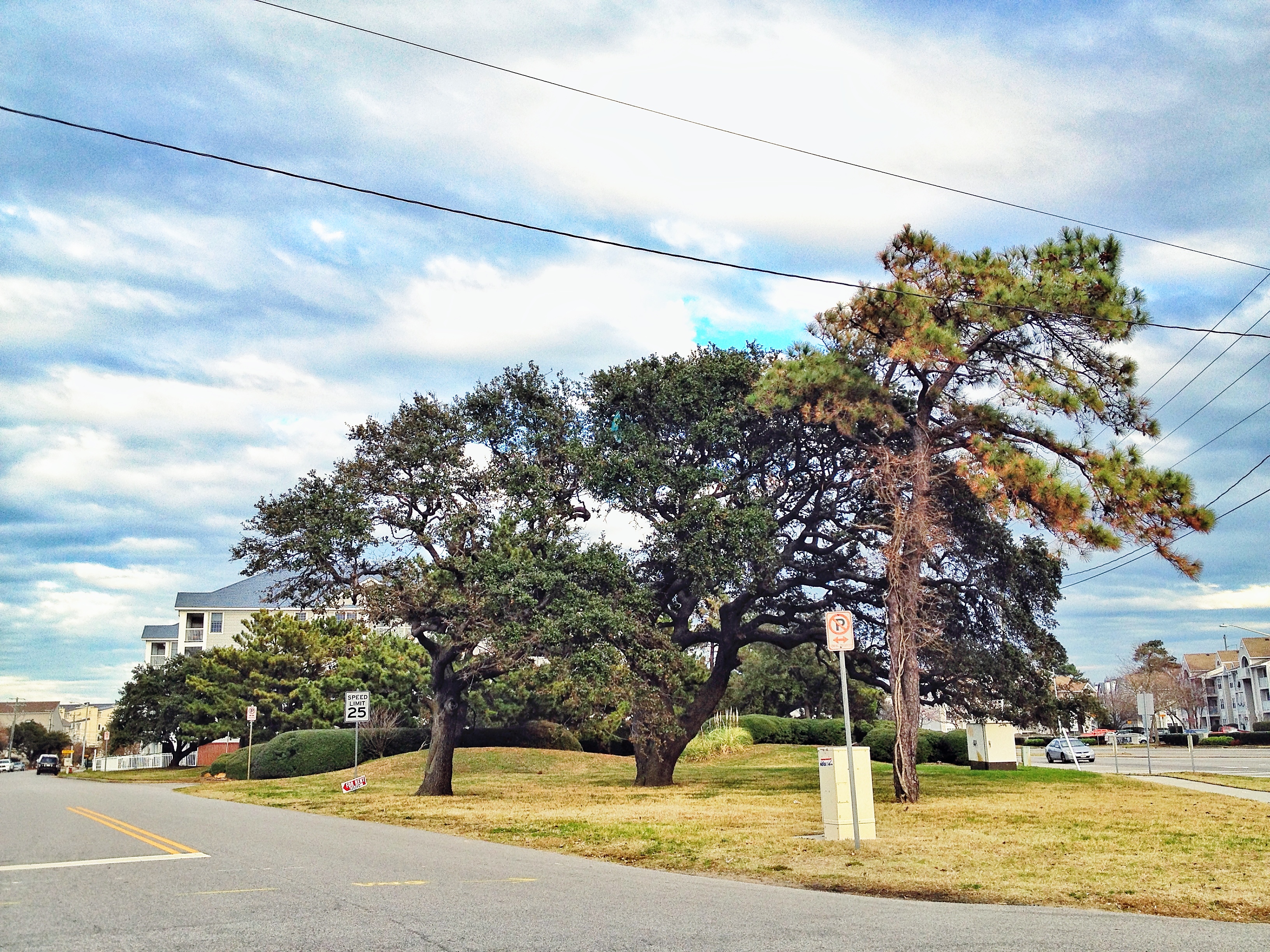
View from Page Avenue looking east down Shore Drive. This is across the street from Starbucks at east end of Lesner Bridge.

View from Page Avenue looking east down Shore Drive.

Trees pictured above would come down under all 3 Alternative proposals.

An excerpt of a comment from previous post at SDCC.info about this proposal:

I don’t understand the reason for ANY if these three proposals. Even when Duck In was hosting their famous Friday night parties, everyone (even drunk drivers) managed to exit onto Shore Dr without problems.

City Continues Engineering Studies for Immediate Stormwater Solutions East of Lesner Bridge – Results Expected April 2013

The following email was received from Deputy City Manager Dave Hansen in respone to requests that immediate stormwater solutions similar to the one used in Ocean Park be installed in flood prone areas east of the Lesner Bridge in Cape Story, Lynnhaven Colony and Cape Henry neighborhoods.


Eastern Shore Drive Leaders,

Let me begin by attesting the Eastern Shore Drive Storm Water Drainage Area Improvement Initiative is one of our top focus areas as we roll into the new year.  The staff and City leadership are very sensitive to the hardships created when we have intense and long-lasting weather events such as Sandy, Irene, and the Nor’easter of Nov 09.  Following Public Works attendance and briefing last Saturday with the Lynnhaven Colony Civic League and concerns we have received from Cape Henry Shores, Cape Story By the Sea and other concerned citizens in the eastern Shore Drive drainage area, our engineering and operations staff will be undertaking an accelerated analysis of several interim solutions which have been suggested and on the face seem to have merit in providing various degrees of protection from tidal inundation.  Below is a summary of the two phases I have asked our engineering staff to pursue.  Phase I is a data map with summary descriptions so we identify all infrastructure, elevations and drainage areas east of the Lesner.  Completing this on 7 Dec allows us to define the study aspects of Phase II.  I have asked Public Works to complete their assessments and recommendations by the first week in April and to publish a written report NLT 12 April.  Intent will be to post this report on-line for the civic leagues and citizens to review. Here are summaries of the first two phases:

1.    Using City topographic mapping as the base, delineate the drainage sub basins, the drainage systems (open and closed), and the outfalls for the Lynnhaven Colony/Cape Henry/Cape Story by the Sea areas.  This will provide a clear graphic that depicts the ground elevations, drainage areas, and drainage system elements – including outfalls.  This will be used as a tool for the additional analyses identified in Phase 2 and will be suitable for discussions with the BAC and civic leagues when describing how the systems function and why engineering analyses are necessary to support any proposed interim measures such as backflow preventers.  I.e., it’s not as simple as just keeping the tide out, the rainfall runoff has to be able to either be safely stored within the particular drainage area or be able to be discharged with the backflow preventers in place (or a combination thereof).  These products will be ready by December 7.

2.    Each sub basin will have an analysis done to determine the suitability of backflow preventers on the outfall for the particular subbasin; if a backflow preventer is suitable, the type of backflow preventer; the amount of rainfall runoff the subbasin can handle without structural flooding; the stand-by pumping requirements (if any); and the probable costs.  While simply jumping to a “solution” as has been suggested by some,  it is absolutely necessary that the City allow the responsible level of engineering to be done to assure that we do not inadvertently worsen the drainage situation for any particular subbasin.  We are estimating four months for this effort. Expect to deliver a written analysis with recommendations and preliminary costs and timeline by mid-April.

Phase III will be the review and approval process leading to design and construction.  Once we firm up the costs and the competitive process we’ll use to get the work done we can provide a reasonable timeline.  I wish to close this email by ensuring our citizens fully understand these interim solutions as with the permanent solutions have definitive limitations.  At some level of tidal surge and some accumulation and intensity of precipitation all infrastructure improvements will be overcome and mother nature will prevail.  Hopefully implementing interim measures will reduce the risk of moderate storm damage and buy the time for us to consider even grander infrastructure solutions to tackle the bigger more threatening hurricanes and nor’easters we seem to be weathering of late.  Happy Thanksgiving and fingers crossed for a quiet winter storm season. Regards, Dave


Dave Hansen

Deputy City Manager

City of Virginia Beach

(757)385-4242

“Temporary Bulkhead” at the beloved Lynnhaven Boat Ramp & Beach Facility further explained

From an email from Dave Hansen posted unedited with permission:

Kal & Grace,

FYI – The “Temporary Bulkhead” as shown in the permit application and on the current design plans, is designed with steel sheeting with a tie-back system and a concrete cap. The length is approx 400 LF.

Timber is great for residential bulkheads, but it is not adequate for a commercial/industrial application like this.

Timber would not hold up for the construction duration. The cap would require cleats to tie-off and a timber cap would not provide an adequate anchor for loaded barges, boats, etc., to tie off.

The concrete cap provides more structural stability for the bulkhead design.

This concrete cap bulkhead design is more of a standard section that contractors are used to building.

As an alternate, a more expensive steel cap could be used, but in either scenario (steel or concrete) the cap needs to be more durable than timber.

As promised in my many briefings to your respective organizations we will visit this discussion just past the 50% construction stage to see how we are co-existing with our boating public. Regards, Dave

Dave Hansen
Deputy City Manager
City of Virginia Beach
(757)385-4242

Permit at US ACOE website.
More about dredging, and the replacement for the Lesner Bridge at SDCC HOT page.

Online Petition to Move Electronic Roadway sign and Save Live Oaks

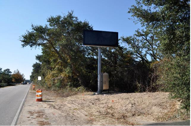
Three electronic ITS traffic/safey warning signs are being installed on Shore Drive. 

1 – West of Marlin Bay Drive in the median

2- West of First Landing State Park Bayside entrance (northside of road)

3- Northend near 89th street

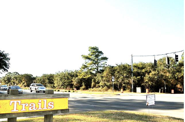
The signs are part of a Federally funded project and were approved by the City’s Public Works department in 2008.  In addition to the signs being big and ugly, the sign installed near the State Park will require several of the City’s official trees, the live oak, to be removed.

Members of the Friends of Live Oaks have started an online petition requesting the sign be relocated to the median to avoid tree removal.  You can sign the petition at the following link

 http://www.thepetitionsite.com/takeaction/702/346/384/


Close up of sign near Park


Trees between sign (located far left just behind the white car) and Park entrance to be removed.

Editorial entitled Negotiate to save Lynnhaven property, Pleasure House Point.

Read entire editorial entitled Negotiate to save Lynnhaven property at Pilotonline.com.

It’s time for the firm, city and foundation leaders to work together for the common good and figure out a way to preserve those four acres.

And:

…whether through negotiations with the developer that involve a land swap, tax breaks or some other method.

One of the groups that worked to preserve PHP. A team of Kemps Landing Magnet School eighth-graders and the sixth-grade class at Cape Henry Collegiate School have a shared vision: to preserve…

Multiple car break ins, drunk driving including hitting various objects, driving on bike path, vandalism and more in Cape Henry Shores and Cape Story by The Sea last night.

Neighborhood Watch from CSTBS will be attending the Citizen’s Advisory Committee meeting on Wednesday night at the Second Precinct at 820 Virginia Beach Blvd and intend to bring all this up. Everyone is invited to attend this meeting to air complaints, and to meet with police and other City officials. They really appreciate public comments. The meeting starts at 7:00 p.m.

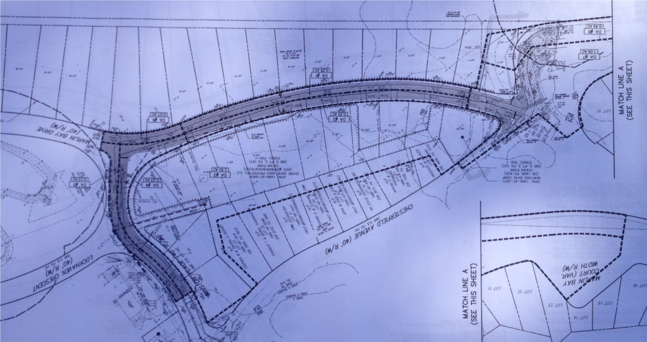
City to discuss private property and Marlin Bay extension next to PHP at next Council Meeting

Watch a WVEC.com news coverage about private property and Marlin Bay extension slatted for property next to PHP.

Previous press about this at SDCC.info.

“If the lots are built upon and the road extended, “unfortunately it would sour the overall project,” said Christy Everett, regional director of the Chesapeake Bay Foundation.”

More press about 100% of Pleasure House Point not being preserved.

“Pleasure House Point Faces New Development

… plans have quietly moved ahead to build duplexes and extend a road through two areas in the tract, known as Pleasure House Point.”

From Pilotonline.com:

Turns out there’s a loophole in the celebrated purchase and preservation of Pleasure House Point, the largest undeveloped tract left on the Lynnhaven River, loaded with sand dunes, maritime forest and waterfront vistas.

Note the amount of trees and vital habitat that is at risk for destruction. Birds, including those migrating in the Atlantic Flyway, depend on Pleasure House Point and it’s open space to survive.

Partial shot of 1 page of plans shown upside down.

Flooding in Cape Story caused by backflow through First Landing outfalls

The photos below show the high tide flooding that occurred Monday Oct. 29th around 10:30am high tide cycle for Long Creek.  The water level above the SW grate on First Landing was about 14 inches.  Estimate for the height of the high tide for this event is close to 7.0 feet based on 2006, 2009 Nor’Ida and 2011 Irene.

At least 8 homes between Calvert and Wake Forest had water come into their homes.  The one at the end of First Landing Lane had at close to 18 inches and will need dry wall and insulation replaced.  All of the flooding for these homes was a direct result of the tidal surge coming backwards through the First Landing outfalls in the Cape Henry canal.

Based on observations during the storm, water from the Cape Henry canal never breeched the roadway crest at the intersection of Admiral and First Landing.  Water entered the ditch along the trail and filled the low lying areas and then flowed west toward Wake Forest.  The maps produced after the 2009 event were very close to what actually happened.

Based on the success of the backflow prevention device in Ocean Park, some type of device needs to be installed in the First Landing outfalls ASAP.  The flooding damage to Cape Story as a result of Sandy could have been prevented.  Based on past experience from 2006, 2009, 2011 and 2012, a backflow device will function satisfactorily for events that have a high tide less than 8.5 feet.  This should be acceptable for most events.  Of course, if a Cat 2 storm hits us directly, we’re all in trouble.  Nothing will save us and we know that.

Catastrophic storm plug for Crab Creek outfall prevented widespread tidal flooding in Ocean Park.

Thanks to Dave Hansen, Assistant City Manager, Phil Koetter & Mike Mundy of Public Works and others for installing the inflatable catastrophic storm plug at the Crab Creek outfall in Ocean Park. It worked!

During past storms Isabel, Nor’Ida and Irene, there was widespread tidal flooding in the Ocean Park area that is on this system. It is not connected to the pump station which protects the Pleasure House Point side of Ocean Park. The area this outfall covers is roughly Salty C’s east to the Lesner Bridge, down Dinwiddie Road past Ocean Park Baptist Church, north on East Stratford Road over to Tazewell into Crab Creek.
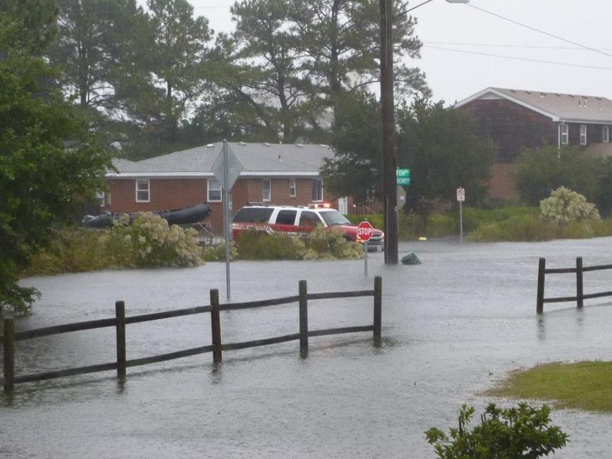
20121030-120830.jpg
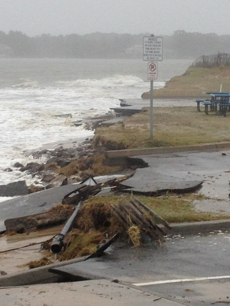
With this much damage at the beloved Lynnhaven Boat Ramp & Beach Facility, there would have again been feet of water on the roads thanks to the tidal surge through the Crab Creek outfall.
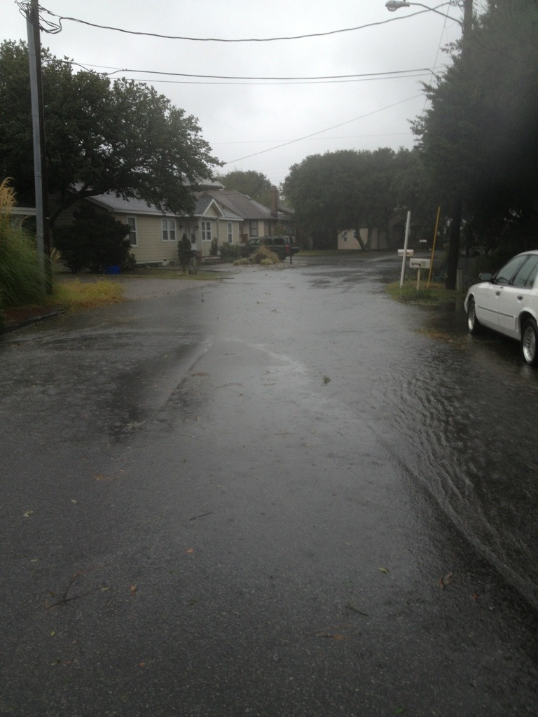
20121030-120900.jpg
This was roughly the worst it got thanks to the installation and use of the plug.
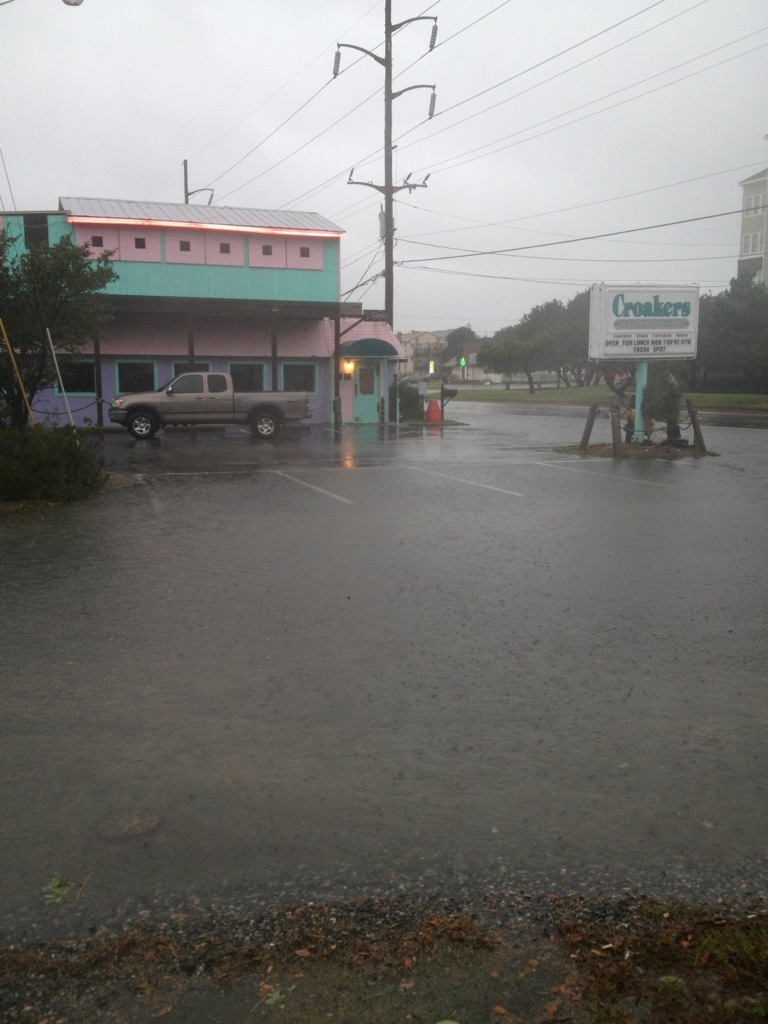
20121030-122840.jpgThis was roughly the worst it got. In previous storms, like Nor ‘Ida, there was feet of water in Croakers.
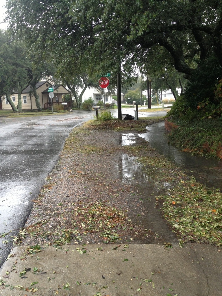
20121030-121005.jpg
This is how it looked for most of Sandy. In previous storms, feet of tidal water were here.

Conclusion?

This inflatable plug in Crab Creek outfall worked!

It’s possible that since this experiment worked here, it might be able to work elsewhere.

Obviously, this might not work everywhere – but certainly, there are many smart people who can come up with creative solutions that could stop tidal flooding in other areas.

Thanks again to Dave Hansen, Assistant City Manager, Phil Koetter & Mike Mundy of Public Works and others for installing the inflatable catastrophic storm plug at the Crab Creek outfall in Ocean Park.

+ + +

How did Crab Creek get this inflatable plug?

During Irene last year, I raised holy hell in Facebook as the tide surged through the storm drains.

Mr. Hansen and some Public Works storm water engineers came out during Irene. After several meetings with many people over weeks including countless emails, our recommendations to install and use this plug were approved.
“As of 3:22 p.m. Shore Dr. is now open, however, there is still an area of high water in the westbound lane at the intersection of Starfish Lane.”

From City of Virginia Beach Facebook page update.

“The rain and strong winds will continue throughout the day as Hurricane Sandy moves north, but the risk of major flooding has subsided for Hampton Roads, according to the National Weather Service.”

Pilotonline.com:

“The one this morning was the one we had to watch out for,” said National Weather Service meteorologist Jeff Orrock.

The next high tide, at 9:43 p.m., will be about the same “as the highest high tide you’d normally see in a year,” Orrock said.

Visit the new Shore Drive Community Coalition Facebook Page for more photos.

City Manager Update #9 from 9am Monday

From an email:

To: City Council; Constitutional Officers and Appointed Officials; Department Directors
Cc: Executive Assistants; Media and Communications; Media and Communications
Subject: Nor’easter SANDY Update #9

At today’s 0900 Monday City Manager we are confident our projections remain valid. Our current challenge is the ongoing high tide and its stacking impacts in the Lynnhaven and Elizabeth River Basins. We are also seeing an increase in the number of road overtopping by storm water ponding. Road closures are being updated on our Hurricane Sandy webpage every two hours. Total rainfall amounts so far vary throughout the City from 2.8 inches to as much as 4.9 inches. We are expecting a change in wind direction to occur late this afternoon.

Our most significant issue remains tidal stacking within the Lynnhaven and Elizabeth River basins creating low level residential flooding. Throughout today our Public Safety and Public Works teams are on the ground monitoring the effects of the ongoing high tide. Projected NWS storm surge will result in a high tide +7 feet above MLLW. This confirms our analysis that tide cycle stacking in the Lynnhaven and the Elizabeth River neighborhoods will result in significant tidal flooding up to elevation 6 feet above sea level. Our neighborhood specific inundation maps have indicate areas below 6 feet above sea level so citizens can make their assessments as to impacts of localized tidal flooding. We remain confident the Historical Tidal & Surge Chart is projecting where Sandy’s high tide elevations above Mean Low Water Level will be in relation to our previous storms. This additional information is being posted on our VBgov website. Here is the link.

http://www.vbgov.com/residents/emergency-preparedness/Pages/hurricane-sandy.aspx

Sustained wind projections have stabilized however the attached charts reflect a significant wind direction change and increased window of gusting will occur late afternoon today. Winds will make a dramatic shift from NW to SW and we should be guarded as to the effects this may have on our canopy. As Sandy makes another turn mid afternoon its projected path will actually bring the storm closer to Virginia Beach – hence our concern regarding impacts of the wind direction change. Winds still will not reach hurricane force and we do not believe sustained tropical force winds (39-74mph) will be reached either. We do however anticipate tropical force gusts that may occasionally reach the mid-fifties. The severity of this nor’eastercane is subsiding though the consistency of the winds will continue until after daylight Tuesday morning. Dom Power reported customer outages stands at 1500 of which 1200 are the result of an accident on Northhampton Blvd that toppled a power pol .
Storm surge has been most dramatic. Atlantic wave height throughout the day has been spectacular with some reaching the projected 15 foot level ; Bay wave height is nearing 8 feet with 9 foot waves being experience further into the bay. Beach erosion observations indicate our Atlantic beaches are faring well. On the Bay the Cape Henry, Ocean Park and Baylake Pines beaches are also holding however the Chesapeake Beach which had little buffer continues losing what little dune system it had. Indications are we are experiencing some structural damage and tidal surge flooding. Public Works is documenting these instances.
Rain is our 4th threat. Some areas of the City may receive up to 7 inches. Rain intensity has been steady but moderate. Projections are we could receive an additional +3 inches before the storm is over. Rains will continue through Tuesday mid-day. Surface ponding is occurring as runoff is being hindered due to elevated levels of the Lynnhaven and Elizabeth Rivers. Back Bay and the North Landing are seeing significant low levels based on the northerly winds pushing the water south and out to the Currituck and Albemarle. Storm water crews are responding to ponding issues. The police are providing high water traffic control. Impassable roads being listed on our storm webpage.
The duration of Sandy continues to make this storm a significant event. Weather conditions have stabilized and will remain consistent through this evening. After midnight we can expect to see a very slow lessening of the storms wind/rain consistency into some intermittency all day Tuesday.

Other highlights from this morning’s staff update:

· We have attached todays 0800 SITREP taken from our WEBEOC reporting database. It gives insight into the myriad actions and issues the departments are wrestling with.

· The Birdneck ES shelter remains open today. Currently reporting @53 individuals enjoying a warm, dry, friendly environment.

· The EOC continues operating under a partial activation.

· City services and staffing will operate under essential conditions beginning throughout Monday. Decisions regarding tomorrows City operational status will be made midafternoon today following our next regional and NWS VTC.

· VB Public Schools are closed today and will also determine their operating status sometime later today.

· The next regional VTC and NMS update is scheduled for 1330 this afternoon.

· It was commented this morning that the winds did not cause our foliage to leave its branches and when Sandy is over we are looking forward to the cornucopia of color our vivid canopy will provide us.

Will keep you advised. Dave

Dave Hansen
Deputy City Manager
City of Virginia Beach
EOC contact # 757-385-0705

(Note: there is a 17 page pdf that goes with this. I am unable to upload at this time.)