SDCC General Meeting Agenda for Monday NOV26 2012

Click here for a printable version of the agends – SDCC Agenda NOV 2012

Shore Drive Community Coalition

Monday 26 NOV 2012

SDCC General Meeting

SDCC General Meeting – Monday, 26 November 7:30 – 9:00 pm

Ocean Park Volunteer Rescue Squad Station (Intersection of Shore Drive and East Stratford Rd.)

Call to order

Meeting topic: Nominations for SDCC Officers for 2013 Election

Vice President’s Report on NOV BAC Meeting

Communications Plan for 2013

Officers’ Reports

President’s Report David Williams

Vice President’s report Grace Moran

Secretary’s Report Todd Solomon –Sept Minutes

Treasurer’s Report Carol Collins

Update on issues: Open questions from the floor

Old Business Shore Drive Issues

Storm Water Flooding of Neighborhoods

New Business

Adjourn

Next SDCC- Monday DEC 17, 2012

PLEASE NOTE DATE CHANGE

Ocean Park Volunteer Rescue Squad Center

Speaker- TBA

Please check http://www.sdcc.info for more information on area news and events

Jetty study at Lesner Bridge, Planning Commission recommends CBF wind turbine proposal at PHP

About Jetty study at Pilotonline:

Once the study is complete, the corps will present its findings to the city. Then both parties will decide whether to move forward with building the structures, said Phil Roehrs, the Virginia Beach coastal engineer.

Roehrs said the city would consider the jetties “only if the study shows they can be built in an environmentally sound way.”

Previously at SDCC.info. We scooped the Pilot. Thanks Andy.

About wind turbines at CBF’s facility on PHP at SavePHP.org:

Hopefully CBF and SmithGroup JJR will far exceed the standard in the wind turbine they use so as to minimize bird conflicts since PHP is a vital stop in the Atlantic Flyway.

Online Petition to Move Electronic Roadway sign and Save Live Oaks

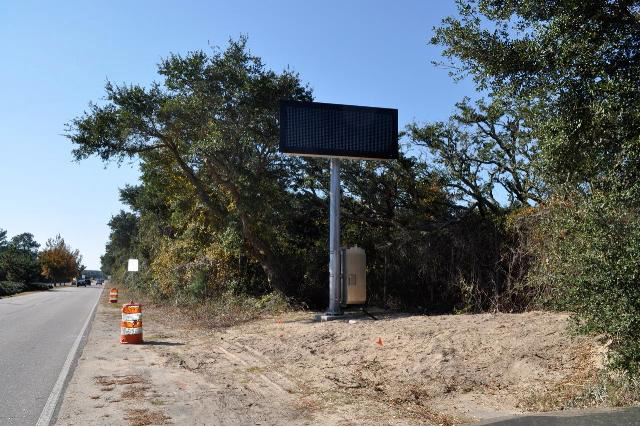
Three electronic ITS traffic/safey warning signs are being installed on Shore Drive. 

1 – West of Marlin Bay Drive in the median

2- West of First Landing State Park Bayside entrance (northside of road)

3- Northend near 89th street

The signs are part of a Federally funded project and were approved by the City’s Public Works department in 2008.  In addition to the signs being big and ugly, the sign installed near the State Park will require several of the City’s official trees, the live oak, to be removed.

Members of the Friends of Live Oaks have started an online petition requesting the sign be relocated to the median to avoid tree removal.  You can sign the petition at the following link

 http://www.thepetitionsite.com/takeaction/702/346/384/


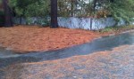
Close up of sign near Park


Trees between sign (located far left just behind the white car) and Park entrance to be removed.

Editorial entitled Negotiate to save Lynnhaven property, Pleasure House Point.

Read entire editorial entitled Negotiate to save Lynnhaven property at Pilotonline.com.

It’s time for the firm, city and foundation leaders to work together for the common good and figure out a way to preserve those four acres.

And:

…whether through negotiations with the developer that involve a land swap, tax breaks or some other method.

One of the groups that worked to preserve PHP. A team of Kemps Landing Magnet School eighth-graders and the sixth-grade class at Cape Henry Collegiate School have a shared vision: to preserve…

Bayfront Advisory Committee Meeting – Thursday Nov. 15th at 3:30pm

Bayfront Advisory Committee to Meet November 15

The Bayfront Advisory Committee will meet Thursday, November 15, at the Virginia Beach Resort and Conference Center, 2800 Shore Drive, from 3:30pm-5:30pm

The agenda for the meeting will include the following:

  • Update on public and private projects in the Bayfront area
  • Update on committee activities in the Bayfront area

 There will be an opportunity for presentations from the public on projects in the Bayfront area. The committee generally concludes its deliberations around 4:30pm. The meeting is then opened to the public for comments.

For additional information or to obtain a copy of the draft agenda, contact Faith Christie in the Planning Department at (757) 385-4621 or fchristi@vbgov.com. For more information regarding the Bayfront Advisory Committee, visit www.VBgov.com/Bayfront.

“Kristin Mazur, project manager for the Norfolk District Lynnhaven Inlet Jetties Navigation Project with the city of Virginia Beach, Va., explains the federal interest determination study process and timetable, Oct. 19, 2012, to add a 1,000-foot jetty in front of the Lesner Bridge.”

Learn more at US Army Corps of Engineers Norfolk District article.

The federal study will determine if jetties or a combination of coastal structures is cost-effective in reducing critical shoaling and annual costs of maintaining the navigation channel, as well as reducing damages incurred on structures in the channel due to continuous wave action.

Multiple car break ins, drunk driving including hitting various objects, driving on bike path, vandalism and more in Cape Henry Shores and Cape Story by The Sea last night.

Neighborhood Watch from CSTBS will be attending the Citizen’s Advisory Committee meeting on Wednesday night at the Second Precinct at 820 Virginia Beach Blvd and intend to bring all this up. Everyone is invited to attend this meeting to air complaints, and to meet with police and other City officials. They really appreciate public comments. The meeting starts at 7:00 p.m.

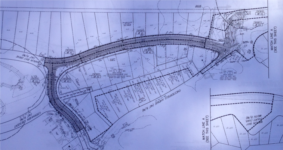
City to discuss private property and Marlin Bay extension next to PHP at next Council Meeting

Watch a WVEC.com news coverage about private property and Marlin Bay extension slatted for property next to PHP.

Previous press about this at SDCC.info.

“If the lots are built upon and the road extended, “unfortunately it would sour the overall project,” said Christy Everett, regional director of the Chesapeake Bay Foundation.”

More press about 100% of Pleasure House Point not being preserved.

“Pleasure House Point Faces New Development

… plans have quietly moved ahead to build duplexes and extend a road through two areas in the tract, known as Pleasure House Point.”

From Pilotonline.com:

Turns out there’s a loophole in the celebrated purchase and preservation of Pleasure House Point, the largest undeveloped tract left on the Lynnhaven River, loaded with sand dunes, maritime forest and waterfront vistas.

Note the amount of trees and vital habitat that is at risk for destruction. Birds, including those migrating in the Atlantic Flyway, depend on Pleasure House Point and it’s open space to survive.

Partial shot of 1 page of plans shown upside down.

“Please be aware of a dangerous “quick sand” environment on the beach. A resident of Baylake Pines sank to his waist on Tues evening while walking his dog and struggled to get out. He notified the city.”

Pulled from Ocean Park Civic League Facebook page …. from Baylake Pines:

Please be aware of a dangerous “quick sand” environment on the beach. A resident of Baylake Pines sank to his waist on Tues evening while walking his dog and struggled to get out. He notified the city. Until it is rectified, please pass the word. Tell the kids to beware! It was suggested that you don’t walk alone and do walk during daylight hours. Pass the word please–its a pretty day for beach-goers.

Email sent to the city (Emergency Mgmt), Tues., Nov. 6:
This is to alert you of a dangerous situation on the beach at the foot of Seaview Avenue in Chicks Beach. I sank to my waist in the sand while walking my dog this evening on the beach in front of the bulkhead immediately to the west of Seaview Avenue. I was able to pull myself out of the sand after a ten to fifteen
minute struggle. I alerted the City backhoe driver who was at work placing fill material on the beach at the end of Seaview Avenue, and suggested that he contact his supervi…sor to report the situation.

Although I am not an expert on these conditions, I believe that at certain tide levels, the beach in front of the bulkhead can become “quick” due to its low elevation and other features of the geography behind the bulkhead. I believe that this poses a serious hazard to the public.

Please take appropriate measures to warn the public of this dangerous condition.

“We will hold the Grand Illumination of the Historic Cape Henry Lighthouse this year on 30 Nov at 5 p.m. The event will be open to the public this year.”

Please share this Info.

If you have any questions, please let me know. Thanks!

Scott Mohr
Public Affairs Officer
Joint Expeditionary Base Little Creek-Fort Story

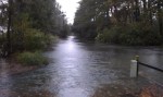
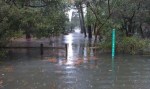
Flooding in Cape Story caused by backflow through First Landing outfalls

The photos below show the high tide flooding that occurred Monday Oct. 29th around 10:30am high tide cycle for Long Creek.  The water level above the SW grate on First Landing was about 14 inches.  Estimate for the height of the high tide for this event is close to 7.0 feet based on 2006, 2009 Nor’Ida and 2011 Irene.

At least 8 homes between Calvert and Wake Forest had water come into their homes.  The one at the end of First Landing Lane had at close to 18 inches and will need dry wall and insulation replaced.  All of the flooding for these homes was a direct result of the tidal surge coming backwards through the First Landing outfalls in the Cape Henry canal.

Based on observations during the storm, water from the Cape Henry canal never breeched the roadway crest at the intersection of Admiral and First Landing.  Water entered the ditch along the trail and filled the low lying areas and then flowed west toward Wake Forest.  The maps produced after the 2009 event were very close to what actually happened.

Based on the success of the backflow prevention device in Ocean Park, some type of device needs to be installed in the First Landing outfalls ASAP.  The flooding damage to Cape Story as a result of Sandy could have been prevented.  Based on past experience from 2006, 2009, 2011 and 2012, a backflow device will function satisfactorily for events that have a high tide less than 8.5 feet.  This should be acceptable for most events.  Of course, if a Cat 2 storm hits us directly, we’re all in trouble.  Nothing will save us and we know that.

“You can contribute to LRNow’s Oyster Restoration work by shopping at the new Whole Foods Store on Laskin Road on Thursday, November 1. Thank you for your continuing support! “

From LRNow eNewsletter.

On Thursday, November 1, the new Virginia Beach Whole Foods Store will donate 5% of the day’s profit to Lynnhaven River NOW to help us continue our oyster restoration work in the Lynnhaven River.

How’d they win?

This magnificent video:

Wednesday, Oct. 31, is Halloween. Trick-or-Treat begins at dusk and ends at 8 p.m. for children 12 years of age and younger. Members of the Virginia Beach Emergency Response System want you and your family to be safe. Planning ahead can help make this Halloween a safe and fun treat.

Read the news release. (2pg PDF)

If you’re planning to take the kids trick-or-treating, or if you’re passing out candy, follow a few simple rules to keep Halloween safe and fun. If you are passing out treats, please turn your porch light on so children will know they are welcome. If you are not passing out treats, please turn your porch light off. Other safety tips for trick-or-treaters include…

100512-NewsRelease_Halloweenbam.docx

Catastrophic storm plug for Crab Creek outfall prevented widespread tidal flooding in Ocean Park.

Thanks to Dave Hansen, Assistant City Manager, Phil Koetter & Mike Mundy of Public Works and others for installing the inflatable catastrophic storm plug at the Crab Creek outfall in Ocean Park. It worked!

During past storms Isabel, Nor’Ida and Irene, there was widespread tidal flooding in the Ocean Park area that is on this system. It is not connected to the pump station which protects the Pleasure House Point side of Ocean Park. The area this outfall covers is roughly Salty C’s east to the Lesner Bridge, down Dinwiddie Road past Ocean Park Baptist Church, north on East Stratford Road over to Tazewell into Crab Creek.
20121030-120830.jpg
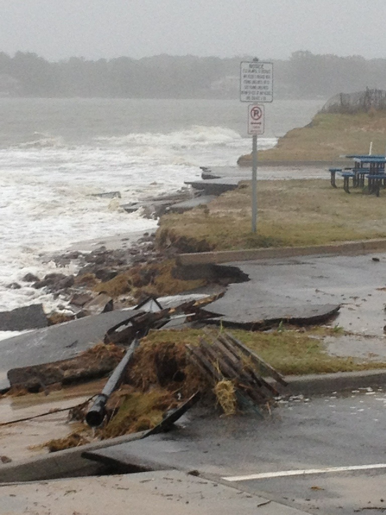
With this much damage at the beloved Lynnhaven Boat Ramp & Beach Facility, there would have again been feet of water on the roads thanks to the tidal surge through the Crab Creek outfall.
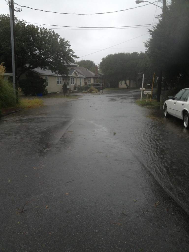
20121030-120900.jpg
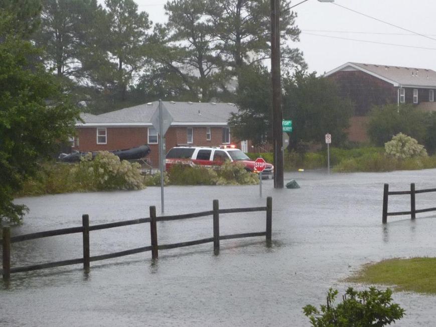
This was roughly the worst it got thanks to the installation and use of the plug.
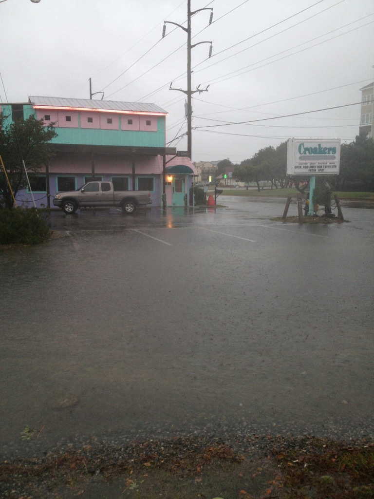
20121030-122840.jpgThis was roughly the worst it got. In previous storms, like Nor ‘Ida, there was feet of water in Croakers.
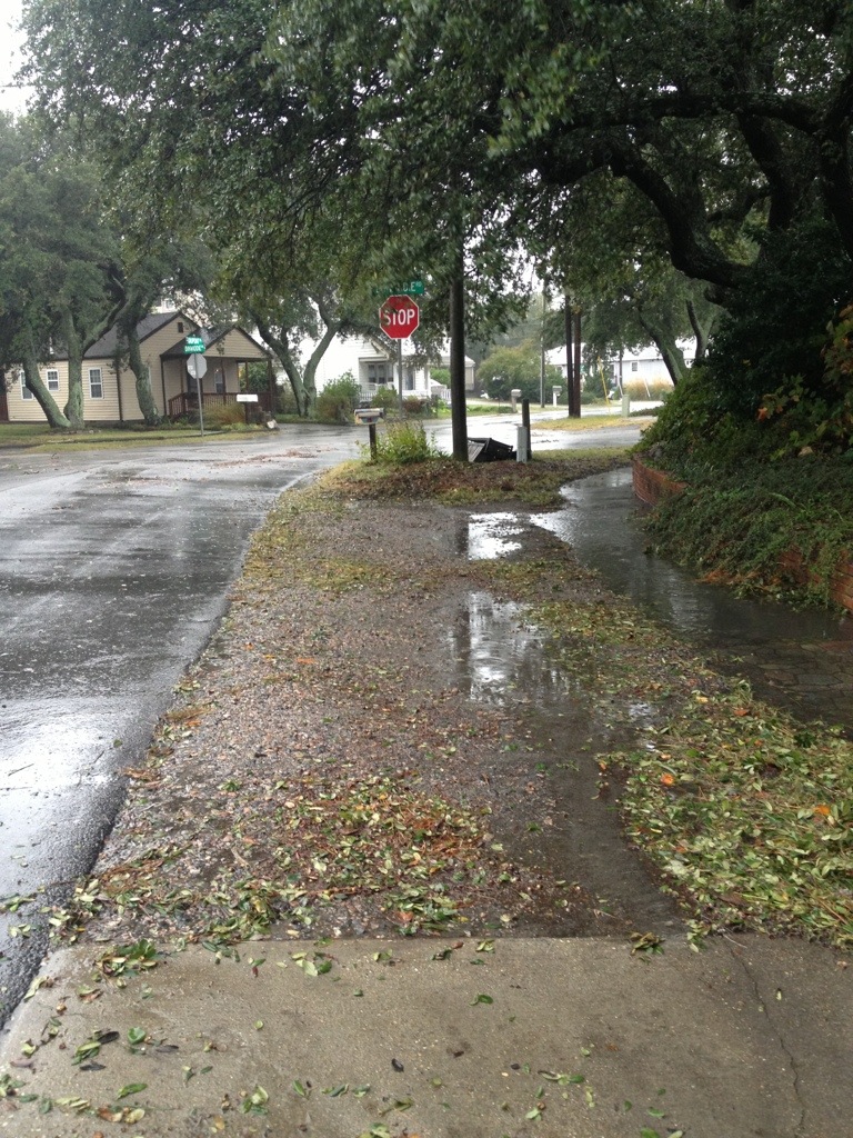
20121030-121005.jpg
This is how it looked for most of Sandy. In previous storms, feet of tidal water were here.

Conclusion?

This inflatable plug in Crab Creek outfall worked!

It’s possible that since this experiment worked here, it might be able to work elsewhere.

Obviously, this might not work everywhere – but certainly, there are many smart people who can come up with creative solutions that could stop tidal flooding in other areas.

Thanks again to Dave Hansen, Assistant City Manager, Phil Koetter & Mike Mundy of Public Works and others for installing the inflatable catastrophic storm plug at the Crab Creek outfall in Ocean Park.

+ + +

How did Crab Creek get this inflatable plug?

During Irene last year, I raised holy hell in Facebook as the tide surged through the storm drains.

Mr. Hansen and some Public Works storm water engineers came out during Irene. After several meetings with many people over weeks including countless emails, our recommendations to install and use this plug were approved.
“As of 3:22 p.m. Shore Dr. is now open, however, there is still an area of high water in the westbound lane at the intersection of Starfish Lane.”

From City of Virginia Beach Facebook page update.

“The rain and strong winds will continue throughout the day as Hurricane Sandy moves north, but the risk of major flooding has subsided for Hampton Roads, according to the National Weather Service.”

Pilotonline.com:

“The one this morning was the one we had to watch out for,” said National Weather Service meteorologist Jeff Orrock.

The next high tide, at 9:43 p.m., will be about the same “as the highest high tide you’d normally see in a year,” Orrock said.

Visit the new Shore Drive Community Coalition Facebook Page for more photos.

City Manager Update #9 from 9am Monday

From an email:

To: City Council; Constitutional Officers and Appointed Officials; Department Directors
Cc: Executive Assistants; Media and Communications; Media and Communications
Subject: Nor’easter SANDY Update #9

At today’s 0900 Monday City Manager we are confident our projections remain valid. Our current challenge is the ongoing high tide and its stacking impacts in the Lynnhaven and Elizabeth River Basins. We are also seeing an increase in the number of road overtopping by storm water ponding. Road closures are being updated on our Hurricane Sandy webpage every two hours. Total rainfall amounts so far vary throughout the City from 2.8 inches to as much as 4.9 inches. We are expecting a change in wind direction to occur late this afternoon.

Our most significant issue remains tidal stacking within the Lynnhaven and Elizabeth River basins creating low level residential flooding. Throughout today our Public Safety and Public Works teams are on the ground monitoring the effects of the ongoing high tide. Projected NWS storm surge will result in a high tide +7 feet above MLLW. This confirms our analysis that tide cycle stacking in the Lynnhaven and the Elizabeth River neighborhoods will result in significant tidal flooding up to elevation 6 feet above sea level. Our neighborhood specific inundation maps have indicate areas below 6 feet above sea level so citizens can make their assessments as to impacts of localized tidal flooding. We remain confident the Historical Tidal & Surge Chart is projecting where Sandy’s high tide elevations above Mean Low Water Level will be in relation to our previous storms. This additional information is being posted on our VBgov website. Here is the link.

http://www.vbgov.com/residents/emergency-preparedness/Pages/hurricane-sandy.aspx

Sustained wind projections have stabilized however the attached charts reflect a significant wind direction change and increased window of gusting will occur late afternoon today. Winds will make a dramatic shift from NW to SW and we should be guarded as to the effects this may have on our canopy. As Sandy makes another turn mid afternoon its projected path will actually bring the storm closer to Virginia Beach – hence our concern regarding impacts of the wind direction change. Winds still will not reach hurricane force and we do not believe sustained tropical force winds (39-74mph) will be reached either. We do however anticipate tropical force gusts that may occasionally reach the mid-fifties. The severity of this nor’eastercane is subsiding though the consistency of the winds will continue until after daylight Tuesday morning. Dom Power reported customer outages stands at 1500 of which 1200 are the result of an accident on Northhampton Blvd that toppled a power pol .
Storm surge has been most dramatic. Atlantic wave height throughout the day has been spectacular with some reaching the projected 15 foot level ; Bay wave height is nearing 8 feet with 9 foot waves being experience further into the bay. Beach erosion observations indicate our Atlantic beaches are faring well. On the Bay the Cape Henry, Ocean Park and Baylake Pines beaches are also holding however the Chesapeake Beach which had little buffer continues losing what little dune system it had. Indications are we are experiencing some structural damage and tidal surge flooding. Public Works is documenting these instances.
Rain is our 4th threat. Some areas of the City may receive up to 7 inches. Rain intensity has been steady but moderate. Projections are we could receive an additional +3 inches before the storm is over. Rains will continue through Tuesday mid-day. Surface ponding is occurring as runoff is being hindered due to elevated levels of the Lynnhaven and Elizabeth Rivers. Back Bay and the North Landing are seeing significant low levels based on the northerly winds pushing the water south and out to the Currituck and Albemarle. Storm water crews are responding to ponding issues. The police are providing high water traffic control. Impassable roads being listed on our storm webpage.
The duration of Sandy continues to make this storm a significant event. Weather conditions have stabilized and will remain consistent through this evening. After midnight we can expect to see a very slow lessening of the storms wind/rain consistency into some intermittency all day Tuesday.

Other highlights from this morning’s staff update:

· We have attached todays 0800 SITREP taken from our WEBEOC reporting database. It gives insight into the myriad actions and issues the departments are wrestling with.

· The Birdneck ES shelter remains open today. Currently reporting @53 individuals enjoying a warm, dry, friendly environment.

· The EOC continues operating under a partial activation.

· City services and staffing will operate under essential conditions beginning throughout Monday. Decisions regarding tomorrows City operational status will be made midafternoon today following our next regional and NWS VTC.

· VB Public Schools are closed today and will also determine their operating status sometime later today.

· The next regional VTC and NMS update is scheduled for 1330 this afternoon.

· It was commented this morning that the winds did not cause our foliage to leave its branches and when Sandy is over we are looking forward to the cornucopia of color our vivid canopy will provide us.

Will keep you advised. Dave

Dave Hansen
Deputy City Manager
City of Virginia Beach
EOC contact # 757-385-0705

(Note: there is a 17 page pdf that goes with this. I am unable to upload at this time.)

LESNER BRIDGE CLOSED. SHORE DRIVE FLOODED IN NORMAL SPOT AT MARLIN BAY

Note: this info is from several different people.

UPDATE: 10:29am Both 385-5000 Public Safety and 385-3111 Information confirm Lesner Bridge is “closed”.
Editors note: I’m viewing traffic traveling both directions on Shore Drive in front of Salty C’s.

High Tides for Lynnhaven Inlet and Storm Info

Everyone,
I googled Virginia Beach Tide Chart and found a site “Sunny Day Guide” which provides a tide chart for VB. From their basic tide time, you have to add or subtract a correction for your specific area. The correction for Lynnhaven Inlet is Basic+48 minutes. The corrected high tide for today (Oct 29) will be 10:02 am and 10:31 pm. The corrected high tide for tomorrow will be 10:49 am and 11:07 pm. I hope everyone fares well and stays dry. Be careful and please watch for any down power lines. If there are down power lines in the area, don’t touch anything metal (fence, etc) or even wood like tree limbs. If the voltage is high enough, a wet tree limb can transmit enough voltage to kill you (saw it at a Dominion Power public demo). Be careful. Please watch out for your neighbors who may be by themselves.

If you experience any damage from the storm, take pictures to document the damage for insurance purposes before you remove it.If you have a lot of damage, separate the damaged material into three piles; mulchible (tree limbs, branches), building material (drywall, carpeting, rugs, etc; and then if you have “white goods” like refrigerators, freezers, lawnmowers, powered equipment, put that in a separate pile because of the possible hazardous material (oil, gas, freon, etc). Do not put everything in one pile, or the city will let it sit there for some time before it can be sorted out.