Flooding in Cape Story caused by backflow through First Landing outfalls

The photos below show the high tide flooding that occurred Monday Oct. 29th around 10:30am high tide cycle for Long Creek.  The water level above the SW grate on First Landing was about 14 inches.  Estimate for the height of the high tide for this event is close to 7.0 feet based on 2006, 2009 Nor’Ida and 2011 Irene.

At least 8 homes between Calvert and Wake Forest had water come into their homes.  The one at the end of First Landing Lane had at close to 18 inches and will need dry wall and insulation replaced.  All of the flooding for these homes was a direct result of the tidal surge coming backwards through the First Landing outfalls in the Cape Henry canal.

Based on observations during the storm, water from the Cape Henry canal never breeched the roadway crest at the intersection of Admiral and First Landing.  Water entered the ditch along the trail and filled the low lying areas and then flowed west toward Wake Forest.  The maps produced after the 2009 event were very close to what actually happened.

Based on the success of the backflow prevention device in Ocean Park, some type of device needs to be installed in the First Landing outfalls ASAP.  The flooding damage to Cape Story as a result of Sandy could have been prevented.  Based on past experience from 2006, 2009, 2011 and 2012, a backflow device will function satisfactorily for events that have a high tide less than 8.5 feet.  This should be acceptable for most events.  Of course, if a Cat 2 storm hits us directly, we’re all in trouble.  Nothing will save us and we know that.

Wednesday, Oct. 31, is Halloween. Trick-or-Treat begins at dusk and ends at 8 p.m. for children 12 years of age and younger. Members of the Virginia Beach Emergency Response System want you and your family to be safe. Planning ahead can help make this Halloween a safe and fun treat.

Read the news release. (2pg PDF)

If you’re planning to take the kids trick-or-treating, or if you’re passing out candy, follow a few simple rules to keep Halloween safe and fun. If you are passing out treats, please turn your porch light on so children will know they are welcome. If you are not passing out treats, please turn your porch light off. Other safety tips for trick-or-treaters include…

100512-NewsRelease_Halloweenbam.docx

Catastrophic storm plug for Crab Creek outfall prevented widespread tidal flooding in Ocean Park.

Thanks to Dave Hansen, Assistant City Manager, Phil Koetter & Mike Mundy of Public Works and others for installing the inflatable catastrophic storm plug at the Crab Creek outfall in Ocean Park. It worked!

During past storms Isabel, Nor’Ida and Irene, there was widespread tidal flooding in the Ocean Park area that is on this system. It is not connected to the pump station which protects the Pleasure House Point side of Ocean Park. The area this outfall covers is roughly Salty C’s east to the Lesner Bridge, down Dinwiddie Road past Ocean Park Baptist Church, north on East Stratford Road over to Tazewell into Crab Creek.

20121030-120830.jpg
With this much damage at the beloved Lynnhaven Boat Ramp & Beach Facility, there would have again been feet of water on the roads thanks to the tidal surge through the Crab Creek outfall.

20121030-120900.jpg
This was roughly the worst it got thanks to the installation and use of the plug.

20121030-122840.jpgThis was roughly the worst it got. In previous storms, like Nor ‘Ida, there was feet of water in Croakers.

20121030-121005.jpg
This is how it looked for most of Sandy. In previous storms, feet of tidal water were here.

Conclusion?

This inflatable plug in Crab Creek outfall worked!

It’s possible that since this experiment worked here, it might be able to work elsewhere.

Obviously, this might not work everywhere – but certainly, there are many smart people who can come up with creative solutions that could stop tidal flooding in other areas.

Thanks again to Dave Hansen, Assistant City Manager, Phil Koetter & Mike Mundy of Public Works and others for installing the inflatable catastrophic storm plug at the Crab Creek outfall in Ocean Park.

+ + +

How did Crab Creek get this inflatable plug?

During Irene last year, I raised holy hell in Facebook as the tide surged through the storm drains.

Mr. Hansen and some Public Works storm water engineers came out during Irene. After several meetings with many people over weeks including countless emails, our recommendations to install and use this plug were approved.

“As of 3:22 p.m. Shore Dr. is now open, however, there is still an area of high water in the westbound lane at the intersection of Starfish Lane.”

From City of Virginia Beach Facebook page update.

“The rain and strong winds will continue throughout the day as Hurricane Sandy moves north, but the risk of major flooding has subsided for Hampton Roads, according to the National Weather Service.”

Pilotonline.com:

“The one this morning was the one we had to watch out for,” said National Weather Service meteorologist Jeff Orrock.

The next high tide, at 9:43 p.m., will be about the same “as the highest high tide you’d normally see in a year,” Orrock said.

Visit the new Shore Drive Community Coalition Facebook Page for more photos.

City Manager Update #9 from 9am Monday

From an email:

To: City Council; Constitutional Officers and Appointed Officials; Department Directors
Cc: Executive Assistants; Media and Communications; Media and Communications
Subject: Nor’easter SANDY Update #9

At today’s 0900 Monday City Manager we are confident our projections remain valid. Our current challenge is the ongoing high tide and its stacking impacts in the Lynnhaven and Elizabeth River Basins. We are also seeing an increase in the number of road overtopping by storm water ponding. Road closures are being updated on our Hurricane Sandy webpage every two hours. Total rainfall amounts so far vary throughout the City from 2.8 inches to as much as 4.9 inches. We are expecting a change in wind direction to occur late this afternoon.

Our most significant issue remains tidal stacking within the Lynnhaven and Elizabeth River basins creating low level residential flooding. Throughout today our Public Safety and Public Works teams are on the ground monitoring the effects of the ongoing high tide. Projected NWS storm surge will result in a high tide +7 feet above MLLW. This confirms our analysis that tide cycle stacking in the Lynnhaven and the Elizabeth River neighborhoods will result in significant tidal flooding up to elevation 6 feet above sea level. Our neighborhood specific inundation maps have indicate areas below 6 feet above sea level so citizens can make their assessments as to impacts of localized tidal flooding. We remain confident the Historical Tidal & Surge Chart is projecting where Sandy’s high tide elevations above Mean Low Water Level will be in relation to our previous storms. This additional information is being posted on our VBgov website. Here is the link.

http://www.vbgov.com/residents/emergency-preparedness/Pages/hurricane-sandy.aspx

Sustained wind projections have stabilized however the attached charts reflect a significant wind direction change and increased window of gusting will occur late afternoon today. Winds will make a dramatic shift from NW to SW and we should be guarded as to the effects this may have on our canopy. As Sandy makes another turn mid afternoon its projected path will actually bring the storm closer to Virginia Beach – hence our concern regarding impacts of the wind direction change. Winds still will not reach hurricane force and we do not believe sustained tropical force winds (39-74mph) will be reached either. We do however anticipate tropical force gusts that may occasionally reach the mid-fifties. The severity of this nor’eastercane is subsiding though the consistency of the winds will continue until after daylight Tuesday morning. Dom Power reported customer outages stands at 1500 of which 1200 are the result of an accident on Northhampton Blvd that toppled a power pol .
Storm surge has been most dramatic. Atlantic wave height throughout the day has been spectacular with some reaching the projected 15 foot level ; Bay wave height is nearing 8 feet with 9 foot waves being experience further into the bay. Beach erosion observations indicate our Atlantic beaches are faring well. On the Bay the Cape Henry, Ocean Park and Baylake Pines beaches are also holding however the Chesapeake Beach which had little buffer continues losing what little dune system it had. Indications are we are experiencing some structural damage and tidal surge flooding. Public Works is documenting these instances.
Rain is our 4th threat. Some areas of the City may receive up to 7 inches. Rain intensity has been steady but moderate. Projections are we could receive an additional +3 inches before the storm is over. Rains will continue through Tuesday mid-day. Surface ponding is occurring as runoff is being hindered due to elevated levels of the Lynnhaven and Elizabeth Rivers. Back Bay and the North Landing are seeing significant low levels based on the northerly winds pushing the water south and out to the Currituck and Albemarle. Storm water crews are responding to ponding issues. The police are providing high water traffic control. Impassable roads being listed on our storm webpage.
The duration of Sandy continues to make this storm a significant event. Weather conditions have stabilized and will remain consistent through this evening. After midnight we can expect to see a very slow lessening of the storms wind/rain consistency into some intermittency all day Tuesday.

Other highlights from this morning’s staff update:

· We have attached todays 0800 SITREP taken from our WEBEOC reporting database. It gives insight into the myriad actions and issues the departments are wrestling with.

· The Birdneck ES shelter remains open today. Currently reporting @53 individuals enjoying a warm, dry, friendly environment.

· The EOC continues operating under a partial activation.

· City services and staffing will operate under essential conditions beginning throughout Monday. Decisions regarding tomorrows City operational status will be made midafternoon today following our next regional and NWS VTC.

· VB Public Schools are closed today and will also determine their operating status sometime later today.

· The next regional VTC and NMS update is scheduled for 1330 this afternoon.

· It was commented this morning that the winds did not cause our foliage to leave its branches and when Sandy is over we are looking forward to the cornucopia of color our vivid canopy will provide us.

Will keep you advised. Dave

Dave Hansen
Deputy City Manager
City of Virginia Beach
EOC contact # 757-385-0705

(Note: there is a 17 page pdf that goes with this. I am unable to upload at this time.)

LESNER BRIDGE CLOSED. SHORE DRIVE FLOODED IN NORMAL SPOT AT MARLIN BAY

Note: this info is from several different people.

UPDATE: 10:29am Both 385-5000 Public Safety and 385-3111 Information confirm Lesner Bridge is “closed”.
Editors note: I’m viewing traffic traveling both directions on Shore Drive in front of Salty C’s.

Saturday afternoon updates from City Manager presentation including Sandy Flood Surge Risk Area Map for Lynhaven Basin

From VBGov.com Hurricane Sandy Page

City Manager Powerpoint Saturday Afternoon Presentation (23 page PDF)

City Manager Update #7 – Schools closed Monday and more

From an email:

This morning’s 1000 City Manager’s update on Hurricane Sandy’s observed and projected impacts to Virginia Beach remain reasonably consistent with our last two updates.

Our most significant issue remains tidal stacking within the Lynnhaven and Elizabeth River basins creating a high risk for low level residential flooding. This morning’s high tide within the Lynnhaven was as predicted @ 2 -2 ½ feet above normal. We observed road inundation in many of the waterfront low lying areas within the Lynnhaven and Rudee basins. We will be closely monitoring the endangered neighborhoods and we are continuing our use of Reverse 911 VB Alert system to notify residents of the risk in those specific neighborhoods. The results of these efforts are being posted on our Hurricane Sandy webpage. Staff continues developing Sandy specific inundation maps to better identify impacts. The number of above high/low tide cycles stacking within the Lynnhaven, Elizabeth and Rudee basin leads us to project that properties whose elevation is below 6 feet above sea level are at great risk to tidal inundation. We remain confident the Historical Tidal & Surge Chart is projecting where Sandy’s high tide elevations above Mean Low Water Level will be in relation to our previous storms. This additional information is being posted on our VBgov website.

Sustained wind projections have increased slightly but still will not reach hurricane force and sustained tropical force winds (39-74mph) may be reached. We do however anticipate tropical force gusts that may occasionally reach 60 mph. As the storm remains offshore and is hooking around VB we will begin to experience consistent wind this afternoon. The extended severity of this nor’eastercane will set in early this afternoon and remain consistent thru tomorrow afternoon. Dom Power reported customer outages has grown to 2500.

Storm surge poses our third threat. Atlantic wave height projection has grown to +15 feet; Bay wave height has grown to 9 feet. Beach erosion will definitely be significant. This morning’s waves on high tide lapped at the base of the Grommet Park berm.

Rain is our 4th threat. Some areas of the City may receive up to 7 inches. This is a slight increase in the projection. Surface ponding will occur as runoff will be hindered due to elevated levels of the Lynnhaven, Elizabeth and North Landing Rivers. Back Bay is seeing significant low levels based on the northerly winds pushing the water south and out to the Currituck. Storm water crews are responding to ponding issues. The police are bringing in additional assets to assist in high water traffic control. We are working on a reporting tool to post this data on the Hurricane Sandy webpage

Duration of Sandy continues to make this storm a significant event. Weather conditions continue to deteriorate and stretch into the new work week. The most intense period of the storm has lengthened and is projected to be Sunday afternoon thru Tuesday early morning. During this intense period will see sustained winds just touching the threshold for tropical storms.

Decisions made at this morning’s meeting:

· The Birdneck ES shelter opened on time this morning at 10AM.

· The EOC will operate under a partial activation effective 1200 (noon) today.

· City services and staffing will operate under essential conditions beginning 0600 Monday until further notice.

· VB Public Schools have just notified the EOC they will be closed Monday.

· The next City Manager staff update is 5PM today.

Will keep you advised. Dave

Emphasis ours.

20121028-133910.jpg
Boat Ramp high tide #1 this morning.

20121028-134010.jpg
Boat Ramp low tide #1

(Note: the tide photos were not necessarily taken at peak hi and peak lo)

“Hurricane Sandy Update Sunday, October 28, 2012, 11:00 a.m. The duration of Sandy continues to make this storm a significant event. Deteriorating weather conditions will stretch into the new work week, impacting the City through Tuesday evening. The most intense period of the storm has lengthened and is projected to be Sunday afternoon through Monday evening.”

SANDY UPDATE AT VBGOV.COM

20121028-121827.jpg

” The number of high/low tide cycles is now more comparable to the number and elevation we experienced in the 2006 Thanksgiving Nor’easter.”

From an email to Empsy from Council Jim Wood:

Subject: Nor’eastercane SANDY Update #5
The 0900 City Manager and 1000 VDEM updates have revealed Sandy’s impacts to Virginia Beach have slipped further into the start of this coming work week. We are predicting on Monday the City will still be experiencing significant effects of the nor’eastercane which may last into Tuesday. The second significant change we have deduced is that the storm tide impacts projection has lessened slightly. We have attached this morning’s briefing charts.(Editors note: I did not receive these briefing charts as of the time of this post.) Addressing the 5 key parameters, here is the latest:

1. Most significant issue remains tidal stacking within the Lynnhaven basin. High risk to low level residential flooding . We will be closely monitoring the endangered neighborhoods and at this time have not issued any evacuation directives. Staff is developing a Sandy specific inundation map utilizing current projections applied to the Corps of Engineers Surge Data map for a Cat 1 storm. The number of high/low tide cycles is now more comparable to the number and elevation we experienced in the 2006 Thanksgiving Nor’easter. We have used the Historical Tidal & Surge Chart to indicate where Sandy’s high tide elevations above Mean Low Water Level will be. We expect to be able to issue specific neighborhood flood warnings Sunday morning.

2. Sustained wind, is still not expected to reach hurricane force (only a 3% chance) and sustained tropical force winds are not expected either (a 9% chance). We do however anticipate tropical force gusts (+35% chance). As the storm remains offshore and is hooking around VB we will begin to experience consistent wind Sunday morning and expect it to last for over 62 hours into Tuesday. This lengthy duration will surely cause tree and debris knock down which in turn will cause power outages. Dominion’s weather advisory of 10:47AM this morning is attached. No change to their amber rating here in Tidewater. Currently 1800 customers are without power in VB.

3. Storm surge poses our third threat. Atlantic wave height projection has grown to +15 feet; Bay wave height has grown to 9 feet. Beach erosion will definitely be significant.

4. Rain is our 4th threat. Some areas of the City may receive up to 6 inches. Surface ponding will occur as runoff will be hindered due to elevated levels of the Lynnhaven, Elizabeth and North Landing Rivers, Back Bay and the many lakes and ponds throughout the City. The intensity projections of the rain may be lessening towards a more consistent downfall for a longer period.

5. Duration of Sandy continues to make this storm a significant event. Weather conditions will deteriorate later than first predicted and stretch into the new work week. Deteriorating conditions will begin after midnight tonight and impact the City thru Tuesday evening. The most intense period of the storm has lengthened and is projected to be Sunday afternoon thru Monday evening. During this intense period will see sustained wind of +30mph for nearly 30 hours. (30/30 effect)

Decisions we are assessing are: Public Schools for Monday, Shelter openings, EOC activation and City operational status for Monday. VBCPS, DHS and the Sherriff Office have been issued an internal warning order to plan/prepare for possible opening the Birdneck ES shelter Sunday morning. The next City Manager staff update is 1500 this afternoon. City staff continues to function under a normal operation status. The EOC is currently operating with EOC staff only except for staff updates. The ECCS 311 staff shifts to 24 hour operations effective 0700 Sunday morning. Current call volume is down and the frequently asked inquiries are: absentee voting and sheltering. Current closings for Sunday include: the Virginia Aquarium and Science Center and the Historic Houses. The VB Visitors Centers at First Landing State Park and the Chesapeake Bay Bridge Tunnel Center will be closed on Sunday and Monday. Decisions on libraries and rec centers will occur following the 1500 update. US Dept of Homeland Security Advisor Milicich is participating in our staff analysis process. Will keep you advised.

Emphasis ours.

“The 5 key parameters are: 1. Most significant issue remains tidal stacking within the Lynnhaven basin. High risk to low level residential flooding . We will be closely monitoring the endangered neighborhoods and at this time have not issued any evacuation directives. The number of high/low tide cycles looks to rival the number we experienced in the 2009 Nor’easter.”

From an email to Empsy from Councilman Bill Desteph:

Subject: Hurricane Sandy Update #4

Empsy,

FYI.
At the City Manager’s afternoon update staff reviewed the current conditions and projections of Hurricane Sandy (see attached)(19pg PDF). We are not registering any significant changes to the projections we summarized in our morning update #3. The 5 key parameters are:
1. Most significant issue remains tidal stacking within the Lynnhaven basin. High risk to low level residential flooding . We will be closely monitoring the endangered neighborhoods and at this time have not issued any evacuation directives. The number of high/low tide cycles looks to rival the number we experienced in the 2009 Nor’easter.
2. Sustained wind, though not expected to reach hurricane force, will gust to a tropical storm level, will last for over 48 hours. Tree and debris knock down will cause power outages. We participated in Dominions conference call and I personally talked with their senior manager, Max Bartholomew.
3. Storm (tidal) surge poses our third threat. Atlantic wave height projection has grown to +12 feet; Bay wave height has grown to 8 feet. Beach erosion will likely be significant. Beach replenishment projects scheduled for the oceanfront scheduled to commence next month are quite timely. We’ll need to make a critical assessment of the Bay beaches and develop protection strategies.
4. Rain possess a 4th threat to our citizens and property. Some areas of the City may receive up to 6 inches. Surface ponding will occur as runoff will be hindered due to elevated levels of the Lynnhaven, Elizabeth and North Landing Rivers, Back Bay and the many lakes and ponds throughout the City.
5. Duration is what is making this storm a significant event. Weather conditions will deteriorate on Saturday afternoon and impact the City thru Tuesday. The height of the storm is projected to be Sunday afternoon till early Monday afternoon.

Facility closings will be announced beginning tomorrow. Most will be open tomorrow as scheduled, but we are not anticipating opening other than essential facilities on Sunday. Mondays conditions will be further refined on Sunday for determining what openings/closing will occur at the start of the new work week. At this time we do not anticipate the need for opening any public shelters. VB Public Schools briefed their preparedness to open Birdneck ES if needed. Sherriff Stolle advised his deputies are prepared to support where needed. The Registrar’s Office will be open tomorrow and closed Sunday. The Virginia Beach EOC will be partially activated on Saturday for updates scheduled for 0900 and 1500.

Grommet Park’s berm was completed midday today. Public Utility generators have been readied to back up our pump stations. The beach stage canopies have been removed as have been the wooden handicap ramps and trashcans on the sand. The Blue Moon Wicked 10K Run at the ocean front will be held on Saturday as planned. The post-race party has moved from the beach to the convention center. Sunday afternoon’s Virginia Symphony concert is under review. We continue to issue press releases, update information on our website and our social media sites. We’ll keep you advised.

Emphasis ours.

COASTAL FLOOD WATCH
COASTAL HAZARD MESSAGE
NATIONAL WEATHER SERVICE WAKEFIELD VA
751 AM EDT SAT OCT 27 2012

* TIMING…TODAY THROUGH MONDAY FOR THE HIGH SURF. FOR TIDAL
FLOODING…SUNDAY MORNING THROUGH MONDAY EVENING…WITH THE
GREATEST IMPACT AND WATER LEVELS LIKELY TO OCCUR WITH THE MONDAY
MORNING HIGH TIDE CYCLE.

* IMPACTS…WATER LEVELS ARE EXPECTED TO RISE TO 2 TO 4 FEET
ABOVE NORMAL BY THE SUNDAY MORNING TIDE CYCLE…AND CONTINUE
THROUGH THE MONDAY EVENING TIDE CYCLE. MODERATE TO POSSIBLY
SEVERE FLOODING WILL BE POSSIBLE WITHIN A FEW HOURS EITHER
SIDE OF EACH HIGH TIDE.

” As what happened in the 2009’ Nor’easter, Virginia Beach will undergo significant tidal stacking within the Lynnhaven Basin. We expect continuous northerly winds to not allow low tide cycles to empty the basin as they normally should. Just as in 2009 we are predicting as many as 6 high/low tide cycles to be held captive within the Lynnhaven Basin.”

SANDY UPDATE FROM VBGOV.COM

Hurricane Sandy Information

The City and the Bayfront Advisory Committee has provided the following helpful documents regarding the potential impact of Hurricane Sandy to our area.

NOAA Briefing Overview with helpful weblinks – Click here to read the overview NWSWakefield_SandyBriefing_Oct25

Storm Surge – Surge potential of 2-3 feet will combine with astronomically high tides resulting in moderate coastal flooding. Highest potential for moderate flooding is along the entire coast and lower Bay (including Hampton Roads) Sun/Mon.

Dominion Weather Statement – the item to note in this statement is the predicted storm surge for the Sunday morning and evening tides. The past noreasters were surges of 8 feet plus. Click here to read the statement DWxC_Statement_-_20121025_1024

High tides near the mouth of the Bay will peak between roughly three and four feet, while in the Outer Banks Atlantic tides will peak between roughly four and five feet.

New electronic billboard for 7 story fast food place going up at Greenwell.

Just kidding.

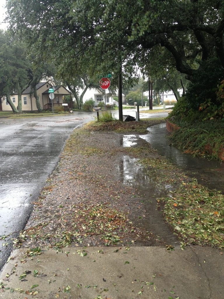
The sign that just popped up supported by the large silver pole instead of a black pole is part of the Virginia Beach Dynamic Message Signs and System Detector Project. The construction at Greenwell and Shore Drive is for the new LEED certified Fire Station.

Virginia Beach Dynamic Message Signs and System Detector Project

An email about the electronic signs:

The Virginia Beach Dynamic Message Signs and System Detector Project will consist of the installation of 11 motorists advisory Dynamic Message Signs (DMS), overhead sign support structures, equipment cabinets, and communication equipment. The DMS’s will have three line displays. Each line will consist of 12 inch height, LED (Light Emitting Diode) characters. The DMS’s will be installed at eight locations within the City. The DMS’s will be installed at the following locations:

1. Princess Anne Rd and Elson Green Ave, southbound
2. General Booth Blvd at the KOA Campground, northbound
3. Shore Dr and First Landing State Park, westbound
4. Shore Dr and Bayville Rd, back to back DMS’s – photo above
5. Northampton Blvd and Bayside Rd, eastbound
6. Northampton Blvd and Shell Rd, westbound
7. Independence Blvd and Wakefield Dr, back to back DMS’s
8. Shore Dr near 83rd St, back to back DMS’s

The project will also include the installation of two types of vehicle detectors. The vehicle detectors will consist of wireless transmitters, and micro loop sensors. The detectors will be installed at 46 locations within the City. Vehicle detector communication equipment will be installed in the existing traffic signal cabinets. There will also be the installation of one CCTV camera on this project. All of the project equipment will be configured to communicate with the City of Virginia Beach Traffic Management Center.

The DMS’s will convey traffic condition information to the roadway motorists. The vehicle detectors will be capable of instantaneously detecting changes in traffic flow patterns. With the construction of this project, the Traffic Management Center will add to its capability of facilitating the application of technology and engineering, to managing traffic, and disseminating traffic related information to the motoring public.

Meeting, February 9, 2012

A Pre-Construction Meeting was held for the stakeholders of the above mentioned construction project. Construction on this project will commence during the spring of this year. The construction team members of this project included;

1. Midasco, specialty infrastructure contractor, the primary Contractor
2. MBP, a construction and program management firm, the lead inspection team
3. URS, lead engineering design firm
4. Public Works/ Traffic Engineering, inspection and traffic control
5. Public Works/ Construction Engineering, inspection
6. Traffic Management Center

The Virginia Beach Dynamic Message Signs and System Detector Project, CIP 2-039 (Capital Improvement Program), completed its bid opening on October 27, 2011. The Engineers Estimate for the Project was $2.616 million. The bidding was won by Midasco, for $1,616,616.

By the way, stakeholders on Shore Drive were apparently told once about this project a couple years ago. No one remembers being invited to the February 2012 meeting mentioned above.

Here is the Official CIP Project Page for the new LEED certified Fire Station.

This project replaces the existing 9,760 square foot facility supporting 4 Fire and 2-to-5 Emergency Medical Services (EMS) personnel, 1 fire engine and 1 ambulance on a daily basis, and various other pieces of equipment that are infrequently used (ranging from fire trucks to zodiac boats).

Todd has been trying to get architectural drawings of the new facility to share.

Update on new Lesner Bridge public notices for required permits

From an email:

Sent: Fri, Oct 19, 2012 10:01 am
Subject: Lesner Update

Kal,
Just wanted to make you and the BAC aware of a few things that are occurring with the Lesner Bridge Project.

Public Notices for Permitting

The Corps of Engineers, DEQ, VMRC, and Coast Guard are advertising public notices for the construction permit on this project. The Corps of Engineers public notice has already been advertised and can be found at: http://www.nao.usace.army.mil/Media/PublicNotices.aspx

We know there has been some concern about the City putting in a bulkhead at the boat ramp site. We just want the BAC and the Shore Drive community to understand that the current public notices are for the construction of the Lesner Bridge only. This will include a temporary bulkhead at the boat ramp. Any effort made to change the scope of the construction permit (e.g., make the temporary bulkhead permanent) will require a separate application and approval from the permitting agencies. We want to be clear with the BAC and the Shore Drive community that this current application is only for the construction needs of the bridge project. This is consistent with the approach that we discussed with the BAC and the SDCC in early 2012.

Drilled Shaft Load Test at the Boat Ramp

Our design team is currently mobilizing a contractor to perform a drilled shaft load test. This effort will consist of drilling a 4’ diameter hole approximately 110’ deep, placing reinforcing steel, and backfilling with concrete. Once the concrete has cured, the contractor will jack against the drilled shaft until it fails. This test will give us actual field information about how well the drilled shaft will perform. With this information, we can finish the foundation design for the bridge using the most economical drilled shaft design. You will likely see the contractor on site starting next week. We just wanted to make you aware of this in case there are any questions from the community.

Project Manager Change

Chris Wojtowicz is taking over this project for Toni Alger. Toni is still in our group, however she was selected for a supervisor position and her duties have expanded beyond managing projects. Chris is getting up to speed and will be taking care of the day to day responsibilities. Chris has been doing a great job managing the Laskin Gateway project and will bring a lot of experience to the table as we get closer to construction. I will still be involved and available for questions as well so we will have continuity during this transition.

If you have any other questions or concerns, please let us know.

David S. Jarman, P.E.
Transportation Project Management Supervisor
Department of Public Works
City of Virginia Beach
757-385-4144 (direct)
757-385-4131 (main)

What: Virginia Beach Mayoral and City Council Candidates’ Forum. When: Wednesday, October 17th, 7-9 PM, doors open at 6:30. Where: Cape Henry Collegiate School Dreyfus Auditorium, 1320 Mill Dam Road, Virginia Beach.

Sponsors: Lynnhaven River NOW, Council of Garden Clubs, Shore Drive Community Coalition, Back Bay Restoration Foundation, Princess Anne Garden Club, and the Virginia Beach Garden Club
Free and open to the public. No pre-registration required.

BE INFORMED

“First, two cyclists suffered serious injuries on Shore Drive after motorists struck them and fled in separate incidents May 3 and June 4. Police have not caught the drivers, despite offering several thousand dollars in reward money through Crime Solvers and local cycling groups. “

Read article at Pilotonline.com entitled Bike crashes in Hampton Roads: Who’s to blame?