URGENT NOW: “PLEASE WITHDRAW SENATE BILL SB926” PLEASE CONTACT SENATOR MCWATERS NOW

Please call and/or email Senator McWaters:

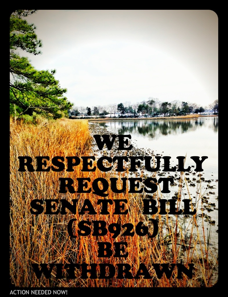
Respectfully ask Senator McWaters to withdraw Senate Bill SB 926.

EMAIL Senator McWaters & His Aid
PHONE Richmond Office: (804) 698-7508

Senator McWaters Contact Info
20130129-195815.jpg
WHY?

Dear Gentleman,

I respectfully request that Senate Bill (SB926) be withdrawn.

Removing local Wetlands Board review of local City projects is unacceptable.

Citizen engagement at the local level must be maintained in order to keep trust in government.

The current review process for “28.2-1302 of the Code of Virginia, relating to the jurisdiction of local wetlands boards” results in State owned wetlands projects being reviewed by State commissions (VMRC) and locally owned wetlands projects being reviewed by local Wetlands Boards.

This is the correct method and must be protected.

Moving review boards out of the local area places an unfair burden on citizens and their rights for public comment.

Additionally, local Wetlands Boards are more familiar with the particulars of local projects and are best suited to review these applications.

Sincerely,

Todd Solomon

Shore Drive Community Coalition-Secretary

Maintaining the Status Quo for Shore Drive, check out http://www.sdcc.info

ALSO:

It could undermine Virginia’s no net loss goals for preservation of wetlands acreage and function.

It could undermine government openness and transparency by imposing additional barriers to public participation in the local public hearing of projects that would impact state-protected wetlands.

PLEASE CONTACT SENATOR MCWATERS NOW
Senator Jeffrey L. McWaters
Republican-District 8

Capitol Office
Senate of Virginia
P.O. Box 396
Richmond, VA 23218
Email: district08@senate.virginia.gov
Phone: (804) 698-7508
Fax: (804) 698-7651
Room No: 310
Legislative Assistant: Cheryl Simmons, Christen T. Smith

District Office
1207 Laskin Road
Virginia Beach, VA 23451

Phone: (757) 965-3700

Legislative Assistant: Cheryl Simmons, Christen T. Smith

1207 Laskin Road
Virginia Beach, VA 23451
Phone: (757) 965-3700

As of the time of this post, this Senate Bill SB926 could be heard Thursday.

UPDATE: read the bill. Start here.

Noticed more files available at replacement for Lesner Bridge CIP Project Page

Added a list of what’s available at our SDCC.info/Hot page. Scroll down to find info about bridge.

Direct link to CIP Project Page for Lesner Bridge.

Landscaping Concept Under Bridge

Landscaping Concept Under Bridge

Construction Impacts – Lesner Bridge Replacement Project

Sneak peak of power point presentation pulled from the Official City Project Page.

Construction – Begin July 2013; Complete July 2016

One image from presentation

One image from presentation

Download presentation from VBGov.com. [24 page PDF]

Note: If you are viewing presentation on a Mac in Preview – you can watch in full screen slideshow mode.
You can also view each slide & read notes for each by clicking on small cartoon bubble icon in upper left corner of each slide.

More info about sand replenishment including study by VIMS

Forwarded from previous OPCL President:

Hope at receiving this you had a festive holiday season and are ready to do great things for our City in 2013. Attached you will find a draft of the legislation Chris Stolle is carrying for the City to set the ground work for a collaborative process of creating a sand replenishment program for the Chesapeake Bay Beaches. Following completion of the Council funded study by VIMS (can be found at http://www.vbgov.com/government/departments/public-works/coastal/Documents/cxb-shoal-report-12-11.pdf )[246 Page PDF]. The study focused on Chesapeake Beach but we are confident the sizeable deposits of suitable material exist offshore of all our Chesapeake Bay Beaches. Please share with your Commission/Board and if you would like Phil and I are more than happy to attend your next meeting to discuss our program initiative. As this has the unanimous support of the City Council we would like to receive both the Beaches and Waterways Advisory Commission and the Bayfront Advisory Committee endorsements. The Norfolk City Manager’s office is endorsing the legislation as well. Also request that once your organizations are behind the initiative that you take the opportunity to let our General Assembly Delegation know of your support. Please call if you have questions. VR Dave

Dave Hansen
Deputy City Manager
City of Virginia Beach
(757)385-4242

Download the VIMS study entitled A Geotechnical Evaluation of Chesapeake Beach for Beach Quality Sand. [246 Page PDF]

VIMS is the Virginia Institute of Marine Science.

One image from VIMS study

One image from VIMS study

“The bill would require the Marine Resources Commission, the Department of Environmental Quality and other involved agencies to establish a procedure for approving within 90 days applications for permits to dredge sand from the bay and dump it on adjacent beaches.”

From Pilotonline.com:

He said Virginia Beach has agreed to pay for sand replenishment along its part of the Chesapeake Bay, which includes Chic’s Beach and the Shore Drive corridor, areas that suffer some of the worst damage from nor’easters and storms like Sandy.

Apparently Ocean Park was hit harder by Sandy than the east side of the Lesner Bridge.

Taken couple days after Sandy. Dinwiddie walkway in Ocean Park. Photo Credit ~ Jen C.

Taken couple days after Sandy. Dinwiddie walkway in Ocean Park. Photo Credit ~ Jen C.

View SB946 at LIS:

SB 946 Public beaches; authorizes MRC and DEQ to establish procedure for sand replenishment.

Introduced by: Frank W. Wagner | all patrons … notes | add to my profiles
SUMMARY AS INTRODUCED:

Sand replenishment for public beaches. Authorizes the Marine Resources Commission and the Department of Environmental Quality to establish an expedited procedure for sand mining and beach replenishment on the public beaches abutting the waters of the Chesapeake Bay. The bill requires the agencies to establish a working group, consisting of representatives from affected localities, to assist in the development of the expedited procedure. The working group is to consider a requirement that the application for the sand replenishment project permit include the submission of a mining plan by the locality for areas within the Chesapeake Bay from which the dredged material will be taken and the location of the beach replenishment project. The bill provides several types of information that such a plan would include, such as the analysis of benthic, marine, and fishery resources; impact on any historical artifacts; and impact on other uses of the state waters and bottomlands at the dredge site.

January 17th BAC meeting currently indicates a Presentation on the Storm Water Plans for east of Lesner Bridge

Plan on attending January 17th THURSDAY meeting at the Va Beach Resort Hotel 2800 Shore Drive at 3:30 PM.

Learn more about Bayfront Advisory Committee(BAC).

First Landing and Bike Path looking North

View more about storm water issues at SDCC.info/HOT.

A Large Shaggy Christmas Present Miracle

As our neighbor was about to leave for his short Christmas holiday with his family, a visitor came to stay for a bit.  About 50 pounds of wet black hair planted himself on our neighbor’s front porch. My neighbor called me to ask if I knew the owner of the friendly mature black lab. Not knowing the owner, I called Marty Schuman, president of Cape Henry Shores Civic Association to ask for help.  He gave me the name and telephone of the Neighborhood Watch coordinator, Ms. Regina Wallace.  She quickly put the word out over the internet and text alert system.  Within 45 minutes, we had some nice people picking up a very happy dog who would have otherwise gone to animal control.  Amazing!  One HAPPY family and one very lucky dog who had apparently chased a duck and ventured across Long Creek from Bay Island.  With the timely return of their dog, and his reunion with their sweet young daughter, Christmas was once again made special.  I am sorry, but I didn’t get her name.  I wonder if it is “Virginia”?

Seasons Greetings From SDCC

As we finish the year of 2012, we wish a warm (no global warming reference intended) season’s greetings to all our families and volunteers who have so freely given of their time, efforts, and treasures to maintain and improve the beauty and community of the Shore Drive area. Many, many people have so generously given to others in our area through food, furniture and clothing drives. You have welcomed our troops home, or said “good bye”, and offered a hand to neighbors while watching over our communities to keep them safe for all. Virginia Beach is truly a generous and caring community. Many of you have given without even expecting  a “thank you”. You are beautiful, friendly and caring. You are the heart and very soul of this community that makes you so special. Enjoy your Christmas, Hanukkah, Kwanzaa, or winter solstice. May you personally feel the sense of community with all your neighbors, friends, and family about you.

We wish to give a special “thank you” to our Mayor, City Council members, and city staff for bringing Pleasure House Point to a reality and preserving this incredible public treasure for our future generations. Lynnhaven River Now and Chesapeake Bay Foundation deserve our very special thanks and continued future support.

On behalf of Grace, Todd, Carol, and Tim, may all of you have a MOST SPECIAL HOLIDAY!

CHEERS!!!!!

Proposed Page Avenue and Cherry Place Intersection Alternative at Shore Drive, Cape Henry Towers.

Thanks to Public Works Project Manager Jason B. Wilson for sharing the proposed changes for the intersection of Page Avenue and Shore Drive.

View the CHT Presentation Final (12 page PDF).
This is part of 2.117.000: Shore Drive Corridor Improvements – Phase III.
Learn more about Shore Drive infrastructure work at SDCC.info/HOT.

Alternative 1 for proposed realignment of intersection.

Alternative 1 for proposed realignment of intersection.

View from Page Avenue looking east down Shore Drive. This is across the street from Starbucks at east end of Lesner Bridge.

View from Page Avenue looking east down Shore Drive.

Trees pictured above would come down under all 3 Alternative proposals.

An excerpt of a comment from previous post at SDCC.info about this proposal:

I don’t understand the reason for ANY if these three proposals. Even when Duck In was hosting their famous Friday night parties, everyone (even drunk drivers) managed to exit onto Shore Dr without problems.

Mayor writes to Governor about forming the Chesapeake Bay Beach Storm Protection Program which includes dredging sand from the Chesapeake Bay for our beaches.

Read the 2 page PDF from the Mayor.

Civic Engagement Opportunities for Transportation and Education

Transportation: HRTPO Online Survey – Deadline Dec. 31st 

Hampton Roads Transportation Planning Organization (HRTPO) would like your help in long range planning for our region.  Read their information below and Please take 5 minutes to answer their online survey. 

http://hrtpo.org/

The Hampton Roads Transportation Planning Organization (HRTPO) is updating the Long-Range Transportation Plan.  Entitled Navigating the Future to 2040, this plan will address future road, transit, passenger rail, freight, bicycle and pedestrian needs for the region. Because these are your needs, and because this plan will directly impact you and shape your quality of life, we want to hear your perspective and opinions on vital transportation issues in the region.  In this way, we can mutually shape a vision for Hampton Roads.  Help us navigate the region’s future!  This short survey should only take about 5 minutes to complete and will be used to help guide transportation in Hampton Roads.  We thank you for assisting us with identifying these issues, and enabling us to direct resources to solving these needs.

Education: Wednesday Dec. 12 at 6:30pm in the Central Library

How should higher education help us create the society we want?   
 
Be a part of the nationwide public policy discussion about the future and role of higher education, Wed., Dec. 12, 6:30 to 8:50 p.m., at Central Library.
 
Library staff will lead a small group discussion using the National Issues Forum Institute guide, “Shaping our Future: How Should Higher Education Help us Create the Society We Want?
 
The program is free and open to teens and adults. Call 385-0150 to register.

Lynnhaven Colony Homeowners Seek Answers to Flooding Woes – Va Pilot Article by Selene Guerrero

HOMEOWNERS SEEK ANSWERS TO FLOODING WOES

  By Selene D. Guerrero, Correspondent Virginia Pilot 

Residents of Lynnhaven Colony filed into Dockside Restaurant on Nov. 17, but instead of appetites they brought questions for the public works officials in attendance.  The city panel and more than 50 residents gathered to discuss solutions to the neighborhood’s common flooding during high tide and inclement weather.

              “The most important and expensive thing you purchase is your home,” Donna Rennick, civic league vice-president, told Phillip Davenport, public works director, before he took the floor.

              “We need to know how we can work with you,” Rennick said. “We need answers.”

Phillip Roehrs, water resources engineer, presented a project that officials believe would alleviate most of the flooding, but further study is needed to make certain it will do the job.   Lynnhaven Colony is south of Shore Drive, on land that is between the Chesapeake Bay and Long Creek, which is a tributary of the Lynnhaven River.  According to a 2005 study, solving the core problems – feeder ditch improvements, flooding on Shore Drive, relieving flooding in low-lying areas – is estimated to cost $50 million, Roehrs said.   Roehrs added that he was not prepared to provide the residents a timeline of when the project would begin or be completed.

   “We’re at a point where we are thinking of moving,” said Joyce Dunn, a 30-year resident. “After the 2009 nor’easter, the city proposed the same and nothing has been resolved.”

   Dunn’s family has made costly adjustments in their home, such as resurfacing their garage and moving their furnace to the attic.   In about a year, when sidewalk construction on Shore Drive begins, the city plans to start Phase I of the project by putting in the components needed for development of a flood-control system.

   The final plan would provide the community with two tide gates, five water pump stations (adding to the two already in place) and an underground conveyance system.  The current outfalls to the Chesapeake Bay and river would be improved with extra collection systems that would provide a better flow.

   “There are minor tweaks in the works,” Roehrs said. “But it will take a number of years to build and a number of years to finance.”

Currently less than $3 million a year is set aside for the project. City officials are working to come up with a way   to fully finance the project and move forward.

   “Even if we are able to come up with a financing plan where we can have all the money today,” Davenport said, “we can’t do all of the work at one time, it has to be phased.”

Construction around the roads and ditches would make it difficult for residents to get in and out of Lynnhaven Colony, he said.

The city plans to put in place a funding and work schedule, and provide residents with a timeline by December 2013.  In the meantime, city representatives suggested that homeowners have their homes elevated and seek federal funding with the Federal Emergency Management Agency through the Severe Repetitive Loss program.

 “Set an expectation,” resident Vin Melwani told the panel after the presentation.  “I’m a homeowner,” Melwani said. “I just would really appreciate it if you could set a realistic expectation.”

  •            For information about the Federal Emergency Management Agency’s Severe Repetitive Loss

program, contact Erin Sutton, city emergency planner, at 385-1076.

  • For proposed plans and maps of the flood-prone areas off Shore Drive east of the Lesner Bridge, visit http://www.tinyurl.com/ akc9nd6

City Continues Engineering Studies for Immediate Stormwater Solutions East of Lesner Bridge – Results Expected April 2013

The following email was received from Deputy City Manager Dave Hansen in respone to requests that immediate stormwater solutions similar to the one used in Ocean Park be installed in flood prone areas east of the Lesner Bridge in Cape Story, Lynnhaven Colony and Cape Henry neighborhoods.


Eastern Shore Drive Leaders,

Let me begin by attesting the Eastern Shore Drive Storm Water Drainage Area Improvement Initiative is one of our top focus areas as we roll into the new year.  The staff and City leadership are very sensitive to the hardships created when we have intense and long-lasting weather events such as Sandy, Irene, and the Nor’easter of Nov 09.  Following Public Works attendance and briefing last Saturday with the Lynnhaven Colony Civic League and concerns we have received from Cape Henry Shores, Cape Story By the Sea and other concerned citizens in the eastern Shore Drive drainage area, our engineering and operations staff will be undertaking an accelerated analysis of several interim solutions which have been suggested and on the face seem to have merit in providing various degrees of protection from tidal inundation.  Below is a summary of the two phases I have asked our engineering staff to pursue.  Phase I is a data map with summary descriptions so we identify all infrastructure, elevations and drainage areas east of the Lesner.  Completing this on 7 Dec allows us to define the study aspects of Phase II.  I have asked Public Works to complete their assessments and recommendations by the first week in April and to publish a written report NLT 12 April.  Intent will be to post this report on-line for the civic leagues and citizens to review. Here are summaries of the first two phases:

1.    Using City topographic mapping as the base, delineate the drainage sub basins, the drainage systems (open and closed), and the outfalls for the Lynnhaven Colony/Cape Henry/Cape Story by the Sea areas.  This will provide a clear graphic that depicts the ground elevations, drainage areas, and drainage system elements – including outfalls.  This will be used as a tool for the additional analyses identified in Phase 2 and will be suitable for discussions with the BAC and civic leagues when describing how the systems function and why engineering analyses are necessary to support any proposed interim measures such as backflow preventers.  I.e., it’s not as simple as just keeping the tide out, the rainfall runoff has to be able to either be safely stored within the particular drainage area or be able to be discharged with the backflow preventers in place (or a combination thereof).  These products will be ready by December 7.

2.    Each sub basin will have an analysis done to determine the suitability of backflow preventers on the outfall for the particular subbasin; if a backflow preventer is suitable, the type of backflow preventer; the amount of rainfall runoff the subbasin can handle without structural flooding; the stand-by pumping requirements (if any); and the probable costs.  While simply jumping to a “solution” as has been suggested by some,  it is absolutely necessary that the City allow the responsible level of engineering to be done to assure that we do not inadvertently worsen the drainage situation for any particular subbasin.  We are estimating four months for this effort. Expect to deliver a written analysis with recommendations and preliminary costs and timeline by mid-April.

Phase III will be the review and approval process leading to design and construction.  Once we firm up the costs and the competitive process we’ll use to get the work done we can provide a reasonable timeline.  I wish to close this email by ensuring our citizens fully understand these interim solutions as with the permanent solutions have definitive limitations.  At some level of tidal surge and some accumulation and intensity of precipitation all infrastructure improvements will be overcome and mother nature will prevail.  Hopefully implementing interim measures will reduce the risk of moderate storm damage and buy the time for us to consider even grander infrastructure solutions to tackle the bigger more threatening hurricanes and nor’easters we seem to be weathering of late.  Happy Thanksgiving and fingers crossed for a quiet winter storm season. Regards, Dave


Dave Hansen

Deputy City Manager

City of Virginia Beach

(757)385-4242

“Temporary Bulkhead” at the beloved Lynnhaven Boat Ramp & Beach Facility further explained

From an email from Dave Hansen posted unedited with permission:

Kal & Grace,

FYI – The “Temporary Bulkhead” as shown in the permit application and on the current design plans, is designed with steel sheeting with a tie-back system and a concrete cap. The length is approx 400 LF.

Timber is great for residential bulkheads, but it is not adequate for a commercial/industrial application like this.

Timber would not hold up for the construction duration. The cap would require cleats to tie-off and a timber cap would not provide an adequate anchor for loaded barges, boats, etc., to tie off.

The concrete cap provides more structural stability for the bulkhead design.

This concrete cap bulkhead design is more of a standard section that contractors are used to building.

As an alternate, a more expensive steel cap could be used, but in either scenario (steel or concrete) the cap needs to be more durable than timber.

As promised in my many briefings to your respective organizations we will visit this discussion just past the 50% construction stage to see how we are co-existing with our boating public. Regards, Dave

Dave Hansen
Deputy City Manager
City of Virginia Beach
(757)385-4242

Permit at US ACOE website.
More about dredging, and the replacement for the Lesner Bridge at SDCC HOT page.

Jetty study at Lesner Bridge, Planning Commission recommends CBF wind turbine proposal at PHP

About Jetty study at Pilotonline:

Once the study is complete, the corps will present its findings to the city. Then both parties will decide whether to move forward with building the structures, said Phil Roehrs, the Virginia Beach coastal engineer.

Roehrs said the city would consider the jetties “only if the study shows they can be built in an environmentally sound way.”

Previously at SDCC.info. We scooped the Pilot. Thanks Andy.

About wind turbines at CBF’s facility on PHP at SavePHP.org:

Hopefully CBF and SmithGroup JJR will far exceed the standard in the wind turbine they use so as to minimize bird conflicts since PHP is a vital stop in the Atlantic Flyway.

Editorial entitled Negotiate to save Lynnhaven property, Pleasure House Point.

Read entire editorial entitled Negotiate to save Lynnhaven property at Pilotonline.com.

It’s time for the firm, city and foundation leaders to work together for the common good and figure out a way to preserve those four acres.

And:

…whether through negotiations with the developer that involve a land swap, tax breaks or some other method.

One of the groups that worked to preserve PHP. A team of Kemps Landing Magnet School eighth-graders and the sixth-grade class at Cape Henry Collegiate School have a shared vision: to preserve…

“Kristin Mazur, project manager for the Norfolk District Lynnhaven Inlet Jetties Navigation Project with the city of Virginia Beach, Va., explains the federal interest determination study process and timetable, Oct. 19, 2012, to add a 1,000-foot jetty in front of the Lesner Bridge.”

Learn more at US Army Corps of Engineers Norfolk District article.

The federal study will determine if jetties or a combination of coastal structures is cost-effective in reducing critical shoaling and annual costs of maintaining the navigation channel, as well as reducing damages incurred on structures in the channel due to continuous wave action.

Multiple car break ins, drunk driving including hitting various objects, driving on bike path, vandalism and more in Cape Henry Shores and Cape Story by The Sea last night.

Neighborhood Watch from CSTBS will be attending the Citizen’s Advisory Committee meeting on Wednesday night at the Second Precinct at 820 Virginia Beach Blvd and intend to bring all this up. Everyone is invited to attend this meeting to air complaints, and to meet with police and other City officials. They really appreciate public comments. The meeting starts at 7:00 p.m.

City to discuss private property and Marlin Bay extension next to PHP at next Council Meeting

Watch a WVEC.com news coverage about private property and Marlin Bay extension slatted for property next to PHP.

Previous press about this at SDCC.info.

“If the lots are built upon and the road extended, “unfortunately it would sour the overall project,” said Christy Everett, regional director of the Chesapeake Bay Foundation.”

More press about 100% of Pleasure House Point not being preserved.

“Pleasure House Point Faces New Development

… plans have quietly moved ahead to build duplexes and extend a road through two areas in the tract, known as Pleasure House Point.”

From Pilotonline.com:

Turns out there’s a loophole in the celebrated purchase and preservation of Pleasure House Point, the largest undeveloped tract left on the Lynnhaven River, loaded with sand dunes, maritime forest and waterfront vistas.

Note the amount of trees and vital habitat that is at risk for destruction. Birds, including those migrating in the Atlantic Flyway, depend on Pleasure House Point and it’s open space to survive.

Partial shot of 1 page of plans shown upside down.