From an email:
To: City Council; Constitutional Officers and Appointed Officials; Department Directors
Cc: Executive Assistants; Media and Communications; Media and Communications
Subject: Nor’easter SANDY Update #9
At today’s 0900 Monday City Manager we are confident our projections remain valid. Our current challenge is the ongoing high tide and its stacking impacts in the Lynnhaven and Elizabeth River Basins. We are also seeing an increase in the number of road overtopping by storm water ponding. Road closures are being updated on our Hurricane Sandy webpage every two hours. Total rainfall amounts so far vary throughout the City from 2.8 inches to as much as 4.9 inches. We are expecting a change in wind direction to occur late this afternoon.
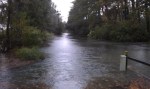
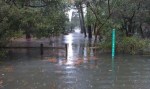
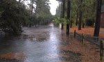
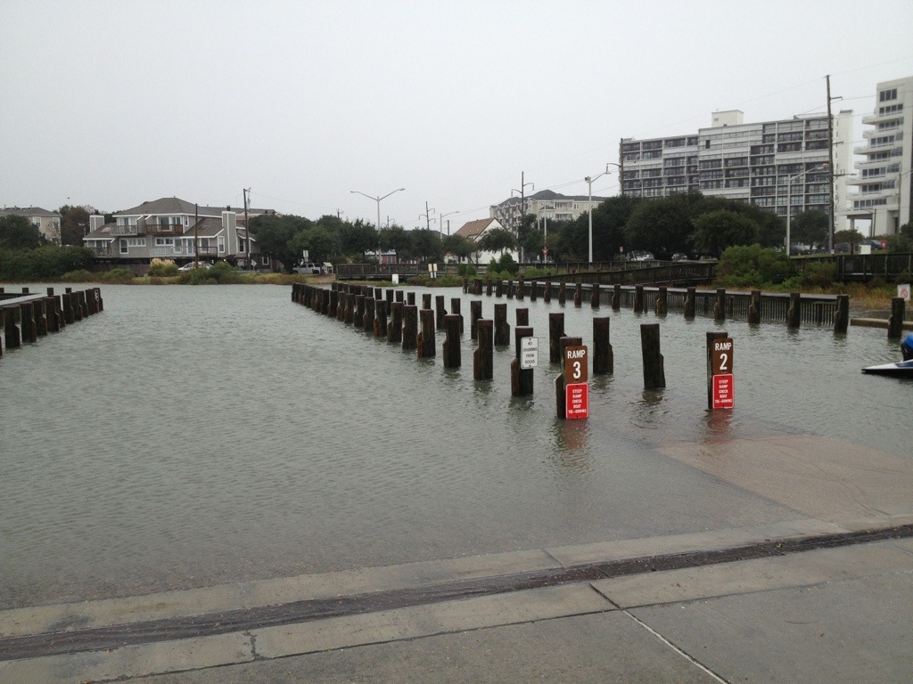
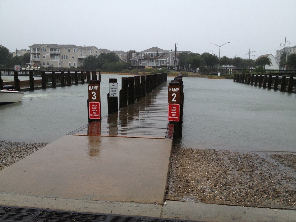
Our most significant issue remains tidal stacking within the Lynnhaven and Elizabeth River basins creating low level residential flooding. Throughout today our Public Safety and Public Works teams are on the ground monitoring the effects of the ongoing high tide. Projected NWS storm surge will result in a high tide +7 feet above MLLW. This confirms our analysis that tide cycle stacking in the Lynnhaven and the Elizabeth River neighborhoods will result in significant tidal flooding up to elevation 6 feet above sea level. Our neighborhood specific inundation maps have indicate areas below 6 feet above sea level so citizens can make their assessments as to impacts of localized tidal flooding. We remain confident the Historical Tidal & Surge Chart is projecting where Sandy’s high tide elevations above Mean Low Water Level will be in relation to our previous storms. This additional information is being posted on our VBgov website. Here is the link.
http://www.vbgov.com/residents/emergency-preparedness/Pages/hurricane-sandy.aspx
Sustained wind projections have stabilized however the attached charts reflect a significant wind direction change and increased window of gusting will occur late afternoon today. Winds will make a dramatic shift from NW to SW and we should be guarded as to the effects this may have on our canopy. As Sandy makes another turn mid afternoon its projected path will actually bring the storm closer to Virginia Beach – hence our concern regarding impacts of the wind direction change. Winds still will not reach hurricane force and we do not believe sustained tropical force winds (39-74mph) will be reached either. We do however anticipate tropical force gusts that may occasionally reach the mid-fifties. The severity of this nor’eastercane is subsiding though the consistency of the winds will continue until after daylight Tuesday morning. Dom Power reported customer outages stands at 1500 of which 1200 are the result of an accident on Northhampton Blvd that toppled a power pol .
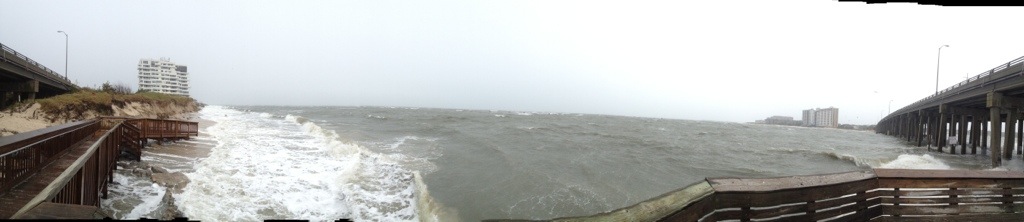
Storm surge has been most dramatic. Atlantic wave height throughout the day has been spectacular with some reaching the projected 15 foot level ; Bay wave height is nearing 8 feet with 9 foot waves being experience further into the bay. Beach erosion observations indicate our Atlantic beaches are faring well. On the Bay the Cape Henry, Ocean Park and Baylake Pines beaches are also holding however the Chesapeake Beach which had little buffer continues losing what little dune system it had. Indications are we are experiencing some structural damage and tidal surge flooding. Public Works is documenting these instances.
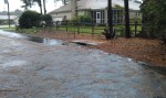
Rain is our 4th threat. Some areas of the City may receive up to 7 inches. Rain intensity has been steady but moderate. Projections are we could receive an additional +3 inches before the storm is over. Rains will continue through Tuesday mid-day. Surface ponding is occurring as runoff is being hindered due to elevated levels of the Lynnhaven and Elizabeth Rivers. Back Bay and the North Landing are seeing significant low levels based on the northerly winds pushing the water south and out to the Currituck and Albemarle. Storm water crews are responding to ponding issues. The police are providing high water traffic control. Impassable roads being listed on our storm webpage.
The duration of Sandy continues to make this storm a significant event. Weather conditions have stabilized and will remain consistent through this evening. After midnight we can expect to see a very slow lessening of the storms wind/rain consistency into some intermittency all day Tuesday.
Other highlights from this morning’s staff update:
· We have attached todays 0800 SITREP taken from our WEBEOC reporting database. It gives insight into the myriad actions and issues the departments are wrestling with.
· The Birdneck ES shelter remains open today. Currently reporting @53 individuals enjoying a warm, dry, friendly environment.
· The EOC continues operating under a partial activation.
· City services and staffing will operate under essential conditions beginning throughout Monday. Decisions regarding tomorrows City operational status will be made midafternoon today following our next regional and NWS VTC.
· VB Public Schools are closed today and will also determine their operating status sometime later today.
· The next regional VTC and NMS update is scheduled for 1330 this afternoon.
· It was commented this morning that the winds did not cause our foliage to leave its branches and when Sandy is over we are looking forward to the cornucopia of color our vivid canopy will provide us.
Will keep you advised. Dave
Dave Hansen
Deputy City Manager
City of Virginia Beach
EOC contact # 757-385-0705
(Note: there is a 17 page pdf that goes with this. I am unable to upload at this time.)